| Previous :: Next Topic |
| Author |
Message |
cartman
Member


Joined: 20 Feb 2007
Posts: 2800 | TRs | Pics
Location: Fremont |
|
cartman
Member
|
 Tue May 05, 2015 9:38 pm |
|
|
After seeing a trip report from Fay P. to these peaks, I was very intrigued by the approach she and her friends made to the area--both for the peaks and for an alternate approach to Kimtah.
Wanting to see for myself, I proposed this as an overnight a few weeks ago to Matt, and he organized the trip to this most scenic area in the heart of the North Cascades with dicey, Barb E and GeoTom.
The name of Trumpet for 6865 was Matt's idea. Peak 6865 is the terminus of the very long ridge running east from Gabriel. The angel Gabriel is sometimes depicted as the sounder of a trumpet--though apparently never specifically mentioned as such in the Bible--signalling the resurrection of the dead before the last judgment. As 6865 is the terminus of the ridge, i.e. arm of Gabriel, the name works geographically as well as symbolically. The name also works in a celebratory sense as this peak is one of the finest viewpoints in the area, and probably the best peak for closeup views of Ragged Ridge--even better than those from Ragged View.
Fay, Jim B. and co. had left the Easy Pass Trail less than a mile and only 400' above the TH and contoured over at ~4000' to get around a long NE-trending buttress running off the east end of Ragged Ridge, then continuing up the valley of Kitling Creek to its source at the little lake, 5800', then to Ragged View 6730'. So that's what we did.
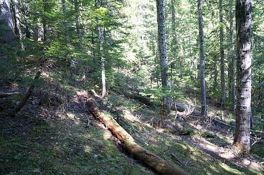
The forest travel once leaving the snowy trail was mostly snow-free for the first mile, with minor brush and log-hopping. The route became continuous snow once we rounded the buttress and headed up the creek. We put on snowshoes, me for the first time this year in fifteen trips--all in snow. We found a good place to cross the creek at ~4200' and continued up good forest until entering the more open terrain mid-valley, passing under Kitling and past the lake to the very broad Kitling Pass at 6000'.
We were unanimous in continuing up the extra 700' to camp just below the summit of Ragged View. We heard some whooping and saw fresh ski tracks below Cub's north face as we were going up; their route showed no hint of snow instability, no sloughing.
On Ragged View we could see how this marvelous viewpoint got its name:
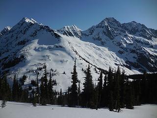 Kitling, Cub, Mesahchie, Katsuk 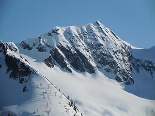 Cub 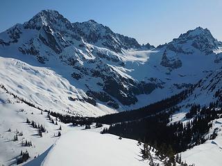 Mesahchie, Katsuk, Kimtah 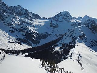 Katsuk, Kimtah, Cosho 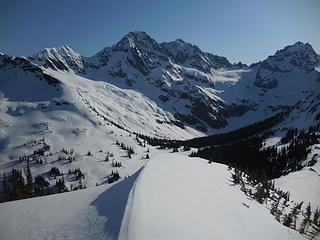 Cub to Kimtah from Ragged View 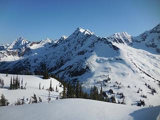 Graybeard, Kitling, Cub from Ragged View 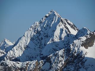 Graybeard 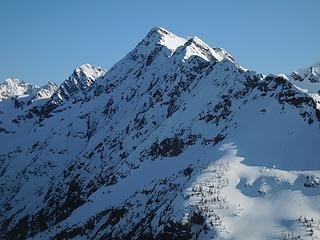 Kitling 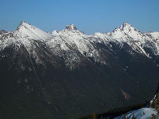 Golden Horn, Tower, Hardy 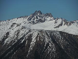 Azurite 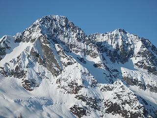 Morning on Mesahchie and Katsuk 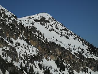 Trumpet 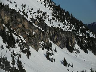 Gully entrance 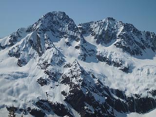 Mesahchie, Katsuk from Trumpet 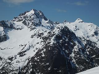 Kimtah, Thieves' Peak, Cosho 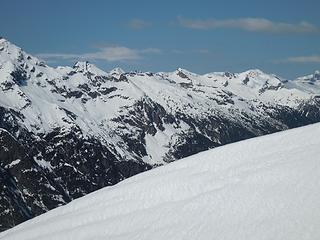 Red Mountain 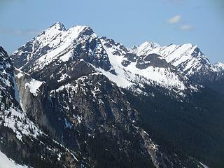 Gabriel, Elija, Ezekiel 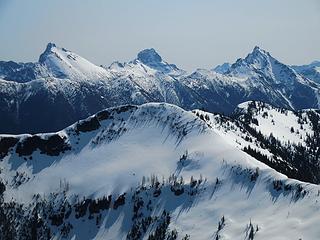 Ragged View and peaks beyond 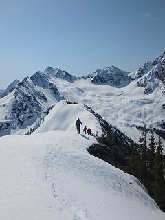 Leaving Trumpet 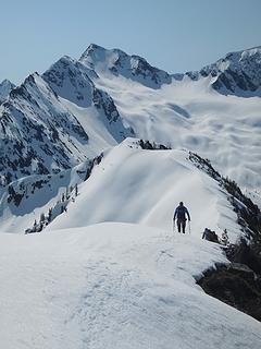 Descending
 Now I Fly Now I Fly
Now I Fly |
| Back to top |
  
|
|
Jetlag
Member
Joined: 17 Aug 2010
Posts: 1410 | TRs | Pics
|
|
Jetlag
Member
|
Tue May 05, 2015 10:03 pm |
|
|
What a great route! And great couple days for exploring it. Terrific photos, especially of Graybeard, and enough detail to unlock the puzzle of getting to this spectacular viewpoint. (Glad that your winter didn't pass by snowshoe-less.)
|
| Back to top |
|
|
Matt
Tea, Earl Grey, Hot

Joined: 30 Jan 2007
Posts: 4307 | TRs | Pics
Location: Shoreline |
|
Matt
Tea, Earl Grey, Hot
|
Tue May 05, 2015 10:34 pm |
|
|
Dicey described it well: "Feeling incredibly lucky to be able to spend the weekend getting up close and personal with these beautiful mountains. Love the North Cascades!"
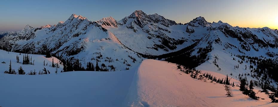 Ragged Ridge at Sunset from Ragged View Peak 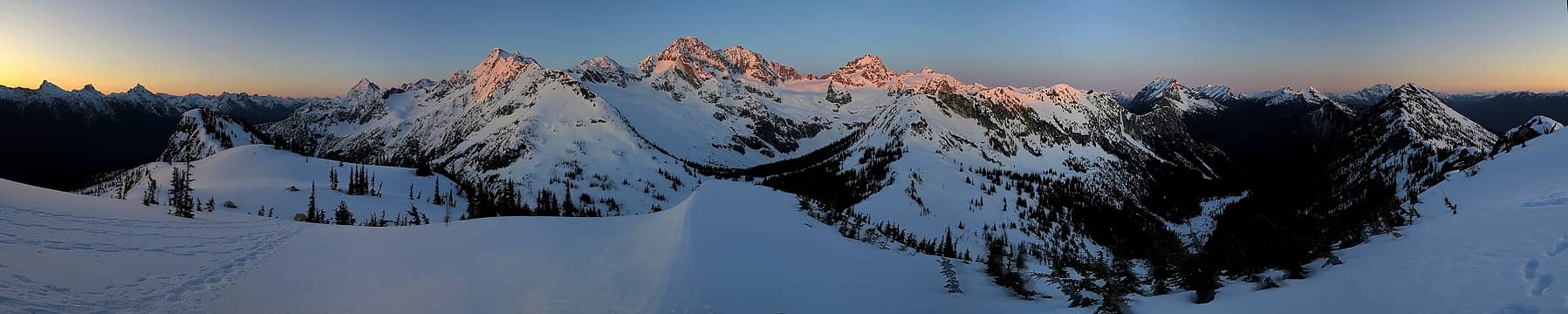 Ragged Ridge at Sunrise from Ragged View Peak 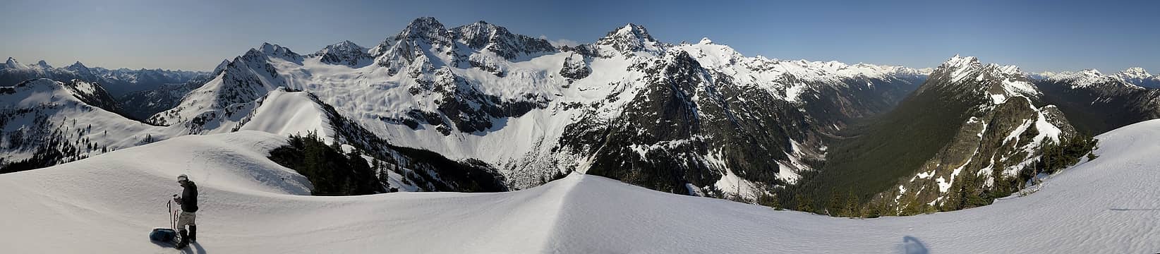 1 label Ragged Ridge at Mid-Day from Trumpet Peak 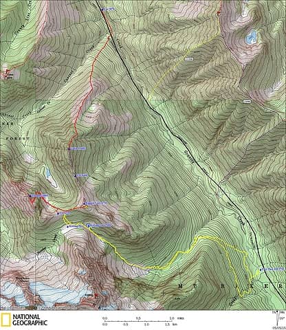 Ragged View GPS Track. Yellow line is our route to camp. Red line is our route to Trumpet Peak. Ignore the other lines for now. 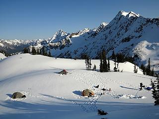 Ragged View Camp 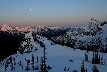 Moonrise above Ragged View Camp 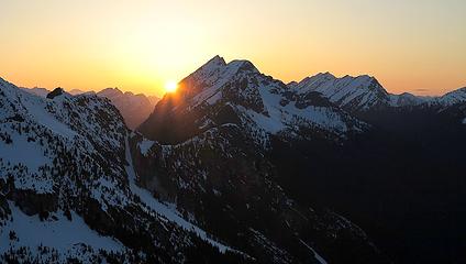 Sunset carving into Gabriel Peak 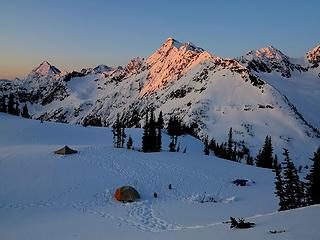 Sunrise at Ragged View Camp 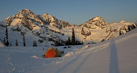 Early morning view from Camp 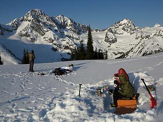 Breakfast on the kitchen bench 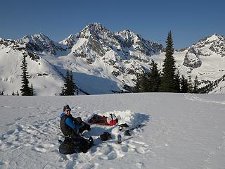 Tom hanging out at his bivy site in the front yard
As beacons mountains burned at evening. J.R.R. Tolkien
As beacons mountains burned at evening. J.R.R. Tolkien
|
| Back to top |
|
|
RichP
Member

Joined: 13 Jul 2006
Posts: 5634 | TRs | Pics
Location: here |
|
RichP
Member
|
Wed May 06, 2015 9:22 am |
|
|
Spectacular photos and trip, folks.
|
| Back to top |
|
|
Goats Know
Gravity's Bitch

Joined: 29 Aug 2007
Posts: 194 | TRs | Pics
|
|
Goats Know
Gravity's Bitch
|
Wed May 06, 2015 10:25 am |
|
|
You guys come up with some neat ideas for trips. This one looks awesome. 
Here on this mountaintop...Woahoho...I got some wild, wild life - Talking Heads
Here on this mountaintop...Woahoho...I got some wild, wild life - Talking Heads
|
| Back to top |
|
|
BarbE
Member

Joined: 28 Jul 2006
Posts: 1153 | TRs | Pics
|
|
BarbE
Member
|
Wed May 06, 2015 10:55 am |
|
|
Great timing for weather and snow conditions. Glad we pushed on to our spectacular campsite. A few more pics.
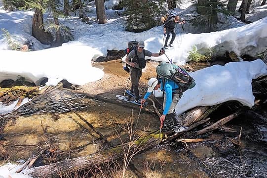 creek crossing 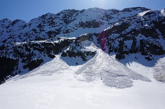 above Kitling creek 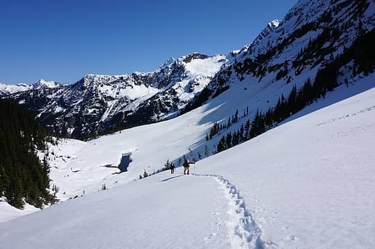 heading toward Kitling Pass 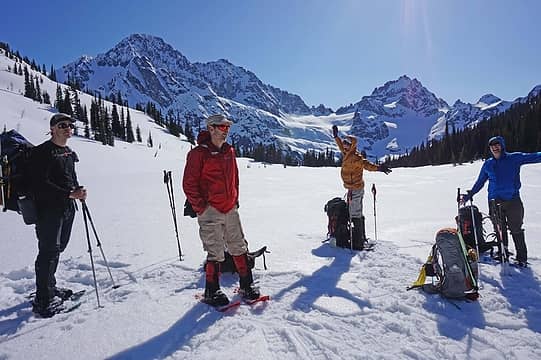 The views are not good enough at Kitling Pass, let's go higher! 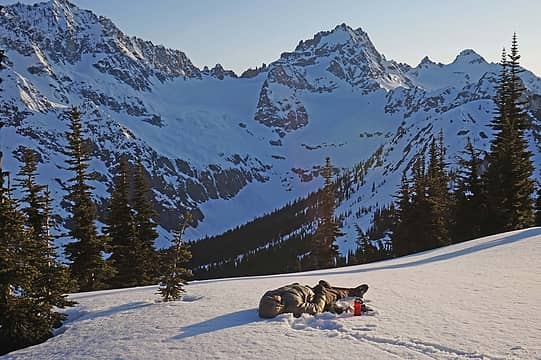 Cartman died and gone to heaven 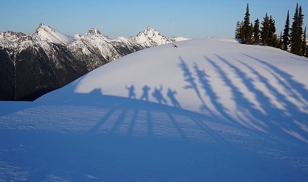 goofy shadow people 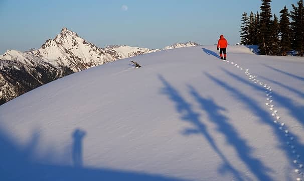 eastern views 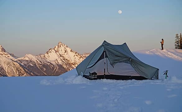 Moon rising over Henry Shire's tarp tent 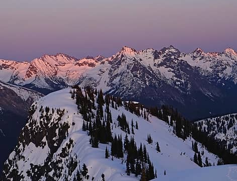 east 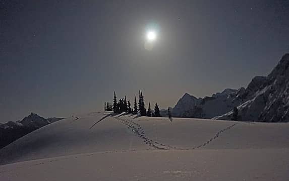 Still light at 10 PM with an almost full moon 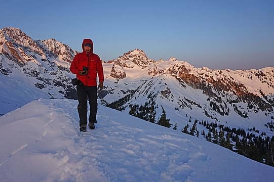 sunset 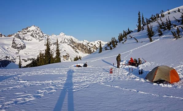 breakfast 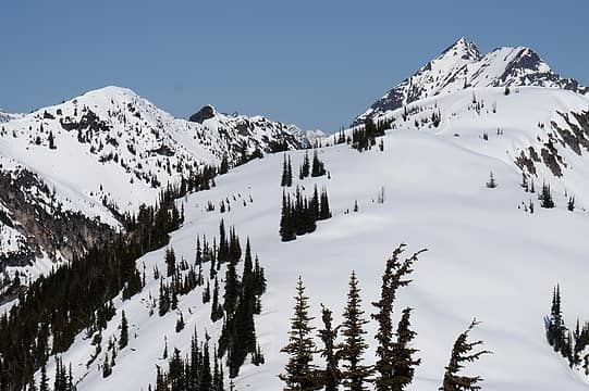 looking back at our camp from Pk 6400 Trumpet on the left 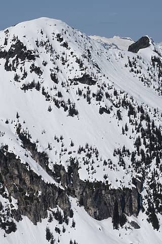 Matt, Carla, Tom and Eric leaving Trumpet Pk and heading for the exit gully on the right 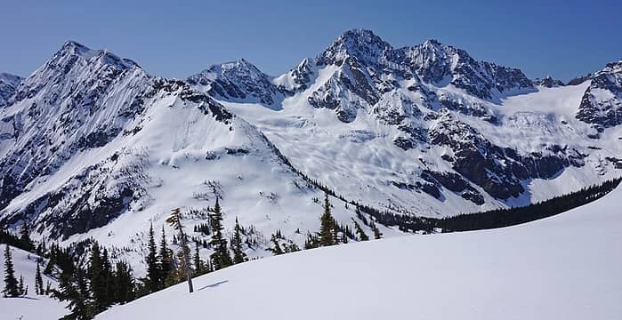 Kitling, Cub, Mesahchie, Katsuk 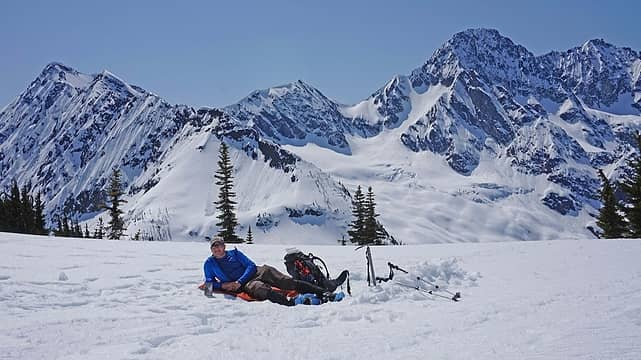 Tom in his happy home 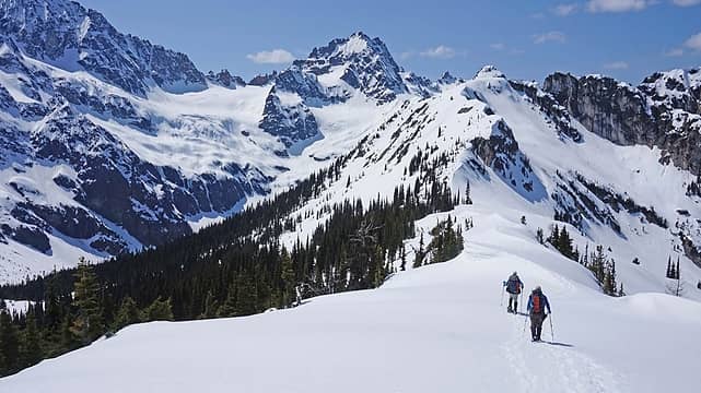 leaving camp 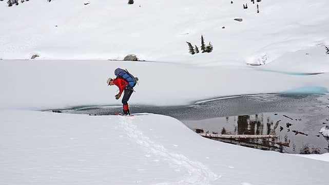 Matt getting ready for a mandatory swim in Kitling Lake 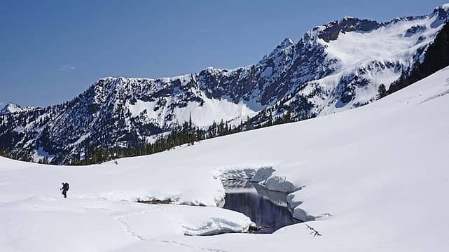 hike out along Kitling Creek
|
| Back to top |
|
|
Jetlag
Member
Joined: 17 Aug 2010
Posts: 1410 | TRs | Pics
|
|
Jetlag
Member
|
Wed May 06, 2015 12:38 pm |
|
|
Superb bluebird photos BarbE, Matt and Eric!
|
| Back to top |
|
|
GeoTom
Member

Joined: 19 May 2005
Posts: 3215 | TRs | Pics
Location: Earth |
|
GeoTom
Member
|
Wed May 06, 2015 6:23 pm |
|
|
It was a nice trip. A few photos from me (full flickr set here: Ragged View; May 2-3, 2015)
 Matt and Carla head up the creek valley 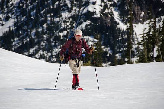 Matt 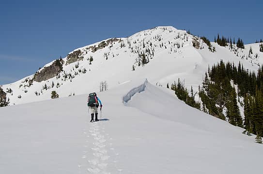 Carla and Ragged View Peak 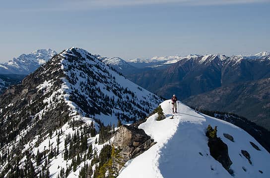 Matt on the lower summit of Ragged View  Barb on Ragged View 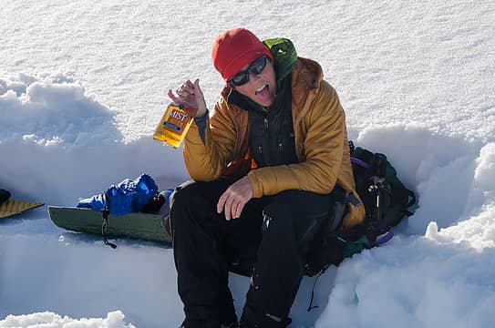 It was about to get misty 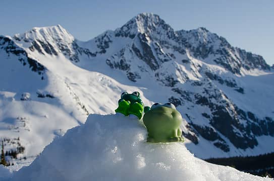 Frogged View 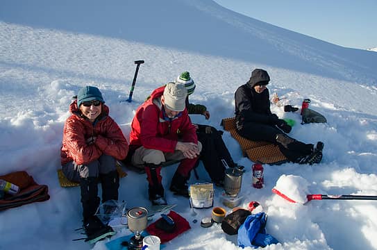 Too many cooks in the kitchen 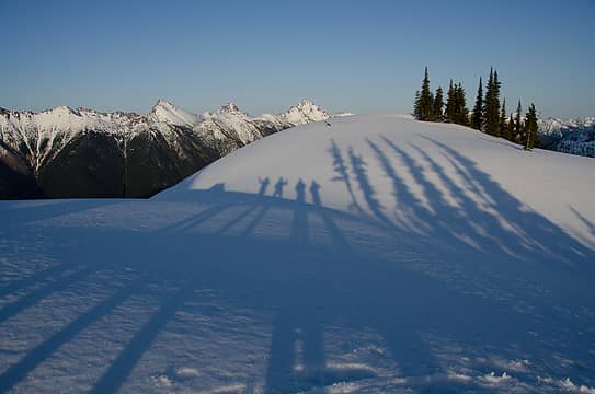 Shadows 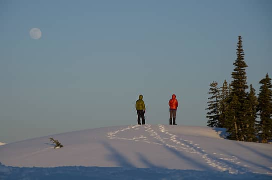 Carla and Barb look at the MOON! 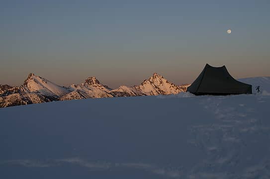 Peaks, tent and moon 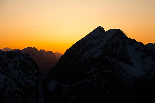 Sunset behind Gabriel Peak 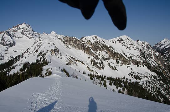 Pointing to our destination 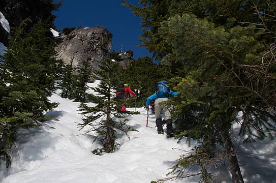 Heading up the tree filled gully 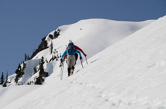 Matt and Carla lead the way 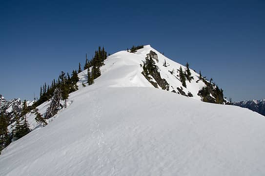 Solid snow on the final ridge 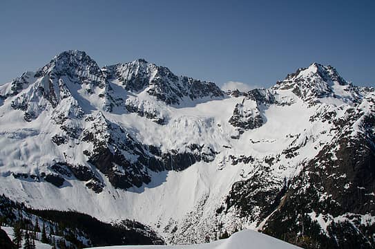 Ragged Ridge 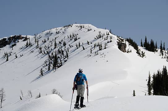 Barb watches from above 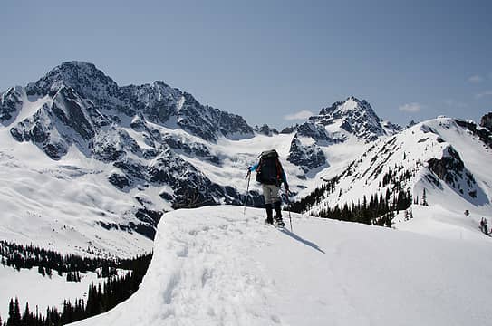 Carla takes in the views 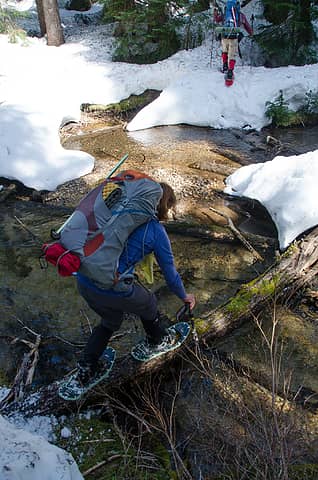 Creek crossing
|
| Back to top |
|
|
mattfirth
Member
Joined: 23 Dec 2013
Posts: 24 | TRs | Pics
|
Nice trip report (great photos) and a great skiing and rambling area. Several years ago a friend and I traversed that ridge from Gabriel Pk to Panther Pass and at the high point of 6865' there was an older summit register with (I think) one entry. In 1999 John Roper and a friend or two had named that point Panthers Tail. If the summit register is still there it was likely buried under snow.
|
| Back to top |
|
|
Matt
Tea, Earl Grey, Hot
Joined: 30 Jan 2007
Posts: 4307 | TRs | Pics
Location: Shoreline |
|
Matt
Tea, Earl Grey, Hot
|
Fri May 08, 2015 1:11 am |
|
|
Here's the route info for Ragged View Peak 6730.
We took the Easy Pass trail across Granite Creek and up the opposite side to somewhere between 3800 and 4100 feet. (Below 3800 there is some snow cover in the bottom of the creek valley. Above that it's dry ground.)
Leave the trail and traverse north and west over to the next creek valley, called Kitling Creek on some maps.
On the way in, we departed the trail circa 4150 feet and traversed between 4100 and 4200. On the way back, we angled lower, but descended too soon, so had to come back up toward 3800 to avoid the snow and logs in the flat creek bottom. Somewhere in between is probably best. It's mostly open forest, but with lots of downed logs to maneuver around. Just pick whatever path seems best as you travel somewhere between 3800 and 4200 feet.
The Kitling Creek basin was snow-covered, which made for easier travel on snowshoes, with most brush or logs covered by snow. We crossed the creek circa 4200.
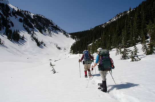
From there on, we just followed the righthand side of the creek uphill to the lake at 5800 and then the very broad pass at 6000, sometimes called Kitling Pass. Admire the impressive cliffs of Kitling on the opposite side of the creek, and be glad that the snow has mostly melted or stabilized and didn't seem to present any danger of the slides that had previously fractured trees in the valley.
From Kitling Pass, ascend moderate sloped northward to the col at 6330 feet. Views of Ragged Ridge get better and better.
Then just follow the ridge crest eastward to Ragged View 6730. We angled right of the crest for the last couple hundred feet to avoid a steeper area, and ended up on the broad flat campside just east of the summit.
As beacons mountains burned at evening. J.R.R. Tolkien
As beacons mountains burned at evening. J.R.R. Tolkien
|
| Back to top |
|
|
contour5
Member

Joined: 16 Jul 2003
Posts: 2963 | TRs | Pics
|
|
contour5
Member
|
Sun May 10, 2015 10:15 am |
|
|
Beautiful. Ragged View looks like a spectacular camp spot...
|
| Back to top |
|
|
Opus
Wannabe

Joined: 04 Mar 2006
Posts: 3700 | TRs | Pics
Location: The big rock candy mountain |
|
Opus
Wannabe
|
Tue May 12, 2015 10:11 am |
|
|
Followed this same route over the weekend, minus the side trip to Trumpet. Snow was just too soft. Conditions haven't changed too much but the snow near Kitling Creek is melting fast. I punched through into buried slide alder and streams several times even with snowshoes. I ascended the left side of the creek simply because I ended up on that side down lower and punched through into the creek trying to cross to the right. It worked fine. Steep in places but not bad.
Had the summit to myself until near sunset when Radka and her husband showed up on skis. Very calm night and plenty warm. I left camp at 7am the next day and used crampons to descend the few hundred feet back to the saddle on the ridge. The snow was already too soft and I switched back to snowshoes on the descent.
 Typical cross country 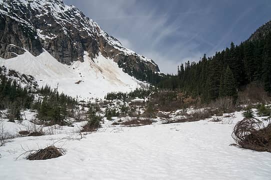 Thin snow minefield 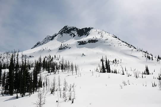 Kitling  Kimtah 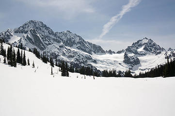 View from the col 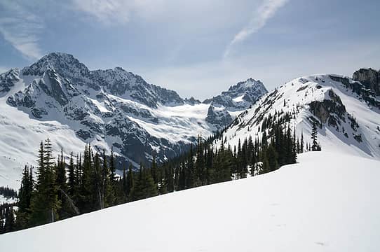 On the ridge 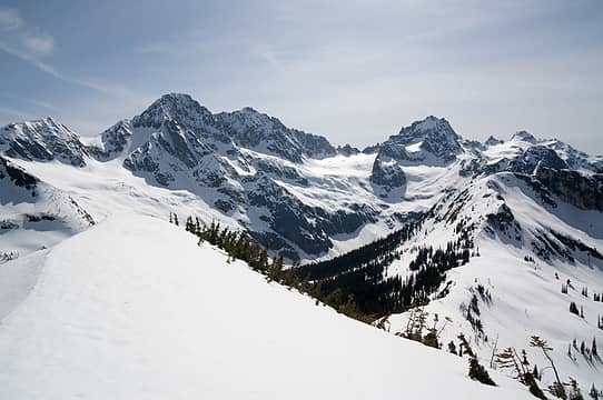 Summit view 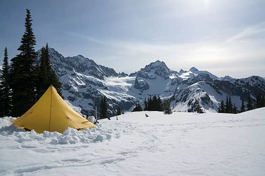 Camp 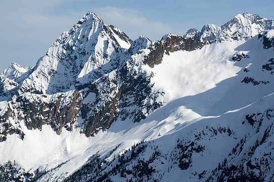 Graybeard 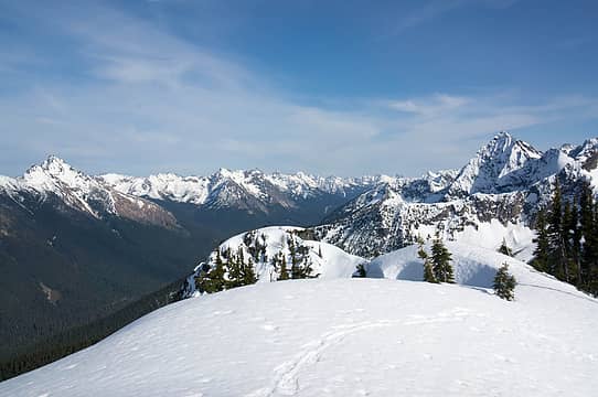 End of the ridge 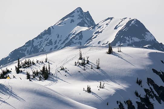 Back to camp 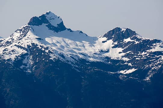 Crater 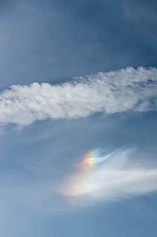 Sundog 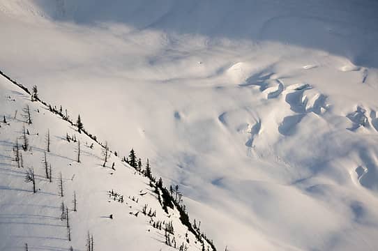 Crevasses 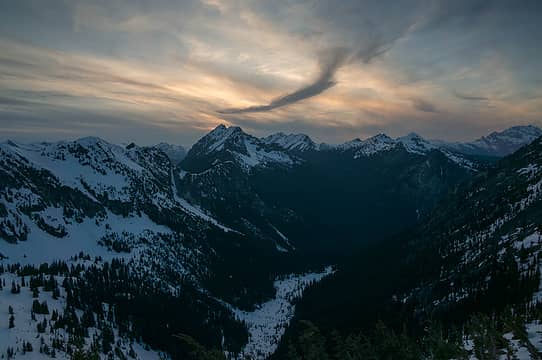 Sunset 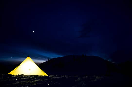 Glowing 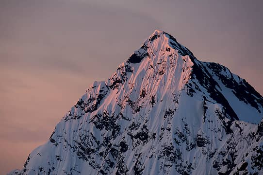 Graybeard 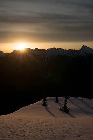 Sun is up 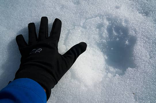 Big bear tracks 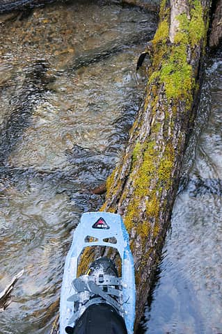 Snowshoe log crossing
|
| Back to top |
|
|
MtnMike
Member
Joined: 15 Oct 2002
Posts: 23 | TRs | Pics
Location: Seattle |
|
MtnMike
Member
|
Wed May 13, 2015 10:36 pm |
|
|
Nice to hear Matt finally got these peaks. When I climbed in April 2000, Pk6882 was called "Grabinet" and Pk6865 was called "Panther Tail" (JohnR names).
|
| Back to top |
|
|
|
|
You cannot post new topics in this forum
You cannot reply to topics in this forum
You cannot edit your posts in this forum
You cannot delete your posts in this forum
You cannot vote in polls in this forum
|
Disclosure: As an Amazon Associate NWHikers.net earns from qualifying purchases when you use our link(s). |


