| Previous :: Next Topic |
| Author |
Message |
cartman
Member


Joined: 20 Feb 2007
Posts: 2800 | TRs | Pics
Location: Fremont |
|
cartman
Member
|
 Thu Jul 30, 2015 9:07 pm |
|
|
After the big trip Oyvind and I were going to do with Greg and Jon got nixed due to the lousy weather this past weekend, I was workin' it to come up with some other ideas.
Within 6 hours last Wednesday, I was able to organize a great trip up Porcupine with Mike C. on Thursday, the West Ridge on Cutthroat with Brent turned back by showers Friday, and this...fine...escapade up Ballard Tuesday with Oyvind and Jeff. Now that's retrieving the weekend. Thanks guys!
CAUTION: Ballard is a very loose, dangerous peak. Be very careful of rockfall and loose holds with extensive steep Class 3 and 4 terrain.
The East Face route on Ballard is quite complex. No real trail, brush, short line of sight up much of the route, very poor and loose rock, complicated routefinding, a couple of thousand feet of junk strewn on anywhere from exposed Class 3 up to low Class 5 terrain makes for a long day even though the route is just under 11 miles RT. To be direct, this peak has very little to recommend it regarding aesthetics. Excellent party management is essential to avoid party-induced rockfall. We did not bring climbing gear for this trip.
To give some perspective of the route, if you have done the neighboring Azurite, that peak is a pleasant walk in the park compared to this one. Ballard is a full grade more difficult on worse rock for a lot longer.
We drove up Monday evening to the gate at the end of the Slate Creek Road down from Harts Pass to get an early start in the morning. The road to Harts Pass is in very good shape. We decided not to try to camp on this trip since the mileage and gain suggested this should go well as a day trip, and the lack of water available on the route this year. Both turned out to be true.
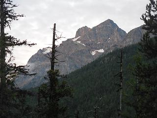 First view of Ballard 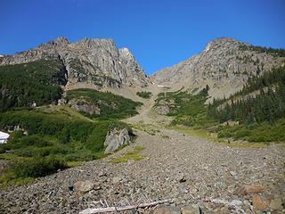 View from first talus field 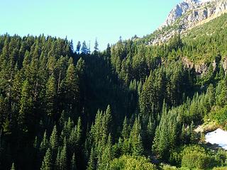 First tree slope 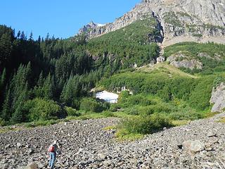 Jeff heads for the brush 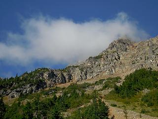 View from second talus field 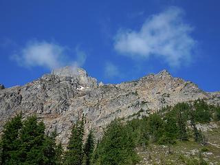 Views 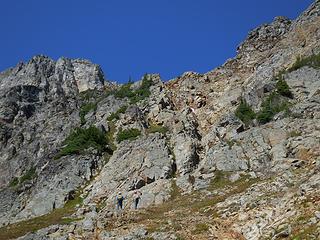 Grassy ramp and rock rib 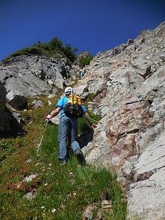 Oyvind in the grassy ramp 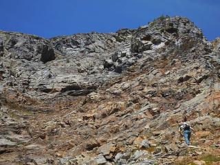 Complex face 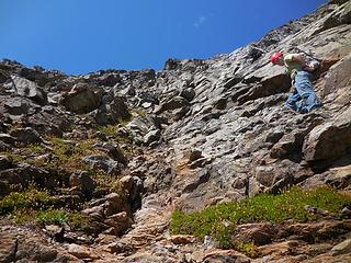 Jeff on an easier section 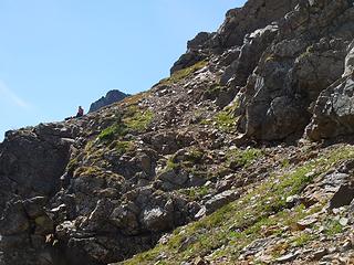 Oyvind waits 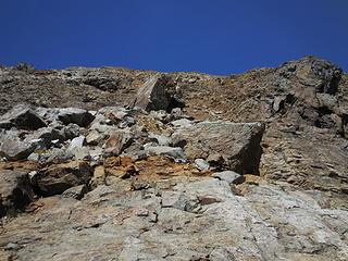 Typical junk 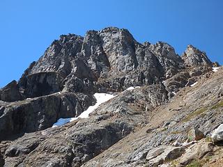 Big wall 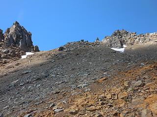 Upper East Face 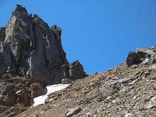 To the notch 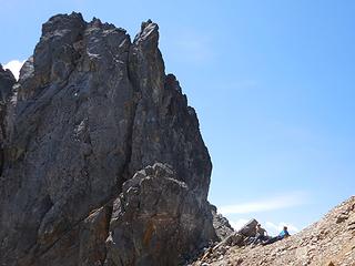 Hanging out, ready for the finish 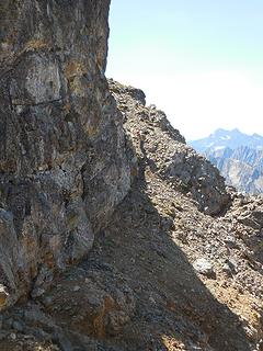 First ledge section 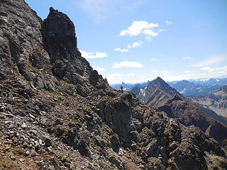 Second ledge section 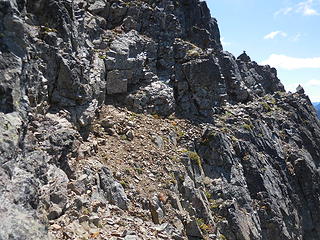 Third ledge section 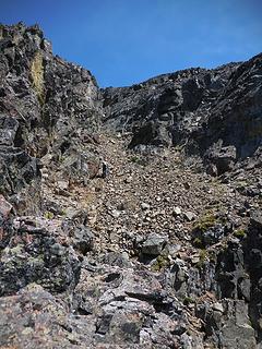 Summit gully 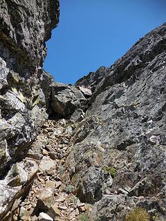 Gully chockstone 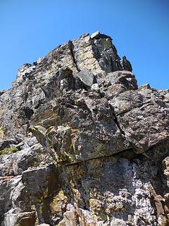 Summit block 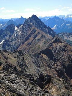 Azurite 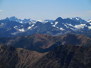 Goode to Logan 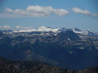 Inspiration Traverse 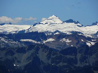 Eldorado 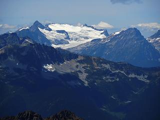 Snowfield group 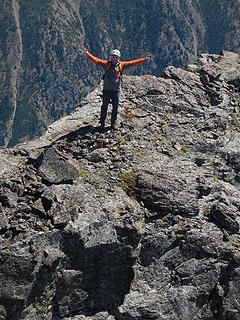 Oyvind
|
| Back to top |
  
|
|
Jetlag
Member
Joined: 17 Aug 2010
Posts: 1410 | TRs | Pics
|
|
Jetlag
Member
|
Thu Jul 30, 2015 9:42 pm |
|
|
Great detail! And I love the picture of Eldorado from that angle.
If I ever decide to tackle Ballard (extremely unlikely after reading your TR) the route description would make it so much easier in a dry summer like this one.
Thanks for taking the time to write it all up!
|
| Back to top |
|
|
puzzlr
Mid Fork Rocks

Joined: 13 Feb 2007
Posts: 7220 | TRs | Pics
Location: Stuck in the middle |
|
puzzlr
Mid Fork Rocks
|
Thu Jul 30, 2015 10:53 pm |
|
|
Congrats on this one. Is there a peak named Phinney too?
|
| Back to top |
|
|
raising3hikers
Member
Joined: 21 Sep 2007
Posts: 2344 | TRs | Pics
Location: Edmonds, Wa |
nice, i've been trying to find time to get there. thanks for the road update and report.
|
| Back to top |
|
|
cartman
Member
Joined: 20 Feb 2007
Posts: 2800 | TRs | Pics
Location: Fremont |
|
cartman
Member
|
Fri Jul 31, 2015 8:22 am |
|
|
| puzzlr wrote: | | Is there a peak named Phinney too? |
Finney
Fremont
| raising3hikers wrote: | | nice, i've been trying to find time to get there. thanks for the road update and report. |
This report isn't supposed to make you want to go there.  
|
| Back to top |
|
|
Shred
Member

Joined: 05 May 2009
Posts: 255 | TRs | Pics
Location: Slowhomish |
|
Shred
Member
|
Sat Aug 01, 2015 3:47 am |
|
|
Looks like a fun pile of crap! Stuff like that, makes me appappreciate the clean climbing of the Cascades, that much more. Nice work, Eric.
|
| Back to top |
|
|
Roald
Member

Joined: 06 Aug 2007
Posts: 367 | TRs | Pics
Location: Seattle |
|
Roald
Member
|
Sun Aug 02, 2015 10:03 pm |
|
|
Congrats, Eric! You made a lot out of that weekend. I am glad Greg and I went up the easier mountain on Monday.
|
| Back to top |
|
|
Matt
Tea, Earl Grey, Hot

Joined: 30 Jan 2007
Posts: 4307 | TRs | Pics
Location: Shoreline |
|
Matt
Tea, Earl Grey, Hot
|
Mon Aug 03, 2015 9:04 am |
|
|
That's a tough undertaking for a day trip in hot weather with the slopes bare of snow. Glad you were able to endure it.
The route's much better earlier in a normal summer when there's some snow on it, since the snow accumulates on the gullies or lower angled slopes, and covers up most of the loosest rock.
https://www.nwhikers.net/forums/viewtopic.php?t=8007375
As beacons mountains burned at evening. J.R.R. Tolkien
As beacons mountains burned at evening. J.R.R. Tolkien
|
| Back to top |
|
|
|
|
You cannot post new topics in this forum
You cannot reply to topics in this forum
You cannot edit your posts in this forum
You cannot delete your posts in this forum
You cannot vote in polls in this forum
|
Disclosure: As an Amazon Associate NWHikers.net earns from qualifying purchases when you use our link(s). |


