| Previous :: Next Topic |
| Author |
Message |
Gimpilator
infinity/21M


Joined: 12 Oct 2006
Posts: 1684 | TRs | Pics
Location: Edmonds, WA |
| Fletcher wrote: | 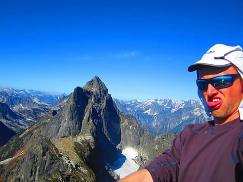 Me on top with Triumph |
I've wanted to do Thornton Peak since I did Trappers with Bryan in 2010. When Fletcher posted his 2012 report (above photo), I was a bit jealous, but happy for him at the same time. Finally I got around to checking out this awesome peak in a very lovely area.
Thornton - October 23
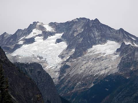
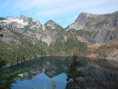 1 label lower Thornton Lake below Thornton Peak and X Mountain 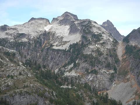 Thornton 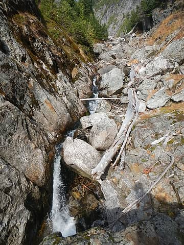 deep narrow channel 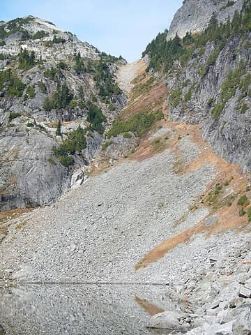 access gully 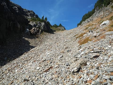 the gap above 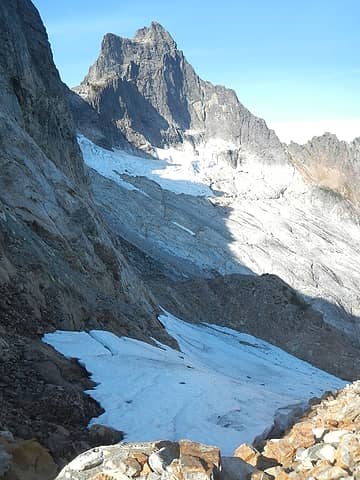 Triumph 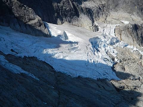 Triumph east glacier 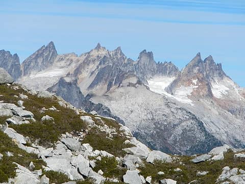 Southern Pickets 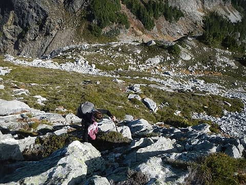 steep terrain above the gap 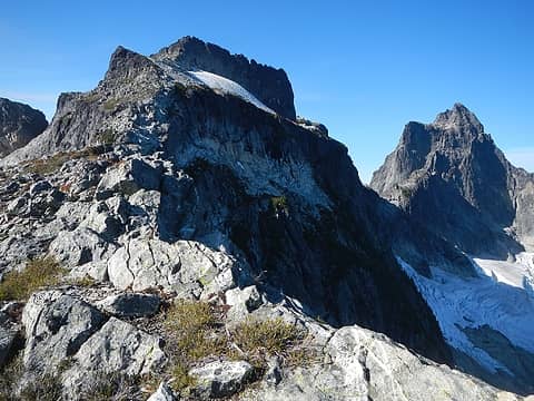 Thornton and Triumph 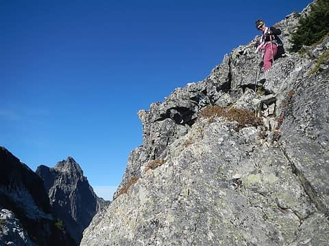 above the notch 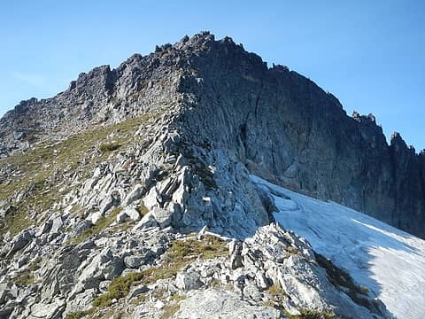 summit block 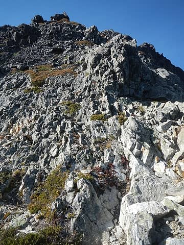 somewhat crumbly rock 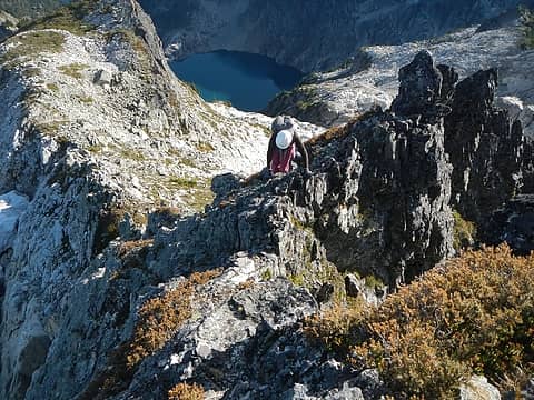 Heather on a narrow exposed section 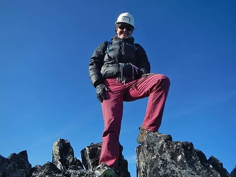 summit 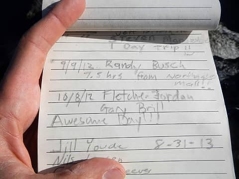 Fletcher 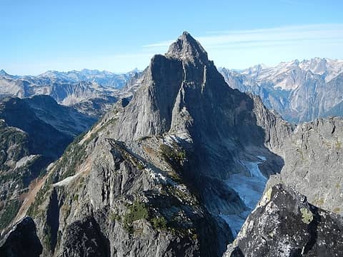 Triumph 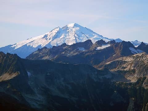 Baker 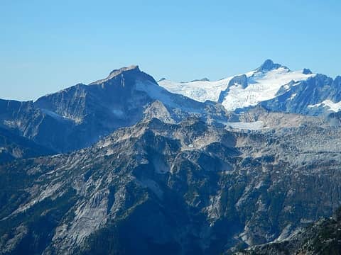 Blum and Shuksan 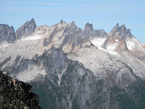 Southern Pickets 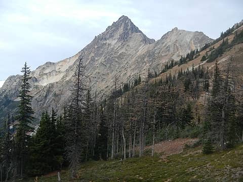 Mesahchie 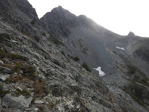 Graybeard traverse 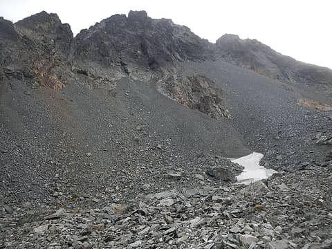 1 label entrance to gully above talus on right 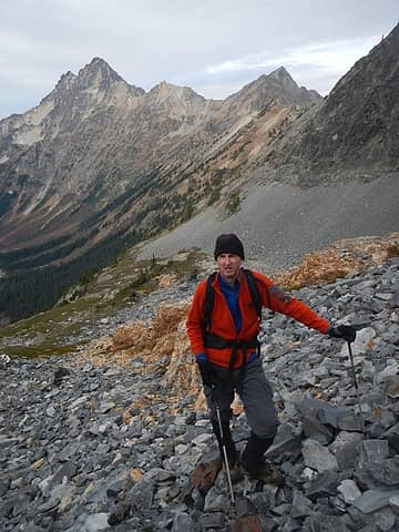 Eric 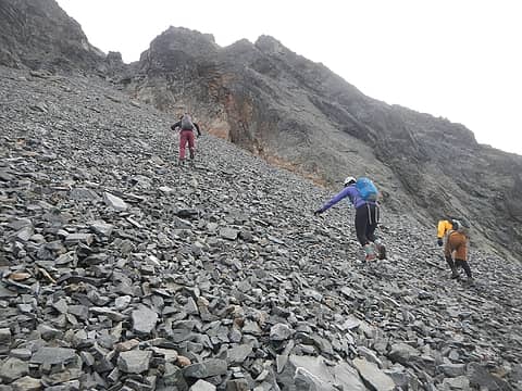 steep crappy scree and talus 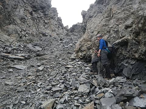 chossy gully 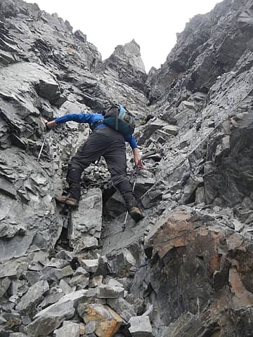 last photo before dropping my camera  No more pictures of the route... Then we came to the crux.
The crux was a 15 foot step of class 4 to 3+. The bottom of it involved climbing two white chock-stones which force you into an awkward stance under an overhang. It eases up near the top with some better hands and feet options on the right side.
Above the crux step we came to a gap in the ridge and did some more tricky scrambling to get onto the upper crest (climbers left). From there it was a short walk to the summit. Dustin was able to get some photos of us on top, so hopefully he can share those later. No summit register present.
Our strategy to get the group down safely was for Eric to go first and get out of the bowling alley gully and then Heather and I to go next and Dustin and Andrea last. This worked well. And Eric found my camera in the gully! Amazingly it was still fully functional despite the long fall. The lens wasn't even scratched. No more pictures of the route... Then we came to the crux.
The crux was a 15 foot step of class 4 to 3+. The bottom of it involved climbing two white chock-stones which force you into an awkward stance under an overhang. It eases up near the top with some better hands and feet options on the right side.
Above the crux step we came to a gap in the ridge and did some more tricky scrambling to get onto the upper crest (climbers left). From there it was a short walk to the summit. Dustin was able to get some photos of us on top, so hopefully he can share those later. No summit register present.
Our strategy to get the group down safely was for Eric to go first and get out of the bowling alley gully and then Heather and I to go next and Dustin and Andrea last. This worked well. And Eric found my camera in the gully! Amazingly it was still fully functional despite the long fall. The lens wasn't even scratched.
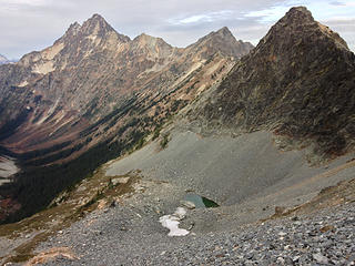
 Logan 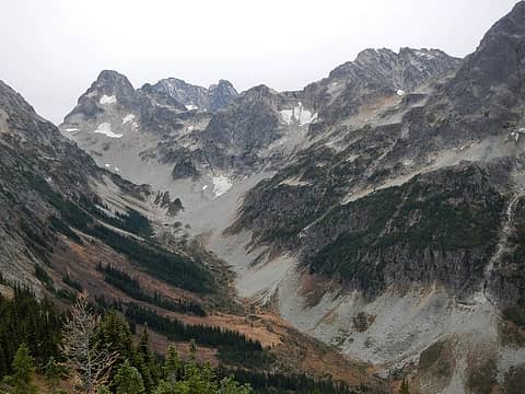 Fisher Creek valley 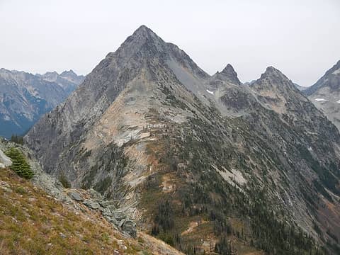 looking back at Graybeard 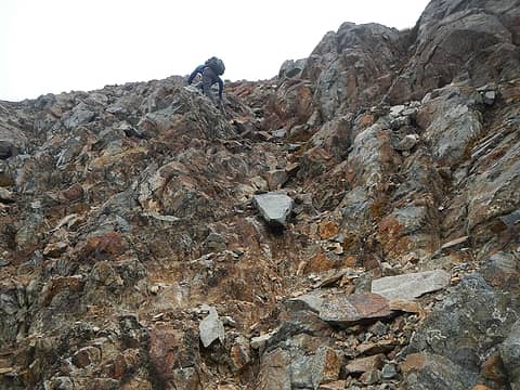 scrambling up Honeymoon Hump 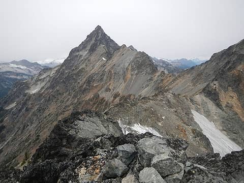 Mesahchie 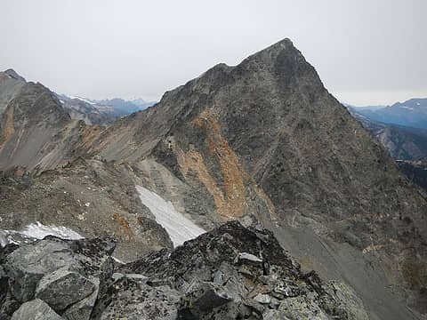 Kitling seen from Honeymoon Hump  snow storm coming  more snow
|
| Back to top |
  
|
|
Dustin Trails
Member

Joined: 23 Feb 2015
Posts: 116 | TRs | Pics
Location: Ashford, WA |
Great trip idea on Eric's part! I'm glad we could assemble this team, it's nice to get out there with a group of five strong climbers.
Here are a few shots that I took, including a few from above Adam's camera drop:
 Katsuk, Mesahchie, Cub, Kitling from halfway up talus on Graybeard 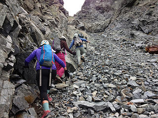 Entering narrow section of upper gully 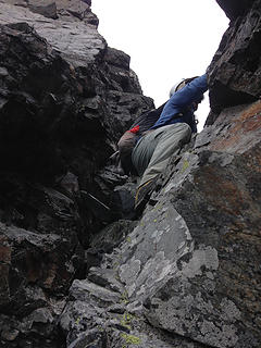 Adam in the class 3+/4 move 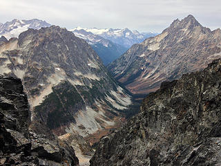 Looking out of the top of the gully at The Arches and Mesahchie with Logan in the background 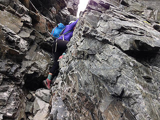 Andrea in the class 3+/4 move 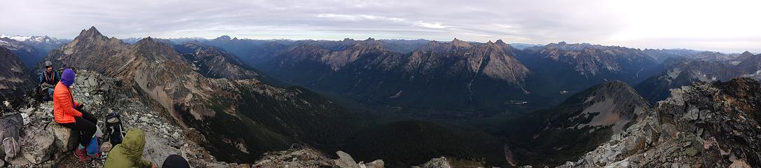 Graybeard summit panorama 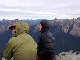 Adam and Heather intently listening to Eric's story 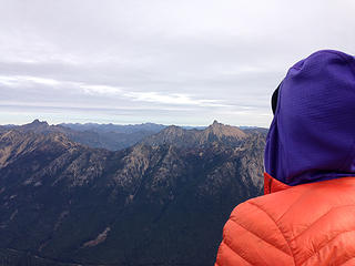 Andrea gazing at the Pasayten with Azurite (left) and Golden Horn (right) in the foreground 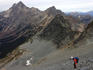 Talus surfing down Graybeard 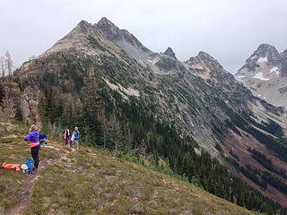 De-layering before the trip up Honeymoon Hump
|
| Back to top |
|
|
Gimpilator
infinity/21M
Joined: 12 Oct 2006
Posts: 1684 | TRs | Pics
Location: Edmonds, WA |
| Dustin Trails wrote: | | Great trip idea on Eric's part! |
Absolutely right! Thanks for allowing Heather and I to jump on your trip. 
|
| Back to top |
|
|
Anish
Member
Joined: 07 Sep 2014
Posts: 79 | TRs | Pics
|
|
Anish
Member
|
 Sun Oct 25, 2015 9:03 am |
|
|
Fun weekend everyone!
"Our way is not soft grass. It's a mountain path with lots of rocks. But it goes upwards, forward, toward the sun." -Ruth Westheimer
"Our way is not soft grass. It's a mountain path with lots of rocks. But it goes upwards, forward, toward the sun." -Ruth Westheimer
|
| Back to top |
|
|
RichP
Member

Joined: 13 Jul 2006
Posts: 5634 | TRs | Pics
Location: here |
|
RichP
Member
|
Sun Oct 25, 2015 9:17 am |
|
|
That's a nice set of peaks. 
|
| Back to top |
|
|
mike
Member

Joined: 09 Jul 2004
Posts: 6398 | TRs | Pics
Location: SJIsl |
|
mike
Member
|
Sun Oct 25, 2015 11:06 am |
|
|
| Gimpilator wrote: | | We made it as far as Honeymoon Hump before an impending snowstorm turned us around. |
Just curious. Did you see the unmarked, unnamed pocket lake just N. below Honeymoon? Old USGS topos show all glacier...
|
| Back to top |
|
|
Bryan K
Shameless Peakbagger

Joined: 29 Sep 2005
Posts: 5129 | TRs | Pics
Location: Alaska |
|
Bryan K
Shameless Peakbagger
|
Sun Oct 25, 2015 2:38 pm |
|
|
Nice job!! Wish I could've done Thornton with you though.
|
| Back to top |
|
|
puzzlr
Mid Fork Rocks

Joined: 13 Feb 2007
Posts: 7220 | TRs | Pics
Location: Stuck in the middle |
|
puzzlr
Mid Fork Rocks
|
Sun Oct 25, 2015 4:12 pm |
|
|
You are so lucky on the camera, which is great.
Many years ago I had a good Nikon film camera and was running down a slope (I could do that back then) and the whole strap bounced over my head and my camera rolled through the woods and apparently over a huge cliff, but still in the case. It was hopeless, but I looked over the cliff at the last spot I saw it and it had caught on a bush just over the lip -- kind of like climbers in Hollywood climbing movies!
|
| Back to top |
|
|
Fletcher
Member

Joined: 29 Jul 2009
Posts: 1870 | TRs | Pics
Location: kirkland |
|
Fletcher
Member
|
Sun Oct 25, 2015 7:26 pm |
|
|
Good stuff guys! Thornton is a good one.
|
| Back to top |
|
|
TK
Member
Joined: 22 Jan 2014
Posts: 43 | TRs | Pics
|
|
TK
Member
|
Mon Oct 26, 2015 8:13 am |
|
|
Nice job.
I have always wanted to get up in that area. I am curious is the road up to Thorton Lakes passable with a normal vehicle?
I've heard some people say you should only attempt this road with a high clearance vehcile. Would hate to make this drive with my honda civic only to find out that I could not make it up the road!
Thanks!
|
| Back to top |
|
|
Gimpilator
infinity/21M
Joined: 12 Oct 2006
Posts: 1684 | TRs | Pics
Location: Edmonds, WA |
Mike - I did not look down the north side of Honeymoon, but now I wish I had.
puzzlr - That's an amazing story. Almost unbelievable. I bet you were pretty happy to see it hanging there.
TK - How many inches of clearance are on your vehicle? It's true that it's not a great road for regular vehicles. Heather has made it up there before with her Hyundai Elantra, however that is really pushing it. The problem is that the road is very steep and some of those sections have very deep washboarding. There is a lower trailhead for those who don't want to drive the road.
|
| Back to top |
|
|
TK
Member
Joined: 22 Jan 2014
Posts: 43 | TRs | Pics
|
|
TK
Member
|
Mon Oct 26, 2015 9:19 am |
|
|
Thanks for the response.
I didn't realize there was a lower trailhead. How many extra miles does that add to your hike?
I drive a Honda Civic. =)
|
| Back to top |
|
|
Brushbuffalo
Member

Joined: 17 Sep 2015
Posts: 1887 | TRs | Pics
Location: there earlier, here now, somewhere later... Bellingham in between |
Classy scarf, Heather! If you ever are short of tat for rapping........  And Adam, just what kind of indestructible camera is that ?
  Amazing!
Passing rocks and trees like they were standing still
Passing rocks and trees like they were standing still
|
| Back to top |
|
|
Brushbuffalo
Member
Joined: 17 Sep 2015
Posts: 1887 | TRs | Pics
Location: there earlier, here now, somewhere later... Bellingham in between |
Southern Pickets
Passing rocks and trees like they were standing still
Passing rocks and trees like they were standing still
|
| Back to top |
|
|
|
|


