| Previous :: Next Topic |
| Author |
Message |
RichP
Member


Joined: 13 Jul 2006
Posts: 5634 | TRs | Pics
Location: here |
|
RichP
Member
|
 Tue Jan 26, 2016 10:16 am |
|
|
Natapoc is a small, forested summit located between Plain and Coles Corner north of Hwy 2. It might not get much attention from the casual hiker, but it does have over 2000' of prominence making it a worthy objective for the peakbagger crowd.
We parked on FR 6601 under the power lines located on River Road outside of Plain. There is a plowed out spot for one or two cars here.
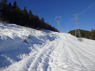 Walking the power lines up Natapoc Mtn. 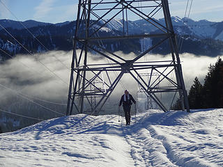 Monty leaving the valley fog above Plain. 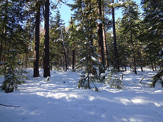 The gentle, treed slopes of Natapoc after leaving the road. 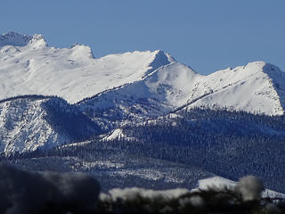 Some distant views from Natapoc summit ridge. 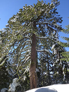 The pine on the north summit at 4204.' 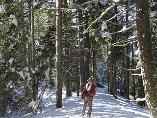 Monty between the north and south summit. 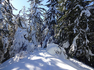 Heading to the south summit. 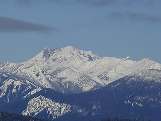 Views along ridge to south summit. 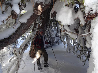 This nice tree is a perfect storm shelter. 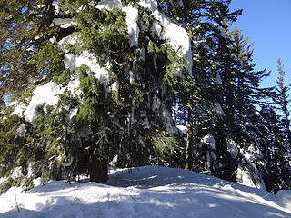 The south summit checked in at 4214' and is also treed. 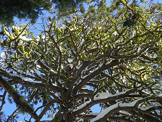 Canopy of pine on the north summit. 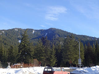 Natapoc from Coles Corner.
|
| Back to top |
  
|
|
mbravenboer
Member

Joined: 20 Oct 2013
Posts: 1422 | TRs | Pics
Location: Seattle |
Looks like gorgeous weather!
| RichP wrote: | Some distant views from Natapoc summit ridge. |
Do you know which direction this was? Looks great!
| RichP wrote: | Views along ridge to south summit. |
I feel like I must be missing something really obvious given the prominence, but do you know which one this is?
I'm surprised I didn't recognize either, must be the unusual angle! Very nice.
|
| Back to top |
|
|
wildernessed
viewbagger

Joined: 31 Oct 2004
Posts: 9275 | TRs | Pics
Location: Wenatchee |
A. Smells like Chiwaukum Ridge.
B. The Maude Complex (Maude, 7FJ, Fernow etc..)
Living in the Anthropocene
Living in the Anthropocene
|
| Back to top |
|
|
mbravenboer
Member
Joined: 20 Oct 2013
Posts: 1422 | TRs | Pics
Location: Seattle |
| wildernessed wrote: | | B. The Maude Complex (Maude, 7FJ, Fernow etc..) |
Ahh, I see it now yeah. My eyes tricked me and the rocky part seemed next to the smooth snow slope of Maude. Thanks!
|
| Back to top |
|
|
RichP
Member
Joined: 13 Jul 2006
Posts: 5634 | TRs | Pics
Location: here |
|
RichP
Member
|
Tue Jan 26, 2016 12:27 pm |
|
|
Thanks Rob. I had trouble with identifying that group too. I can even see the "thumbtack" on the summit ridge to Fernow now that you mention it.
|
| Back to top |
|
|
wildernessed
viewbagger
Joined: 31 Oct 2004
Posts: 9275 | TRs | Pics
Location: Wenatchee |
There are quite a few official and unofficial peaks in that mass so I just started calling it the "Maude Complex" at a certain point. Awesome.😊
Living in the Anthropocene
Living in the Anthropocene
|
| Back to top |
|
|
puzzlr
Mid Fork Rocks

Joined: 13 Feb 2007
Posts: 7220 | TRs | Pics
Location: Stuck in the middle |
|
puzzlr
Mid Fork Rocks
|
Thu Jan 28, 2016 6:50 pm |
|
|
Took me a while to get my photos done. This day definitely didn't meet my normal criteria for the ratio of hiking hours vs driving hours, but RichP did all the driving so I can't complain. It started inauspiciously on logging/power line maintenance roads but got better as we got higher. A cool thing was the natural igloo formed by the branches of a severely distorted pine tree on the summit ridge.
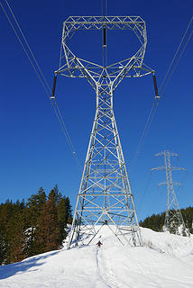 RichP squares off agains the Towerasaurus 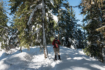 Southern summit, the high point 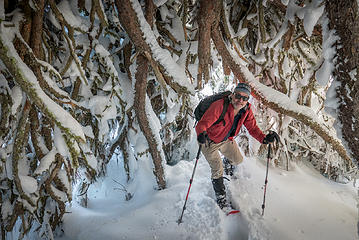 RichP in the natural tree igloo 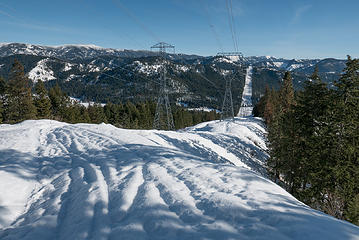 Back to the power lines. One the way back we made a beeline under the power lines which saved a little time.
|
| Back to top |
|
|
|
|


