| Previous :: Next Topic |
| Author |
Message |
Gimpilator
infinity/21M


Joined: 12 Oct 2006
Posts: 1684 | TRs | Pics
Location: Edmonds, WA |
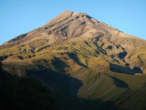
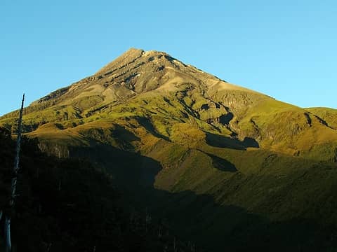
Mount Taranaki on the west coast of the north island is one of the most symmetrical volcanic cones in the world. It was also named Mount Egmont by Captain Cook in 1770 and is known by both names. After Heather concluded her obligations in Wellington we drove to Taranaki National Park. We were glad to be back on the north island. We actually prefer it over the south island.
 Taranaki 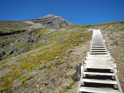 stairs 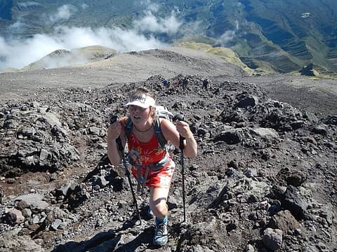 on The Lizard 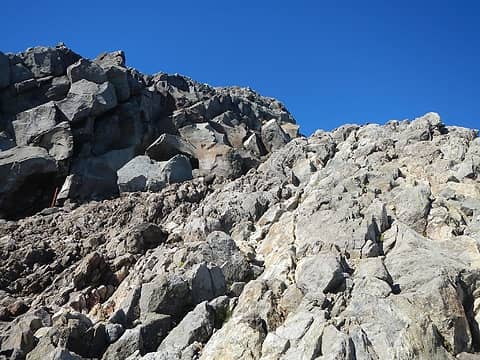 ledge above 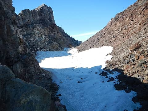 snow in the collapsed crater 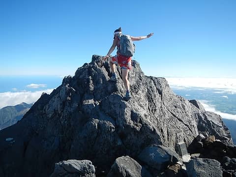 summit rock 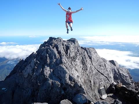 summit leap 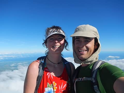 Taranaki summit 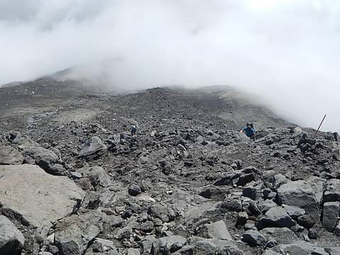 encroaching clouds 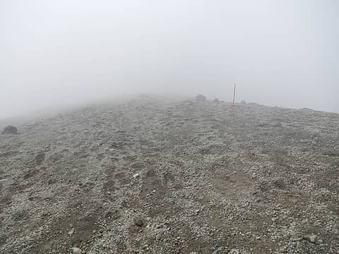 white out 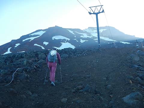 Ruapehu lifts 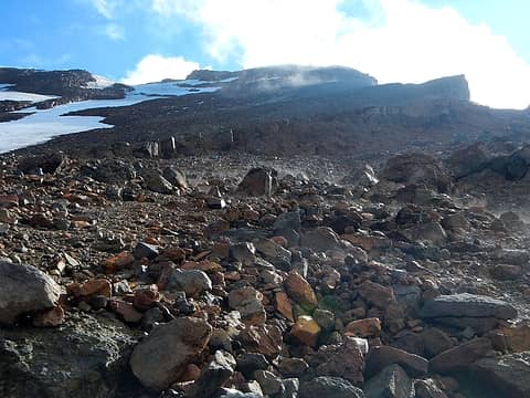 steaming rocks 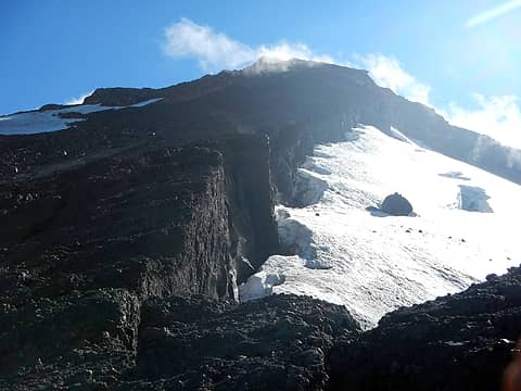 edge of the glacier 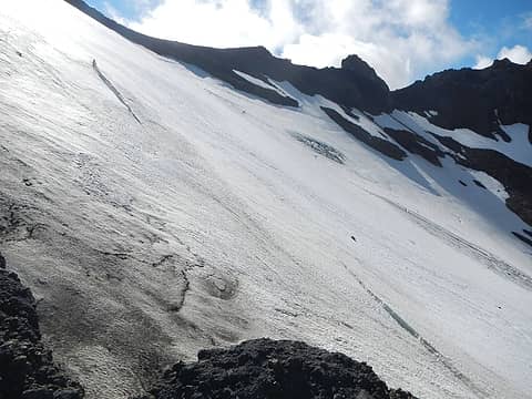 Mangaehuehu Glacier 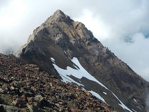 Girdlestone Peak 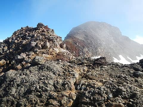 summit visible 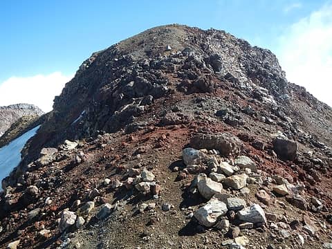 Ruapehu summit block 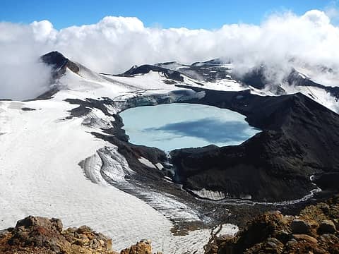 summit plateau 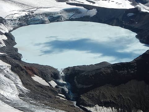 crater lake 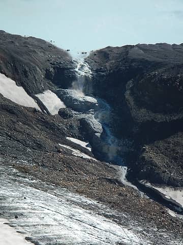 yellow waterfall steam 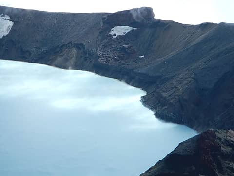 lake steam 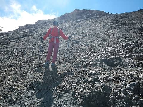 descending 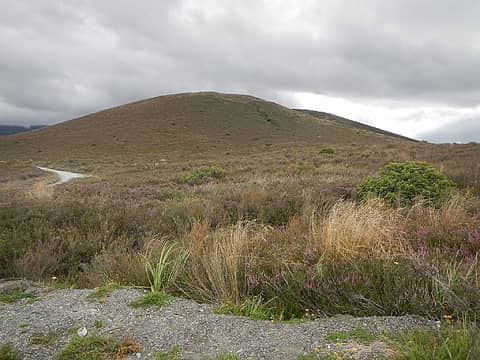 Pukeonake 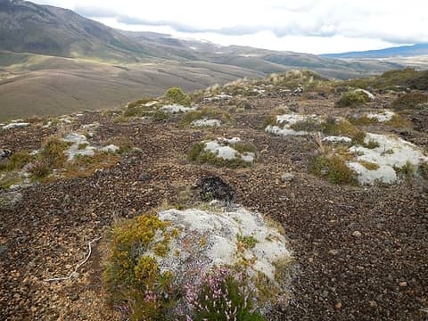 moss mounds 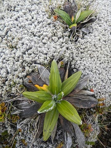 microcosm 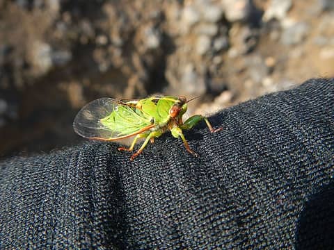 cicada visitor 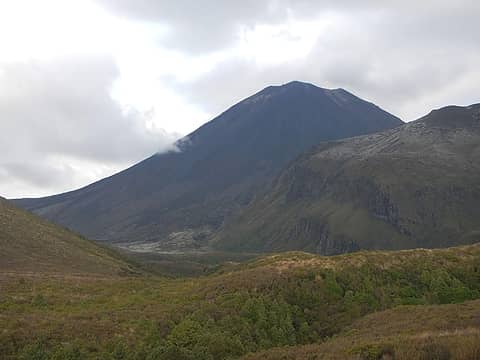 Mount Doom 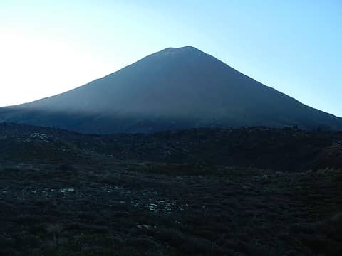 aka Ngauruhoe 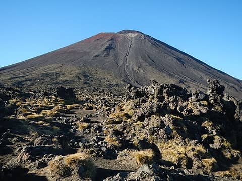 north face 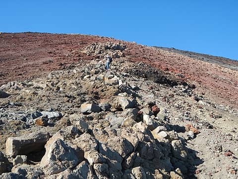 red band ahead 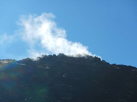 steam vent 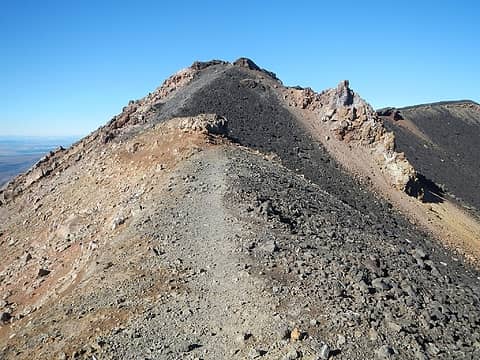 outer rim 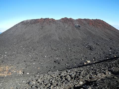 inner crater rim seen from outer rim 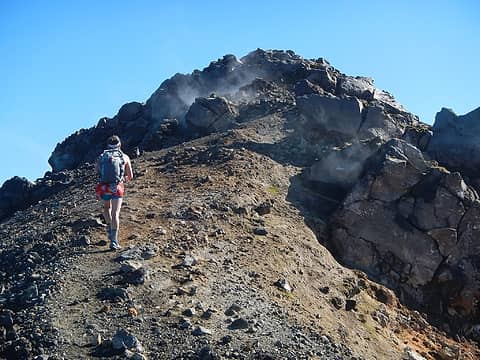 more steam vents 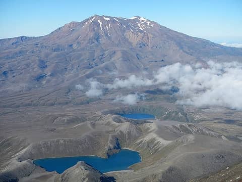 Ruapehu and Tama Lakes 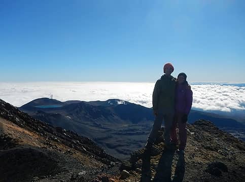 Ngauruhoe summit 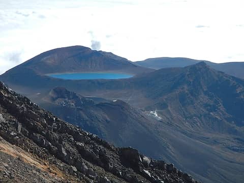 distant Rotopaunga and Blue Lake 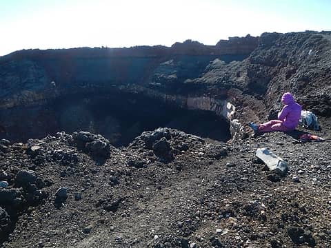 inner caldera 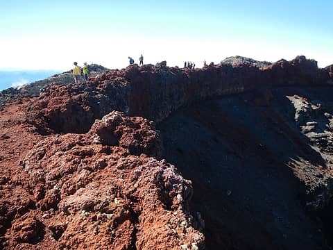 crowds forming 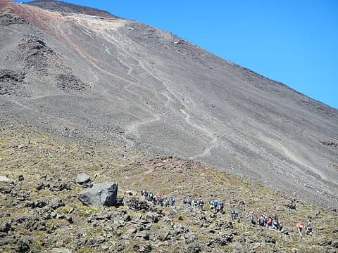 conga line (view full size) 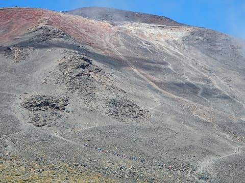 conga line (view full size) 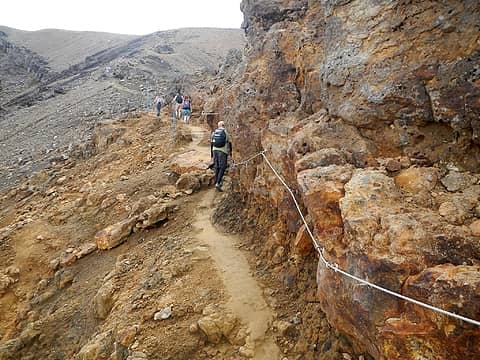 bolted chain 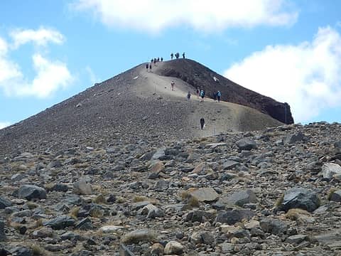 Red Crater summit 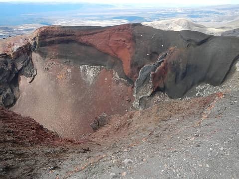 inside Red Crater 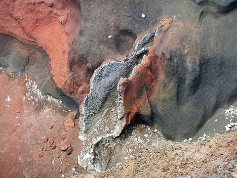 It's a girl!  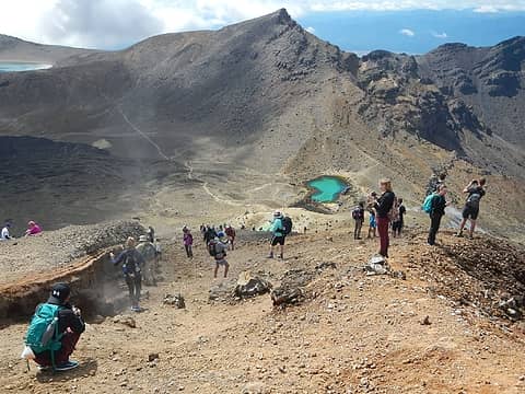 the hordes of Mordor 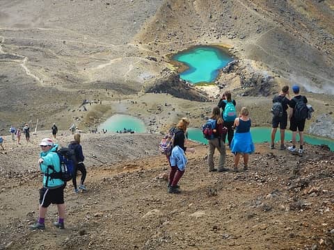 crowds in a surreal setting  Emerald Lakes 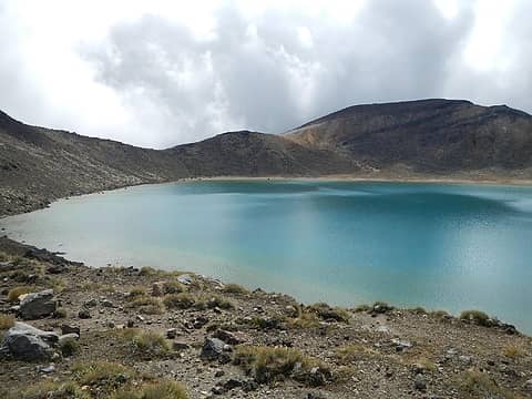 Blue Lake 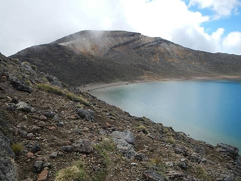 Rotopaunga 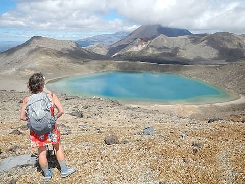 Rotopaunga summit 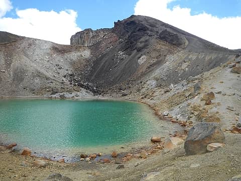 Red Crater above Emerald Lakes 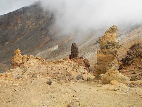 pinnacles near Mount Tongariro 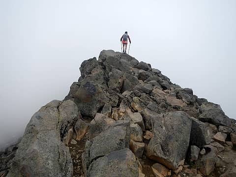 Tongariro summit rocks 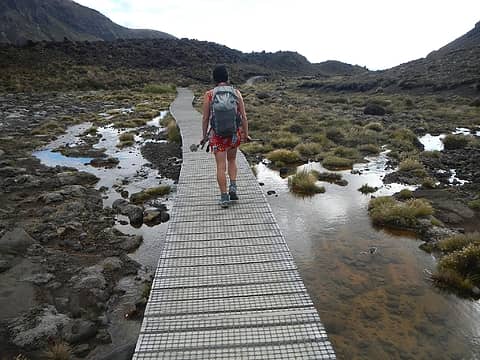 boardwalk
|
| Back to top |
  
|
|
Anish
Member

Joined: 07 Sep 2014
Posts: 79 | TRs | Pics
|
|
Anish
Member
|
 Sun Mar 20, 2016 8:46 am |
|
|
 Taranaki in the morning light 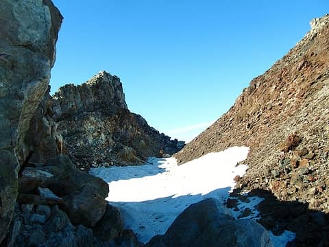 Taranaki Crater 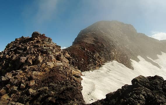 Summit Ridge on Tahurungi 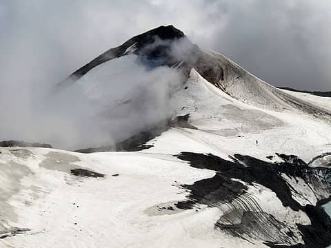 Ruapehu 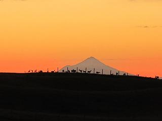 Taranaki at sunset from Tongariro  Starting the Tongariro route 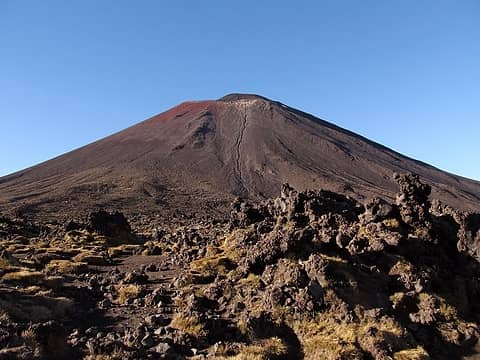 Mt. Doom! 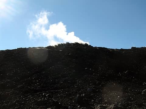 Steam Vents on Ngaurahoe 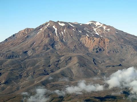 Mt. Ruapehu from Ngaurahoe 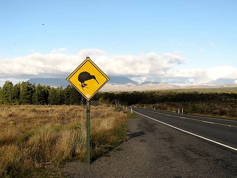 "Skiwi" crossing, apparently
"Our way is not soft grass. It's a mountain path with lots of rocks. But it goes upwards, forward, toward the sun." -Ruth Westheimer
"Our way is not soft grass. It's a mountain path with lots of rocks. But it goes upwards, forward, toward the sun." -Ruth Westheimer
|
| Back to top |
|
|
Fletcher
Member

Joined: 29 Jul 2009
Posts: 1870 | TRs | Pics
Location: kirkland |
|
Fletcher
Member
|
Sun Mar 20, 2016 1:32 pm |
|
|
Nice! The best installment yet, IMO. So glad you're such a LotR nerd like me, love seeing all these locations from the movies.
|
| Back to top |
|
|
Magellan
Brutally Handsome

Joined: 26 Jul 2006
Posts: 13116 | TRs | Pics
Location: Inexorable descent |
|
Magellan
Brutally Handsome
|
Sun Mar 20, 2016 3:05 pm |
|
|
Lovely report and pictures, you two.  Very fun interspersing LOtR references. Very fun interspersing LOtR references.
|
| Back to top |
|
|
Anish
Member
Joined: 07 Sep 2014
Posts: 79 | TRs | Pics
|
|
Anish
Member
|
Sun Mar 20, 2016 6:43 pm |
|
|
| Fletcher wrote: | | So glad you're such a LotR nerd like me, love seeing all these locations from the movi |
I think Adam wishes he had a dollar for every time I said "We're going to climb/have climbed/see Mt. Doom!"
"Our way is not soft grass. It's a mountain path with lots of rocks. But it goes upwards, forward, toward the sun." -Ruth Westheimer
"Our way is not soft grass. It's a mountain path with lots of rocks. But it goes upwards, forward, toward the sun." -Ruth Westheimer
|
| Back to top |
|
|
Anish
Member
Joined: 07 Sep 2014
Posts: 79 | TRs | Pics
|
|
Anish
Member
|
Mon Mar 21, 2016 9:36 pm |
|
|
| Doppelganger wrote: | | Just saw the credit on the PCT guidebook Anish, congrats on that and the TRs! |
Thanks! Yogi does a great job with that guide and it's invaluable to hundreds of people planning their hikes. I am honored to be a part of that.
"Our way is not soft grass. It's a mountain path with lots of rocks. But it goes upwards, forward, toward the sun." -Ruth Westheimer
"Our way is not soft grass. It's a mountain path with lots of rocks. But it goes upwards, forward, toward the sun." -Ruth Westheimer
|
| Back to top |
|
|
mbravenboer
Member
Joined: 20 Oct 2013
Posts: 1422 | TRs | Pics
Location: Seattle |
The view of the acidic crater lake is truly gorgeous! I can imagine Heather's opinion on that view!
Are you allowed to go down to the lake, or is that unwise anyway?
|
| Back to top |
|
|
Frodo Barefoot
Member

Joined: 09 Apr 2015
Posts: 91 | TRs | Pics
|
For some reason I imagined NZ as completely lush all over; that's what I get for believing what I see on tv. Thanks for clearing that up  Excellent reports! Excellent reports!
|
| Back to top |
|
|
|
|
You cannot post new topics in this forum
You cannot reply to topics in this forum
You cannot edit your posts in this forum
You cannot delete your posts in this forum
You cannot vote in polls in this forum
|
Disclosure: As an Amazon Associate NWHikers.net earns from qualifying purchases when you use our link(s). |


