| Previous :: Next Topic |
| Author |
Message |
Gimpilator
infinity/21M


Joined: 12 Oct 2006
Posts: 1684 | TRs | Pics
Location: Edmonds, WA |
Chimney Rock is the highest peak between Mount Daniel and Mount Rainier. Its an intimidating sight from most perspectives, right in the heart of what some have dubbed The Stone Kingdom. Chimney Rock is the apex of a line of rugged craggy spires uncharacteristic of the Central Cascades. I have even heard it called The Pickets of I-90, which is sort of funny.
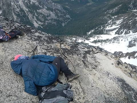
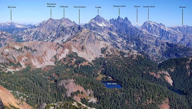 Chimney seen from Hibox October 2010 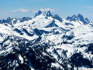 Chimney seen from Malachite, May 2016 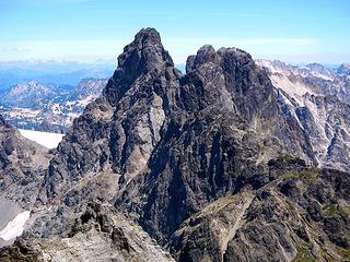 Chimney seen from Lemah, August 2015 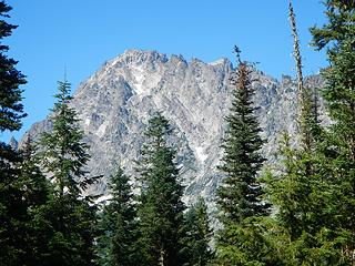 Summit Chief from Lemah Meadows 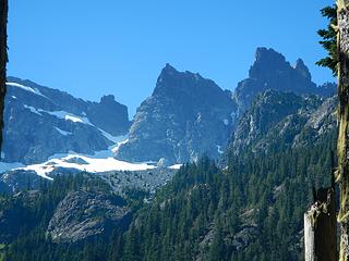 1 label the south and main peak above 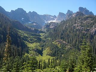 climbers camp is somewhere up there above waterfalls 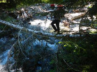 crossing north fork Lemah Creek 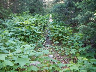 popped balloon and start of climbers path 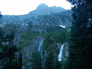 waterfalls 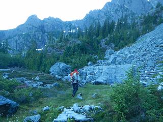 the boulder 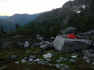 camp 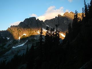 first light 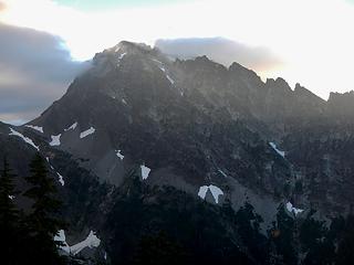 Summit Chief 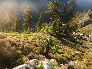 north side of the buttress 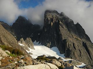 south peak and main peak 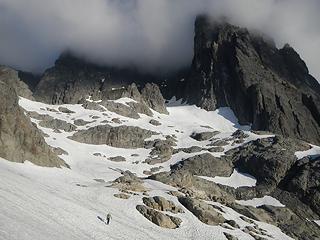 questionable weather 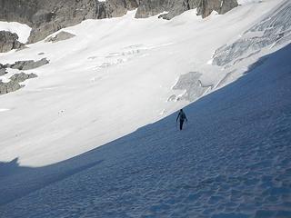 crossing the Chimney Glacier 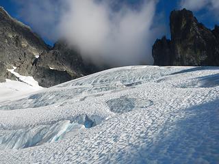 exposed ice 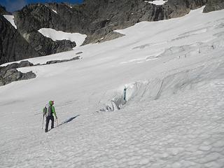 small crevasse 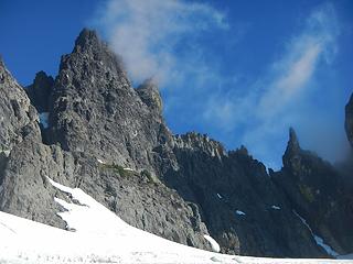 Chimney Rock and Finger of Fate 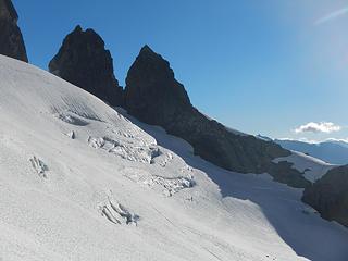 looking back at the NE side of the glacier 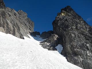 the U-Gap above 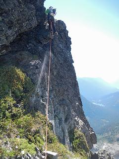 the start of the Improbable Ledge 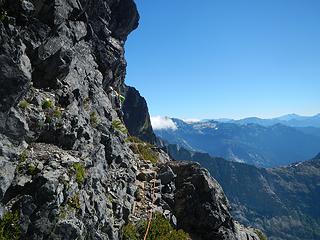 narrow ledge 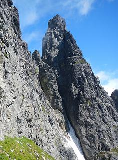 1 label the main peak with cleft and dividing rock formation 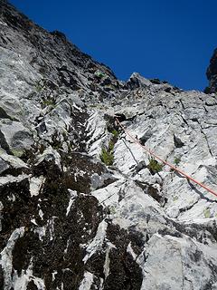 climbing up from white rocks area, Matt called this class 3 but it felt like 4 or 5.0 to me in a couple spots, we were probably too far left 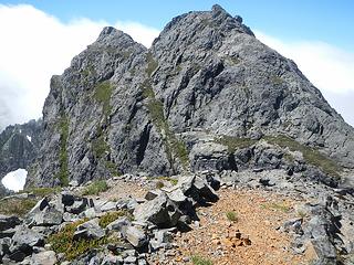 Looking back at the south peak from the excellent bivy spot. The furthest left green heather band is the Improbable Ledge that we came from. 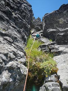 bottom of pitch 1 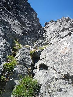 bottom of pitch 3 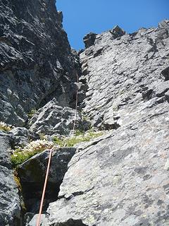 Matt nearing the summit 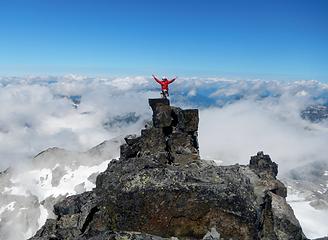 intense joy 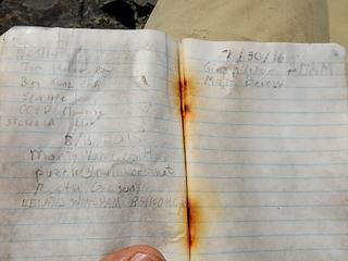 I tried to inscribe our names on the wet paper 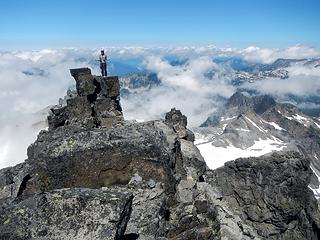 Matt 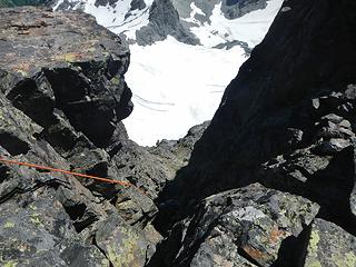 1st rappel 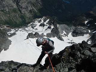 3rd rappel 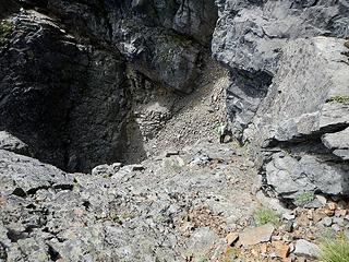 1 label access ledges and the rotten gully between the main peak and the rock divider in the cleft 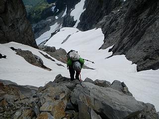 final rappel across a deep moat, I lost count 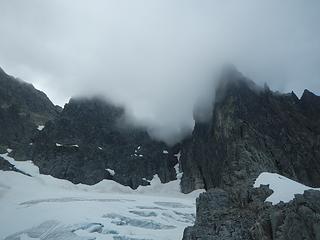 clouds dropping down to hide the peak and route
|
| Back to top |
  
|
|
awilsondc
Member

Joined: 03 Apr 2016
Posts: 1324 | TRs | Pics
|
|
| Back to top |
|
|
Redwic
Unlisted Free Agent

Joined: 23 Feb 2009
Posts: 3292 | TRs | Pics
Location: Going to the Prom(inence) |
|
Redwic
Unlisted Free Agent
|
 Tue Aug 02, 2016 9:05 pm |
|
|
60 pounds lighter but not 60 points brighter.
|
| Back to top |
|
|
RichP
Member

Joined: 13 Jul 2006
Posts: 5634 | TRs | Pics
Location: here |
|
RichP
Member
|
Tue Aug 02, 2016 9:06 pm |
|
|
One ascent a year sounds about right. You are getting some good peaks this year.
|
| Back to top |
|
|
Anish
Member

Joined: 07 Sep 2014
Posts: 79 | TRs | Pics
|
|
Anish
Member
|
Tue Aug 02, 2016 9:37 pm |
|
|
Great report! So happy you finally got this dream peak! xo
"Our way is not soft grass. It's a mountain path with lots of rocks. But it goes upwards, forward, toward the sun." -Ruth Westheimer
"Our way is not soft grass. It's a mountain path with lots of rocks. But it goes upwards, forward, toward the sun." -Ruth Westheimer
|
| Back to top |
|
|
Michael Lewis
Taking a nap
Joined: 27 Apr 2009
Posts: 629 | TRs | Pics
Location: Lynnwood, WA (for now) |
Well written  . Beautiful looking mountain. Joy washing over is a rare treat. Glad you made it back safe. . Beautiful looking mountain. Joy washing over is a rare treat. Glad you made it back safe.
|
| Back to top |
|
|
Magellan
Brutally Handsome

Joined: 26 Jul 2006
Posts: 13116 | TRs | Pics
Location: Inexorable descent |
|
Magellan
Brutally Handsome
|
Tue Aug 02, 2016 11:56 pm |
|
|
Nice work, fellas.
Peter Potterfield wrote a book called In the Zone. It detailed three amazing stories of mountain survival. The third story was his personal account of his terrible fall and subsequent rescue on Chimney Rock. That book made me want to live a life of adventure.
|
| Back to top |
|
|
Brushbuffalo
Member

Joined: 17 Sep 2015
Posts: 1887 | TRs | Pics
Location: there earlier, here now, somewhere later... Bellingham in between |
Makes me nervous just looking at that unprotectable Improbable Ledge!
| Magellan wrote: | | Peter Potterfield wrote a book called In the Zone. It detailed three amazing stories of mountain survival. The third story was his personal account of his terrible fall and subsequent rescue on Chimney Rock. |
Potterfield's ordeal even became a "Drama in Real Life" or whatever they called it in Readers Digest.
Sure glad you and Matt came back unscathed.
Passing rocks and trees like they were standing still
Passing rocks and trees like they were standing still
|
| Back to top |
|
|
Jake Robinson
Member
Joined: 02 Aug 2016
Posts: 521 | TRs | Pics
|
| Brushbuffalo wrote: | | Makes me nervous just looking at that unprotectable Improbable Ledge! |
When in doubt, run it out?
Congratulations on this impressive achievement!
|
| Back to top |
|
|
mbravenboer
Member
Joined: 20 Oct 2013
Posts: 1422 | TRs | Pics
Location: Seattle |
Too far out of my league to truly appreciate the challenge of this climb, but I enjoy the photos!  Thanks for sharing! Thanks for sharing!
|
| Back to top |
|
|
Frodo Barefoot
Member

Joined: 09 Apr 2015
Posts: 91 | TRs | Pics
|
|
| Back to top |
|
|
Gimpilator
infinity/21M
Joined: 12 Oct 2006
Posts: 1684 | TRs | Pics
Location: Edmonds, WA |
Thanks everyone! I'm going through some older reports today and responding to comments that I neglected. Chimney Rock is probably the hardest peak on the Jeff Smoot list and I'm really motivated to work that list. So far I've got 81/100. As for the book Alexei mentioned, I'd like to read it.
|
| Back to top |
|
|
Kascadia
Member
Joined: 03 Feb 2014
Posts: 651 | TRs | Pics
|
|
Kascadia
Member
|
Thu Sep 01, 2016 1:04 pm |
|
|
Good job. There's something about Chimney Rock. . . . it's never really hard, and is a very good mixed alpine climb (we did E Face/Direct) - but the overall tone is gnarly. It has an imposing dark, gothic quality to it up close, just has an aura about it. . .
Spectacular bivy site - bugs like it, too.
It is as though I had read a divine text, written into the world itself, not with letters but rather with essential objects, saying:
Man, stretch thy reason hither, so thou mayest comprehend these things. Johannes Kepler
It is as though I had read a divine text, written into the world itself, not with letters but rather with essential objects, saying:
Man, stretch thy reason hither, so thou mayest comprehend these things. Johannes Kepler
|
| Back to top |
|
|
mehitabel
archyologist

Joined: 23 Mar 2009
Posts: 519 | TRs | Pics
Location: the Emerald City |
|
mehitabel
archyologist
|
Thu Sep 01, 2016 2:35 pm |
|
|
I'm not necessarily planning to finish the Smoots (only at 35), but I'm familiar with the list and surprised you think Chimney Rock is the hardest. You think Chimney Rock is harder than Jack or Bonanza?
toujours gai toujours gai
toujours gai toujours gai
|
| Back to top |
|
|
iron
Member

Joined: 10 Aug 2008
Posts: 6392 | TRs | Pics
Location: southeast kootenays |
|
iron
Member
|
Thu Sep 01, 2016 3:07 pm |
|
|
| mehitabel wrote: | | I'm not necessarily planning to finish the Smoots (only at 35), but I'm familiar with the list and surprised you think Chimney Rock is the hardest. You think Chimney Rock is harder than Jack or Bonanza? |
CR likely has more routefinding issues where if you're off, it gets bad. otherwise, i personally felt CR was pretty easy (helped to have tom_s leading the way)
i think jack via the smoot route is probably garbage and very exposed. there are easier routes.
|
| Back to top |
|
|
|
|


