| Previous :: Next Topic |
| Author |
Message |
Fletcher
Member


Joined: 29 Jul 2009
Posts: 1870 | TRs | Pics
Location: kirkland |
|
Fletcher
Member
|
 Wed Aug 17, 2016 8:20 am |
|
|
I left my house before 5am on Tuesday morning having no idea what I was going to climb that day, I just knew I was getting out. I haven't done a whole lot in the Olympics this year, and the call of The Peninsula was strong, so I found myself forking over the cash and driving onto the ferry. Thanks to Puzzlr's awesome report from 2009, these peaks above Royal Basin had been on my radar.
It was 8:15 when I started hiking up the Dungeness Trail. Just over 2 hours later, I was having a snack break at Royal Lake. I have been to Upper Royal Basin before but never over to the large tarn en route to Surprise Basin, what a place!
 I think thats Clark on the left, from the Royal Basin Trail 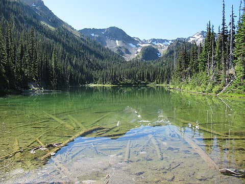 Royal Lake 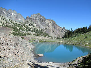 Tarn with peaks I am about to climb 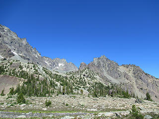 Route to Surprise Basin with peaks 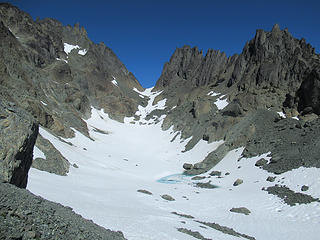 Johnson on the left, Clark on the right 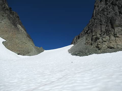 almost to the pass 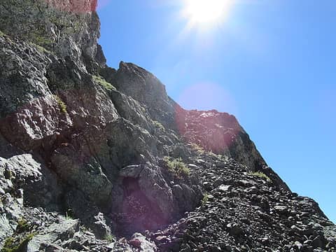 the ledge 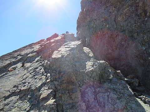 not the right way 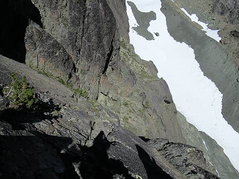 go down here 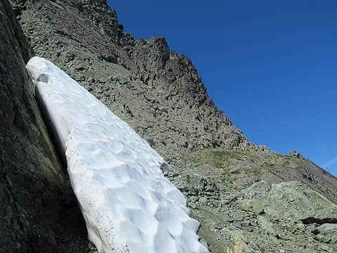 corkscrewing around Clark 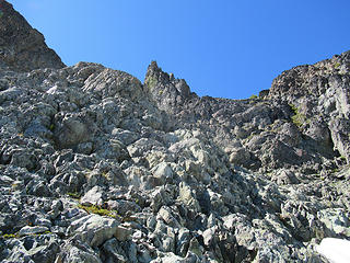 class 3 terrain below the summit 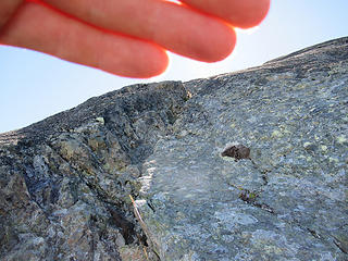 break in the rock, final bit before bagging Clark 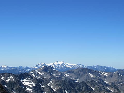 Olympus 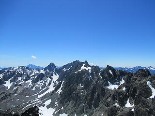 Mystery, Deception, Martin 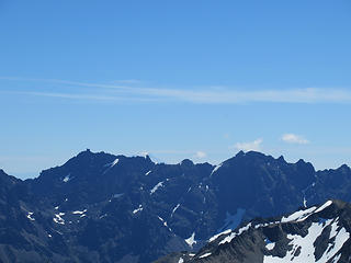 Constance Massif with Rainier peeking 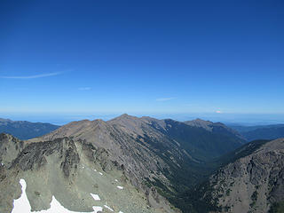 Greywolf, Baldy, and Tyler 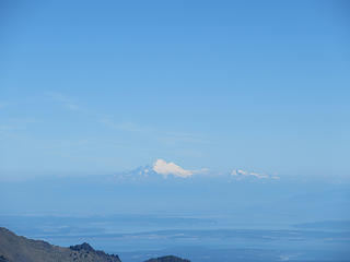 Baker and Shuksan above Puget Sound 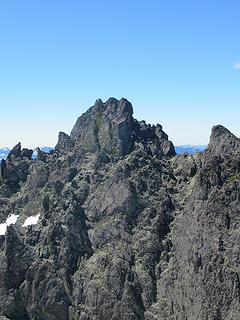 Johnson from Clark  flying ants on Clark summit 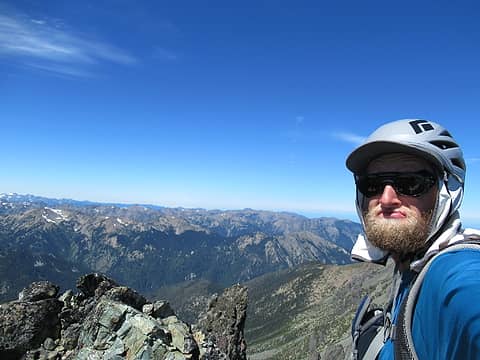 Clark summitshot 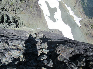 down here (not as bad as it looks) 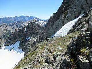 across the north and east ledges 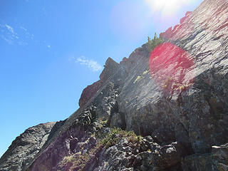 up here 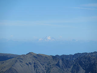 Glacier Peak 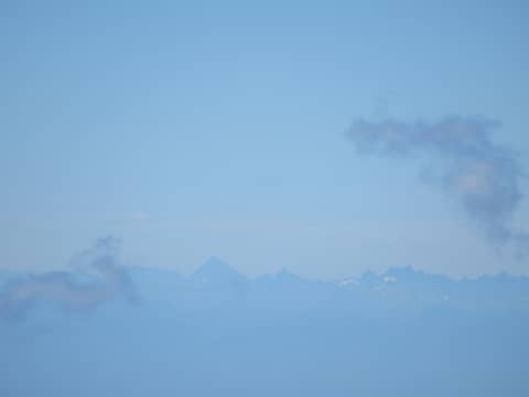 Stuart!! with Snoqualmie Crest Peaks 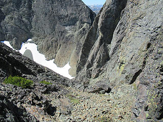 down this 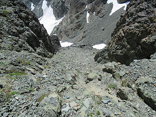 down this and around the corner 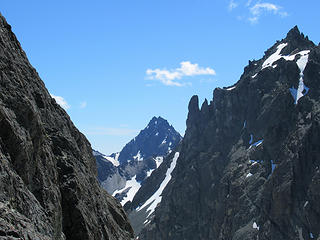 Mount Mystery 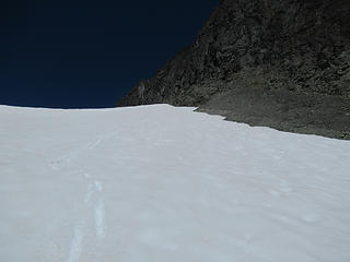 skiing in August 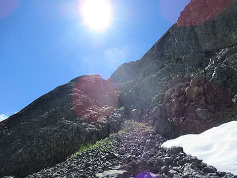 Johnson access ledge 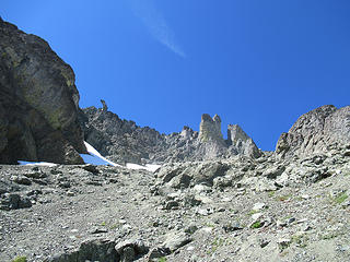 I stayed right up through here 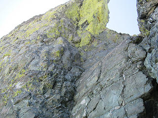 I climbed up to where it looked like easy passage, but it was just more class 4, and more exposed than what I had done before. Being solo, it was very intimidating 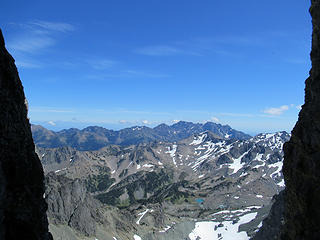 Framed shot of Constance from where I turned around 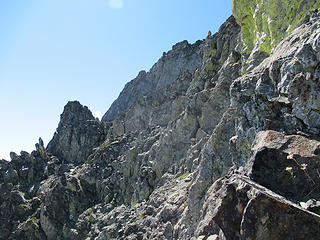 the left option 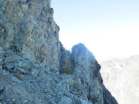 route around the pinnacles is marked by this small tree 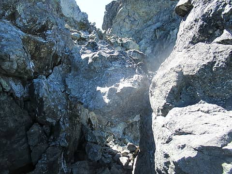 the chockstone 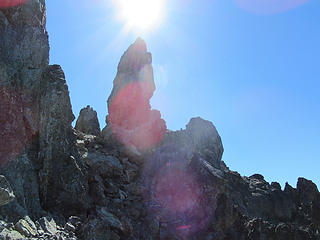 working around the pinnacles 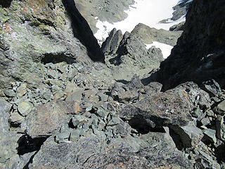 looking down what I bypassed 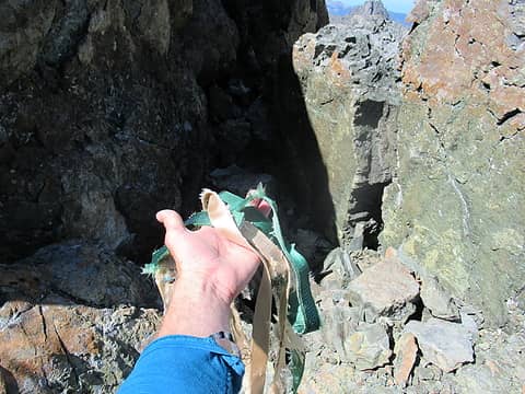 old tat 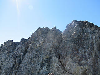 Johnson summitblock 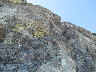 class 4 leading to Johnson summit 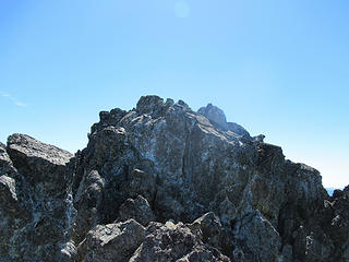 Johnson summit 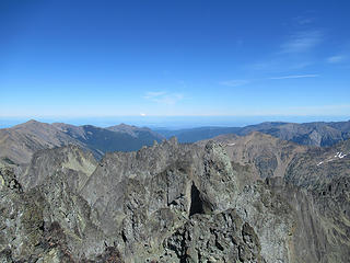 Clark, Sweat Spire, and Gasp Pinnacle from Johnson 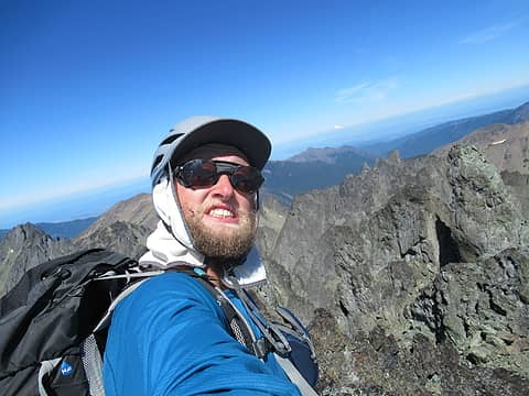 Johnson summitshot 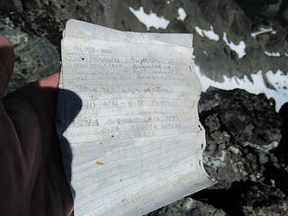 Johnson register 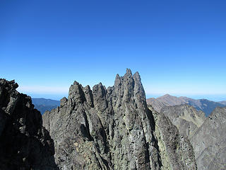 more Needles 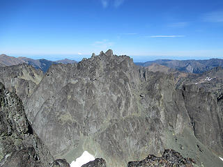 6 labels you can really see the lower route on Clark in this one 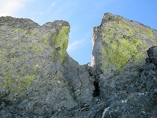 looking back up through the spires 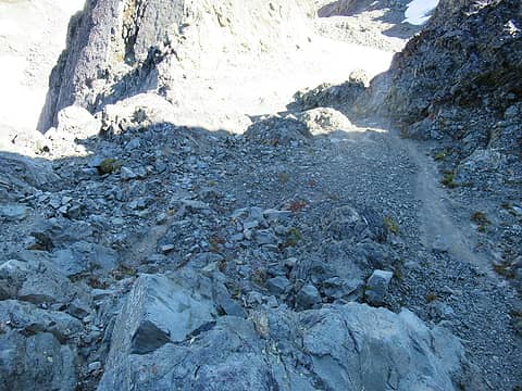 Johnson descent  I left this here and it was much needed on my return 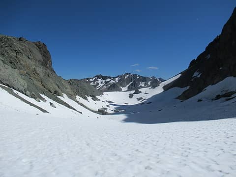 Surprise Basin 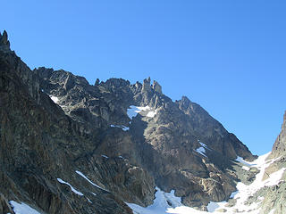 Johnson 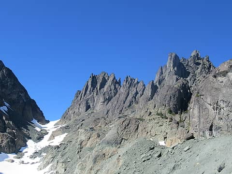 Clark and the Sundial 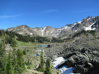 Royal Basin 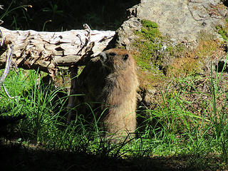 Marmot 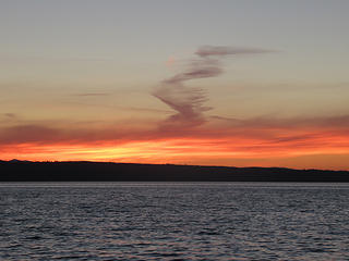 nice end to a great day
|
| Back to top |
  
|
|
IanB
Vegetable Belayer

Joined: 21 Jul 2010
Posts: 1062 | TRs | Pics
Location: gone whuljin' |
|
IanB
Vegetable Belayer
|
Wed Aug 17, 2016 9:41 am |
|
|
Wow!  Awesome adventure - admirable perseverance!
Great report and photos!
Awesome adventure - admirable perseverance!
Great report and photos!
"Forget gaining a little knowledge about a lot and strive to learn a lot about a little." - Harvey Manning
"Forget gaining a little knowledge about a lot and strive to learn a lot about a little." - Harvey Manning
|
| Back to top |
|
|
b00
Member

Joined: 29 Sep 2003
Posts: 1144 | TRs | Pics
|
|
b00
Member
|
Wed Aug 17, 2016 11:15 am |
|
|
i second you on that fletcher, monty's t/r was invaluable!
of the peaks i've done in the area, i personally liked clark the best.
fast time for both peaks and all that distance!
:>)
|
| Back to top |
|
|
meck
Member

Joined: 31 Dec 2010
Posts: 920 | TRs | Pics
|
|
meck
Member
|
Wed Aug 17, 2016 5:39 pm |
|
|
Very cool trip! I'd eyeballed that route up Mt Clark last year from the head of surprise basin, but couldn't convince myself to pull the trigger and climb it.
So for Mt Johnson, would you say the route you went down was class 3 (high end class 3 or 4)?
*Just say NO to Rent-Seeking, don't give up the concept of "ownership"*
*Just say NO to Rent-Seeking, don't give up the concept of "ownership"*
|
| Back to top |
|
|
Fletcher
Member
Joined: 29 Jul 2009
Posts: 1870 | TRs | Pics
Location: kirkland |
|
Fletcher
Member
|
Wed Aug 17, 2016 7:42 pm |
|
|
The way I came down Johnson avoided all class 4. It was actually all easy class 3.
|
| Back to top |
|
|
NorDub
Member

Joined: 17 Jul 2015
Posts: 56 | TRs | Pics
Location: Redmond |
|
NorDub
Member
|
Thu Aug 18, 2016 11:04 am |
|
|
| Quote: | Mount Clark and Mount Johnson 8-16-16 |
Well that's pretty slick...
|
| Back to top |
|
|
Just_Some_Hiker
Member

Joined: 02 Jan 2013
Posts: 691 | TRs | Pics
Location: Snoqualmie, WA |
| Fletcher wrote: | skiing in August |
Roughly how much mileage is it from the TH to this point?
|
| Back to top |
|
|
Fletcher
Member
Joined: 29 Jul 2009
Posts: 1870 | TRs | Pics
Location: kirkland |
|
Fletcher
Member
|
Fri Aug 19, 2016 2:52 pm |
|
|
I would estimate it to be about 8.5 miles or so.
|
| Back to top |
|
|
puzzlr
Mid Fork Rocks

Joined: 13 Feb 2007
Posts: 7220 | TRs | Pics
Location: Stuck in the middle |
|
puzzlr
Mid Fork Rocks
|
Fri Aug 19, 2016 9:20 pm |
|
|
I'm impressed you did both of those solo, and glad my TR helped. Your class 2/3 bypass on Johnson will be helpful to people as well, but that 4th class chimney was fun and none of us felt the need for a rope, even though I'm usually a wimp about that. Solo would be a different thing, however.
|
| Back to top |
|
|
vtdoc
Member
Joined: 23 Jun 2013
Posts: 1 | TRs | Pics
Location: puyallup |
|
vtdoc
Member
|
Sun Aug 28, 2016 12:58 am |
|
|
Repeated part of your trip today! Took the climbers path on approach to the left of the waterfall as described in Olympic climbing guide. I got Clark(main objective), but really wanted to get Martin and was short on time! I was a little longer but did get Martin, made a loop coming back down on the trail vs. the boulder field to waterfall. The last step on the northside down was a reach for me...there is a crack to the left or a ledge to climbers right while looking down. The summit was interesting on the last section....class 3 but be careful! I could still see your skiiing from last week(but no foot prints up-how come you didn't kick deep steps for me?)! I brought 'one' crampon just incase the snow was too steep or hard, fortunately didn't need it! The ranger followed me up to Surprise Basin, but I think he had enough and wasn't really interested in the summit. Thanks for your great report-much better than the guide book! Now I've got to go back up sometime with some friends and pick up Mrs. Johnson!
|
| Back to top |
|
|
cascadetraverser
Member

Joined: 16 Sep 2007
Posts: 1407 | TRs | Pics
|
The Pickets, the Olympic coast and now the Olympic mountains! You get around Fletcher. I have enjoyed reading your posts... Cool solo climbing trip!
|
| Back to top |
|
|
|
|
You cannot post new topics in this forum
You cannot reply to topics in this forum
You cannot edit your posts in this forum
You cannot delete your posts in this forum
You cannot vote in polls in this forum
|
Disclosure: As an Amazon Associate NWHikers.net earns from qualifying purchases when you use our link(s). |


