| Previous :: Next Topic |
| Author |
Message |
awilsondc
Member


Joined: 03 Apr 2016
Posts: 1324 | TRs | Pics
|
Short version: Jake Robinson and I climbed Cashmere Mountain via a loop route. We used beta from a couple trip reports here and here. We took the SE slopes up to the SE gully where we found one of the best scrambles either of us had done. We took the standard route down the west ridge past the Caroline Lakes back to the car. It was probably the best trip of the year for both of us.
Long version: It had been four years since I last hiked with Jake. We did Warrior peak in the Olympics and had an awesome time. I was glad to be able to hike with him again. Jake slept in his vehicle at the trailhead and I woke up super early to meet him there in the morning. There was some pretty cool sunrise colors in the clouds on the way in that looked like an interdimensional portal or something from an Avengers movie. It was cool. After I arrived, we hit the trail at 7:00 am sharp.
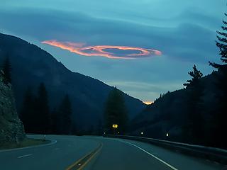 portal looking clouds 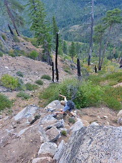 Jake breaking free of the ash-dirt hell 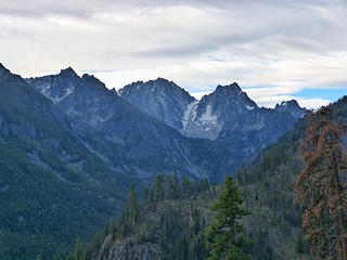 early views of Dragontail and Colchuck 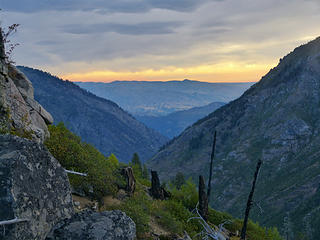 this early morning fire sky lasted an hour plus 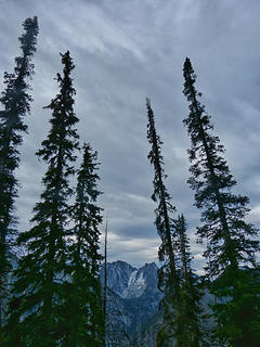 tall trees 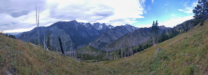 Enchantment peaks from the dirt 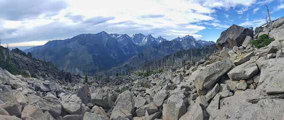 Enchantment peaks from the boulders 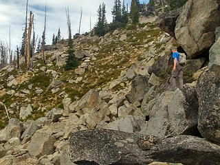 Me crossing boulders (Jake photo) 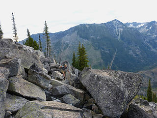 Jake crossing boulders 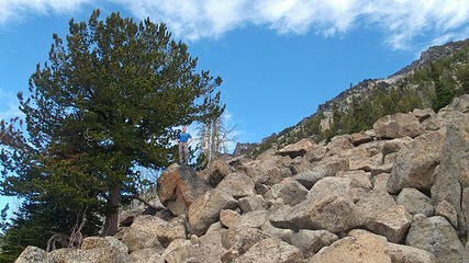 I like boulders (Jake photo) 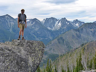 Jake on a boulder - Dragontail in the back 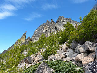 Our route comes into view (gully is upper right) 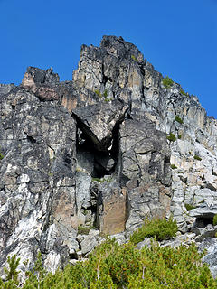 chockstone 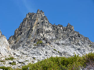 Cashmere south buttress 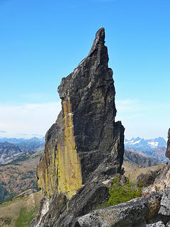 Dagger! 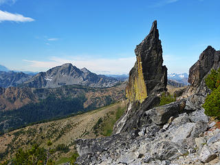 Eightmile Mountain and the Cashmere dagger 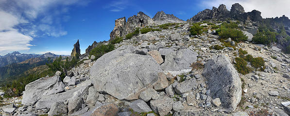 Start of the gully (widest V right of center) 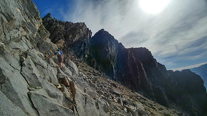 traversing the left side of the gully (Jake photo) 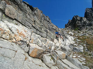 class 3 moves (optional at this point) (Jake photo) 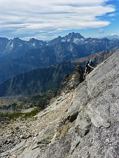 Jake with a class 4 traverse (optional) 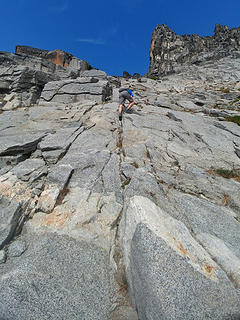 solid fun class 3 (Jake photo) 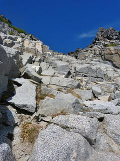 blocky solid rock 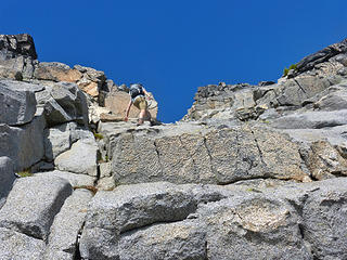 scrambling 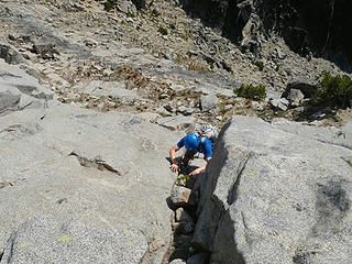 scrambling (Jake photo) 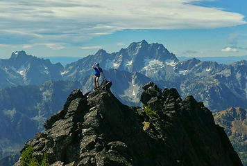 ridge shot (Jake photo) 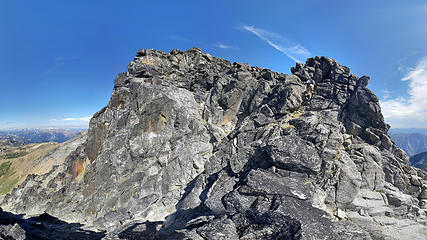 nearing the summit block 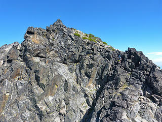 almost there 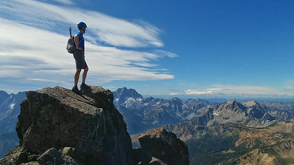 Cashmere summit! (Jake photo) 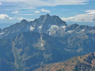 Stuart with Axis below 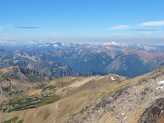 ALW peaks - Daniel on right 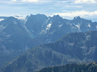 Dragontail, Colchuck, Argonaut 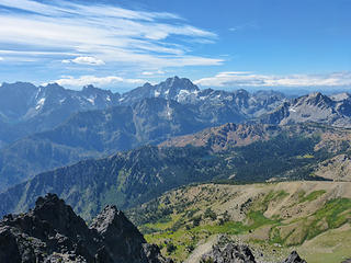 Looking out towards stuart 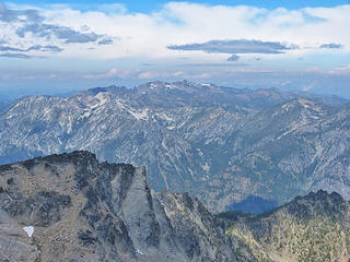 Chiwaukums 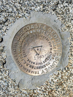 benchmark 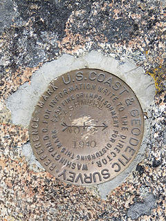 benchmark 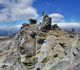 Jake on descent 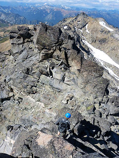 Jake downclimbing 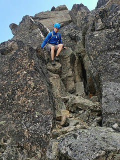 descending Cashmere (Jake photo) 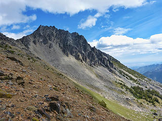 Looking back at Cashmere 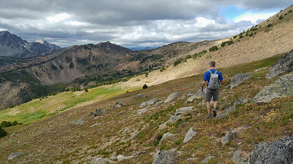 descending the meadow (Jake photo) 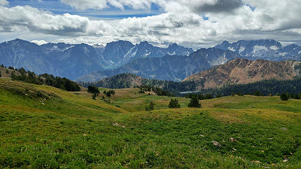 beautiful scenery (Jake photo) 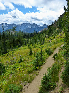 back on trail 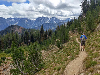 heading towards the Caroline lakes (Jake photo) 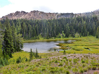 Little Caroline Lake 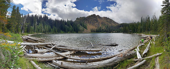 Caroline Lake pano 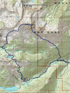 topo map of our route 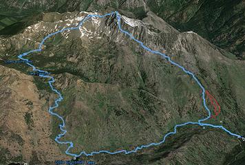 overlay of our route, the red routes might avoid the ash-dirt 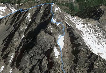 overlay of our route up the gully 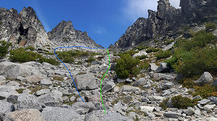 South gully, enlarge to see route green class 2 blue class 3  fire  fire
 zimmertr zimmertr
zimmertr |
| Back to top |
  
|
|
Brushbuffalo
Member

Joined: 17 Sep 2015
Posts: 1887 | TRs | Pics
Location: there earlier, here now, somewhere later... Bellingham in between |
| awilsondc wrote: | | We were both super thrilled with this route. I give it an A+. |
Glad you enjoyed it. I think this route will become the standard.
Youu are correct about the first steep climb above the old road. You left the road a little too soon. It is easier if you travel along the old road for a few hundred more feet, where the angle eases back a little. However, I don't share your enthusiasm for the BBB...the Big Bad Boulder field!
Passing rocks and trees like they were standing still
Passing rocks and trees like they were standing still
|
| Back to top |
|
|
Jake Robinson
Member

Joined: 02 Aug 2016
Posts: 521 | TRs | Pics
|
Thanks for the TR Aaron! I agree with Brushbuffalo, I think this route will become standard someday. The top part is fantastic. I think if you stick left as soon as you hit the gully, you can piece together a mostly uninterrupted line of class 3 for nearly 1000 vertical feet until you reach the summit. The rock quality is surprisingly good too.
|
| Back to top |
|
|
awilsondc
Member
Joined: 03 Apr 2016
Posts: 1324 | TRs | Pics
|
| Brushbuffalo wrote: | | I think this route will become the standard. |
I'd have to agree with you, especially after descending the standard route. I can't imagine why you'd want to go up that way, especially with how much shorter and more enjoyable the SE route is. I guess if you're camping at the lakes...
Hey, thanks for the beta! Your trip report was immensely helpful. 
|
| Back to top |
|
|
|
|
You cannot post new topics in this forum
You cannot reply to topics in this forum
You cannot edit your posts in this forum
You cannot delete your posts in this forum
You cannot vote in polls in this forum
|
Disclosure: As an Amazon Associate NWHikers.net earns from qualifying purchases when you use our link(s). |


