| Previous :: Next Topic |
| Author |
Message |
John Morrow
Member


Joined: 03 Apr 2007
Posts: 1526 | TRs | Pics
Location: Roslyn |
If anyone has ever done research on potential backpacking in Death Valley two things probably stood out:
1. Water????
2. Something called the Cottonwood/Marble Loop makes a nice 3 day loop of a few canyons with 2 springs for H2O.
However, high clearance is needed for the 28 mile loop w/o needing to hike 16 miles of road out and back.
3. Death Valley, despite nearly 3 million acres, is really known for its dayhikes.
I am never one to enjoy a road hike so I wanted to devise a greater loop that left 2WD pavement and saw the highlights of the known route.
I'll call this the: Unknown Canyon---E. Fk Cottonwood---Cottonwood---Marble---Deadhorse---Upper Cottonwood---Lemoigne Canyons Loop
It goes like this:
TH at Emigrant Campground/Ranger Station on CA Hwy 190. This made it about a 45 miler with about 5 miles of side trips.
Unknowns:
1. Crossing the incised washes of three miles of bajada from the start.
2. An undocumented canyon climb to the crest of the Southern Ridge of the Cottonwood Mountains (We figured we could scramble ridgelines if the canyon deadended. Our canyon is noted for two white dot blaze rock forms visible from the campground and hwy.).
3. Would Deadhorse spring be flowing or would 7 liters (most we each carried) need to extend into a third day?
Well, it goes great and I'd rate it a Classic!!!!
Maps:
Note: notations are for clockwise direction, we went counterclockwise.
Day 1:
From Emigrant Campground across the playa for three miles.
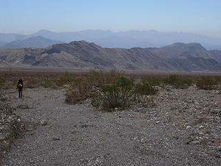 Starting From Emigrant Campground 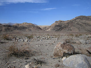 Aim for the dotted white blaze 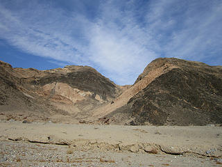 Cottonwood Mountains. Death Valley National Park, CA 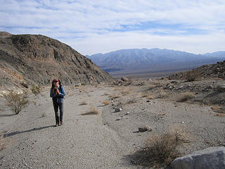 Back across long playa crossing 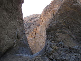 Cottonwood Mountains, Death Valley NP, CA 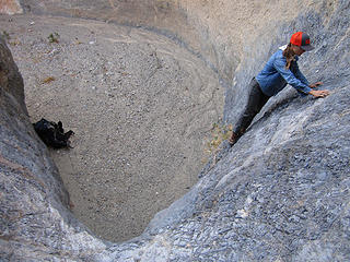 Working out the first obstruction 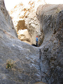 Hauling packs over it 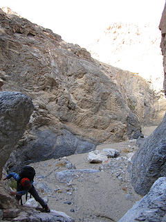 Easier second obstruction 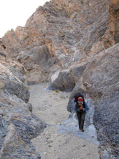 A nice canyon 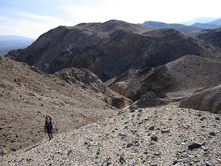 Death Valley Wilderness, CA 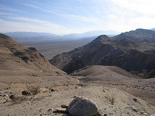 Crossed that 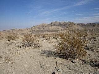 Onto the brown desert 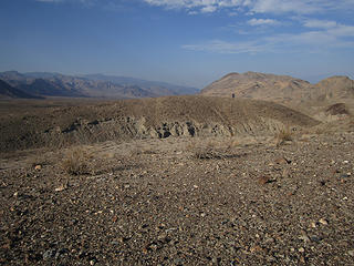 Moving along 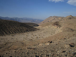 Into the E Fork Cottonwood 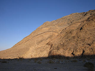 Striated walls 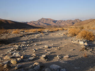 Junction Cottonwood Canyon 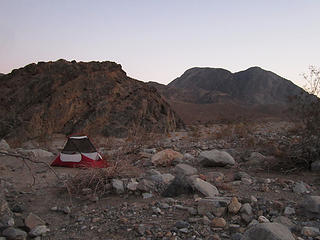 A fine camp 1 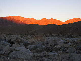 Marble Canyon 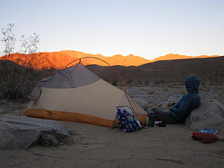 Vic enjoys a camp sunrise 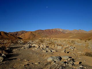 Marble Canyon. Death Valley National Park, CA 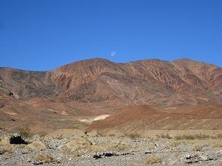 Moonset up Marble Canyon, Death Valley NP 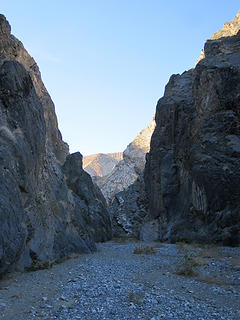 First Marble narrows 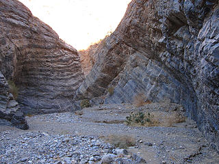 Pretty Marble Canyon 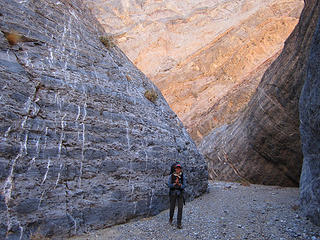 Marble Canyon. Death Valley National Park, CA 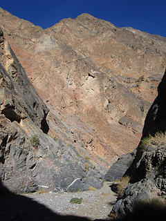 Deep canyon 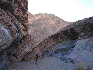 interesting 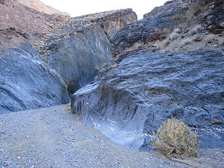 Marble Canyon, Death Valley Wilderness, CA 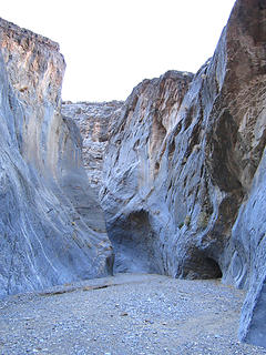 Death Valley National Park, CA 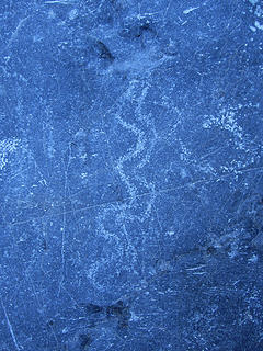 M1 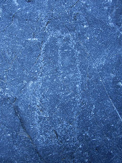 M2 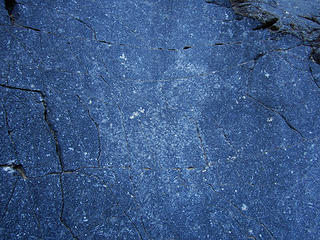 M3  M4 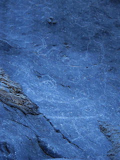 M5 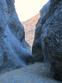 Death Valley National Park, Death Valley Wilderness, CA 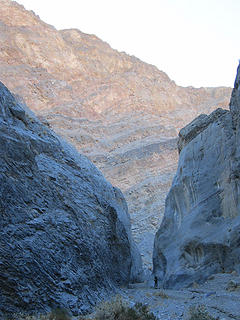 Goes on 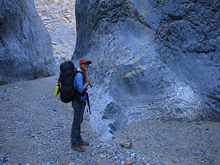 Neat glueing 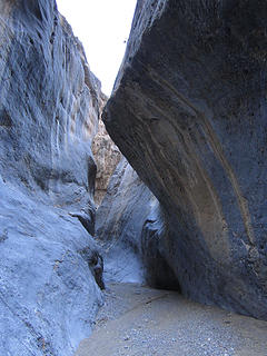 Death Valley Wilderness; Death Valley National Park, CA 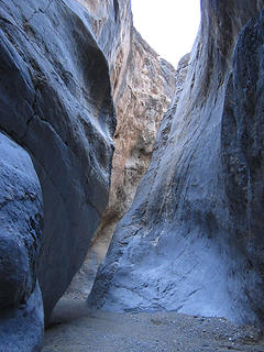 Death Valley Wilderness; Death Valley National Park, CA 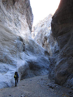 Love long narrows 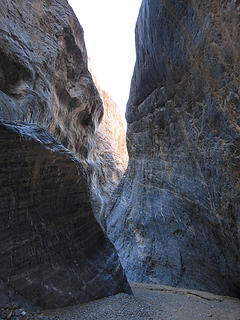 Marble Canyon, Death Valley Wilderness 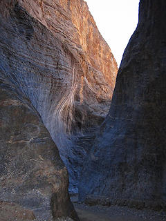 Marble Canyon, Death Valley National Park, CA 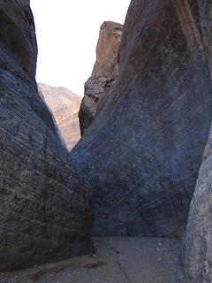 beautiful Marble Canyon DVNP 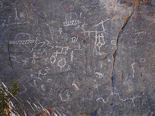 M6 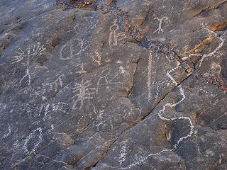 M7 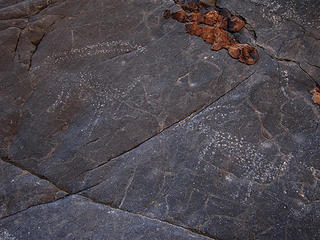 M8 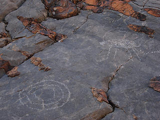 M9 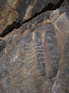 M10 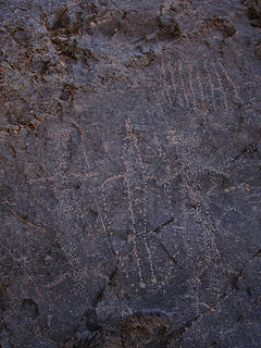 M11 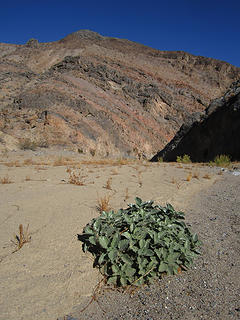 Marble Canyon, Cottonwood Mountains 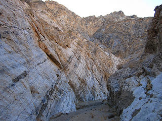 sidetrip into fourth narrows 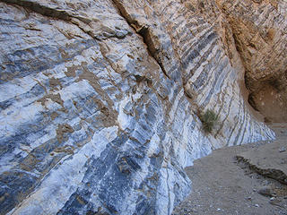 Marbled 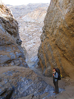 More fun 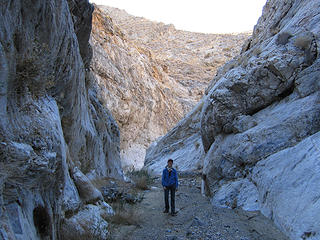 not as deep 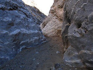 crazy marbling 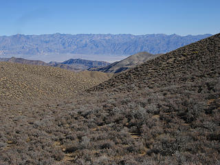 Looking down Marble from Camp 2 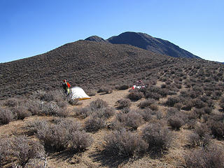 Canyon Benchmark above 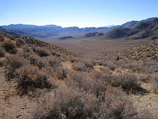 Heading down Cottonwood 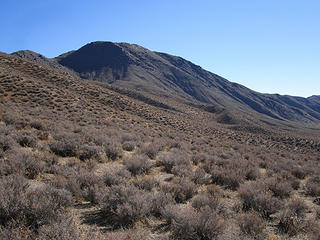 Shadow line our route up Canyon BM 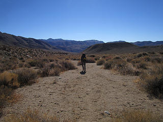 Descending 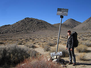 Old miners routes 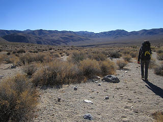 Will head up over there 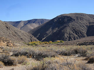 Oasis! 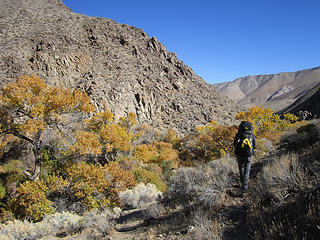 Water? 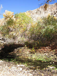 Water! 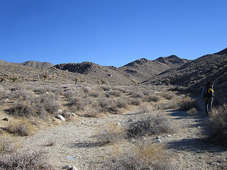 Starting to Lemoigne Divide 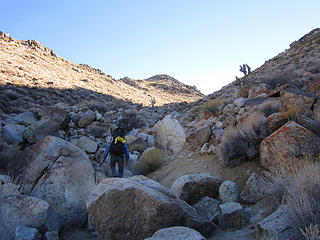 A slightly wrong turn 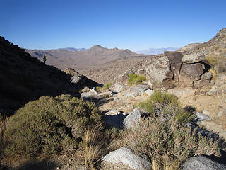 Looking back at Cottonwood 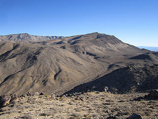 Our mistake: need that wash 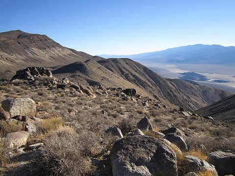 Death Valley Wilderness CA 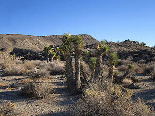 Up to Lemoigne Divide 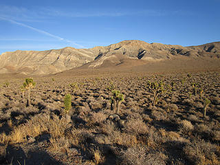 Big Joshua Tree Flat surprise 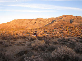 Fine camp 3, Upper Lemoigne Canyon 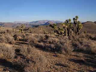 Starting up Panamint Butte 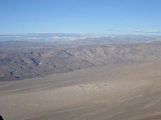 From Panamint Butte, thousands of feet above. Death Valley Wilderness, CA. 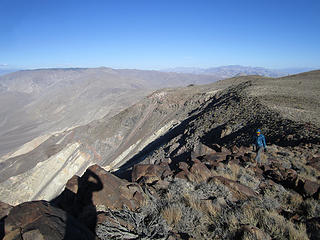 North ridge Panamint Butte 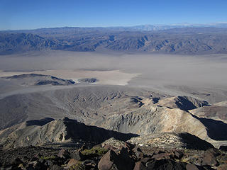 Big drop, Lake Hill far far below 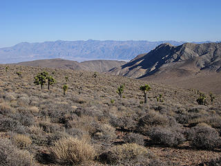 Time for Lemoigne descent 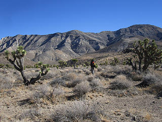 Leaving the flat 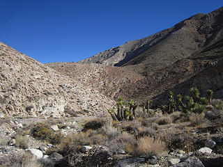 Enter Lemoigne Canyon 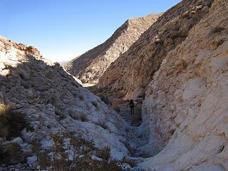 A small narrow 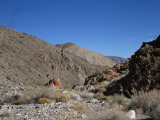 some colors 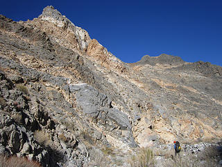 Big vertical 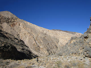 Increasing depth 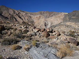 Death Valley Wilderness, CA 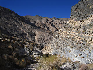 Lemoigne Canyon, Death Valley National Park, CA 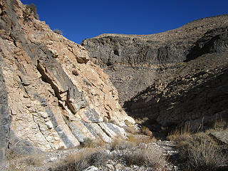 nice 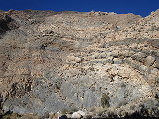 twisted earth 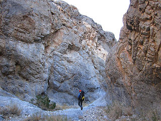 a final narrows 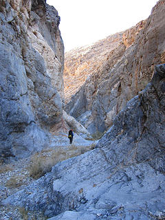 almost out Lemoigne Canyon 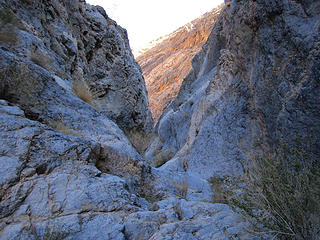 Lemoigne Canyon, Death Valley National Park, CA
Tell me, what is it you plan to do with your one wild and precious life?-Mary Oliver
A nation that continues year after year to spend more money on military defense than on programs of social uplift is approaching spiritual doom.
― MLK Jr.
Tell me, what is it you plan to do with your one wild and precious life?-Mary Oliver
A nation that continues year after year to spend more money on military defense than on programs of social uplift is approaching spiritual doom.
― MLK Jr.
|
| Back to top |
  
|
|
ree
Member

Joined: 29 Jun 2004
Posts: 4399 | TRs | Pics
|
|
ree
Member
|
 Fri Nov 25, 2016 12:58 pm |
|
|
Wow, I always love a DV trip report.  Love your pictures.
So are you using a guidebook to find some of these remote areas? Panamint Butte is not exactly on the beaten path.
Esp. love the petroglyphs.
I had to go on caltopo to see exactly where you were. I can see all the water routes.
With recent storms, I wonder if those high elevation places are snow covered now. Love your pictures.
So are you using a guidebook to find some of these remote areas? Panamint Butte is not exactly on the beaten path.
Esp. love the petroglyphs.
I had to go on caltopo to see exactly where you were. I can see all the water routes.
With recent storms, I wonder if those high elevation places are snow covered now.
|
| Back to top |
|
|
Pyrites
Member

Joined: 16 Sep 2014
Posts: 1884 | TRs | Pics
Location: South Sound |
|
Pyrites
Member
|
Fri Nov 25, 2016 3:34 pm |
|
|
Holey Moley. Trip had everything. Maybe sheep missing. A route that will last.
Beyond being in the desert and having water concerns two short climbs will make for low use. They would stop me. Fun to see that people had lived there without benefit of modern foods and water containers.
Did you see any new growing Joshua trees? Or were they all older?
Any tracks at water hole?
Keep Calm and Carry On?
Heck No.
Stay Excited and Get Outside!
Keep Calm and Carry On?
Heck No.
Stay Excited and Get Outside!
|
| Back to top |
|
|
John Morrow
Member
Joined: 03 Apr 2007
Posts: 1526 | TRs | Pics
Location: Roslyn |
| ree wrote: | | So are you using a guidebook to find some of these remote areas? Panamint Butte is not exactly on the beaten path. |
Hi Ree, sorry for the long delayed answer! Check out Hiking Death Valley by Michel Digonnet. He also has Hiking the Mojave Natl Preserve. This loop isn't specifically mentioned, I stitched several hikes into one. Only unknown was the canyon climb at the start: which was a map, aerial photo, and google earth study. Since it was at the start I figured we could turn around, defeated, if it didn't go. Panamint Butte is a Sierra Club DPS Peak (Desert Peaks Section). Not really motivated to plie up peaks on that list, necessarily, but it does help one to seek and find potentially worthy objectives.
| Pyrites wrote: | | Did you see any new growing Joshua trees? Or were they all older?
Any tracks at water hole? |
Hello Pyrites,
There are regenerating J-trees, not sure if within natural range of sucession or too few. Lots of tracks at water holes. Mostly ungulates and burros. Don't remember any carnivores this time and I checked back at my pics. I'll often photo carnivore tracks for memory sake. Thanks for the comments, I am still dreaming of this and future DVNP trips.
Tell me, what is it you plan to do with your one wild and precious life?-Mary Oliver
A nation that continues year after year to spend more money on military defense than on programs of social uplift is approaching spiritual doom.
― MLK Jr.
Tell me, what is it you plan to do with your one wild and precious life?-Mary Oliver
A nation that continues year after year to spend more money on military defense than on programs of social uplift is approaching spiritual doom.
― MLK Jr.
|
| Back to top |
|
|
puzzlr
Mid Fork Rocks

Joined: 13 Feb 2007
Posts: 7220 | TRs | Pics
Location: Stuck in the middle |
|
puzzlr
Mid Fork Rocks
|
Mon Feb 13, 2017 12:58 am |
|
|
Very cool trip! Except for the lack of water, I'd love to do this sometime.
|
| Back to top |
|
|
|
|
You cannot post new topics in this forum
You cannot reply to topics in this forum
You cannot edit your posts in this forum
You cannot delete your posts in this forum
You cannot vote in polls in this forum
|
Disclosure: As an Amazon Associate NWHikers.net earns from qualifying purchases when you use our link(s). |


