| Previous :: Next Topic |
| Author |
Message |
meck
Member


Joined: 31 Dec 2010
Posts: 920 | TRs | Pics
|
|
meck
Member
|
 Sat Feb 11, 2017 1:27 pm |
|
|
I love those pics boot up! Such a nice variety of colors and textures, thank you for sharing.
*Just say NO to Rent-Seeking, don't give up the concept of "ownership"*
*Just say NO to Rent-Seeking, don't give up the concept of "ownership"*
|
| Back to top |
  
|
|
Nancyann
Member
Joined: 28 Jul 2013
Posts: 2319 | TRs | Pics
Location: Sultan Basin |
|
Nancyann
Member
|
Tue Feb 14, 2017 12:50 am |
|
|
The mountains were beckoning today, but the avalanche conditions weren't, so we took a little walk on the logging roads outside of Darrington.
The snow had a nice crust on it and made for easy walking with boots.
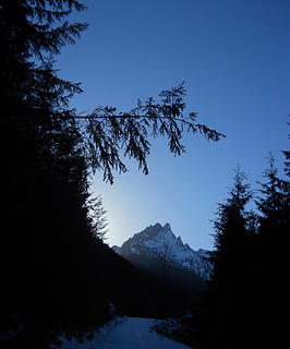 Whitehorse Mountain 2/13/17 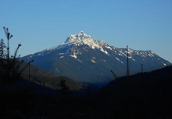 Mt. Pugh 2/13/17 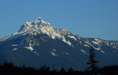 Mt. Pugh 2/13/17 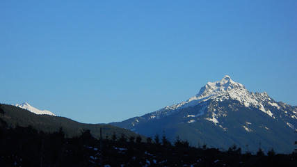 Glacier Peak and Mt.Pugh 2/13/17 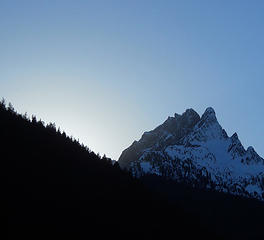 Whitehorse Mountain 2/13/17 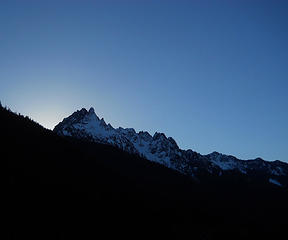 Whitehorse Mountain 2/13/17 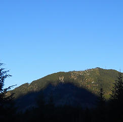 Shadow of Whitehorse on Gold Hill 2/13/17
|
| Back to top |
|
|
bobbi
stillaGUAMish

Joined: 13 Jul 2006
Posts: 8012 | TRs | Pics
Location: olympics! |
|
bobbi
stillaGUAMish
|
Tue Feb 14, 2017 4:46 pm |
|
|
Striped Peak, Tongue Point, Salt Creek Recreation Area, February 13, 2017
bobbi ૐ
"Today is your day! Your mountain is waiting. So
get on your way!" - Oh, the Places Youll Go! By Dr. Seuss
bobbi ૐ
"Today is your day! Your mountain is waiting. So
get on your way!" - Oh, the Places Youll Go! By Dr. Seuss
|
| Back to top |
|
|
zephyr
aka friendly hiker

Joined: 21 Jun 2009
Posts: 3370 | TRs | Pics
Location: West Seattle |
|
zephyr
aka friendly hiker
|
Tue Feb 14, 2017 8:09 pm |
|
|
Striped Peak--yaay! I have camped there with friends over the years when we had an annual Pirate Party in midsummer. Fun times. I have stood by that cable at sunset or sunrise watching the ships cruise down the Strait. Sometimes it's filled with low-lying clouds. Cool! Bobbi. ~z
|
| Back to top |
|
|
bobbi
stillaGUAMish
Joined: 13 Jul 2006
Posts: 8012 | TRs | Pics
Location: olympics! |
|
bobbi
stillaGUAMish
|
Tue Feb 14, 2017 8:25 pm |
|
|
zephyr ... i haven't been on this trail for at least 15 years! it's so much better now!
here's a better photo with the cable, vancouver island, canada, and strait of juan de fuca
bobbi ૐ
"Today is your day! Your mountain is waiting. So
get on your way!" - Oh, the Places Youll Go! By Dr. Seuss
bobbi ૐ
"Today is your day! Your mountain is waiting. So
get on your way!" - Oh, the Places Youll Go! By Dr. Seuss
|
| Back to top |
|
|
zephyr
aka friendly hiker
Joined: 21 Jun 2009
Posts: 3370 | TRs | Pics
Location: West Seattle |
|
zephyr
aka friendly hiker
|
Tue Feb 14, 2017 9:19 pm |
|
|
Yes, that's the place with many memories. Such a fun spot. That's quite a drop off below the cable and originally the trees below had been cut. Soon they will overtake the view. There's a trail near there that descends to the cove. Thanks, bobbi. ~z
|
| Back to top |
|
|
bobbi
stillaGUAMish
Joined: 13 Jul 2006
Posts: 8012 | TRs | Pics
Location: olympics! |
|
bobbi
stillaGUAMish
|
Wed Feb 15, 2017 8:51 am |
|
|
~z,
mile marker posts along the trail, including direction to cove. would have gone there, too, but time constraints.
photo of cove from main trail. oh, waterfall was really flowing!
let me know via PM when the pirates return to the area! 
bobbi ૐ
"Today is your day! Your mountain is waiting. So
get on your way!" - Oh, the Places Youll Go! By Dr. Seuss
bobbi ૐ
"Today is your day! Your mountain is waiting. So
get on your way!" - Oh, the Places Youll Go! By Dr. Seuss
|
| Back to top |
|
|
JonnyQuest
Member
Joined: 10 Dec 2013
Posts: 593 | TRs | Pics
|
Love that spot! Great winter camping, as the place is usually almost empty. We enjoy making the loop - out along the North side, past the cove, up to the top, and then looping back on the south side via the little (horseman maintained) connector trail that leads to the old road in the logged area. On a cold, clear winter day, the sunny southern exposure is nice!
|
| Back to top |
|
|
boot up
Old Not Bold Hiker

Joined: 12 Dec 2006
Posts: 4745 | TRs | Pics
Location: Bend Oregon |
|
boot up
Old Not Bold Hiker
|
Fri Feb 17, 2017 10:27 pm |
|
|
Tromped around Swampy lakes sno park today with my wife. She is just starting to get out and appreciate winter hiking on Snowshoes. Weather and snow conditions were surprisingly good.
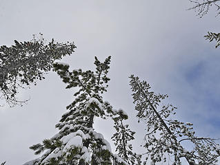 swampy lakes sno park, Bend OR, 2/17/17 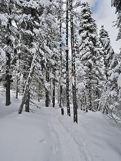 swampy lakes sno park, Bend OR, 2/17/17  swampy lakes sno park, Bend OR, 2/17/17 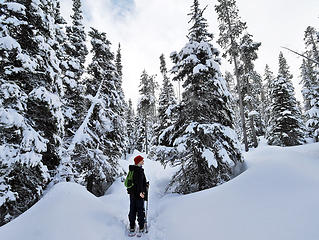 With Renee, swampy lakes sno park, Bend OR, 2/17/17 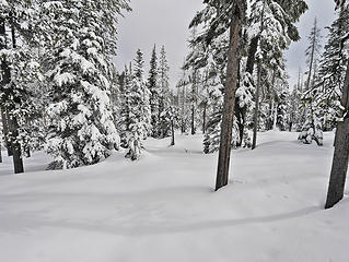 swampy lakes sno park, Bend OR, 2/17/17 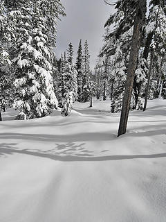 swampy lakes sno park, Bend OR, 2/17/17 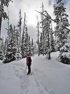 With Renee,
swampy lakes sno park, Bend OR, 2/17/17 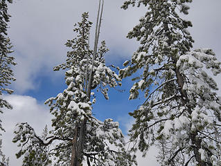 swampy lakes sno park, Bend OR, 2/17/17 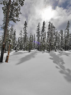 swampy lakes sno park, Bend OR, 2/17/17
|
| Back to top |
|
|
zephyr
aka friendly hiker
Joined: 21 Jun 2009
Posts: 3370 | TRs | Pics
Location: West Seattle |
|
zephyr
aka friendly hiker
|
Fri Feb 17, 2017 10:34 pm |
|
|
| bobbi wrote: | | mile marker posts along the trail, including direction to cove. would have gone there, too, but time constraints.
let me know via PM when the pirates return to the area! |
Whoa. Mile markers and signs. Sounds too civilized. haha
Definitely. Arrrgh. ~z
|
| Back to top |
|
|
Nancyann
Member
Joined: 28 Jul 2013
Posts: 2319 | TRs | Pics
Location: Sultan Basin |
|
Nancyann
Member
|
Thu Feb 23, 2017 11:00 am |
|
|
Some more pics from my tree farm ramblings, Sultan/Startup foothills, taken yesterday evening. 
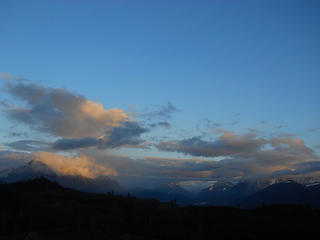 Sky Valley views 2/22/17 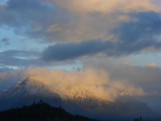 Sky Valley views 2/22/17  Clouds over the Olympics 2/22/17 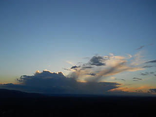 Clouds over the Olympics 2/22/17
|
| Back to top |
|
|
bobbi
stillaGUAMish
Joined: 13 Jul 2006
Posts: 8012 | TRs | Pics
Location: olympics! |
|
bobbi
stillaGUAMish
|
Fri Feb 24, 2017 8:54 am |
|
|
Ha ha! Snow and sunshine, of course! 
bobbi ૐ
"Today is your day! Your mountain is waiting. So
get on your way!" - Oh, the Places Youll Go! By Dr. Seuss
bobbi ૐ
"Today is your day! Your mountain is waiting. So
get on your way!" - Oh, the Places Youll Go! By Dr. Seuss
|
| Back to top |
|
|
zephyr
aka friendly hiker
Joined: 21 Jun 2009
Posts: 3370 | TRs | Pics
Location: West Seattle |
|
zephyr
aka friendly hiker
|
Sun Mar 19, 2017 9:45 pm |
|
|
April 3, 2017 Baldy on Umtanum Ridge. Wildy encouraged by RichP's recent report on Baldy last month, I decided to go soon before it got too hot. I thought there would be some snow and ice still so I brought along microspikes. They never left the pack nor did much of my more wintry gear. In spite of my early wake up, it still took awhile to get there and I didn't start hiking until after 9:30 am. There were clouds along the way and lots of snow still on the ground in Snoqualmie Pass, Easton and Cle Elum. But close to Ellensburg the snow was disappearing and the sun was bright. Lots of blue sky in the canyon. The ground was still a bit frozen. But I warmed as I began climbing up.
I was able to park in the Big Pines Campground parking area with my pass. Others later parked along the highway. More discussion about maps and parking in this recent thread. I was the first hiker of the day as far as I could tell. I started out on the main trail but managed to divert into a shallow gully that led straight up. Later I found out on the descent that there is a much more graded approach. I definitely did that coming down. My knees were not happy.
I didn't realize it at the time, but this is a popular local conditioner. There are 6-7 of these short, but intense hikes in the canyon. I got the run down from one of the folks coming up. I met lots of friendly people--local peeps from Yakima and Ellensburg. The mountain is so big and open that everyone distributes nicely along the trail and you still get plenty of solitude/space. It's pretty much a beaten boot path. Off track the ground is pretty rough and littered with small boulders and cobbles of basalt. The entire time you get (on a day like today) stupendous views up and down the river canyon and then across the many ridges. During lunch on the west shoulder I could see Mt. Rainier and Mt. Adams poking above the horizon. To the north I could see the Stuart Range. (This was especially nice on the drive home along I-90.)
Along the ridge ascent I had an exciting encounter with three Desert Bighorn Sheep ewes. I startled them on the ridge above me. They were fairly high above, but not happy seeing me. I wasn't sure what they were at first. So tall and bright white--almost like elk by their carriage, I even wondered if they were llamas. They decided to bolt toward the north over the ridge. But I knew it was very steep and rugged that way. I slowed down and gave them some time. Eventually one comes bounding across the ridge now heading south in a gallop if you will. Then seconds later the other two joined her and they vanished.
As I mentioned in the other thread, I really enjoyed meeting the friendly local folks, a guy from the neighborhood, a couple from Yakima and a guy who had moved to Ellensburg a year ago and was really enjoying it. Great day to be on those ridges high above the canyon and hills. ~z
|
| Back to top |
|
|
Nancyann
Member
Joined: 28 Jul 2013
Posts: 2319 | TRs | Pics
Location: Sultan Basin |
|
Nancyann
Member
|
Sat Apr 01, 2017 12:47 am |
|
|
Triciaann and I only had a limited amount of time this rare sunny day, so we settled on a reconnaissance mission in our own backyard, the "trail" to Lake Isabel.
We accessed a network of obscure DNR roads and trails from the May Creek Road. As expected, lots of water everywhere!
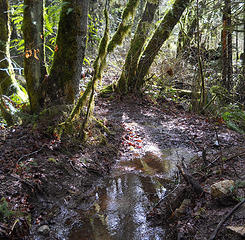 Along the Lake Isabel Trail 3/31/17 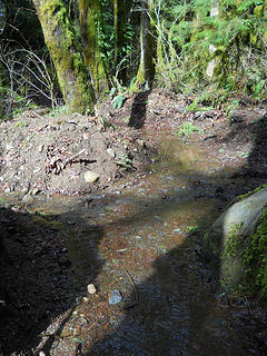 Along the Lake Isabel Trail 3/31/17 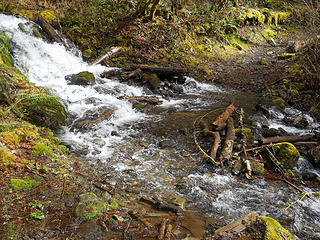 First creek crossing, Lake Isabel Trail 3/31/17 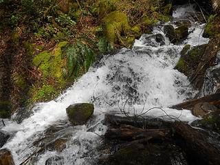 First creek crossing, Lake Isabel Trail 3/31/17 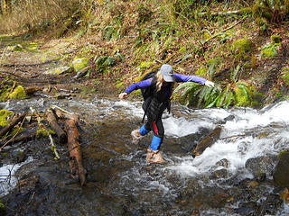 Bag Lady, first creek crossing, Lake Isabel Trail 3/31/17 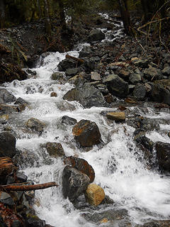 May Creek, Lake Isabel Trail 3/31/17 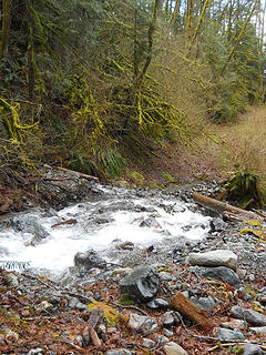 May Creek, Lake Isabel Trail 3/31/17 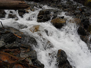 May Creek, Lake Isabel Trail 3/31/17 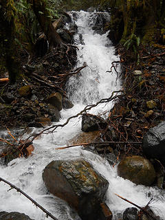 May Creek, Lake Isabel Trail 3/31/17 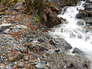 Storm damage, May Creek, Lake Isabel Trail 3/31/17 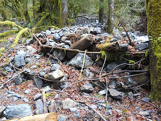 Storm damage, May Creek, Lake Isabel Trail 3/31/17 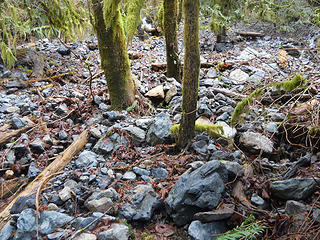 Storm damage, May Creek, Lake Isabel Trail 3/31/17 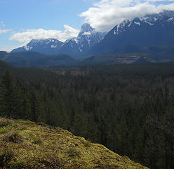 Mt.Index from the Lake Isabel Trail 3/31/17 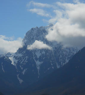 Mt.Index from the Lake Isabel Trail 3/31/17  Along the Lake Isabel Trail, 3/31/17  Along the Lake Isabel Trail, 3/31/17  Along the Lake Isabel Trail, 3/31/17
|
| Back to top |
|
|
Double_E
Member

Joined: 21 Jul 2005
Posts: 36 | TRs | Pics
Location: Seattle |
|
Double_E
Member
|
Mon Apr 03, 2017 11:59 am |
|
|
Snowshoed up the road to Mowich Lake yesterday... only second time going there for me, and the first time on snow!
We took the shortcut trail to avoid the road switchbacks.
Too socked in at the lake to see the mountain, but oh well.
Road was snow-free to about 1/2 mile before the gate; there were four other cars there and plenty of room for more. The road to there had lots of potholes though, yeesh. (Passable by low clearance cars as long as you drove slow and carefully.)
|
| Back to top |
|
|
|
|
You cannot post new topics in this forum
You cannot reply to topics in this forum
You cannot edit your posts in this forum
You cannot delete your posts in this forum
You cannot vote in polls in this forum
|
Disclosure: As an Amazon Associate NWHikers.net earns from qualifying purchases when you use our link(s). |


