| Previous :: Next Topic |
| Author |
Message |
Matt
Tea, Earl Grey, Hot


Joined: 30 Jan 2007
Posts: 4307 | TRs | Pics
Location: Shoreline |
|
Matt
Tea, Earl Grey, Hot
|
 Tue Feb 28, 2017 1:03 am |
|
|
Date: 2/25/2017
Destination: Dock Butte 5239 (2299P) and Point 4413 (433P) [USGS Baker Pass]
Night Trip: Yana
Day Trip: Matt, Steph Abegg, Dicey, Dave Creeden, b00, Monty Vanderbilt, Will Segall, Cartman
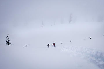
With a mostly sunny forecast for Saturday, we planned to go somewhere with big views. We decided to visit Dock Butte. In summer, that's a 1.75 mile hike from the trailhead. In winter, we had to start all the way down on the Baker Lake Road, using a route described by raising3hikers. But it would be a good workout, and the area looks better in its winter garments. As the weekend, approached, the weather window became smaller and smaller, and closed entirely before we reached the summit. But it was still a fun trip with a good group of friends, and even included a smaller bonus summit on the way out.
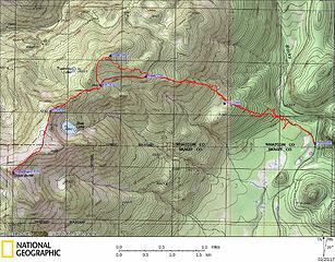 Dock Butte GPS track 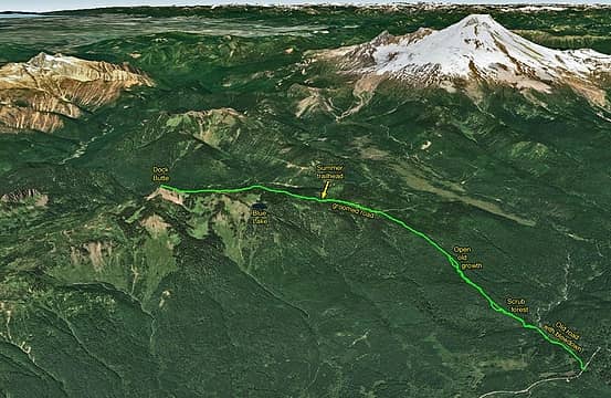 Dock Butte route, showing the scenic views we might have had of Baker and the Sisters Range 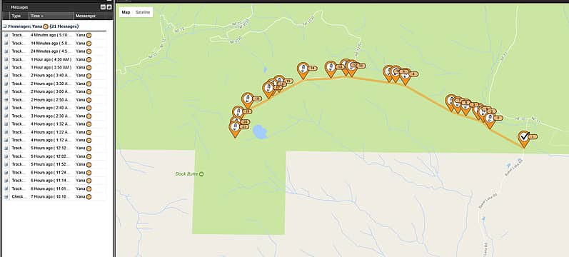 Yana's Spot Track, note the timestamps at left 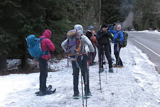 Putting on snowshoes at the start 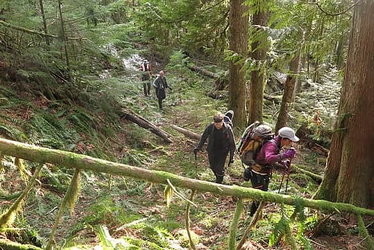 Hiking up the rib 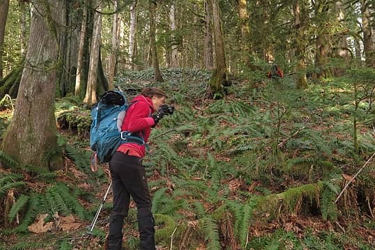 Steph & Dave running away uphill 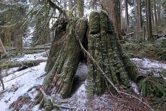 One of the smaller stumps in the woods 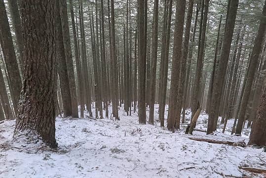 Open hiking up the ridge 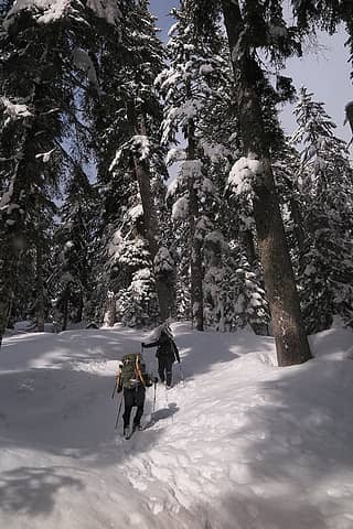 Deeper snow and sunshine 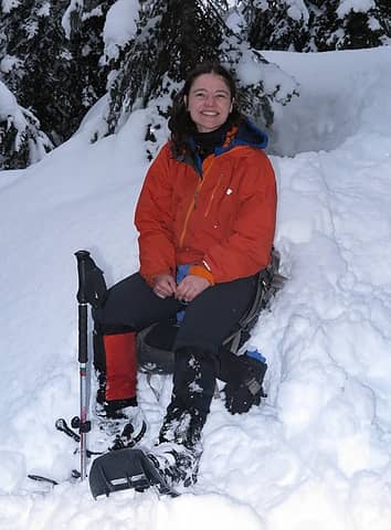 We found Yana 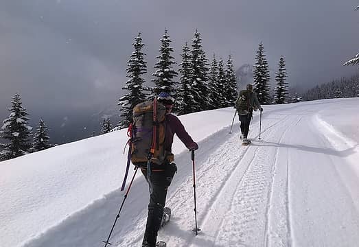 Dicey and b00 hiking up the road. 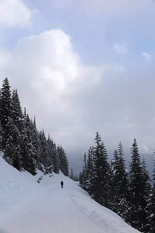 Cartman hiking up the road 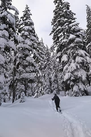 Cartman hiking up the trail 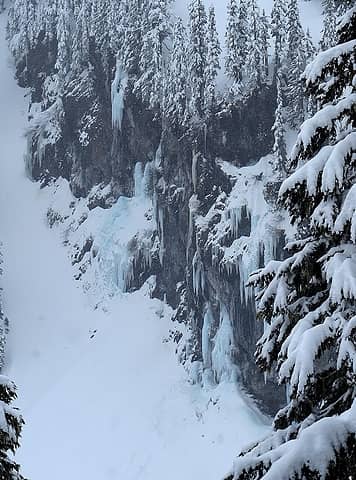 Cliffs and icicles down below 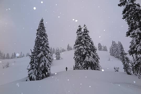 Hiking up into the snow 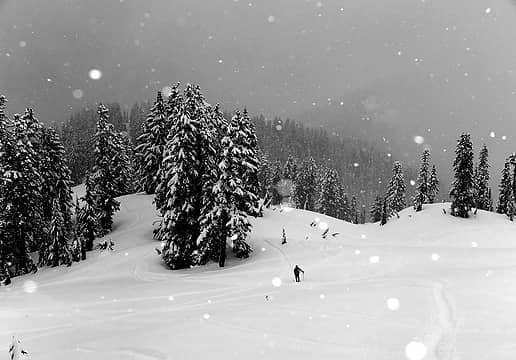 More hiking up in the snowstorm 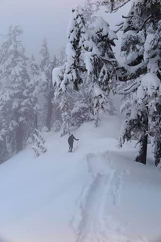 Thicker weather higher up 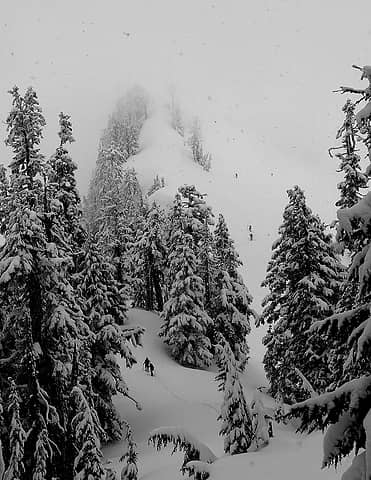 Approaching the final rib 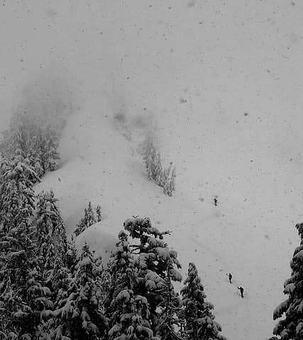 Hikers disappearing into the storm 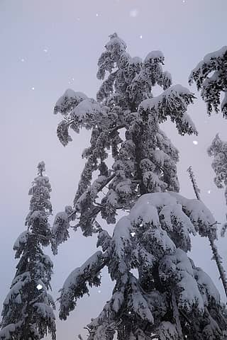 Snowy rimed tree along the crest 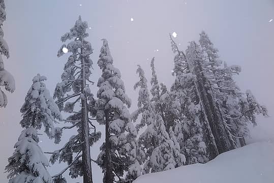 More rimed trees along the crest 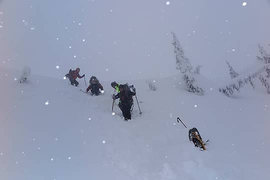 Final steep bit to the top 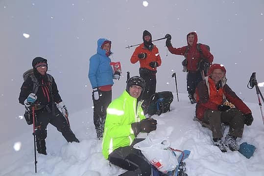 Most of the group on top, including Will's shiny jacket, Dicey's snowflake nose, Brett stabbing Dave, Monty's bagel, and Steph's Fruite Loops 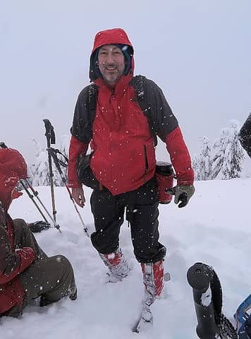 Me on Dock Butte 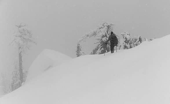 Dave disappearing down the crest into the storm 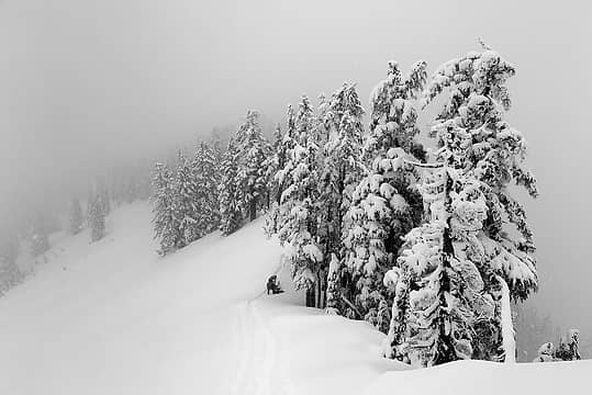 A pause to put snowshoes back on, after booting on the steep part 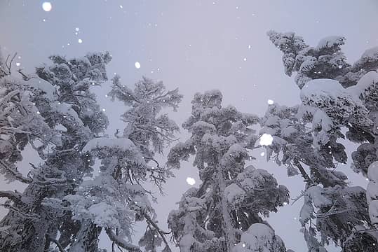 More snowflakes and rime 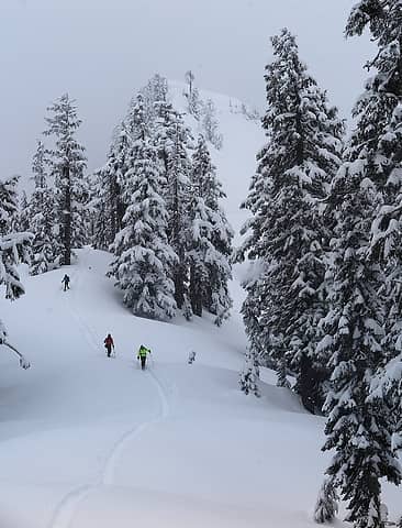 An almost clear moment while hiking down 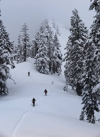 More people hiking down 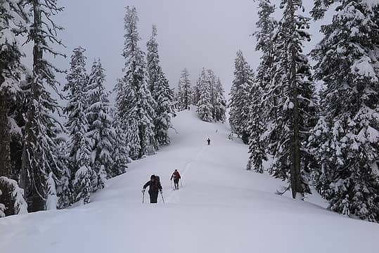 Running along the ridge 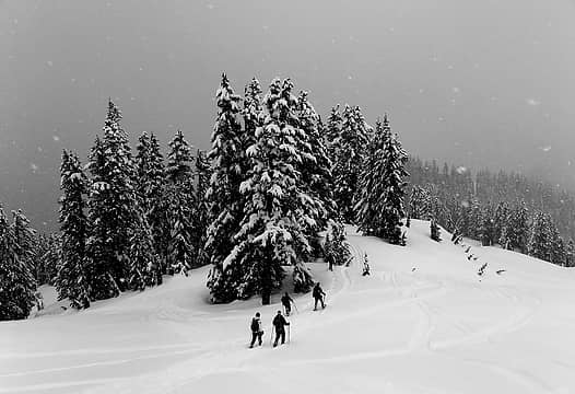 Descending snowshoers 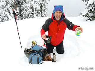 me with my soup and tea (Steph Abegg photo) 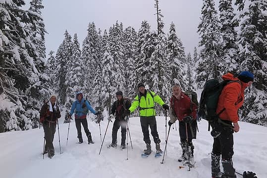 last group shot 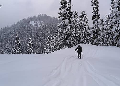 Might Point 4413, viewed from the Dock Butte trail 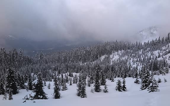 Brief view down to Lake Shannon 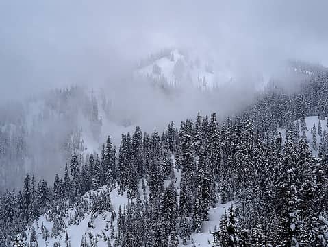 Brief view of most of Dock Butte
As beacons mountains burned at evening. J.R.R. Tolkien
As beacons mountains burned at evening. J.R.R. Tolkien
|
| Back to top |
  
|
|
Stefan
Member

Joined: 17 Dec 2001
Posts: 5091 | TRs | Pics
|
|
Stefan
Member
|
Tue Feb 28, 2017 10:12 am |
|
|
looks like a great time with a solid group!
|
| Back to top |
|
|
Yana
Hater

Joined: 04 Jun 2004
Posts: 4212 | TRs | Pics
Location: Out Hating |
|
Yana
Hater
|
Tue Feb 28, 2017 12:22 pm |
|
|
PLAY SAFE! SKI ONLY IN CLOCKWISE DIRECTION! LET'S ALL HAVE FUN TOGETHER!
|
| Back to top |
|
|
iron
Member

Joined: 10 Aug 2008
Posts: 6392 | TRs | Pics
Location: southeast kootenays |
|
iron
Member
|
Tue Feb 28, 2017 2:09 pm |
|
|
fun group. i wish we had tagged your other summit, but we had too much in tow.
|
| Back to top |
|
|
mike
Member
Joined: 09 Jul 2004
Posts: 6397 | TRs | Pics
Location: SJIsl |
|
mike
Member
|
Tue Feb 28, 2017 2:29 pm |
|
|
I wonder what an approach via Bear Ck Rd would be like...??
|
| Back to top |
|
|
puzzlr
Mid Fork Rocks

Joined: 13 Feb 2007
Posts: 7220 | TRs | Pics
Location: Stuck in the middle |
|
puzzlr
Mid Fork Rocks
|
Tue Feb 28, 2017 10:50 pm |
|
|
Matt, your photos capture the day very well. This one doesn't stand out as a thumbnail, but you managed to get quite a few of our group in open areas at the same time. My favorite 
| Matt wrote: | Approaching the final rib |
My photos look a lot like Matt's, just not as good. But here's a few that aren't repeats.
 Matt and Brett about to gain the ridge 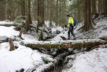 Crossing a stream 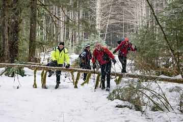 Dealing with one of many annoying blowdowns on the old logging road
|
| Back to top |
|
|
Matt
Tea, Earl Grey, Hot
Joined: 30 Jan 2007
Posts: 4307 | TRs | Pics
Location: Shoreline |
|
Matt
Tea, Earl Grey, Hot
|
Tue Feb 28, 2017 10:57 pm |
|
|
Check out Monty's photos for a lot of good shots of travel in the forest. The Google Earth overlay of our track at the top of my report is also from him.
And Steph Abegg has a good report, including a great photo of hiking on dry ground wearing snowshoes: http://www.stephabegg.com/home/tripreports/washington/northcascades/dockbutte
As beacons mountains burned at evening. J.R.R. Tolkien
As beacons mountains burned at evening. J.R.R. Tolkien
|
| Back to top |
|
|
Matt
Tea, Earl Grey, Hot
Joined: 30 Jan 2007
Posts: 4307 | TRs | Pics
Location: Shoreline |
|
Matt
Tea, Earl Grey, Hot
|
Tue Feb 28, 2017 11:01 pm |
|
|
| mike wrote: | | I wonder what an approach via Bear Ck Rd would be like...?? |
I think you can pretty much only approach Dock Butte from the northeast or north, because of the cliffs on the south and west sides. You can see them in the Google Earth view.
As beacons mountains burned at evening. J.R.R. Tolkien
As beacons mountains burned at evening. J.R.R. Tolkien
|
| Back to top |
|
|
Dave Creeden
Member

Joined: 04 Sep 2007
Posts: 99 | TRs | Pics
|
Dallas Kloke's Winter Climbs book lists three routes for Dock Butte, include one via the Bear Creek approach.
Here's the description.
Access: Drive the Baker Lake Road just past the bridge over Bear Creek. (about 9 miles.) Take a left hand turnoff and follow it for 1.0 mile to where it forks. Park car here (1,000 feet) or continue as far as possible.
Route: East Ridge - Using the Bear Creek approach, follow the spur road to its end and then climb up a clear cut area into a timbered slope. Continue up along a forested ridge which narrows at one point with a steep open slope on the left. Near the peak, follow the northeast ridge to the summit.
Time: 4 hours
Avalanche hazard: I
|
| Back to top |
|
|
cartman
Member
Joined: 20 Feb 2007
Posts: 2800 | TRs | Pics
Location: Fremont |
|
cartman
Member
|
Wed Mar 01, 2017 9:18 pm |
|
|
The Northeast Ridge--which I took up and down and Dave & Steph took down--was not corniced but is a bit narrow for a short stretch, and is no-slip terrain on the south side. I was able to snowshoe all the way up it in 1-2' deep snow.
|
| Back to top |
|
|
mike
Member
Joined: 09 Jul 2004
Posts: 6397 | TRs | Pics
Location: SJIsl |
|
mike
Member
|
Thu Mar 02, 2017 6:58 pm |
|
|
| Dave Creeden wrote: | | Dallas Kloke's Winter Climbs book lists three routes for Dock Butte, include one via the Bear Creek approach. |
Thanks. Can't find my copy. I hiked all over that area during my surveyor days including on snowmachine in the winter. I was thinking that the route Dallas describes would be the most direct.
|
| Back to top |
|
|
contour5
Member

Joined: 16 Jul 2003
Posts: 2963 | TRs | Pics
|
|
contour5
Member
|
Thu Mar 02, 2017 8:58 pm |
|
|
It does seem early for tree frog eggs...
|
| Back to top |
|
|
oneeyedfatman
Member
Joined: 14 Dec 2015
Posts: 26 | TRs | Pics
Location: Seattle, WA |
Nice effort! Love the photos of people working their way up the final crest.
That was a long approach, even with the shortcuts. The variation in the snowpack and on-and-off with the snowshoes must have gotten a little old.
Years ago, in August, I also did Pt. 4413 as a sidetrip from a hike up Dock Butte. It was memorable, all in bad ways. A few bits from my notes:
"... an evil bushwhack through a weed-choked clearcut. Hot, and worst bugs I've ever endured in Western Washington, bar none."
I think you chose the better time of year for this one, even factoring in the long approach.
|
| Back to top |
|
|
Matt
Tea, Earl Grey, Hot
Joined: 30 Jan 2007
Posts: 4307 | TRs | Pics
Location: Shoreline |
|
Matt
Tea, Earl Grey, Hot
|
Sat Mar 04, 2017 12:30 am |
|
|
Yes, for any places that have brush or old clearcuts, the winter snow cover can make travel a lot easier.
As beacons mountains burned at evening. J.R.R. Tolkien
As beacons mountains burned at evening. J.R.R. Tolkien
|
| Back to top |
|
|
|
|
You cannot post new topics in this forum
You cannot reply to topics in this forum
You cannot edit your posts in this forum
You cannot delete your posts in this forum
You cannot vote in polls in this forum
|
Disclosure: As an Amazon Associate NWHikers.net earns from qualifying purchases when you use our link(s). |


