| Previous :: Next Topic |
| Author |
Message |
RangerSciacca
Member


Joined: 07 Nov 2014
Posts: 13 | TRs | Pics
|
This trip was a few years back, but I thought it might be helpful for anyone considering a trip linking the skyline trail and the queets. I always lament the fact that the queets and hoh/sol duc trails aren't more easily connected to the rest of trail network.
My friend and I hiked up the queets river trail and then up a ridge and out the skyline trail on Sep 4-6, 2010. The flow was around 600 cfs according to the USGS. The first day, we went about 15 miles up the queets. The trail was solid for 5 miles, then a little tougher to follow for 5 miles, than hard enough to find that it was easier to just keep walking in the right general direction than spend time looking for flagging and cut logs. We found a nice flat spot by the river and made camp!
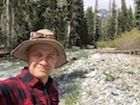
Day 2 started too early, as you can tell by my expression...
Found an easy way across the queets:
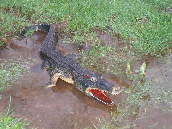
Saw a big bull elk, bugling away!
Here's a nice profile view of the ridge we would eventually take up to the skyline trail:
We crossed alta creek and went upstream, just to where the valley narrows dramatically. Then we turned due east and went straight uphill, trying to stay on the nose of the ridge. Near the bottom, it's rounded, and hard to tell if you're right on course, but it narrows and becomes more obvious as you go up. It was steep, and there were lots of small trees and downed wood to pick through, over, and around, but very little undergrowth, so very manageable.
Lunch break:
As you get up around 3500-4000 feet, the ridge narrowed considerably--steep drops on the side, but without too much trouble, we were able to stay on top of the ridge.
Got some peekaboo views too!
We hit the skyline trail in the early afternoon at a nice flat meadow about a mile south of kimta peak:
And a shot looking back down at the queets where we came up from:
It was hard uphill hiking, getting scratched by little trees, but easier than we expected! The ridge never cliffed out, and we didn't have to do any real scrambling. If you're looking to connect the queets trail to the skyline, this is a pretty good way to go! Here's a map of our route: Link
|
| Back to top |
  
|
|
flatsqwerl
Member
Joined: 23 Feb 2010
Posts: 1051 | TRs | Pics
Location: tacoma |
Thats my kind of trip. I need to get the maps for that. Thanks!
|
| Back to top |
|
|
meck
Member
Joined: 31 Dec 2010
Posts: 920 | TRs | Pics
|
|
meck
Member
|
 Sat Apr 29, 2017 8:30 am |
|
|
Thanks for posting this info RangerSciacca! I was interested in hiking the Queets but was not really looking forward to just an out and back. I remember passing through that meadow on the Skyline in Aug 2015. Nice too know there is a "manageable-with-a-big-pack" route up from the valley.
*Just say NO to Rent-Seeking, don't give up the concept of "ownership"*
*Just say NO to Rent-Seeking, don't give up the concept of "ownership"*
|
| Back to top |
|
|
HermitThrush
Member
Joined: 14 Jan 2016
Posts: 384 | TRs | Pics
Location: Brainerd Lakes Area, MN |
Love that picture with the hiker silhouette!
|
| Back to top |
|
|
monorail
Member
Joined: 06 May 2012
Posts: 267 | TRs | Pics
|
|
monorail
Member
|
Sat Apr 29, 2017 9:47 am |
|
|
Excellent report on a great trip. I'm thinking of trying this route in reverse with my packraft, and floating down the Queets to the ocean (I would need to get tribal permission for the last stretch). Anyway, you've provided soime really helpful info.
Not to nitpick, but...
| RangerSciacca wrote: | | Then we turned due west and went straight uphill, |
...did you mean to say that you turned due east?
|
| Back to top |
|
|
RangerSciacca
Member
Joined: 07 Nov 2014
Posts: 13 | TRs | Pics
|
Wow! I'm very glad I wrote up this old trip since multiple people have already found it who are considering something of the sort. Hope this helps!
Meck--
Yeah, that's a very memorable spot on the skyline--when I was researching the trip I was happy to recognize where our ridge intersected the trail! It was definitely manageable--we gave ourselves a whole day to get from the queets to skyline, but were able to do that short section in half a day. Would be a great spot for a trail, haha.
Monorail--
Cool, good luck on your trip! And thank you for the correction--I'll go back and fix that.
Thanks, HermitThrush! A personal favorite of mine too--fun to see it again.
|
| Back to top |
|
|
Ski
><((((°>

Joined: 28 May 2005
Posts: 12832 | TRs | Pics
Location: tacoma |
|
Ski
><((((°>
|
Tue May 02, 2017 11:23 am |
|
|
 In one of the old Doherty interviews (Reed Marshall?) there's a vague description of a similar route a trail crew took, but as I recall they started from a point a bit farther upstream - near Hee Hee Creek.
A few years ago I ran into a large group who dropped down off the Skyline and came down in the vicinity of Alta.
Another route is to drop down from Lake Beauty along the ridge crest below Hee Haw, but that will put you into the upper valley almost up to where the canyon begins.
Looks like you broke away from the Queets right near Alta. Nice shot of the Valhallas there.
In one of the old Doherty interviews (Reed Marshall?) there's a vague description of a similar route a trail crew took, but as I recall they started from a point a bit farther upstream - near Hee Hee Creek.
A few years ago I ran into a large group who dropped down off the Skyline and came down in the vicinity of Alta.
Another route is to drop down from Lake Beauty along the ridge crest below Hee Haw, but that will put you into the upper valley almost up to where the canyon begins.
Looks like you broke away from the Queets right near Alta. Nice shot of the Valhallas there.
"I shall wear white flannel trousers, and walk upon the beach.
I have heard the mermaids singing, each to each."
"I shall wear white flannel trousers, and walk upon the beach.
I have heard the mermaids singing, each to each."
|
| Back to top |
|
|
RangerSciacca
Member
Joined: 07 Nov 2014
Posts: 13 | TRs | Pics
|
Yes, we broke off right at alta and followed it upstream for a mile or so before heading up the ridge. I really like the look of the ridge below lake beauty! Looks broad and dotted with pocket meadows and small lakes. Lake Beauty is one of my favorite spots, and I never realized that was there--thanks for pointing it out! Also, I'm inspired by your reports on the lower queets river--thank you.
|
| Back to top |
|
|
tinman
Member

Joined: 08 Oct 2004
Posts: 355 | TRs | Pics
Location: Where it rains, WA |
|
tinman
Member
|
Tue May 02, 2017 5:20 pm |
|
|
When I was camped at Lake Beauty in 1983 a group of 3 guys came up that ridge from the Queets and said it was a great route. If I remember correctly, old maps showed a trail heading part way down from Lake Beauty towards the Queets. Didn't ask the guys if they saw any remnants of it.
Wherever you go, there you are.......
Wherever you go, there you are.......
|
| Back to top |
|
|
Pyrites
Member
Joined: 16 Sep 2014
Posts: 1884 | TRs | Pics
Location: South Sound |
|
Pyrites
Member
|
Tue May 02, 2017 8:30 pm |
|
|
What a trip. Anything with Queets in the report has to be good, better, or best.
Keep Calm and Carry On?
Heck No.
Stay Excited and Get Outside!
Keep Calm and Carry On?
Heck No.
Stay Excited and Get Outside!
|
| Back to top |
|
|
Ski
><((((°>
Joined: 28 May 2005
Posts: 12832 | TRs | Pics
Location: tacoma |
|
Ski
><((((°>
|
Wed May 03, 2017 11:57 am |
|
|
| RangerSciacca wrote: | | I really like the look of the ridge below lake beauty! Looks broad and dotted with pocket meadows and small lakes. Lake Beauty is one of my favorite spots, and I never realized that was there--thanks for pointing it out! Also, I'm inspired by your reports on the lower queets river--thank you. |
I've met more than one person who's hiked the Skyline-to-Lake-Beauty-to-Queets route up there. About 10 years ago I ran into a couple guys who went up the Queets and then up to Lake Beauty and then to Skyline, so it's been done both ways more than once or twice. The 7.5 topo does indeed look interesting, although I haven't been that far up that valley; my forays up there in the upper valley were all before I joined here - photos are buried somewhere in boxes here.
Whatever you do, don't attempt to gain the top of the ridge coming up off the Queets anywhere between Hee Hee and Kilkelly - that section is pretty much vertical up past a certain point - pretty brutal terrain.
As a creature of habit, I tend to haunt the area I'm most familiar with up there - brings back nice memories of playing with my little sister up there when we were kids.
"I shall wear white flannel trousers, and walk upon the beach.
I have heard the mermaids singing, each to each."
"I shall wear white flannel trousers, and walk upon the beach.
I have heard the mermaids singing, each to each."
|
| Back to top |
|
|
Wazzu_camper
Go Cougs!

Joined: 06 Feb 2008
Posts: 550 | TRs | Pics
Location: Woodinville |
Thanks for the post. I've been up to Bob Creek and also have done the Skyline but never anything in between. Going to have to put it on my list as I've always wanted to go up to Pelton Creek. Would be a lot more interesting than just an out and back.
I also second your thoughts on the isolation of the Queets. I'm kind of torn though, the isolation is part of why its so special to those that have ventured up there.
|
| Back to top |
|
|
Ski
><((((°>
Joined: 28 May 2005
Posts: 12832 | TRs | Pics
Location: tacoma |
|
Ski
><((((°>
|
Wed May 03, 2017 1:57 pm |
|
|
| Wazzu Camper wrote: | | "...go up to Pelton Creek..." |
Just a thought:
The upper valley between Tshletshy and Pelton is pretty much same/same for that nine-mile stretch in between; the trail meanders up the north bank and doesn't vary much except for one little hump you go up and over and then drop down from just above Bob. Otherwise pretty much just a long slog; no change in scenery, but you can catch some views of Pelton Peak if you cross over and find a wide gravel bar over on the south bank.
Where things change, and where the scenery starts, is just above Alta, where the valley narrows and starts running north-south.
Currently it's going to be a mess between Bob and Alta because of the fire a couple years ago. See the photos posted from last summer by javman and the shots I posted that Gary Patton sent to me. Might be easier to hop over to the south bank at Paradise and just bushwhack up along the south bank to Alta.
There are patches of snow still visible up at the headwaters of Pelton clear into mid-July or August some years; I don't think attempting to gain the crest of Tshletshy Ridge by going up the Pelton drainage would be much fun - take a close look at that topo he linked to in the OP.
Just sayin'..... 
"I shall wear white flannel trousers, and walk upon the beach.
I have heard the mermaids singing, each to each."
"I shall wear white flannel trousers, and walk upon the beach.
I have heard the mermaids singing, each to each."
|
| Back to top |
|
|
RangerSciacca
Member
Joined: 07 Nov 2014
Posts: 13 | TRs | Pics
|
| Ski wrote: | | I've met more than one person who's hiked the Skyline-to-Lake-Beauty-to-Queets route up there. About 10 years ago I ran into a couple guys who went up the Queets and then up to Lake Beauty and then to Skyline, so it's been done both ways more than once or twice. |
Thanks, Ski! I'm putting it on the "someday" list : )
And you've inspired me to get back to the lower queets soon, and explore the Sam's River and Upper Crossing trails. One of my first family trips was to see the record fir tree, so that area bring me nice memories as well.
|
| Back to top |
|
|
RangerSciacca
Member
Joined: 07 Nov 2014
Posts: 13 | TRs | Pics
|
| Wazzu_camper wrote: | | Thanks for the post. I've been up to Bob Creek and also have done the Skyline but never anything in between. Going to have to put it on my list as I've always wanted to go up to Pelton Creek. Would be a lot more interesting than just an out and back.
I also second your thoughts on the isolation of the Queets. I'm kind of torn though, the isolation is part of why its so special to those that have ventured up there. |
See good points from Ski about queets fire... I"m also thinking of going back to the upper queets, but might wait a few years for things to stabilize. Good point about the isolation. The queets is perfect exactly the way it is.
|
| Back to top |
|
|
|
|


