| Previous :: Next Topic |
| Author |
Message |
Abert
Member


Joined: 02 Sep 2010
Posts: 588 | TRs | Pics
Location: Sequim |
|
Abert
Member
|
 Wed Jun 21, 2017 6:51 pm |
|
|
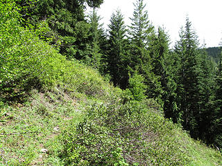
Hiking in the mountains south of Rainier has some advantages for me. Coming from Sequim, it means I don't have to include a ferry ride or drive through the Seattle-Tacoma traffic (drawbacks to everything from I-90 north) and I haven't hiked there much, leaving a lot of new stuff to do. So I headed over on Sunday. Not knowing the area very well and the Gifford Pinchot current conditions report listing a lot of closed or damaged roads, I focused on what I was fairly sure I could actually get to.
I hiked up to South Point Sunday afternoon. The 20 road south from Highway 12 had sections with a lot of potholes but nothing about it was memorably bad. The trail was fine as it climbed up towards the ridge. At 4900' or so it was mostly snow and I traversed south for awhile and then went more steeply up to the ridgeline and reunited with the trail just a short distance from the summit. Coming down, I was able to stay on the ridge far enough to avoid the steepest part of my ascent.
 South Point Trail 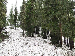 012 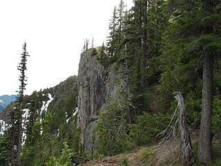 013 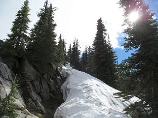 014 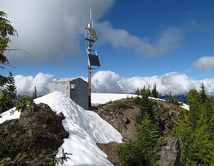 018 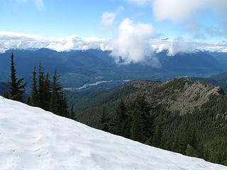 026 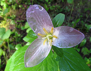 029 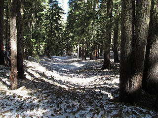 Klickitat Trail 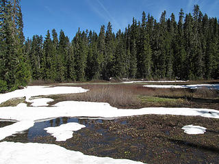 038 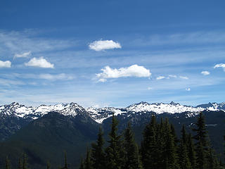 Goat Rocks 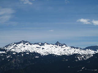 Old Snowy/Ives 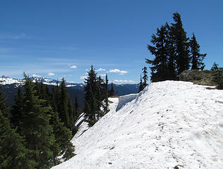 051 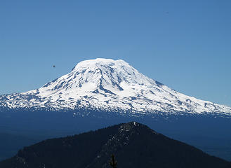 Mt Adams 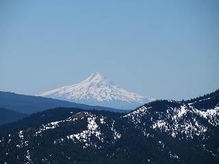 Mt Hood 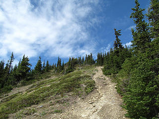 Elk Peak Trail 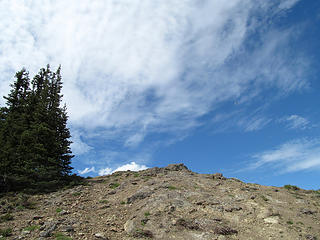 071 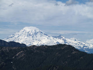 073 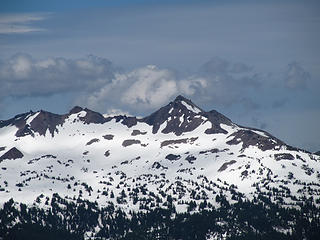 085 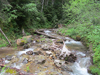 Davis Creek 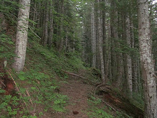 Purcell Mountain Trail 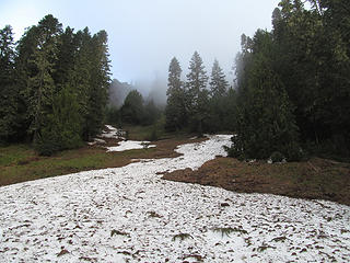 109 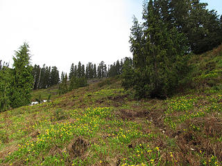 115 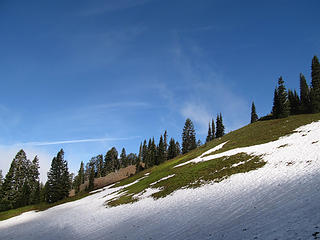 125 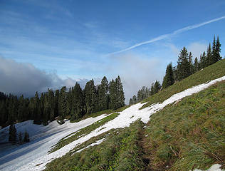 128 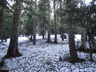 130 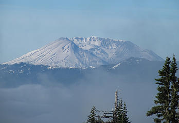 Mt St Helens 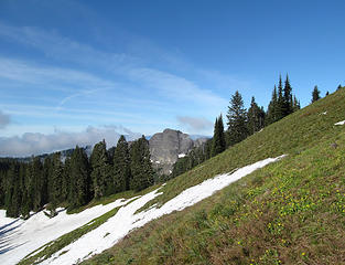 150
|
| Back to top |
  
|
|
Ski
><((((°>

Joined: 28 May 2005
Posts: 12832 | TRs | Pics
Location: tacoma |
|
Ski
><((((°>
|
Wed Jun 21, 2017 7:23 pm |
|
|
 mosquitoes up there can be something awful when there's snow melting or water anywhere nearby - by the end of the season it's pretty much done with but the weather can get sketchy after Labor Day.
very cool. never saw the peak of South Point with snow on it.
mosquitoes up there can be something awful when there's snow melting or water anywhere nearby - by the end of the season it's pretty much done with but the weather can get sketchy after Labor Day.
very cool. never saw the peak of South Point with snow on it.
"I shall wear white flannel trousers, and walk upon the beach.
I have heard the mermaids singing, each to each."
"I shall wear white flannel trousers, and walk upon the beach.
I have heard the mermaids singing, each to each."
|
| Back to top |
|
|
treeswarper
Alleged Sockpuppet!
Joined: 25 Dec 2006
Posts: 11279 | TRs | Pics
Location: Don't move here |
|
treeswarper
Alleged Sockpuppet!
|
Thu Jun 22, 2017 10:39 am |
|
|
I have a map showing an old trail that goes to South Point from the South. It takes off from the Klickitat Trail. Of course, it is no longer maintained.
What's especially fun about sock puppets is that you can make each one unique and individual, so that they each have special characters. And they don't have to be humananimals and aliens are great possibilities
What's especially fun about sock puppets is that you can make each one unique and individual, so that they each have special characters. And they don't have to be humananimals and aliens are great possibilities
|
| Back to top |
|
|
Pyrites
Member
Joined: 16 Sep 2014
Posts: 1884 | TRs | Pics
Location: South Sound |
|
Pyrites
Member
|
Thu Jun 22, 2017 2:13 pm |
|
|
Abert,
Size 10 1/2?
Yours were the only human tracks I saw yesterday on South Point. I forgot my poles so I stopped right where the trail meets the ridge on the left.
Only one set of deer tracks too. I don't know why a deer would bother with this hill. Maybe it carried a lunch bucket.
Maybe the burn area from a couple years ago has some feed.
Keep Calm and Carry On?
Heck No.
Stay Excited and Get Outside!
Keep Calm and Carry On?
Heck No.
Stay Excited and Get Outside!
|
| Back to top |
|
|
Pyrites
Member
Joined: 16 Sep 2014
Posts: 1884 | TRs | Pics
Location: South Sound |
|
Pyrites
Member
|
Thu Jun 22, 2017 2:58 pm |
|
|
TS
I had to look around for trail south. Being too literal misled me. Guidebook and USFS both talk about trail continuing S from South Point. So I looked around from the top. Everywhere I ventured it went from steep to too steep for a non-climber. Yipes.
But I remembered trail was built for teams to supply FS in the backcountry. No where I headed south from top was a possibility for stock. Once I did some thinking (ouch) I went lower and found trail that continues towards Jackpot Lake.
Trail breaks over ridge where South Point trail just kisses the ridge on left, at ~5,600' per USFS topo. This is spot main trail decidedly makes last up hill push to the Point.
To the first switchback you head back towards Packwood, on the E side of ridge.
Spur trail to shown spring is a real, if overgrown, built FS trail. Where it leaves continuation trail it looks like a switchback, again headed back north down hill towards Packwood, until that spur trail's first switchback. On Google Earth you can spot a large boulder at bottom of scree. Spring comes out from bottom of boulder.
From south, at the Jackpot Lake end (Blue Lake 7 1/2 minute) be careful. At least three different old routes are flagged. And the flagger(s) used the same color for all of them. Grr. The older Klickitat trail, that used to be on the N side of that ridge, is on of the junctions you need to get right, i.e. not follow. PM me for some more detailed description.
Once you get past that mess and are clearly headed northwards on the ridge you still have some options. There are bypasses of the first couple high points that stay on the west side of the ridge and maintain consistent contour. Or you can stay right on top of the ridge and go up and down, meeting the bypasses farther north. They are both real constructed, if ancient, trails.
1962, 1:62,500 15 minute Packwood Quadrangle shows continuation trail correctly, even if limited by scale. Our lookout locater would have done his homework first, instead of afterwards. Oh well.
Keep Calm and Carry On?
Heck No.
Stay Excited and Get Outside!
Keep Calm and Carry On?
Heck No.
Stay Excited and Get Outside!
|
| Back to top |
|
|
Ski
><((((°>
Joined: 28 May 2005
Posts: 12832 | TRs | Pics
Location: tacoma |
|
Ski
><((((°>
|
Thu Jun 22, 2017 4:07 pm |
|
|
My memory's really fuzzy on this one, but I believe I have a paper copy of an old USGS topo that shows a portion of that abandoned trail - I thought it went over toward Dry Creek Pass Point ??? -
I have to wonder if some of that flagging you found in the vicinity of Jackpot Lake was elk hunter stuff - they build some serious encampments up there - worst one I ever found was just off the west shore of Jackpot - they literally hauled in a double-wide porcelain cast iron kitchen sink and had it mounted on a 2 x 4 that was spiked to two small Western Red Cedars that they'd lopped off about 8 feet from the ground. The guys down at Randle RS weren't too pleased when I mailed them the photos.
"I shall wear white flannel trousers, and walk upon the beach.
I have heard the mermaids singing, each to each."
"I shall wear white flannel trousers, and walk upon the beach.
I have heard the mermaids singing, each to each."
|
| Back to top |
|
|
Pyrites
Member
Joined: 16 Sep 2014
Posts: 1884 | TRs | Pics
Location: South Sound |
|
Pyrites
Member
|
Thu Jun 22, 2017 4:43 pm |
|
|
Ski
This is Klickitat trail that is shown E of high point 5758', in Section 3.
On older maps the Klickitat trail is shown going N of the main E-W rigde it is on, losing altitude in that basin E of 5758', then connecting back into Klickitat near Jackpot Lake.
At some later date Klickitat trail was constructed between these two locations, and staying on the S (view) side.
To some extent this makes sense, when viewed as a business access for the FS.
Take out all the roads. Closest access from west is trail from valley at Kilborn Ck. But closer than that would have been stock trail up South Point Ridge, from valley floor, a tenth or two E of junction of current Hwy 12 and RD #21.
If you view accessing from the valley floor at that point, locating trail here makes some sense. On the other hand brush/blowdown conditions a hundred years ago might have driven location of Klickitat to N side of ridge.
The trail between South Point and the valley floor seems to have escaped government mapping. Older Metsker shows it, and US. Coast & Geodetic describes route in discussion of accessing BM at the Point. And discussion with retired FS engineers says it's there, and easily located at bottom end. They more or less rolled their eyes when I said 'No Trespass' signs dissuaded me. The signs seem about 20' o.c. (some exaggeration).
Best.
Keep Calm and Carry On?
Heck No.
Stay Excited and Get Outside!
Keep Calm and Carry On?
Heck No.
Stay Excited and Get Outside!
|
| Back to top |
|
|
treeswarper
Alleged Sockpuppet!
Joined: 25 Dec 2006
Posts: 11279 | TRs | Pics
Location: Don't move here |
|
treeswarper
Alleged Sockpuppet!
|
Fri Jun 23, 2017 5:57 am |
|
|
I was mistaken. The only map I can find shows the trail from South Point south and the zaggy one that heads down Smith Cr.
What's especially fun about sock puppets is that you can make each one unique and individual, so that they each have special characters. And they don't have to be humananimals and aliens are great possibilities
What's especially fun about sock puppets is that you can make each one unique and individual, so that they each have special characters. And they don't have to be humananimals and aliens are great possibilities
|
| Back to top |
|
|
|
|
You cannot post new topics in this forum
You cannot reply to topics in this forum
You cannot edit your posts in this forum
You cannot delete your posts in this forum
You cannot vote in polls in this forum
|
Disclosure: As an Amazon Associate NWHikers.net earns from qualifying purchases when you use our link(s). |


