| Previous :: Next Topic |
| Author |
Message |
jbaillie
Member


Joined: 20 Oct 2011
Posts: 63 | TRs | Pics
|
|
jbaillie
Member
|
 Tue Aug 08, 2017 3:22 pm |
|
|
Ptarmigan Traverse 2017
We hadnt done the trip since 1997 so when some friends at a Christmas dinner suggested it, we said sure. I was to be my sixth complete traverse. On Thursday after work we stashed two cars at the Downey Creek Trailhead to alleviate the driving on Saturday, the first day of the Traverse. We rented a large Enterprise van, picked folks up and drove straight to the trailhead arriving at 8am. A grade school chum came along just to drive the van back home, thanks David.
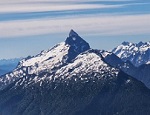
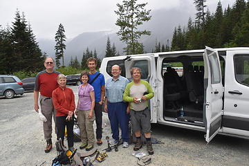 Jerry, Kathy, Cathy, Morten, David & Rich at Cascade Pass Trailhead 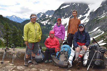 Rich, Kathy, Cathy, Morten & Jerry at Cascade Pass 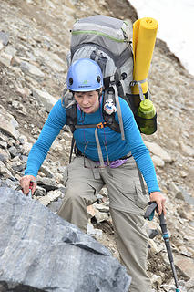 Cathy - Focused steep dirt 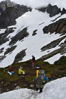 ~6500 ft point just before the Cache Glacier 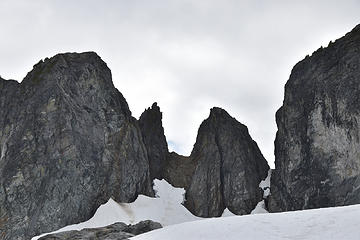 Gunsight Notch on Right from Cache Glacier 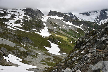 First views of Kool Aide Lake from near Cache Col 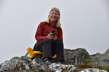 Kathy enjoying a break at Camp 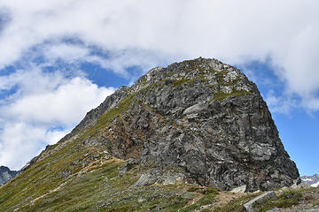 Initial slopes up Magic from Saddle 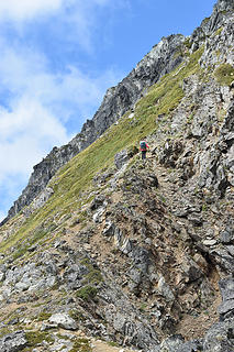 Initial slopes up Magic from Saddle 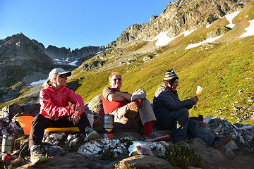 Kathy, Jerry & Rich at Kool Aide Lake 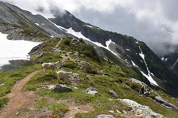 Welcoming committee at Kool Aide Lake 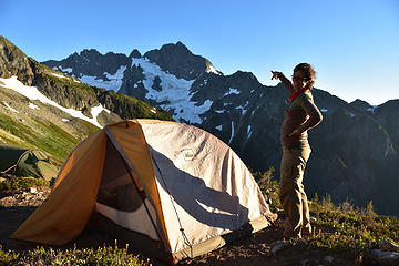 Cathy at Kool Aide Lake 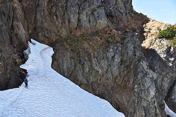 Entrance to moat allowing access to Red Ledge from behind the snow 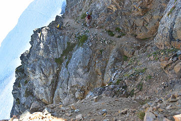 Upper portions of Red Ledge 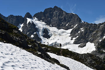 "Picture Point" beyond the Red Ledge 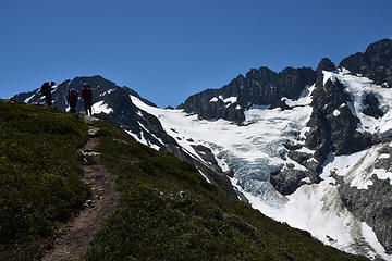 Trail just above the Red Ledge 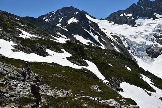 Slopes beyond the "Red Ledge" 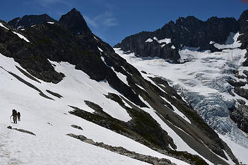 Traversing to Middle Cascade Glacier 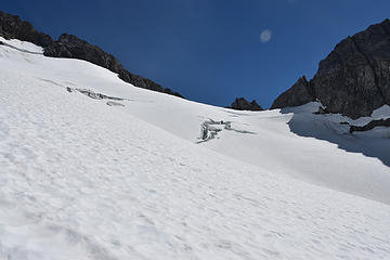 Upper Middle Cascade Glacier 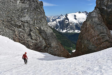 Kathy investigating the Formidable Spider Col 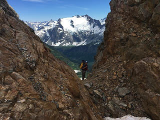 Jerry in Formidable Spider Col 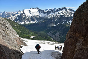 Looking down the south side of the Formidable Spider Col 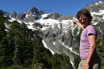 Cathy pointing precisely at the southerly decent chute from Formidable Spider Col. 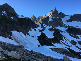 Climbers one the traverse from bottom of chute below Formidable Spider Col 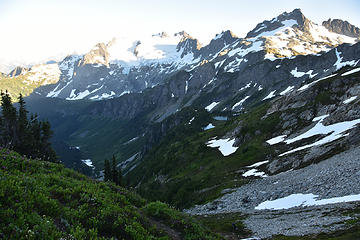 First View of Yang Yang Lakes from Traverse from Chute below Formidable Spider Col 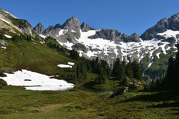 Yang Yang Lakes with Formidable 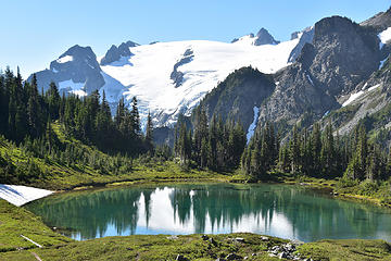 Yang Yang Lakes 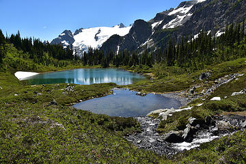 Yang Yang Lakes 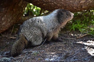 Resident of Yang Yang Lakes 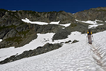 Snow patch south of Yang Yang Lakes. Boot path climbs up to high snow patches where it traverses left on steep heather/rock rib to gain the skyline in upper LH corner of image. 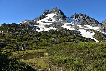 Meadowed Ridge north of Le Conte Mtn 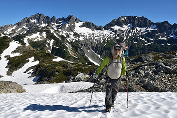 Rich below Le Conte Mtn 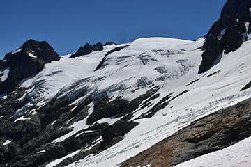 Slope approaching Le Conte Glacier from north. 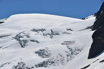 Le Conte Glacier 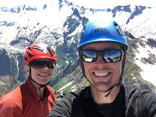 Kathy and Chris on summit of Old Guard Peak 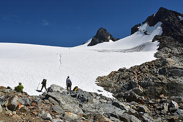 Kathy returning (with Chris) from Old Guard 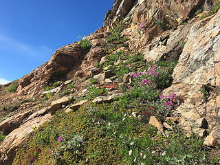 Easy portions of the ramp on the southerly route up Sentinel Peak 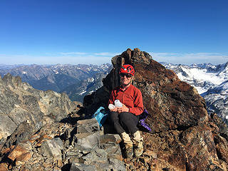 Kathy enjoying a rest on the summit of Sentinel Peak 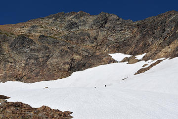 Sentinel Peak - South Route - Go left from the two small triangular snow patches 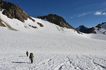 Crossing the head of the S. Cascade Glacier 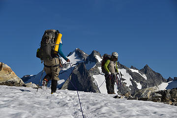 Leaving the S. Cascade Glacier 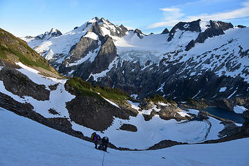 Firm snow meant a few belays descending to White Rock Lakes 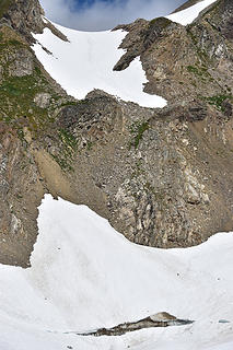 Descent slope from S. Cascade Glacier to White Rock Lakes 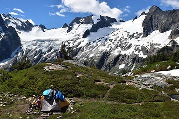 Day off at White Rock Lakes - Note: Sleeping Bags help keep the tent cool 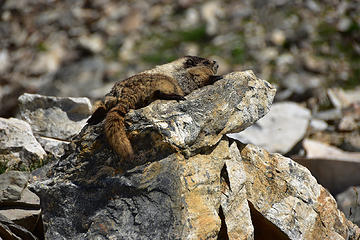 Guard duty 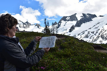 Cathy spent the day sketching 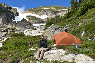 Chris - Not in Michigan 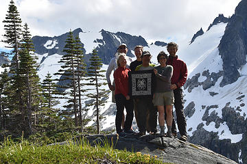 Boealps at White Rock Lakes - Kathy, Jerry, Chris, Rich, Cathy & Morten (L>R) 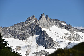 Gunsight Peak from White Rock Lakes 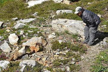 Rich with a wildlife stare down 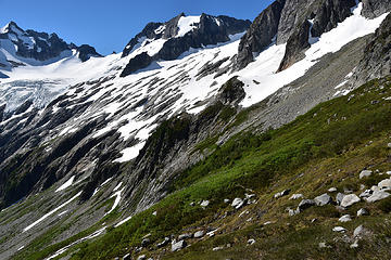 Northern most toe of the Dana Glacier 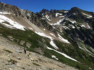 Looking back at White Rock Lakes basin from traverse to Dana Glacier 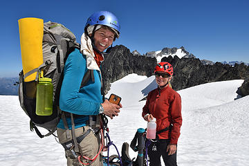 Cathy & Kathy high on the Chickamin Glacier 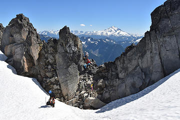 Notch in Ridge just east of Spire Pt 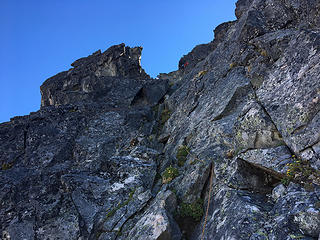 1st Pitch on Spire Pt - Left Hand Gully 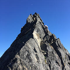 Leading summit pitch on Spire Point 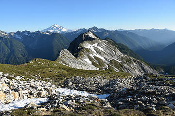 Lower Itswoot Ridge 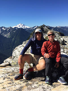 Kathy & Jerry in Itswoot Ridge 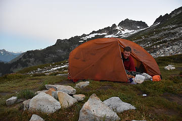 Chris in the morning before Dome Peak Climb 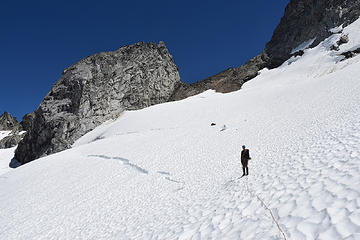 High pass from Dome to Chickamin Glaciers very near summit of Dome Peak 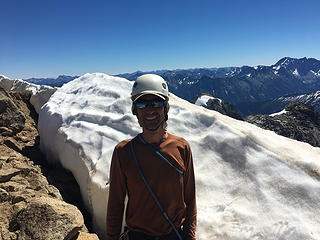 Morten near the Summit 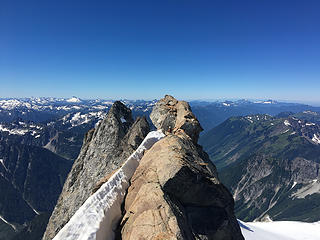 Summit Rock of Dome Peak 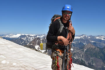 Chris high Chickamin Glacier 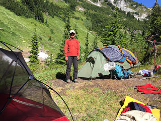 Looking up Itswoot Ridge toward Spire Pt (Left) 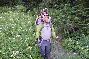 Rich 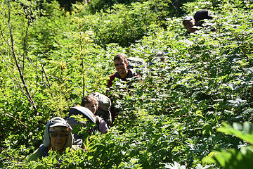 On Trail - Bachelor Creek 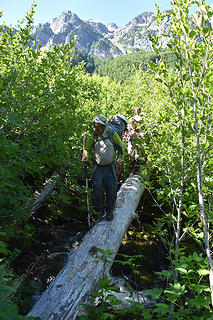 Crossing Bachelor Creek ~4100 ft on the Trail 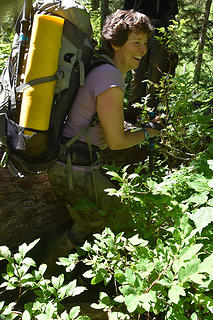 Cathy has said she like the brush! 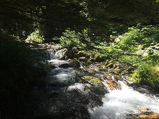 Bachelor Creek 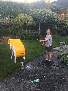 Kathy cleaning up after the trip! Note: her backpack went into the washing machine!
|
| Back to top |
  
|
|
ree
Member

Joined: 29 Jun 2004
Posts: 4399 | TRs | Pics
|
|
ree
Member
|
Tue Aug 08, 2017 3:58 pm |
|
|
What a wonderful trip! Impressive! 
|
| Back to top |
|
|
raising3hikers
Member
Joined: 21 Sep 2007
Posts: 2344 | TRs | Pics
Location: Edmonds, Wa |
|
| Back to top |
|
|
ash789
Member
Joined: 11 Sep 2014
Posts: 2 | TRs | Pics
|
|
ash789
Member
|
Tue Aug 08, 2017 7:34 pm |
|
|
Glad you had a great trip! 
|
| Back to top |
|
|
Frodo Barefoot
Member

Joined: 09 Apr 2015
Posts: 91 | TRs | Pics
|
|
| Back to top |
|
|
RichP
Member

Joined: 13 Jul 2006
Posts: 5634 | TRs | Pics
Location: here |
|
RichP
Member
|
Tue Aug 08, 2017 9:32 pm |
|
|
Looks like a great group.
|
| Back to top |
|
|
Porkrind
Porkrind

Joined: 24 May 2017
Posts: 7 | TRs | Pics
Location: GA |
|
Porkrind
Porkrind
|
Wed Aug 09, 2017 1:26 pm |
|
|
Great pics, I'd love to do that some day.
We can't always control what happens,
But you can how you respond to it.
We can't always control what happens,
But you can how you respond to it.
|
| Back to top |
|
|
BarbE
Member

Joined: 28 Jul 2006
Posts: 1153 | TRs | Pics
|
|
BarbE
Member
|
Wed Aug 09, 2017 3:33 pm |
|
|
Wow, your sixth complete traverse! I would consider myself lucky to do it once!
Great trip descriptions and pictures. Thanks for posting!
|
| Back to top |
|
|
puzzlr
Mid Fork Rocks

Joined: 13 Feb 2007
Posts: 7220 | TRs | Pics
Location: Stuck in the middle |
|
puzzlr
Mid Fork Rocks
|
Wed Aug 09, 2017 11:28 pm |
|
|
Incredible photos, and a good selection for all the key places along this classic route. Congrats on another completion. Once was enough for me, but I'll never forget it.
|
| Back to top |
|
|
Distel32
Member
Joined: 03 Jun 2014
Posts: 961 | TRs | Pics
Location: Edmonds, WA |
|
Distel32
Member
|
Thu Aug 10, 2017 6:31 am |
|
|
|
| Back to top |
|
|
Routes
Member
Joined: 13 Apr 2016
Posts: 31 | TRs | Pics
Location: Seattle |
|
Routes
Member
|
Thu Aug 10, 2017 9:58 pm |
|
|
Great trip and pictures!
I'm BoeAlps basic class of 2008. Cool to see some familiar faces from that time.
|
| Back to top |
|
|
pula58
Member
Joined: 13 Aug 2009
Posts: 589 | TRs | Pics
|
|
pula58
Member
|
Fri Aug 11, 2017 3:09 pm |
|
|
I did the PT in 1993, my first summer living in WA. I had just taken the Mountaineers Basic Climbing course.
The Suiattle River road had some wash-out troubles back then (as it did in the last 10 years as well). So, when we did the trip it was the first year you could get in there for quite some time. The Bachelor Creek trail was hellish (as I recall) Devils club, swampy, going around in circles!
We had rainy weather..I would like to do it again, with sunshine this time! Your photos have got me thinking!
|
| Back to top |
|
|
silence
Member

Joined: 25 Apr 2005
Posts: 4420 | TRs | Pics
|
|
silence
Member
|
Sun Aug 13, 2017 1:07 pm |
|
|
Dream trip ... great TR and pix ... thx!
PHOTOS
FILMS
Keep a good head and always carry a light bulb. Bob Dylan
PHOTOS
FILMS
Keep a good head and always carry a light bulb. Bob Dylan
|
| Back to top |
|
|
DIYSteve
seeking hygge

Joined: 06 Mar 2007
Posts: 12655 | TRs | Pics
Location: here now |
|
DIYSteve
seeking hygge
|
Mon Aug 14, 2017 10:34 am |
|
|
|
| Back to top |
|
|
|
|


