| Previous :: Next Topic |
| Author |
Message |
Jake Robinson
Member


Joined: 02 Aug 2016
Posts: 521 | TRs | Pics
|
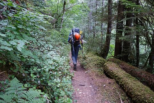
Fletcher and I had grand plans of summiting Dark and Sinister peaks in one trip these past four days. The original plan was to climb both in a long loop from the Suiattle River trailhead. We didn't end up summiting either peak, but we still had a great 3 day outing in one of the more remote regions of the Cascades.
We started hiking from the Suiattle River TH just after 7am on Monday. In a few hours we intersected the PCT and made our way towards Suiattle Pass.
 Cruisin' the Suiattle 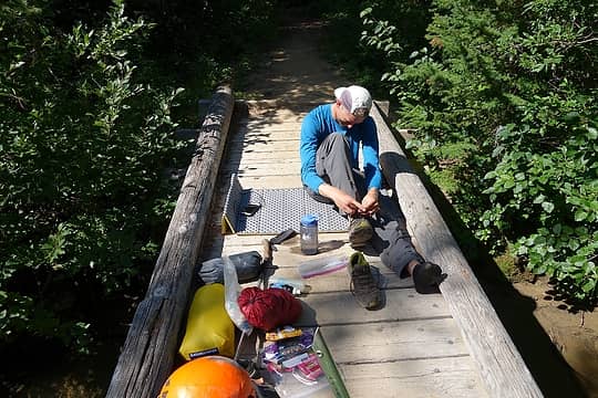 Short break just south of Suiattle Pass. One of the most beautiful old growth forests I've visited. 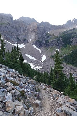 Basin on the PCT north of Suiattle Pass 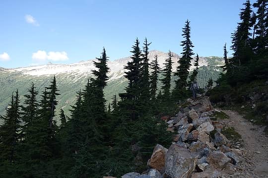 So many miles today...Are we there yet? 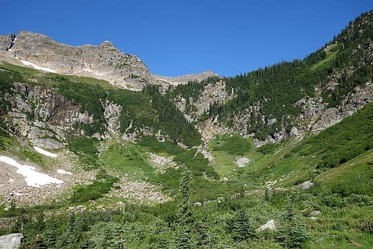 Nearing camp 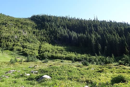 This will have to do 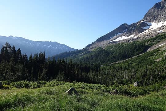 South from camp 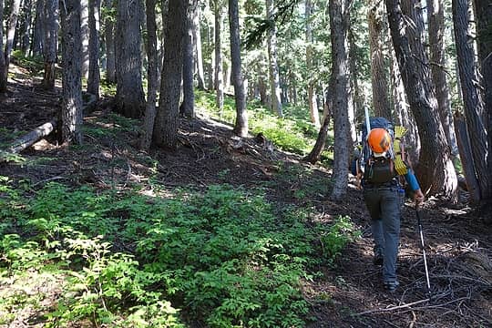 Fletcher en route to Bannock Lakes 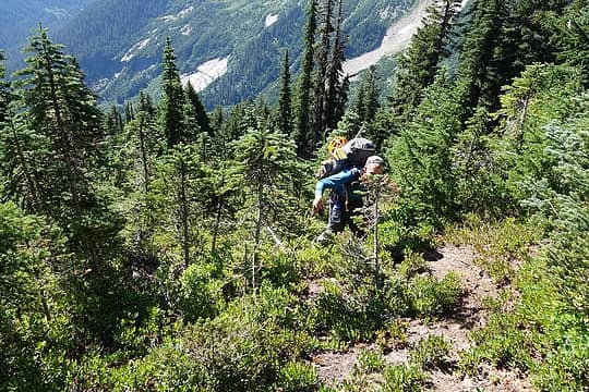 Almost to Bannock 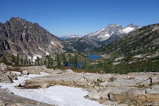 Bannock, Upper Bannock Lakes, Dome, and Sinister 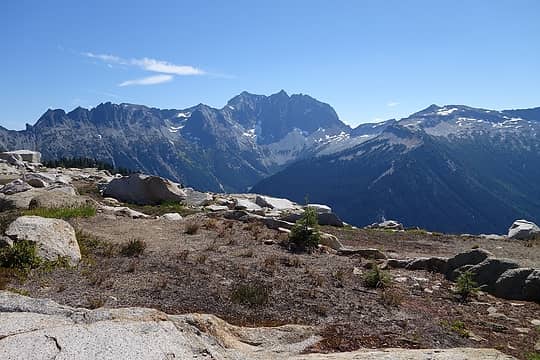 Bonanza 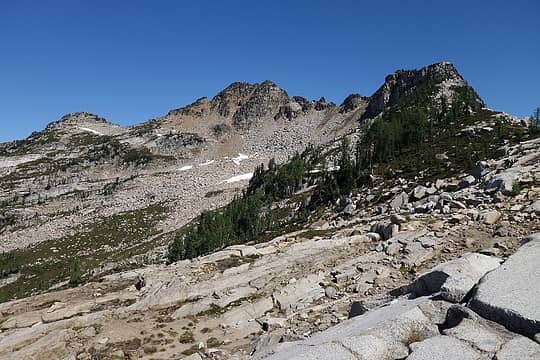 Saddle Bow 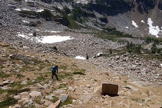 Fletcher starts up to Saddle Bow 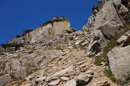 The notch we climbed to in Saddle Bow's summit ridge 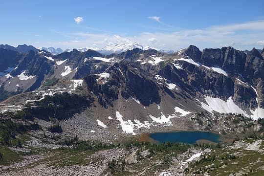 Glacier and upper Bannock Lakes 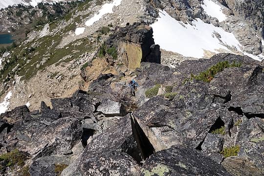 Fletcher climbs boulders to the summit 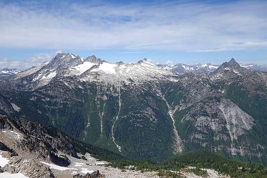 Dome, Sinister, Gunsight, Agnes 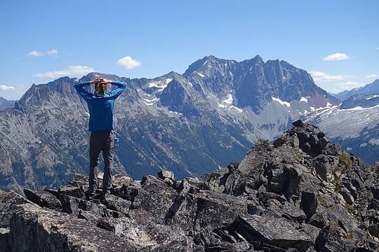 Fletcher on the summit of Saddle Bow with Bonanza 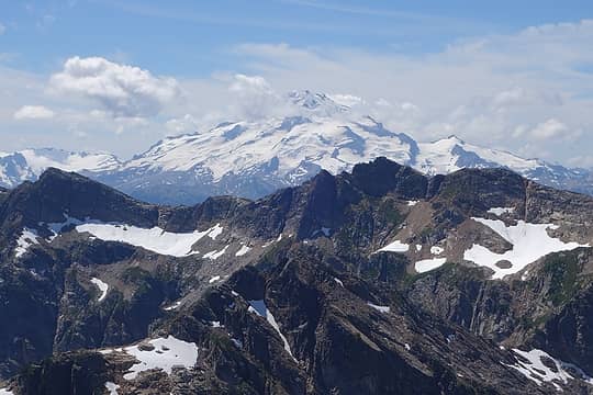 Glacier is beautiful from any angle 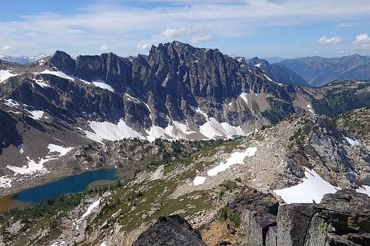 Bannock's impressive NE face with upper Bannock Lakes 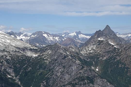 Eldorado, Forbidden, Sahale, Boston, Agnes 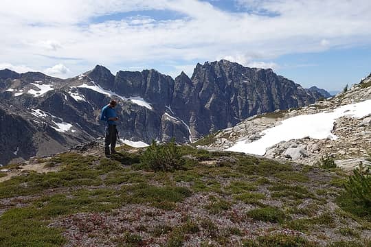 Fletcher and Bannock 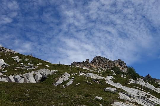 Saddle Bow  Descending from Saddle Bow 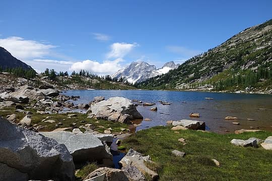 Upper Bannock Lakes, Dome, Sinister 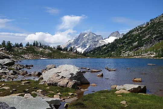 Gorgeous 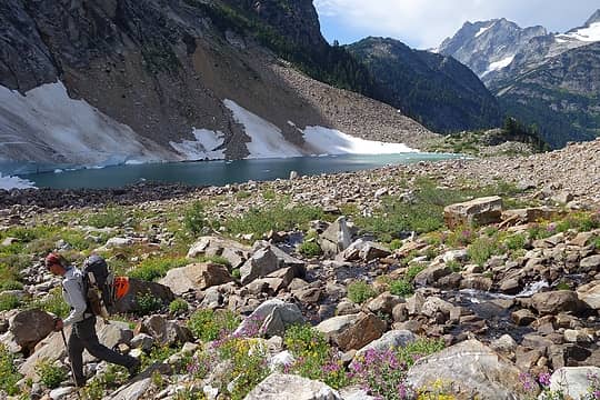 Fletcher and lower Bannock Lakes 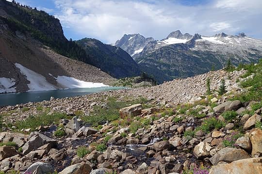 Lower Bannock, Dome, Sinister 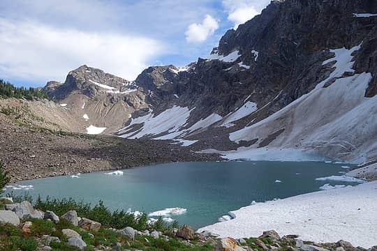 Lower Bannock and some icebergs that probably cleaved off of Bannock Mountain's northeast face 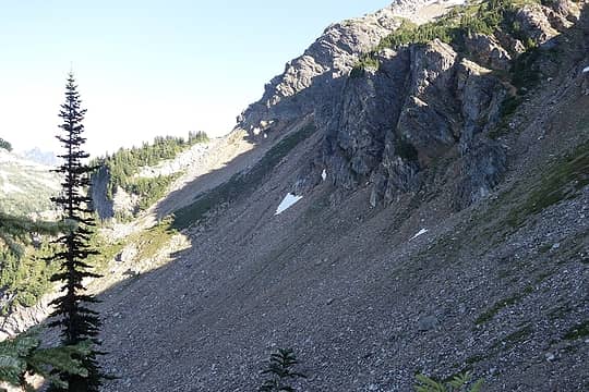 Typical terrain between Bannock Lakes and Ross Pass 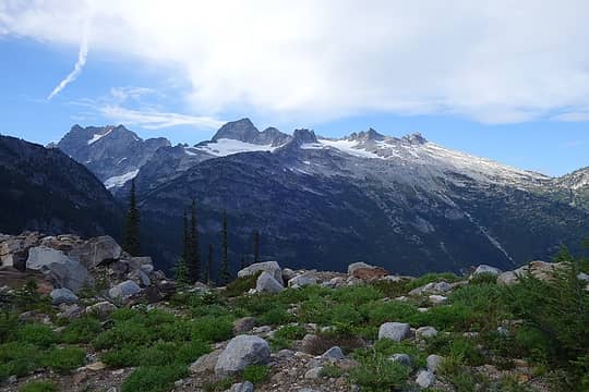 Dome and Sinister from the Hanging Gardens. 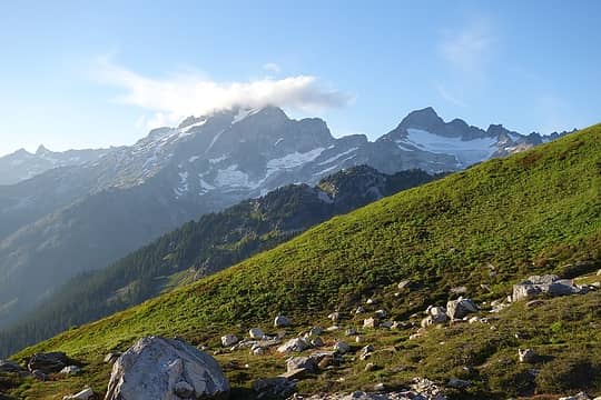 Dome and Sinister from our gorgeous bivy site 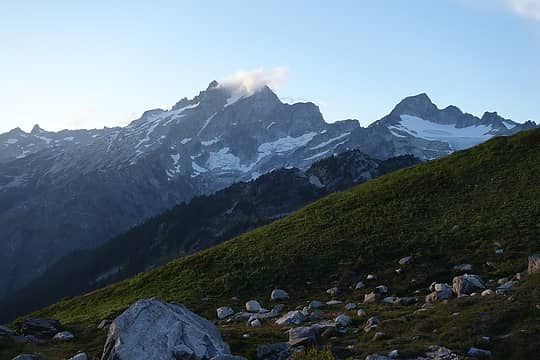 Light fades over Dome and Sinister 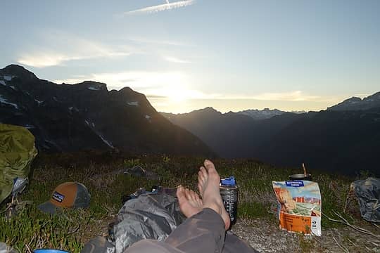 Enjoying a cocktail at sunset from our luxurious bivy. Apologies for the gross feet. 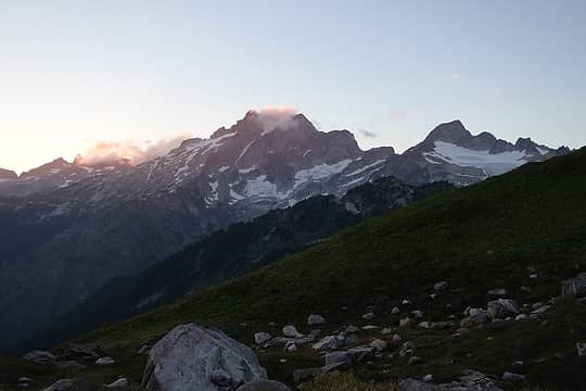 Golden hour 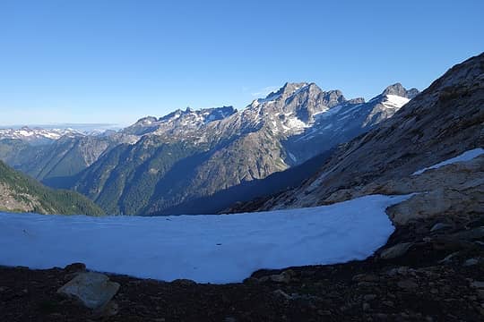 Views from Totem Pass 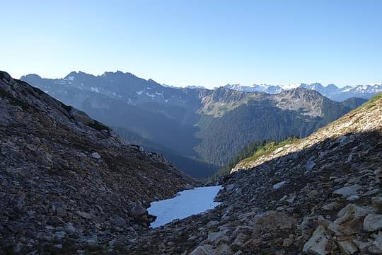 Looking south from Totem Pass. Canyon Lake is out of view to the lower left. In the upper right is the Dakobed Range. 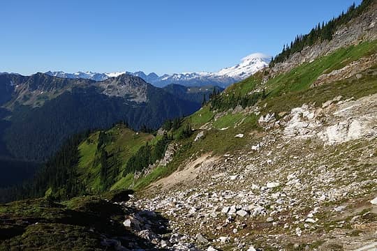 Glacier Peak capped with a nice lenticular from just below Totem Pass 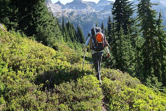 Fletcher on a way trail to Canyon Lake 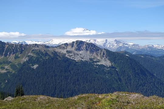 Glacier from the Canyon Lake trail 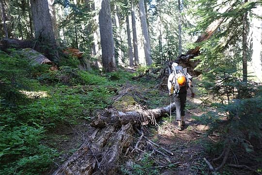 Fletcher on one of the rougher sections of the unmaintained Canyon Lake trail 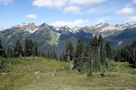 Stonehenge Ridge from near Image Lake 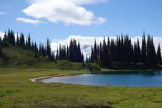 Image Lake and Glacier 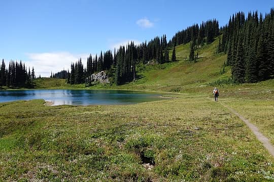 Fletcher and Image Lake 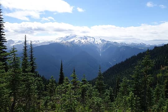 Views from Miners Ridge 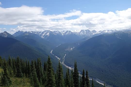 Dakobed Range 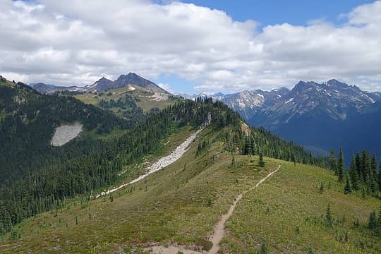 Views east 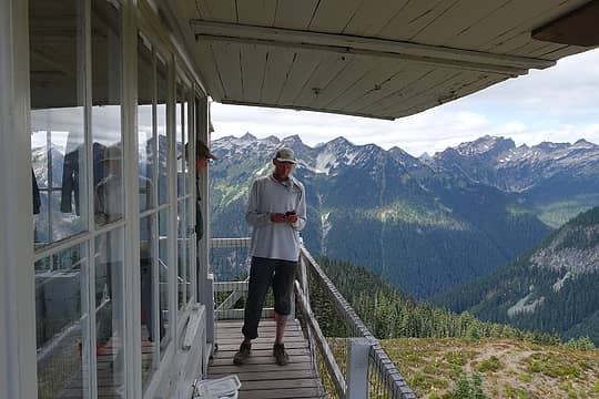 Fletcher at the lookout 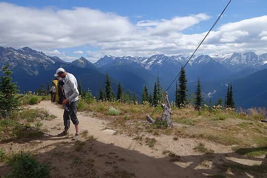 Well, guess it's time to go 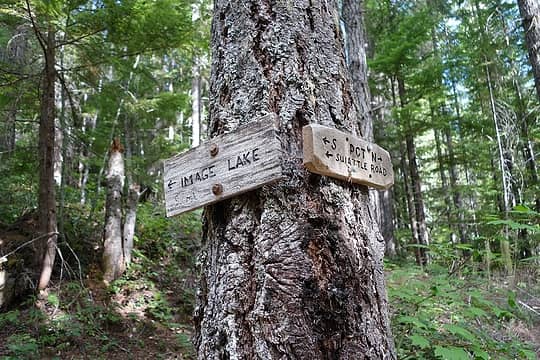 PCT/Image Lake junction 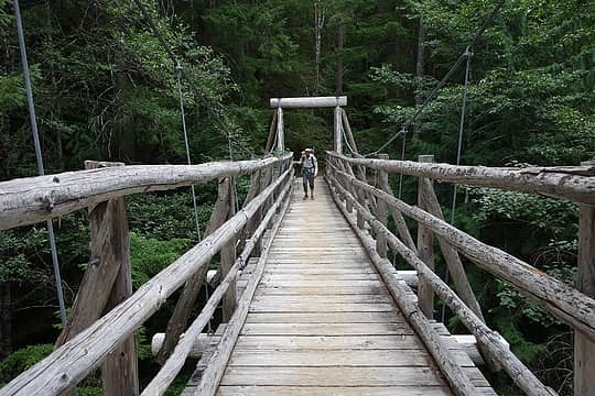 Canyon Creek Bridge
|
| Back to top |
  
|
|
geyer
Member

Joined: 23 May 2017
Posts: 463 | TRs | Pics
Location: Seattle |
|
geyer
Member
|
 Thu Aug 17, 2017 6:03 pm |
|
|
| Jake Robinson wrote: | | Fletcher and I both agreed that this was one of the most remote places we'd ever been. |
That's a strange coincidence - I was just looking at this area on the map yesterday wondering if anyone had any pictures of this place and I could find absolutely nothing. Not even from Bannock or Saddle Bow. You basically confirmed my suspicions that it's as nice looking as the satellite images. Great trip, even without the big summits.
|
| Back to top |
|
|
KekistaniProphet
LOL I WIN
Joined: 25 Sep 2016
Posts: 221 | TRs | Pics
|
Oh god your one of those people who sit on bridges and block the entire right of way
Badass sh## though, Bannock Lakes are my goal for a 5 night quest in a few weeks.
|
| Back to top |
|
|
ree
Member

Joined: 29 Jun 2004
Posts: 4399 | TRs | Pics
|
|
ree
Member
|
Thu Aug 17, 2017 7:09 pm |
|
|
Wow, so gorgeous. How were the bugs? Excellent trip.
|
| Back to top |
|
|
Jake Robinson
Member
Joined: 02 Aug 2016
Posts: 521 | TRs | Pics
|
| KekistaniProphet wrote: | | Oh god your one of those people who sit on bridges and block the entire right of way |
Funny you say that...we hadn't seen anyone in hours and hours, and then as soon as we sat down on that bridge, a PCT southbounder came through.
| ree wrote: | | Wow, so gorgeous. How were the bugs? Excellent trip. |
The flies were bad at Image Lake. Bugs weren't really an issue for us anywhere else on this trip.
|
| Back to top |
|
|
raising3hikers
Member
Joined: 21 Sep 2007
Posts: 2344 | TRs | Pics
Location: Edmonds, Wa |
That's quite the trip! Thanks for sharing
|
| Back to top |
|
|
Fletcher
Member

Joined: 29 Jul 2009
Posts: 1870 | TRs | Pics
Location: kirkland |
|
Fletcher
Member
|
Thu Aug 17, 2017 8:16 pm |
|
|
Can't imagine a worse totally debacle in trip planning. Had a great time regardless! Such cool country.
|
| Back to top |
|
|
Get Out and Go
Member

Joined: 13 Nov 2004
Posts: 2128 | TRs | Pics
Location: Leavenworth |
Nice......!  I remember Iron's report from a few years ago. Now you remind me much I want to get up in there. I remember Iron's report from a few years ago. Now you remind me much I want to get up in there. 
"These are the places you will find me hiding'...These are the places I will always go."
(Down in the Valley by The Head and The Heart)
"Sometimes you're happy. Sometimes you cry.
Half of me is ocean. Half of me is sky."
(Thanks, Tom Petty)
"These are the places you will find me hiding'...These are the places I will always go."
(Down in the Valley by The Head and The Heart)
"Sometimes you're happy. Sometimes you cry.
Half of me is ocean. Half of me is sky."
(Thanks, Tom Petty)
|
| Back to top |
|
|
RichP
Member

Joined: 13 Jul 2006
Posts: 5634 | TRs | Pics
Location: here |
|
RichP
Member
|
Thu Aug 17, 2017 9:32 pm |
|
|
Awesome trip guys, even without the T/100's.
|
| Back to top |
|
|
Brushbuffalo
Member

Joined: 17 Sep 2015
Posts: 1887 | TRs | Pics
Location: there earlier, here now, somewhere later... Bellingham in between |
Fantastic trip! 
| Jake Robinson wrote: | | We swallowed our pride and decided cutting our trip short and hiking out the next day was the responsible call. |
Although initially disappointed, once you made the decision I bet you were relieved to have a more relaxed hike back out.
You'll get 'em next time, by this or another route.
Passing rocks and trees like they were standing still
Passing rocks and trees like they were standing still
|
| Back to top |
|
|
olderthanIusedtobe
Member
Joined: 05 Sep 2011
Posts: 7708 | TRs | Pics
Location: Shoreline |
That looks awesome!
|
| Back to top |
|
|
Kim Brown
Member
Joined: 13 Jul 2009
Posts: 6899 | TRs | Pics
|
| Jake Robinson wrote: | | We swallowed our pride and decided cutting our trip short and hiking out the next day was the responsible call. |
You could pick up chicks in a bar with that! Nothing better than someone who sees the truth, owns it, and deals with it as it should be dealt with.
I would love to visit up there again. I only got to Image and explored the way trail toward Canyon Lake; being solo, I didn't want to try Canyon Lake, knowing the beginning of the trail was in rough shape.
Sweet trip!
"..living on the east side of the Sierra world be ideal - except for harsher winters and the chance of apocalyptic fires burning the whole area."
Bosterson, NWHiker's marketing expert
"..living on the east side of the Sierra world be ideal - except for harsher winters and the chance of apocalyptic fires burning the whole area."
Bosterson, NWHiker's marketing expert
|
| Back to top |
|
|
|
|


