| Previous :: Next Topic |
| Author |
Message |
GaliWalker
Have camera will use


Joined: 10 Dec 2007
Posts: 4929 | TRs | Pics
Location: Pittsburgh |
|
GaliWalker
Have camera will use
|
 Fri Sep 22, 2017 5:08 am |
|
|
Is there a more satisfying feeling than to look around and see the horizon eclipsed by towering mountains, and then, a few hours later, to stand atop one of those peaks? There is nothing I like more in this world than mountains: the soothing peace one gets from walking their forest trails, the thrill of gazing at the sweeping views from atop them, the lightness in one's soul evoked by the sparkling lakes and splashing waterfalls that hide in their folds, the sense of accomplishment from summiting, and the humbling feeling when gazing up at their lofty heights from the valleys. This was my first trip to the Adirondack Mountains of Upstate New York. By the end of my four days there I had fallen in love with them.
Sep 16: Arrival
Whiteface Mountain, High Falls Gorge, Connery Pond
I left Pittsburgh around 4:00am. 9.5hrs later I reached Lake Placid, my home for the next four days. Since I didn't want to tire myself out for my hike planned for the coming day, I decided to do more touristy things on my arrival day.
Whiteface Mountain (drive up)
The town of Lake Placid lies at the northern edge of the High Peaks Area of the Adirondacks, nestling around the shores of lake from which it gets its name. At the far end of the lake 4,867ft high Whiteface Mountain - one of the 46 peaks above 4000ft that the High Peaks are named for - dominates the skyline. A 12mi hike would put the intrepid hiker atop said mountain, but a road accomplishes much the same for the more delicate. Since I was in delicate mode, I made my way up by gasoline power. A $10 fee was small price to pay for the relaxing approach up; I was informed that this price was reduced by $5 because "the elevator was not working" and that I would have to walk the final 0.2mi to the summit. 300ft of elevation were gained on this 0.2mi, up a narrow rocky ridge guarded by railings, so I was panting a bit when I reached the large summit area, crowned by a spiffy stone tower. Despite the vastness of the summit, people teamed amongst the rocks like ants at a picnic spread.
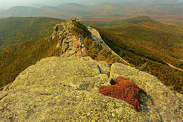 1 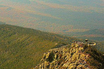 2 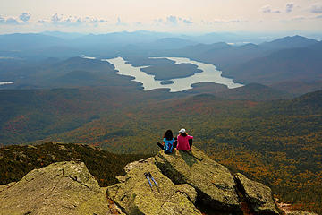 3 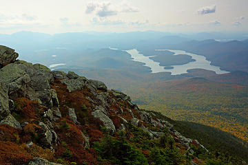 4 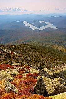 5 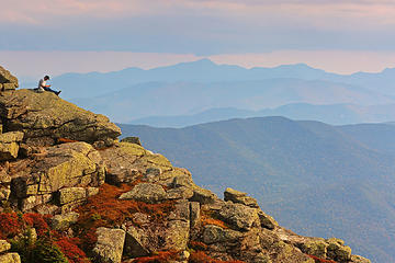 6- The Great Range, a barrier across the horizon
|
| Back to top |
  
|
|
GaliWalker
Have camera will use
Joined: 10 Dec 2007
Posts: 4929 | TRs | Pics
Location: Pittsburgh |
|
GaliWalker
Have camera will use
|
Fri Sep 22, 2017 5:09 am |
|
|
Part II: Great Range sampler (Sep 17)
Gothics, Armstrong, Upper Wolfjaw
After spending my first day in the Adirondacks doing sightseeing I was ready to hit the trail. The next three days were to be spent doing dayhikes; the plan was to spend as much time as I could manage out on the trail, come back to my motel in Lake Placid for the night, and then repeat. Obviously, I anticipated that my current flatlander conditioning would take a beating with the steep ups and downs of the Adirondacks, so each successive day was scheduled to be a bit easier than the one before. I kicked off the proceedings with a partial tour of the Great Range.
The Great Range stretches like a picket fence across the eastern horizon of the Adirondacks High Peaks, and includes seven (or more, depending on which source you consult) of the 46 High Peaks. The 1-day traverse of the entire range is a grueling 25mi, 10,000ft elevation gain extravaganza. I had much more modest goals in mind and was content to settle with three of the 4,000 footers, on a 13.7mi loop.
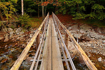
The day before, I had taken a look at the Great Range from Whiteface Mountain's summit. So, I was fairly rubbing my hands in anticipation of walking atop it when I pulled into the Ausable Club's hiker parking lot at 6:00am. Fifteen minutes later I was on my way, walking up the dirt road that one has to endure for 0.8mi until you hit the actual trailhead. After signing the register, I finally hit the trail, and proceeded to cross over the East Branch of the Ausable River on a spiffy bridge. Immediately afterwards, I hung a left to pick up the West River Trail.
 15 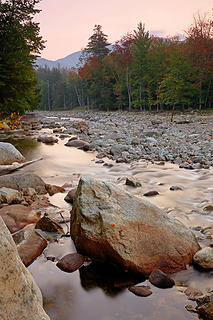 16 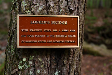 17 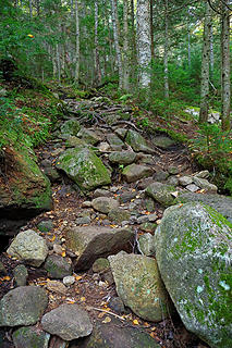 22 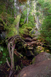 23 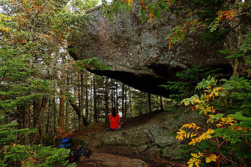 24 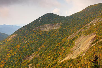 25 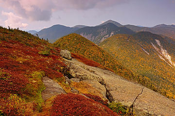 26 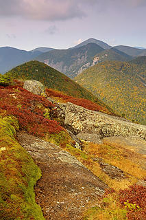 27 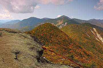 28 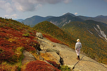 29- GaliWalker on Gothics 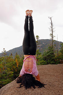 36
|
| Back to top |
|
|
GaliWalker
Have camera will use
Joined: 10 Dec 2007
Posts: 4929 | TRs | Pics
Location: Pittsburgh |
|
GaliWalker
Have camera will use
|
Fri Sep 22, 2017 5:09 am |
|
|
Part III: "Hitch up Matildas" and Mount Colden (Sep 18, 2017)
This was to be my second consecutive day of hiking in the Adirondacks. As I got up early in the morning, my quads burned from the previous days excesses. Experience told me to ignore them; they would adjust as they warmed up. Other than this little trifle, I felt good as I drove over to the Adirondack Loj trailhead. After taking care of the bureaucracy of paying my $10 parking fee and self registering, I finally got boots on the trail at 6:30am.
I motored along the wide, smooth Van Hoevenberg Trail. Nothing much seemed to happen in the initial going, so I reached the site of the Marcy Dam without much of a fuss. 2011's Tropical Storm Irene had washed out the dam, as well as the small lake, but not the mosquitoes which seemed to be making do quite well with just Marcy Brook, thank you very much. From here, the view of Avalanche Mountain and Mount Colden, amongst other luminaries, was great.
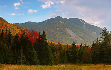 37- Mount Colden (photo taken on the return) 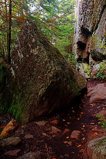 38 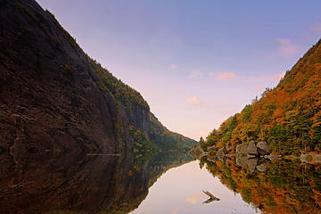 39 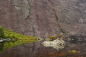 40 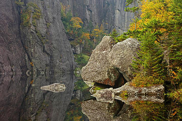 41 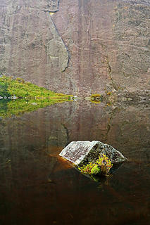 42 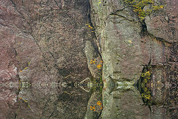 43 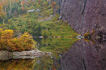 44 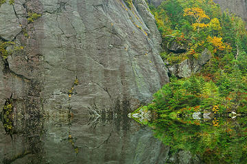 45- Entrance to the Trap Dike route up Mount Colden 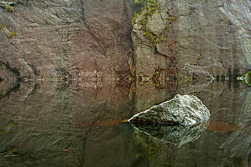 46 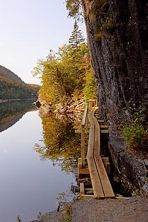 47 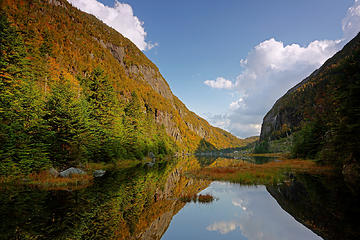 48 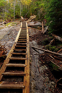 49 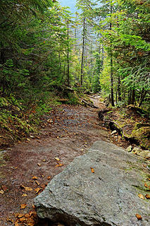 50- Steeper than it looks 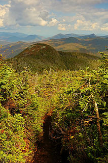 54- False summit in the distance 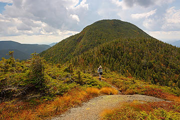 55- GaliWalker at the false summit, actual summit behind ('selfie') 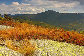 56- Mount Marcy
|
| Back to top |
|
|
GaliWalker
Have camera will use
Joined: 10 Dec 2007
Posts: 4929 | TRs | Pics
Location: Pittsburgh |
|
GaliWalker
Have camera will use
|
Fri Sep 22, 2017 5:09 am |
|
|
Part IV: Indian Head, Chapel Pond, Copperas Pond and departure
Sep 19: Indian Head, Chapel Pond, Copperas Pond
My final full day of hiking, and I was suffering slightly. The previous two days of steep ups and downs had left me the proud owner of chaffing burns on the front of both ankles, where the boot uppers had been given a thorough workout. This was the first time I'd ever had any issues in these spots, a testament to how unrelentingly rough and steep the travel had been. I was glad that I had scheduled a relatively easy set of hikes for this day.
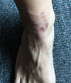 57- iPhone photo, after my return to Pittsburgh 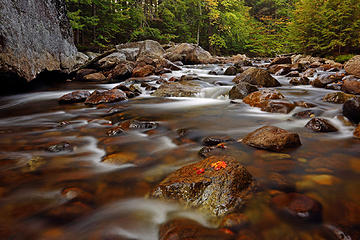 58 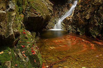 69 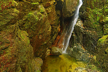 70- Gill Brook waterfall room 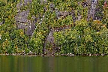 71 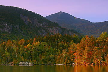 72 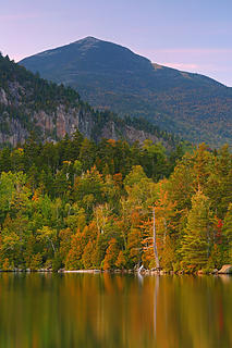 73
|
| Back to top |
|
|
Malachai Constant
Member

Joined: 13 Jan 2002
Posts: 16092 | TRs | Pics
Location: Back Again Like A Bad Penny |
When we lived in Ottawa we went there many times. No big mountains in Ontario. The trails are surprisingly difficult. The Daks are Americas first wilderness.
"You do not laugh when you look at the mountains, or when you look at the sea." Lafcadio Hearn
"You do not laugh when you look at the mountains, or when you look at the sea." Lafcadio Hearn
|
| Back to top |
|
|
GaliWalker
Have camera will use
Joined: 10 Dec 2007
Posts: 4929 | TRs | Pics
Location: Pittsburgh |
|
GaliWalker
Have camera will use
|
Fri Sep 22, 2017 8:15 am |
|
|
Yeah, I saw lots of hikers from Canada. It seemed like half the people there were speaking French. I was extremely impressed with the Adirondacks, so it wasn't surprising to encounter so many visitors from north of the border.
|
| Back to top |
|
|
Malachai Constant
Member
Joined: 13 Jan 2002
Posts: 16092 | TRs | Pics
Location: Back Again Like A Bad Penny |
What was fun was nearly every peak ended with a bare granite scramble. 
"You do not laugh when you look at the mountains, or when you look at the sea." Lafcadio Hearn
"You do not laugh when you look at the mountains, or when you look at the sea." Lafcadio Hearn
|
| Back to top |
|
|
GaliWalker
Have camera will use
Joined: 10 Dec 2007
Posts: 4929 | TRs | Pics
Location: Pittsburgh |
|
GaliWalker
Have camera will use
|
Fri Sep 22, 2017 8:57 pm |
|
|
  Parts II and III are now up.
|
| Back to top |
|
|
Jim Dockery
Member

Joined: 12 Sep 2007
Posts: 3092 | TRs | Pics
Location: Lake Stevens |
I'm normally not that interested in NY TRs, but glad you posted this since my wife and I are headed back that way next week. Nice pics as usual, some nice color in this one 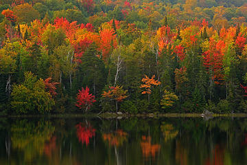 My first day in the Adirondacks. I spent the evening at Connery Pond, which ended up being far better than I'd expected, with some beautiful golden light.
Adirondacks, Upstate New York (Sep 16, 2017)
|
| Back to top |
|
|
GaliWalker
Have camera will use
Joined: 10 Dec 2007
Posts: 4929 | TRs | Pics
Location: Pittsburgh |
|
GaliWalker
Have camera will use
|
Sat Sep 23, 2017 7:45 pm |
|
|
The Adirondacks were definitely 1-2 weeks further ahead than other places. Some nice color was already showing up. You might be timing it perfectly.
|
| Back to top |
|
|
tmatlack
Member

Joined: 21 Aug 2007
Posts: 2854 | TRs | Pics
|
|
tmatlack
Member
|
Sun Sep 24, 2017 1:57 am |
|
|
Gali,
Thanks for fond memories. I went to Paul Smiths College, a 2 yr. school on Saranac Lake and hiked up Gothics with a buddy. Right outside our campus was St. Regis Mtn., with 360 views and incredible fall color.
I know our Cascades/Olympics are more alpine and dramatic, but we get ass kicked by eastern peaks in fall foilage.
Tom
|
| Back to top |
|
|
Malachai Constant
Member
Joined: 13 Jan 2002
Posts: 16092 | TRs | Pics
Location: Back Again Like A Bad Penny |
We did the Colden Algonquin loop as our first hike in the Daks shortly after Sandy went through. We thought it would be like Tiger Mountain in vertices and length. We were wrong it was near as hard as the JMT the direct route up Algonquin was up a 30 degree "slide" of bare granite marked on our map as a "trail". We loved it😍. Thanks for the pics, did you do Marcy?
"You do not laugh when you look at the mountains, or when you look at the sea." Lafcadio Hearn
"You do not laugh when you look at the mountains, or when you look at the sea." Lafcadio Hearn
|
| Back to top |
|
|
GaliWalker
Have camera will use
Joined: 10 Dec 2007
Posts: 4929 | TRs | Pics
Location: Pittsburgh |
|
GaliWalker
Have camera will use
|
Sun Sep 24, 2017 11:16 am |
|
|
| Malachai Constant wrote: | | ... did you do Marcy? |
No, I'd wanted to do it via Avalanche Lake, which was a must visit for me, but that route would have been 18.5mi long, and maybe not the wisest choice given that I had other destinations to visit too. In any case it was a toss up between Marcy and Colden for me, and I did Colden. No regrets.  Marcy's #1 on the list for my next visit, closely followed by Algonquin.
|
| Back to top |
|
|
chefothefuture
Member

Joined: 18 Aug 2003
Posts: 97 | TRs | Pics
Location: Chuckanut Mountain WA. |
Great TR of my home turf :-)
Gee, you missed the adventure of Saddleback and Basin (on the range trail)!
Love the pictures.
|
| Back to top |
|
|
GaliWalker
Have camera will use
Joined: 10 Dec 2007
Posts: 4929 | TRs | Pics
Location: Pittsburgh |
|
GaliWalker
Have camera will use
|
Tue Sep 26, 2017 9:00 am |
|
|
It's like discovering a new author and then wanting to read all of his/her books.
| chefothefuture wrote: | | Gee, you missed the adventure of Saddleback and Basin (on the range trail)! |
And my list of reasons to go back grows...
By the way, for people who aren't familiar with the Adirondacks, while the mountains aren't as spectacular as in Washington (except possibly during fall), the hiking is challenging and just as much fun. I would highly recommend it as a destination to visit if ever in the neighborhood.
|
| Back to top |
|
|
|
|
You cannot post new topics in this forum
You cannot reply to topics in this forum
You cannot edit your posts in this forum
You cannot delete your posts in this forum
You cannot vote in polls in this forum
|
Disclosure: As an Amazon Associate NWHikers.net earns from qualifying purchases when you use our link(s). |


