| Previous :: Next Topic |
| Author |
Message |
puzzlr
Mid Fork Rocks


Joined: 13 Feb 2007
Posts: 7220 | TRs | Pics
Location: Stuck in the middle |
|
puzzlr
Mid Fork Rocks
|
 Tue Jan 02, 2018 8:27 pm |
|
|
The weather gods were considerate to provide a beautiful day to kick off the new year. It was tough to round up a group for New Years day but eventually three of us (neek, penquin, me) made it to the trailhead at the Big River Bridge at MP 5 on the Middle Fork road. There was a pocket of freezing air on the valley bottom, but as we climbed higher the temperatures rose in a mild inversion and it was pleasantly warm all day.
The creek by the road was running high enough to mostly submerge the crossing rocks so we found an alternate icy log to cross on. Hair ice was plentiful, but it looked a day old and not so spectacular. We made good time to the end of the trail and road, getting to the end of the west Green Mountain road in 2 hours -- 3.8 miles and 3000' of gain so far.
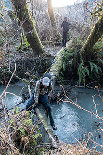 Crossing Moraine Creek on an icy log 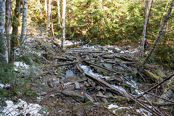 Brawling Creek crossing on the ALP road 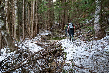 West Green road in a spot where it has eroded out. Most of it is still in good shape. 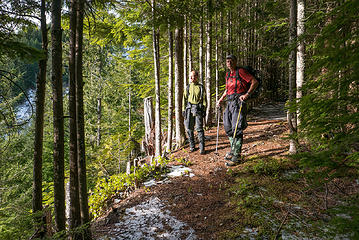 View point on the west Green road 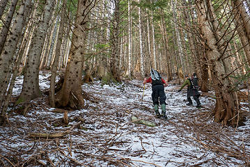 We put on microspikes for extra traction on the frosted ground beyond the road 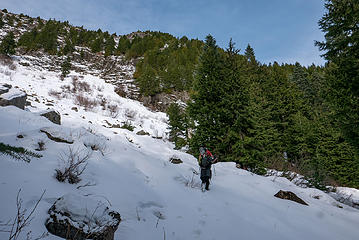 At the opening below the cliffs of West Green 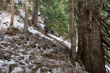 Traversing right through the old growth 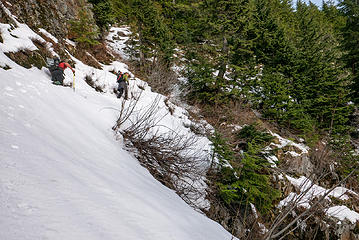 This is the very top of Brawling Creek, and a deep gully forms below this spot. We crossed an easy spot above the small waterfall and kept doing a downward traverse to get past the cliff bands on the other side. 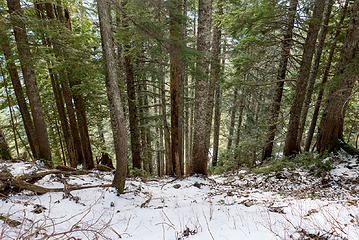 There is a beautiful old Mountain Hemlock forest up here, but just below it has been logged. 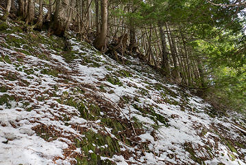 We had to keep traversing because above was all slabby rocks covered in moss. 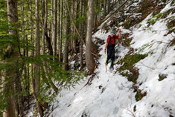 This was one of the scary spots where a slip could have been dangerous. 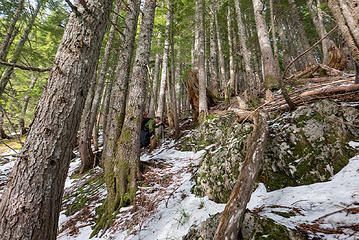 Before too long we got past the cliffs and emerged onto the summit ridge with a mild slope 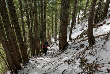 Heading up the ridge to Middle Green 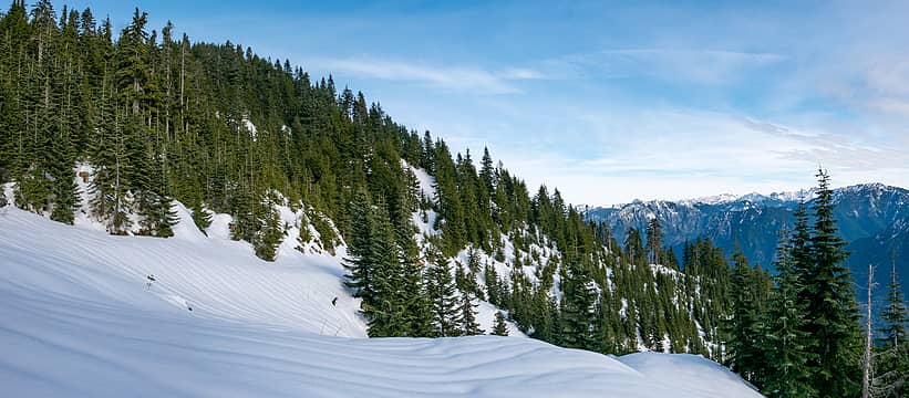 We drifted right an broke out into an open area that is the old logging road and slash pile area 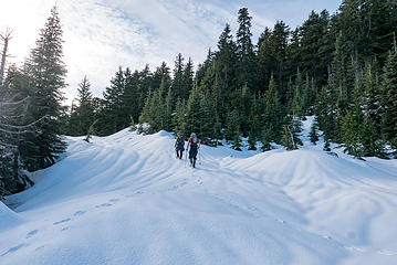 Continuing up the old logging road toward the pass 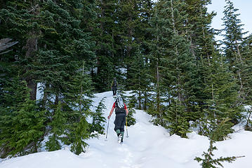 We broke off left from the road to climb the last 150' to the Middle Green summit 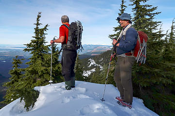 On Middle Green summit. Photo by Nick Michal. 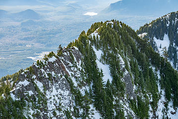 West Green from Middle 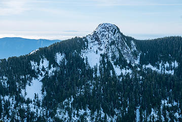 Teneriffe 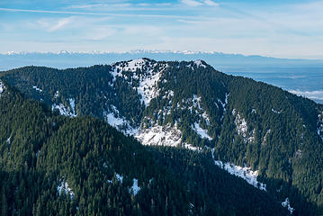 Dixie peak 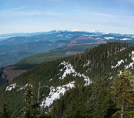 View north from Middle Green summit. The old logging road with snow on it has been decommissioned. 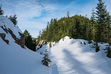 Green pass with the old logging road blasted through it 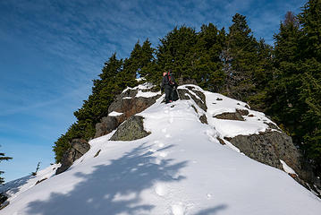 Fun rocks on the climb to the main summit 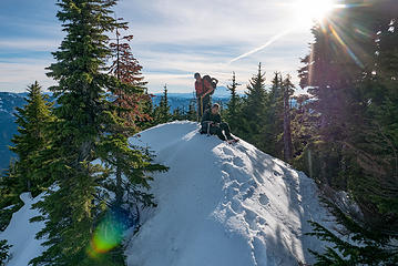 Bryan and Nick on the main Green summit 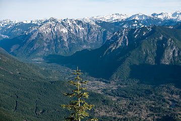 Garfield and central part of the Middle Fork valley 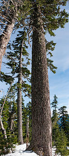 The one huge tree on the ridge 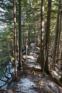 Dramatic level spot along the south ridge 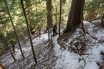 Some sections have been flagged and then used often enough to form a faint trail 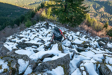 Descending the talus field just above Absolute Last Promontory 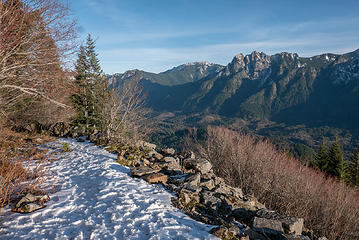 Absolute Last Promontory 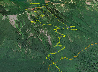 Route up to the middle summit, over to the main one, then down the normal route.
|
| Back to top |
  
|
|
RichP
Member

Joined: 13 Jul 2006
Posts: 5633 | TRs | Pics
Location: here |
|
RichP
Member
|
Tue Jan 02, 2018 9:30 pm |
|
|
So wish I could have joined you. New Year's Day is a family tradition in my house though.
Your photos of the Middle Fork peaks show a stark lack of snow.
|
| Back to top |
|
|
Bernardo
Member

Joined: 08 Feb 2010
Posts: 2174 | TRs | Pics
Location: out and about in the world |
|
Bernardo
Member
|
Tue Jan 02, 2018 9:46 pm |
|
|
|
| Back to top |
|
|
neek
Member

Joined: 12 Sep 2011
Posts: 2336 | TRs | Pics
Location: Seattle, WA |
|
neek
Member
|
Wed Jan 03, 2018 10:14 am |
|
|
Glad to finally check this one off. Thanks for the plan & TR. A few more shots -
|
| Back to top |
|
|
flatsqwerl
Member

Joined: 23 Feb 2010
Posts: 1049 | TRs | Pics
Location: tacoma |
|
| Back to top |
|
|
snowhat
Member

Joined: 14 Mar 2008
Posts: 53 | TRs | Pics
|
|
snowhat
Member
|
Thu Jan 04, 2018 8:19 pm |
|
|
Looks like a great trip. We saw your car as we headed to the Middle Fork trailhead, and 6 hours later on the way back. Figured someone must be on Green.
I have been to Green mountain via the Absolute Last Promontory, great winter route. However, my friends that have attempted this trip recently (last 12 months) have been stopped by the DNR guy who unlocks the Mailbox & Granite Creek gates and have been told that the Sitka Spruce Trail is closed, supposedly to protect the Sitka Spruce. Did you see any sign of a closure, or know anything about it? It was way to long to get to Green via CCC.
Hopefully they'll put a real trail there in that section someday.
|
| Back to top |
|
|
User-Name
Member

Joined: 10 Aug 2010
Posts: 312 | TRs | Pics
Location: bellevue |
nice! I remember poking around Green a while back. Traversed over from near the top of Tenny. We only hit one of the highpoints you guys snagged. A descent pic:
|
| Back to top |
|
|
puzzlr
Mid Fork Rocks
Joined: 13 Feb 2007
Posts: 7220 | TRs | Pics
Location: Stuck in the middle |
|
puzzlr
Mid Fork Rocks
|
Fri Jan 05, 2018 5:13 pm |
|
|
| snowhat wrote: | | the DNR guy who unlocks the Mailbox & Granite Creek gates and have been told that the Sitka Spruce Trail is closed, supposedly to protect the Sitka Spruce |
That is the DNR's position -- they want to discourage use of this trail. That's why they cut out the log crossing on the creek at the trailhead a couple years ago. But so far there is no signage about not using it. A few short boardwalk sections would protect the trees and make the trail in that first short section less muddy solving a couple problems. Beyond Brawling Creek, most of the trail is on ridge lines and old logging roads so it makes a fine trail that's not susceptible to erosion and doesn't get into goopy clay areas. But another motivation might be to keep that part of the Middle Fork friendlier for animals by reducing the number of people walking through.
One possible plan I've heard is to convert the open area on the Bessemer Road just past the creek near the gate into a trailhead to access the CCC trail midway and connect to a possible Green Mountain trail. It would be longer than from the Big River Bridge but workable. But none of these get done without money being allocated via a grant and I haven't heard if that's happened yet.
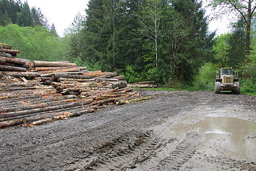 Logs cleared for the paving project are stacked in the big opening just beyond Big Blowout Creek on the Bessemer road. This was taken in 2016 and all the logs were trucked away in 2017.
|
| Back to top |
|
|
GaliWalker
Have camera will use

Joined: 10 Dec 2007
Posts: 4929 | TRs | Pics
Location: Pittsburgh |
|
GaliWalker
Have camera will use
|
Fri Jan 05, 2018 5:41 pm |
|
|
Amongst a number of some nice photos, I really like this one. 
|
| Back to top |
|
|
EastKing
Surfing and Hiking

Joined: 28 Mar 2007
Posts: 2082 | TRs | Pics
Location: 77 miles from Seattle! |
|
EastKing
Surfing and Hiking
|
Thu Feb 08, 2018 10:39 pm |
|
|
Went up on 2/7/18. The log across the creek is about to give way. Chances are that soon someone is either going to have to bring something to cross the creek or find a more solid log. Made to just above the talus field in which because of the soggy conditions we decided to turn back. I hope to be back there next month in order to get a view.
YouTube | SummitPost
Saw the depths of despair. Now I am salvaging what time I have left on Earth.
YouTube | SummitPost
Saw the depths of despair. Now I am salvaging what time I have left on Earth.
|
| Back to top |
|
|
Malachai Constant
Member

Joined: 13 Jan 2002
Posts: 16092 | TRs | Pics
Location: Back Again Like A Bad Penny |
Yum, I think I will stick to Cableline for training.
"You do not laugh when you look at the mountains, or when you look at the sea." Lafcadio Hearn
"You do not laugh when you look at the mountains, or when you look at the sea." Lafcadio Hearn
|
| Back to top |
|
|
whitebark
Member

Joined: 08 Jul 2005
Posts: 1864 | TRs | Pics
Location: Seattle |
That log crossing of Moraine Creek looks nasty! Fortunately, the creek's water level has now gone down enough so that you can use the stepping stones. As a very rough rule of thumb, if the Mid Fork is running at 1000 CFS or less, the stepping stones will be above water.
|
| Back to top |
|
|
|
|


