| Previous :: Next Topic |
| Author |
Message |
Joe
Member


Joined: 29 Jun 2002
Posts: 819 | TRs | Pics
Location: Kent |
|
Joe
Member
|
 Tue Jun 02, 2015 8:50 am |
|
|
I hiked the Bogachiel River trail to the junction with the Little Divide (Mink Lake). I camped the first night at Flapjack camp, then 2 nights at 21 mile shelter camp and the final night back at Flapjack camp. I saw 5 people the whole trip. The lower and upper sections of the trail are in reasonable shape, the middle section is a bit rough.
Trip Stats: 51.4 miles with 6595 feet gain.
5/27 Trailhead to Flapjack camp. 10.3 miles with 645 feet elevation gain.
This section of the trail is in pretty good shape. At about 3 miles, the river has washed out a section of trail, so the trail climbs and descends steeply getting over the obstacle. The route starts with a rope assist to get you up (or down) the initial steep bank. The final 2.5 miles to Flapjack camp are a bit rough and muddy. The trail around Flapjack has numerous blowdowns across the trail.
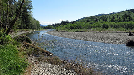 Bogachiel river 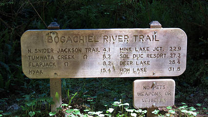 sign at park boundary 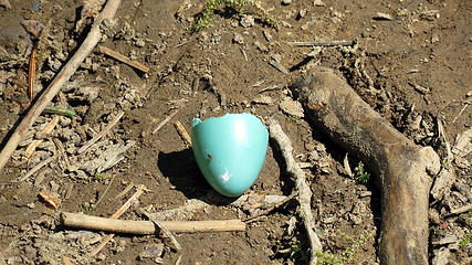 broken egg shell 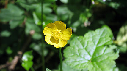 Yellow flower 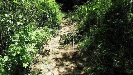 rope assist section 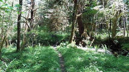 Bogachiel River trail 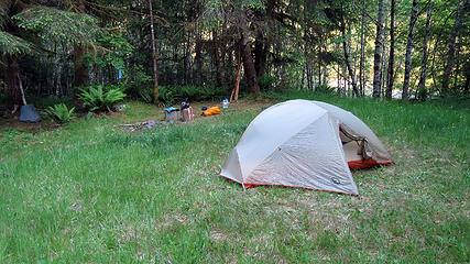 Flapjack camp 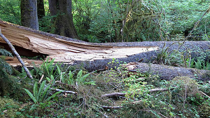 other view of large windfall 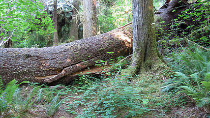 Large windfall across trail, about 6 foot diameter tree 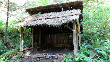 15 mile shelter 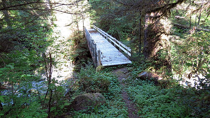 Bridge over North Fork Bogachiel 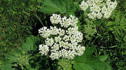 Coltsfoot 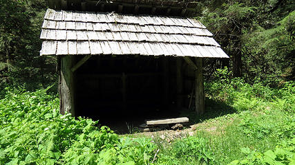 Hyak Shelter 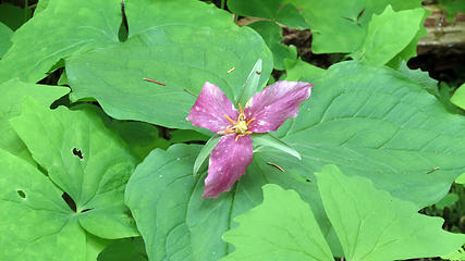 Trillium turning purple 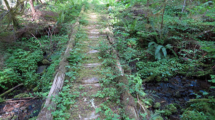 Old puncheon section 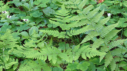 Ferns 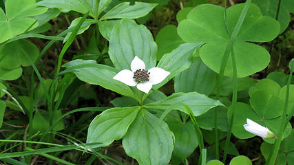 Canadian Dogwood 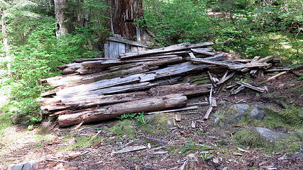 remains of 21 mile shelter 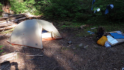 21 Mile Shelter camp 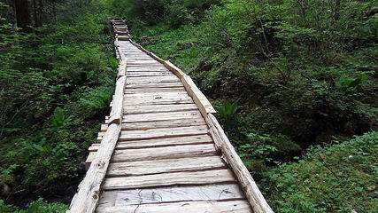 new puncheon section 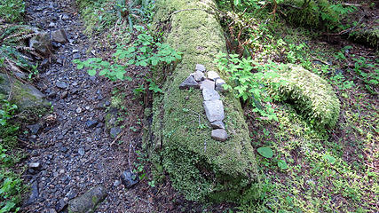 arrow marks the way 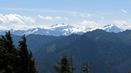 View of Mount Olypmus 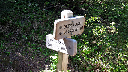 Junction at Little Divide 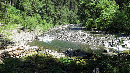 Bogachiel River 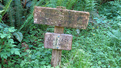 Old Flapjack camp sign 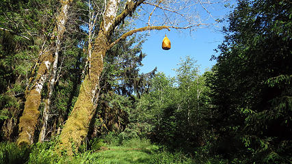 Bear bagging tree at flapjack camp 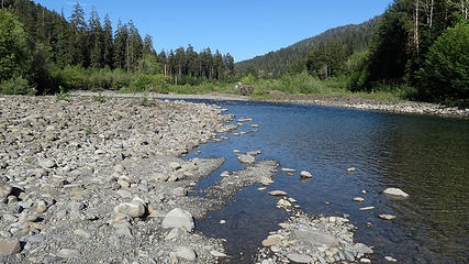 Bogachiel River at Flapjack camp 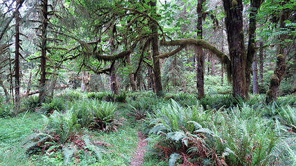 Bogachiel River trail 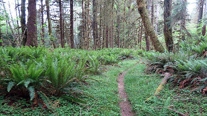 Bogachiel River trail 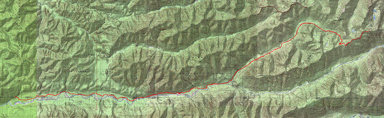 Bogachiel River route
|
| Back to top |
  
|
|
Ski
><((((°>

Joined: 28 May 2005
Posts: 12832 | TRs | Pics
Location: tacoma |
|
Ski
><((((°>
|
Tue Jun 02, 2015 9:05 am |
|
|
very cool.
please do us the favor of posting the shelter photos in the Olympic Trail Shelter thread as well. (that third one looks like it needs a bit of repair work.)
gotta love the 6-foot blowdowns over the trail! 
"I shall wear white flannel trousers, and walk upon the beach.
I have heard the mermaids singing, each to each."
"I shall wear white flannel trousers, and walk upon the beach.
I have heard the mermaids singing, each to each."
|
| Back to top |
|
|
Stonefly
Member

Joined: 12 Oct 2014
Posts: 1 | TRs | Pics
|
|
Stonefly
Member
|
Tue Jun 02, 2015 10:55 am |
|
|
Absolutely gorgeous, I've always wanted to walk up the Bogachiel. Thanks so much for posting!
"The idea of wilderness needs no defense, it only needs defenders."
"The idea of wilderness needs no defense, it only needs defenders."
|
| Back to top |
|
|
bobbi
stillaGUAMish

Joined: 13 Jul 2006
Posts: 8012 | TRs | Pics
Location: olympics! |
|
bobbi
stillaGUAMish
|
Sun Feb 04, 2018 7:35 pm |
|
|
I totally forgot to read your TR for this trail.
our nwhikers lurkers are talking about doing this hike and I remembered, hey, Joe did it and we even met for lunch on your way back through port angeles!!
it'll be 3 years soon, and hopefully the trail is still in good enough condition.
thanks!
bobbi ૐ
"Today is your day! Your mountain is waiting. So
get on your way!" - Oh, the Places Youll Go! By Dr. Seuss
bobbi ૐ
"Today is your day! Your mountain is waiting. So
get on your way!" - Oh, the Places Youll Go! By Dr. Seuss
|
| Back to top |
|
|
RodF
Member

Joined: 01 Sep 2007
Posts: 2593 | TRs | Pics
Location: Sequim WA |
|
RodF
Member
|
Mon Feb 05, 2018 12:35 pm |
|
|
Bobbi, thanks for reminding us all of Joe's and Sir-Hikes-A-Lot's super TRs on the Bogachiel Trail!
Good news: Backcountry Horsemen of Washington's Mt. Olympus Chapter has received support its volunteer work on the Bogachiel Trail through a small part of BCHW's grant from the state Recreation and Conservation Office Recreational Trails Program. BCHW might also seek an additional mini-grant to facilitate further volunteer trail and road work, including establishing safe tread and gravelling muddy sections, in 2019.
The USFS announced a full two years ago that With the help of partners, we expect to have the trail rerouted soon" and we're now told USFS may finally be prepared to approve this work so it might begin in 2018. It's About Time Already!
All this was delayed, in part, by damage to Undi Road, which is the sole access to the trailhead. Jefferson County did a exemplary job facilitating this work, most of which was actually within Clallam County. It's admirable that although Jefferson County "had no assurance that any federal assistance would be provided and had to make the difficult financial choice to commit over $1 million dollars to this project", they went ahead without delay and without even any offer of cooperative risk-sharing from Clallam County. All Bogachiel hikers owe a debt of gratitude to Monte Reinders of Jeffco public works for his leadership, indeed championship, of this project.
This is such a stark contrast to the delays and inaction of Federal officials (Elwha Olympic Hot Springs Road, Dosewallips Road, Bogi trail re-routes, Park way trails, etc., etc...) that we can only pray they might find inspiration in Mr. Reinders' example, as well.
"of all the paths you take in life, make sure a few of them are dirt" - John Muir
"the wild is not the opposite of cultivated. It is the opposite of the captivated - Vandana Shiva
"of all the paths you take in life, make sure a few of them are dirt" - John Muir
"the wild is not the opposite of cultivated. It is the opposite of the captivated - Vandana Shiva
|
| Back to top |
|
|
puzzlr
Mid Fork Rocks

Joined: 13 Feb 2007
Posts: 7220 | TRs | Pics
Location: Stuck in the middle |
|
puzzlr
Mid Fork Rocks
|
Mon Feb 05, 2018 2:33 pm |
|
|
Good for them. Thanks for letting us know.
|
| Back to top |
|
|
|
|
You cannot post new topics in this forum
You cannot reply to topics in this forum
You cannot edit your posts in this forum
You cannot delete your posts in this forum
You cannot vote in polls in this forum
|
Disclosure: As an Amazon Associate NWHikers.net earns from qualifying purchases when you use our link(s). |


