| Previous :: Next Topic |
| Author |
Message |
Matt
Tea, Earl Grey, Hot


Joined: 30 Jan 2007
Posts: 4307 | TRs | Pics
Location: Shoreline |
|
Matt
Tea, Earl Grey, Hot
|
 Thu Feb 08, 2018 1:31 am |
|
|
Dates: December 9-10, 2017
Destination: Green Mtn 6500 & Is People 6665 (USGS Downey Mtn)
Party: Matt, Carla
Note: this report is from back in December, when there was far less snow.
A persistent inversion had brought warm temperatures and stable snow. We decided to make an overnight trip by camping near the Green Mtn lookout, and then day tripping out to Point 6675, and unnamed 1295P peak. By association with Green Mtn, I had named that peak "Soylent." However, Soylent turned out to be too far and difficult, so we aimed instead for the closer Point 6665, which lacked prominence due to its 10-foot lesser height.
As we were hiking across the bright snow dunes under the hot inversion sun, suddenly Carla exclaimed: "izpeepl."
Matt: "What?"
Carla, louder "Izpeepl!"
Matt: "What did you say?"
Carla, looking very pleased with herself: "itziz peepl"
Matt, fearing that Carla has become delusional from the heat: "What are you saying?"
Carla, more emphatically: "IT'S IS PEOPLE."
Matt, being rather dull, asks: "I don't get it. What do you mean?"
Carla: "That's the name of this peak." Pointing to the peak ahead of us, "Soylent." Pointing to the peak behind us, "Green." Pointing to the peak we're climbing, "Is People."
Enlightenment dawns on Matt as clearly as the inversion haze: "Huh? Oh. Ok."
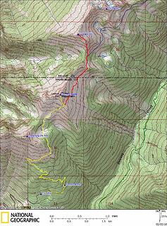 GPS Track 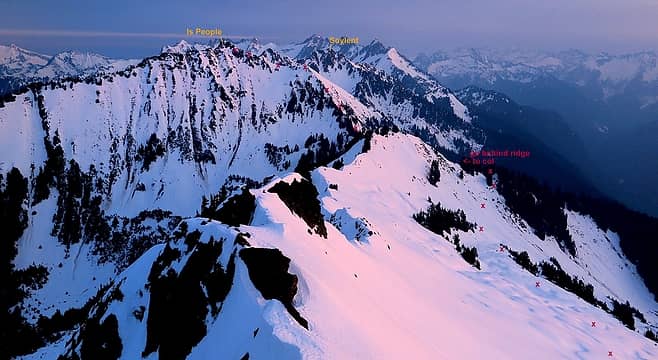 IsPeople Route viewed from Green Mtn 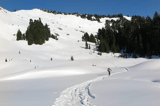 Basin below the lookout 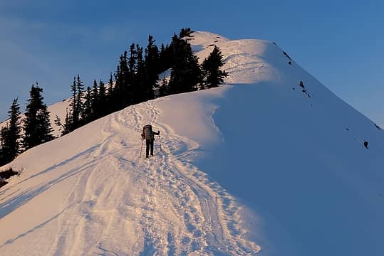 Going up the final crest toward the lookout 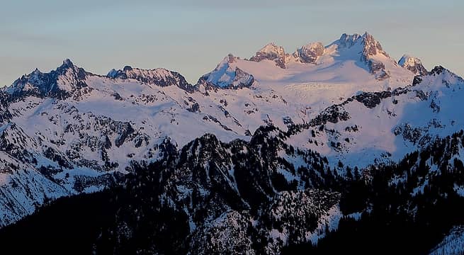 Faint alpenglow on Dome Peak 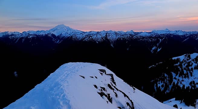 Pastel colors from Glacier to Sloan 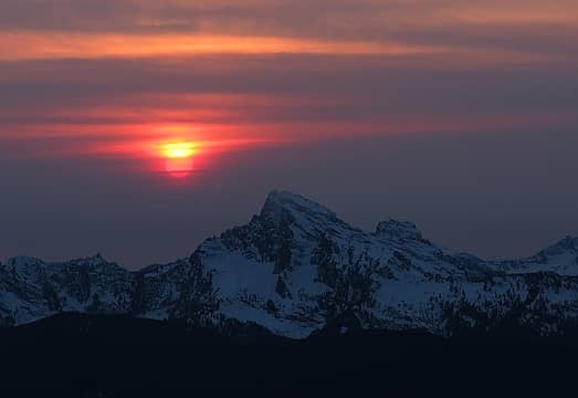 Sun descending toward Whitechuck 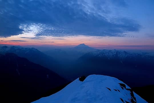 Glacier Peak before sunrise 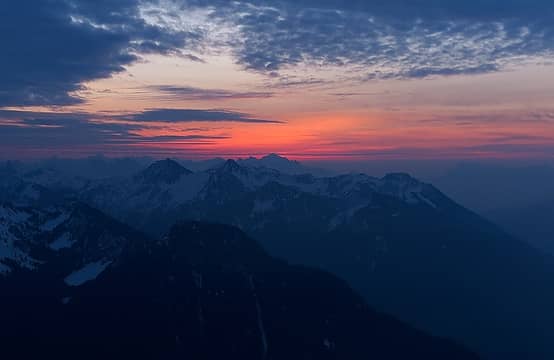 Pre-dawn glow getting brighter, 7:43am 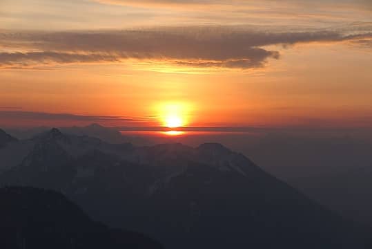 Sunrise bonfire in the inversion haze, 8:03am 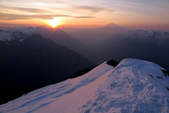 Sunrise & Glacier Peak 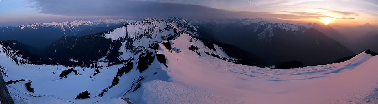 Wider panorama for sunrise 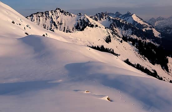 Animal tracks ahead of us on the traverse of Green's east slope 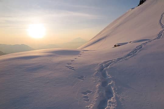 Hiking across the snowy heat wave 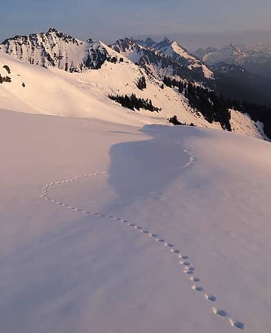 More tracks leading us onward 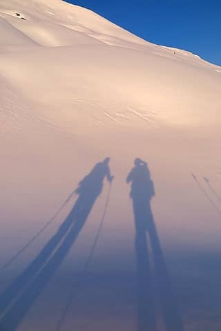 Shadows in the inversion haze 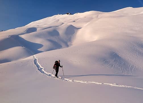 Carla hiking across the dunes 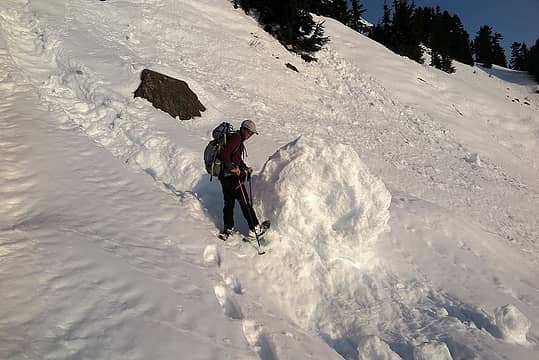 Carla kicking the truck tire sized snow wheel that had come down a couple days earlier 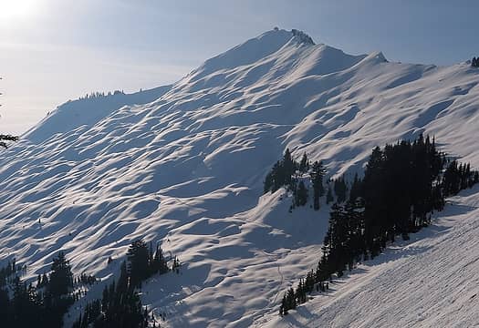 A view back to our tracks on the snow dune slope, and the steeper slope that had already been heat-released 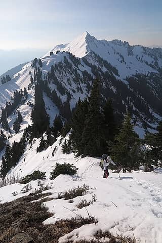 Back on the crest of IsPeople's south ridge. 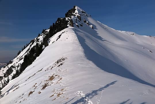 Looking up to the summit area from the 6400-foot saddle (looks like an animal stopped its tracks at the same place) 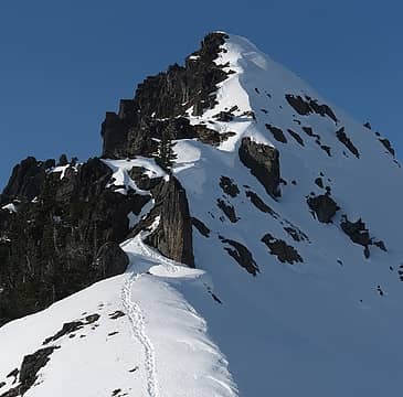 My tracks up the summit block 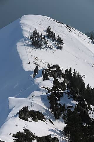 Looking back from the summit down to Carla waiting at the 6400-foot saddle 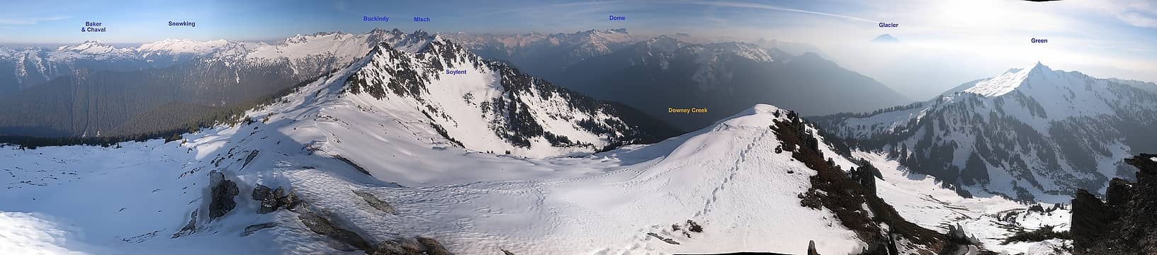 Panoramic view northwest to east to south (best viewed full size) 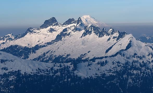 Looking northwest, Chaval & Baker 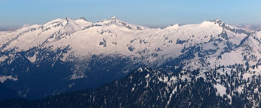 Looking NNW, Snowking & Mutschler 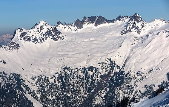 The Lord of the Rings Spires (west end of the Buckindy Range) 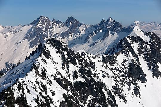 Looking north, Buckindy & Misch, (with Soylent's summit at far right) 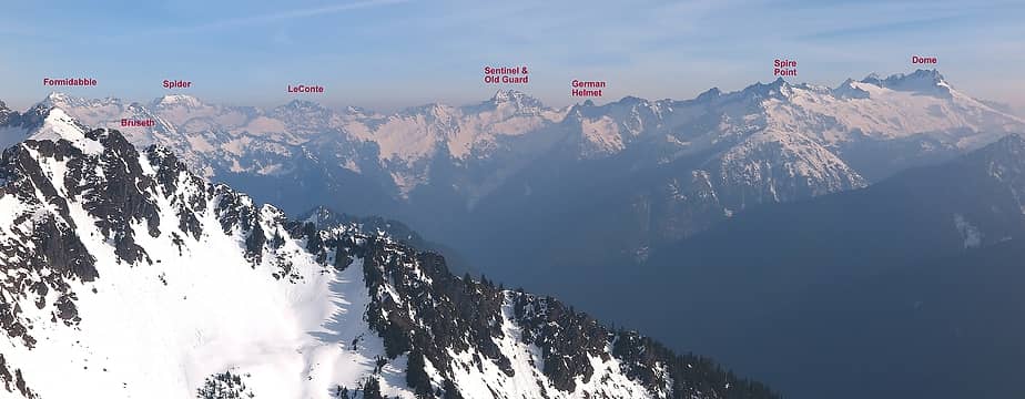 Looking northeast to east, the Ptarmigan Traverse 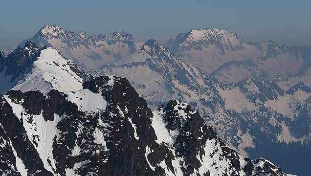 Formidable & Spider, with Soylent's rocky summit in the foreground 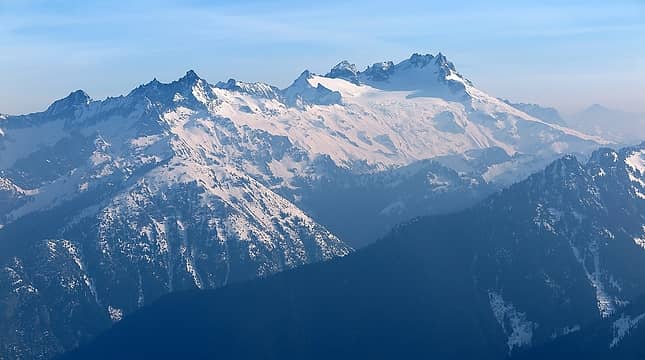 Spire Point & Dome 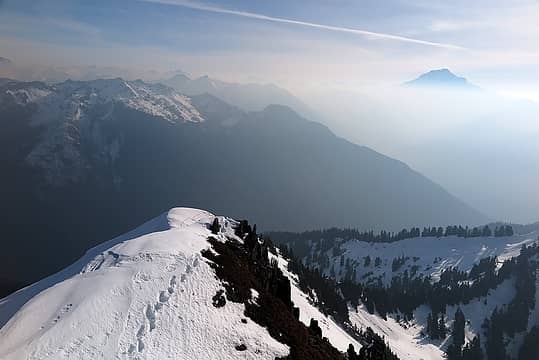 Looking southeast, Downey Peak & Glacier, almost hidden in the haze 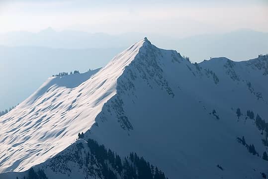 Looking south, Green Mtn Lookout 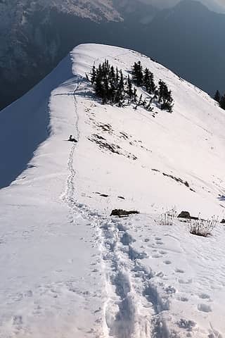 Carla waiting at the 6400-foot saddle 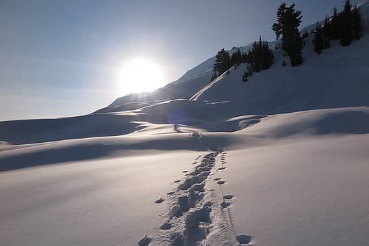 Hiking back up the snow dunes into the sun 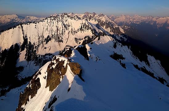 Late afternoon light on the peak we visited 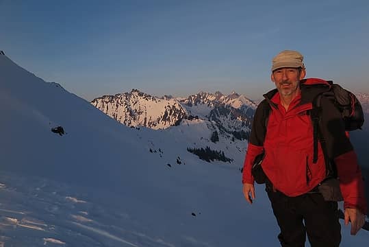 Ready to head down 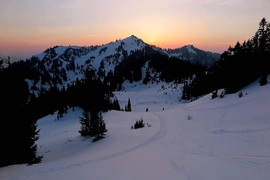 Soft evening light in the basin south of Green Mtn 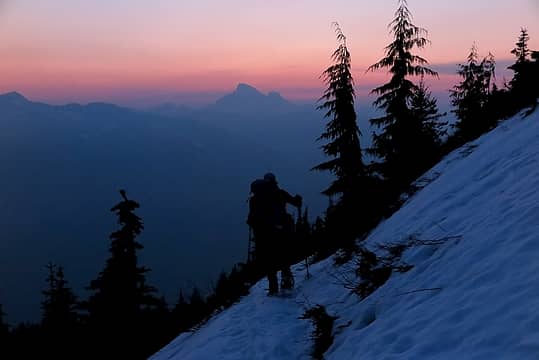 Hazy silhouettes descending the trail 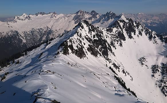 the ridge running from IsPeople to Soylent (its the farther rocky summit, not the closer one) 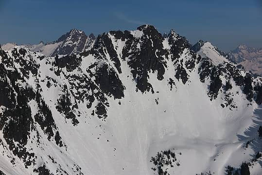 the steep basins below Soylent 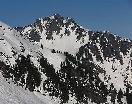 view of Soylent from farther back
As beacons mountains burned at evening. J.R.R. Tolkien
As beacons mountains burned at evening. J.R.R. Tolkien
|
| Back to top |
  
|
|
Stefan
Member

Joined: 17 Dec 2001
Posts: 5091 | TRs | Pics
|
|
Stefan
Member
|
Thu Feb 08, 2018 10:43 am |
|
|
Nice white undulation pictures, getting that!
| Matt wrote: | | The Peak Not VisitedI especially like to visit summits that are rarely travelled. Thus my interest in Soylent. The Buckindy Traverse route runs past the 5371-foot tarn below it, but snow and gullies in the basin above looked too steep and loose in present conditions. The crest running from IsPeople has too many rocky outcrops. Contours on the west and north side look like they, but there was no way to get a view of the north. I wonder who has ever been there. Maybe Roper? |
I have been there:
https://www.nwhikers.net/forums/viewtopic.php?t=8017100&highlight=6675
You even made a comment in the post further down. Mitch B and Greg K have been there too--but many years ago. They called it Horsefeathers.
|
| Back to top |
|
|
Matt
Tea, Earl Grey, Hot
Joined: 30 Jan 2007
Posts: 4307 | TRs | Pics
Location: Shoreline |
|
Matt
Tea, Earl Grey, Hot
|
Thu Feb 08, 2018 11:46 am |
|
|
| Stefan wrote: | | I have been there:https://www.nwhikers.net/forums/viewtopic.php?t=8017100&highlight=6675 |
Thanks for the info, Stefan. I forgot you had been there, but should've figured you'd be a likely person to have visited any obscure peak.
As beacons mountains burned at evening. J.R.R. Tolkien
As beacons mountains burned at evening. J.R.R. Tolkien
|
| Back to top |
|
|
Kascadia
Member

Joined: 03 Feb 2014
Posts: 651 | TRs | Pics
|
|
Kascadia
Member
|
Thu Feb 08, 2018 12:10 pm |
|
|
That traverse looks a lot better done as a snow dune traverse than as "succulent hellebore"! Amazing conditions for December and spectacular photos of a wild and rugged area.
Green Mt - Mt. Buckindy - Snow King, circa ~1990
It is as though I had read a divine text, written into the world itself, not with letters but rather with essential objects, saying:
Man, stretch thy reason hither, so thou mayest comprehend these things. Johannes Kepler
It is as though I had read a divine text, written into the world itself, not with letters but rather with essential objects, saying:
Man, stretch thy reason hither, so thou mayest comprehend these things. Johannes Kepler
|
| Back to top |
|
|
puzzlr
Mid Fork Rocks

Joined: 13 Feb 2007
Posts: 7220 | TRs | Pics
Location: Stuck in the middle |
|
puzzlr
Mid Fork Rocks
|
Thu Feb 08, 2018 7:45 pm |
|
|
Using this rainy spell to catch up on TRs? It's nice to see another report from beyond the lookout.
|
| Back to top |
|
|
EastKing
Surfing and Hiking

Joined: 28 Mar 2007
Posts: 2082 | TRs | Pics
Location: 77 miles from Seattle! |
|
EastKing
Surfing and Hiking
|
Thu Feb 08, 2018 10:47 pm |
|
|
Incredible!!!
YouTube | SummitPost
Saw the depths of despair. Now I am salvaging what time I have left on Earth.
YouTube | SummitPost
Saw the depths of despair. Now I am salvaging what time I have left on Earth.
|
| Back to top |
|
|
|
|
You cannot post new topics in this forum
You cannot reply to topics in this forum
You cannot edit your posts in this forum
You cannot delete your posts in this forum
You cannot vote in polls in this forum
|
Disclosure: As an Amazon Associate NWHikers.net earns from qualifying purchases when you use our link(s). |


