| Previous :: Next Topic |
| Author |
Message |
meck
Member


Joined: 31 Dec 2010
Posts: 920 | TRs | Pics
|
|
meck
Member
|
 Sun May 20, 2018 9:48 pm |
|
|
On Saturday I decided to go visit, and trailbag, another low-land trail given the view obscuring weather. The north leg of the Snider-Jackson trail in the ONP looked to be a good option given that the Calawah appeared to be running low-ish, making the ford easier. I ran into 4 other hikers on the trail, 2 of whom were making a loop down the Bogie. The FS road in was in good condition from 101.
The ford across the Calawah was only mid-calf deep where I crossed heading to the Bogachiel, and only just over ankle deep where I crossed on the way back north.
While not the most exciting trail per se, it does have some moderate ups-and-downs (especially on the way back from the Bogachiel), an occasional view out of of the drainage, and is currently quite green.
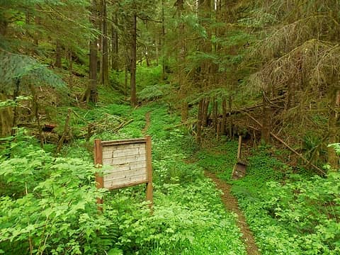 trailhead the FSR deadend 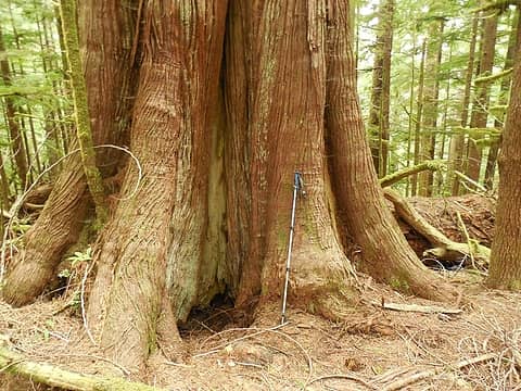 big cedar 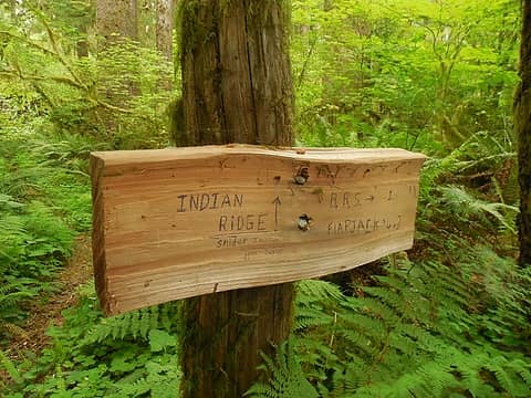 Bogie trail jct. 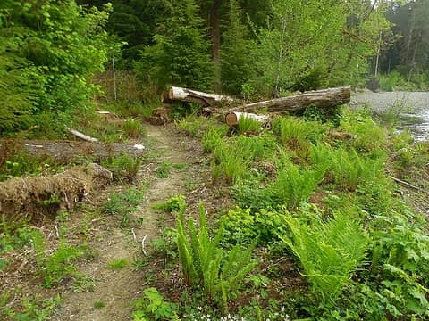 fresh ferns 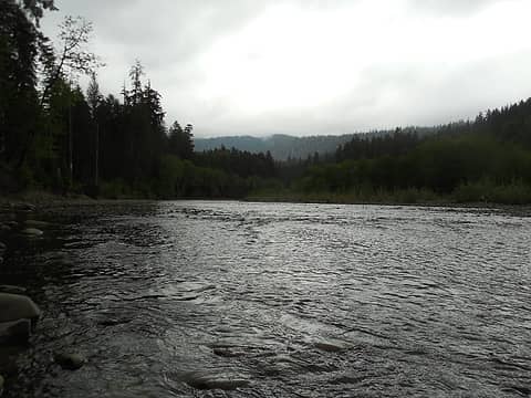 looking east up the Bogie 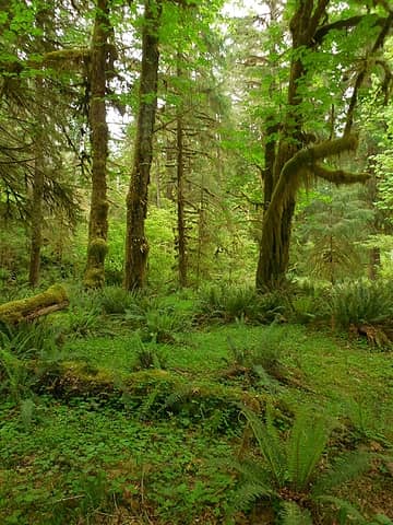 lush green atriums 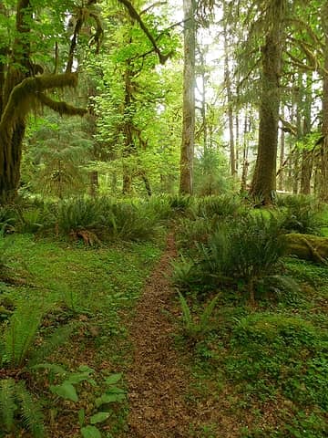 solitary peace on the trail 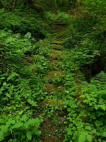 nature reclaiming the old boardwalks 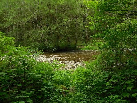 back at the Calawah crossing 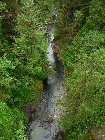 the Sitkum River below the bridge crossing
*Just say NO to Rent-Seeking, don't give up the concept of "ownership"*
*Just say NO to Rent-Seeking, don't give up the concept of "ownership"*
|
| Back to top |
  
|
|
RodF
Member

Joined: 01 Sep 2007
Posts: 2593 | TRs | Pics
Location: Sequim WA |
|
RodF
Member
|
Mon May 21, 2018 9:10 am |
|
|
Is the start of the trail on the south bank of the Calawah ford still flagged? Hope so. The trail on the south bank, and the shallower ford, are slightly upriver of the trail on the north bank, and the flagging was helpful.
When Undi Road was signed "Closed to public use" in 2016, this trail was the only "legal" way into the lower Bogachiel. Until the county decided to re-route Undi Road, we thought it might become the only way!
Rumor has it that USFS is almost ready to approve the re-routes around the two washouts of the lower Bogachiel Trail, two years after they announced they were "fast-tracking the process" and "hoped to have the trail re-routed soon".
"of all the paths you take in life, make sure a few of them are dirt" - John Muir
"the wild is not the opposite of cultivated. It is the opposite of the captivated - Vandana Shiva
"of all the paths you take in life, make sure a few of them are dirt" - John Muir
"the wild is not the opposite of cultivated. It is the opposite of the captivated - Vandana Shiva
|
| Back to top |
|
|
meck
Member
Joined: 31 Dec 2010
Posts: 920 | TRs | Pics
|
|
meck
Member
|
Mon May 21, 2018 8:49 pm |
|
|
Hi RodF, I think I remember seeing some flagging on the south bank, there was also a stone cairn on that side near where the trail left the river (but a higher water event could easily take it out). The north bank had flagging both near the camp where the trail first reaches the river, and just a few dozen yards upriver where I and the other 2 hikers crossed (just above where the river makes a slight drop, about the shallowest spot we could see). The rocks were slick!
Are the current washouts downriver trail, or trail and road? Aside from the coastline, I've got about 12 trails/sections of trail left in ONF & ONP to hike and was hoping to meander the Bogachiel sometime this summer or fall.
*Just say NO to Rent-Seeking, don't give up the concept of "ownership"*
*Just say NO to Rent-Seeking, don't give up the concept of "ownership"*
|
| Back to top |
|
|
RodF
Member
Joined: 01 Sep 2007
Posts: 2593 | TRs | Pics
Location: Sequim WA |
|
RodF
Member
|
Tue May 22, 2018 3:51 pm |
|
|
| meck wrote: | | Are the current washouts downriver trail, or trail and road? |
Yes, the trail washouts are in the first 2 miles, below the Park boundary. The trail re-routes were flagged by USFS and are hikers are using them. The re-routes need to be improved for pack stock to support Park trail crews.
Note added: Some "well meaning" hiker removed the USFS flagging, so the entire re-route process is now delayed until USFS has time to re-flag the re-routes. USFS has only one ranger to cover all trails and trailheads in the entire Pacific Ranger District. Please do not remove USFS flagging, people! That is vandalism. BCHW Mt. Olympus hopes to clear trail to Flapjack this summer.
I heard there was a separate washout above Flapjack, but hikers are getting through. (Stock ford across the river to the opposite, southeast, bank, so don't use this section of trail.)
The road is repaired and open.
"of all the paths you take in life, make sure a few of them are dirt" - John Muir
"the wild is not the opposite of cultivated. It is the opposite of the captivated - Vandana Shiva
"of all the paths you take in life, make sure a few of them are dirt" - John Muir
"the wild is not the opposite of cultivated. It is the opposite of the captivated - Vandana Shiva
|
| Back to top |
|
|
|
|
You cannot post new topics in this forum
You cannot reply to topics in this forum
You cannot edit your posts in this forum
You cannot delete your posts in this forum
You cannot vote in polls in this forum
|
Disclosure: As an Amazon Associate NWHikers.net earns from qualifying purchases when you use our link(s). |


