| Previous :: Next Topic |
| Author |
Message |
Brushbuffalo
Member


Joined: 17 Sep 2015
Posts: 1887 | TRs | Pics
Location: there earlier, here now, somewhere later... Bellingham in between |
Our goal was to camp on top of Crater Mountain or as plan B, where the former lookout #2 was on Point 7054.
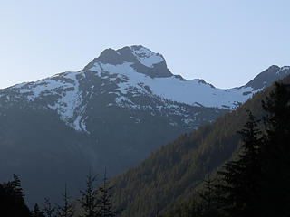 Crater Mountain from highway, south side 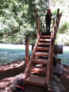 Sturdy bridge across Canyon Creek 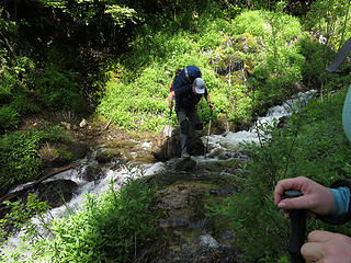 First creek crossing is a baby, just a rock hop 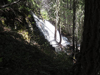 We heard the second creek long before we saw it and hoped we didn't have to cross it....wrong...  This is about where a person would plummet if they goofed up on the crossing ( right). 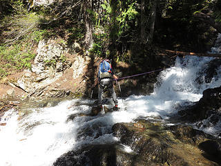 Second creek crossing ( photo on our return) was scary enough for us to safeguard it. In this view the dropoff on the left is unseen.It is worse than this suggests, the kind where if you don't slip, what was the big deal? If you do slip, pick your poison: trauma, drowning, hypothermia, or combo.  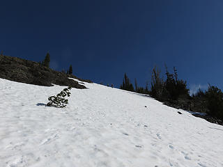 Snow covers trail to Point 7054 
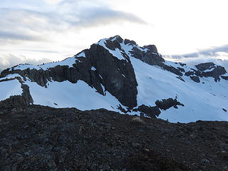 Crater Mountain 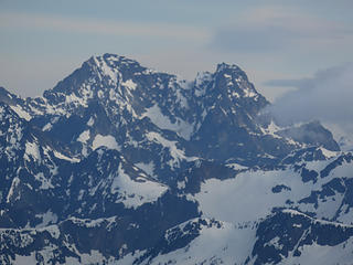 Black Peak 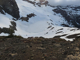 Still-frozen tarn below 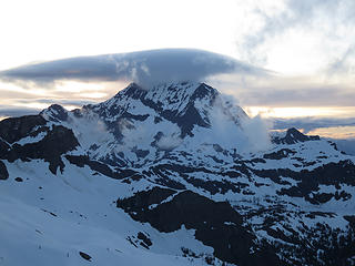 Jack 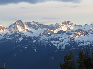 Mesahchie and friends 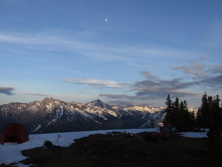 Ballard and Azurite. We could see roughly a quarter of the highest 100. 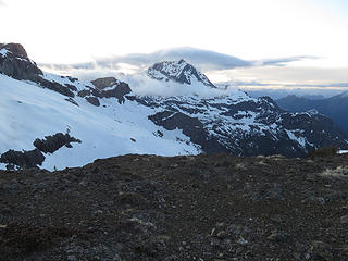 Jack 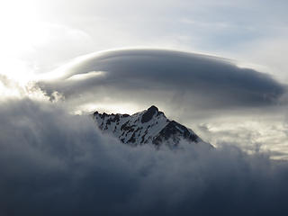 Hi, Jack! 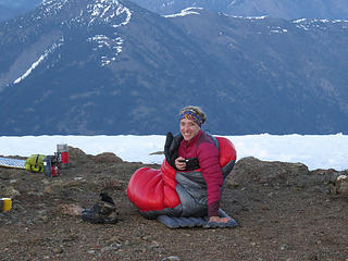 Katy likes her warm bag 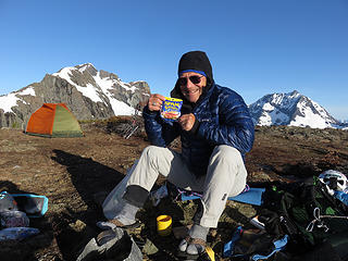 Aw, breakfast! 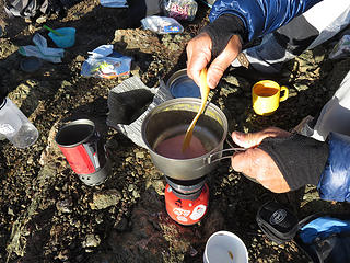 Spam, breakfast of champions? (just ignore the ingredients) 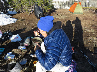 yummy Spam, Spam, Spam Spam  (apologies to Monty Python) 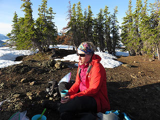 "You actually enjoy that?" 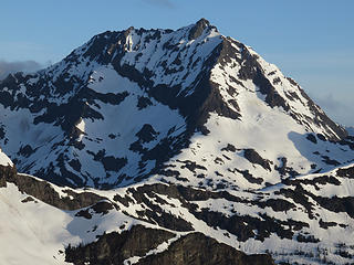 "Good morning, Jack! You look hard!" 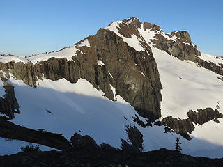 Same to you, Crater! ( you aren't hard in summer 😁) 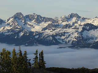 Ragged Ridge group 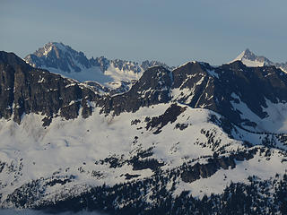 Buckner with its twin summits and Eldo with its distinctive snow crest. Edit: Roper pointed out that "Eldo" is actually Boston. The Sahale Glacier peaking over its left side fooled me. Thanks John!😊 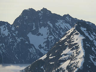 northwest side of Ballard and the "North American snowfield"...see it? Oops, it's missing most of Canada and Alaska! 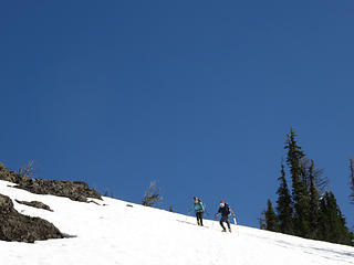 we were happy to have crampons for the hard morning snow
Passing rocks and trees like they were standing still
Passing rocks and trees like they were standing still
|
| Back to top |
  
|
|
GaliWalker
Have camera will use

Joined: 10 Dec 2007
Posts: 4929 | TRs | Pics
Location: Pittsburgh |
|
GaliWalker
Have camera will use
|
 Tue May 29, 2018 12:59 pm |
|
|
Those are some really nice photos, and I enjoyed the write up too. 
|
| Back to top |
|
|
awilsondc
Member

Joined: 03 Apr 2016
Posts: 1324 | TRs | Pics
|
Great views from up there! Looks like I need to add this one to my to do list. Looks awesome! Well, except for the SPAM that is... 
|
| Back to top |
|
|
Brushbuffalo
Member
Joined: 17 Sep 2015
Posts: 1887 | TRs | Pics
Location: there earlier, here now, somewhere later... Bellingham in between |
Aaron, hike up the main peak and camp on top. Why spend all that effort to get there, only to leave in a bit? It is wonderful! There is a cornice for water until late July or so, too. Spam, of course, is optional.
Spam or sausage...very little difference in ingredients IMO. Both are rather disgusting but taste so good! 
Passing rocks and trees like they were standing still
Passing rocks and trees like they were standing still
|
| Back to top |
|
|
iron
Member

Joined: 10 Aug 2008
Posts: 6392 | TRs | Pics
Location: southeast kootenays |
|
iron
Member
|
Tue May 29, 2018 10:04 pm |
|
|
never trust roper on peak IDs. can't be trusted...
|
| Back to top |
|
|
wildernessed
viewbagger

Joined: 31 Oct 2004
Posts: 9275 | TRs | Pics
Location: Wenatchee |
Nice pics. I think the sub freezing temps knocked down the bugs quite a bit.
Living in the Anthropocene
Living in the Anthropocene
|
| Back to top |
|
|
joker
seeker

Joined: 12 Aug 2006
Posts: 7953 | TRs | Pics
Location: state of confusion |
|
joker
seeker
|
Wed May 30, 2018 11:47 am |
|
|
Nice!
And luxury on that bridge what with handrails and all now!! We had a big dog who was not amused at being coaxed to cross the old flattened big log bridge with no sides over that rushing river. He finally did it but only by following me with his nose inches from my heels. Good dog - he was a sport for sure.
|
| Back to top |
|
|
|
|
You cannot post new topics in this forum
You cannot reply to topics in this forum
You cannot edit your posts in this forum
You cannot delete your posts in this forum
You cannot vote in polls in this forum
|
Disclosure: As an Amazon Associate NWHikers.net earns from qualifying purchases when you use our link(s). |


