| Previous :: Next Topic |
| Author |
Message |
Brushbuffalo
Member


Joined: 17 Sep 2015
Posts: 1887 | TRs | Pics
Location: there earlier, here now, somewhere later... Bellingham in between |
When you plan a trip months in advance based on the busy participants' schedules, it isn't uncommon that when the date finally arrives, the weather doesn't.
Or rather it does! Just not the weather you had hoped for.
We wanted to climb Little Tahoma. I've summited Rainier 20 times by various routes, and several of the others had climbed the Big White as well, but none of us had ever been up the Little Brother, including MRNP master williswall.
So when we saw the steadily more ominous forecast for rain all weekend (June 9-10) and snow down to 4,000' on Sunday, we changed plans. I don't really enjoy several inches of wet snow on top of hard snow on a steep slope, which would have been our fate up high on Little T. Besides, when we had a ultra-comfortable cabin to hang out in at Crystal Springs, we didn't relish the thought of camping on Meany Crest in a storm.
Getting soft in middle age, stage 2? You bet!
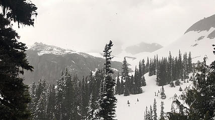
What to do? Since the trail to Crystal Peak is just 4.5 miles up US410 from the cabin, and since none of us had been up it (not even WW), we headed up on Saturday. Our party included Marty, Katy, Lydia, RJ, Jack, Steve (williswall), and the brushbuffalo. This trail is splendid, with a gentle but steady gradient and nary a rock or root, except at the start and along the summit ridge. Although new wet snow was accumulating on vegetation, on this west-facing slope we didn't hit old snow until we were at about 5600',and the single 100' snow slope was so mellow that most didn't even unpack ice axes. A slip would merely land one on the huckleberry bushes below, and it was simple to kick bomber buckets in the soft snow.
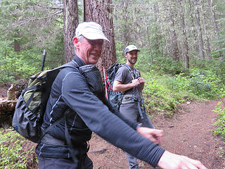 Williswall and Jack 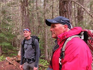 RJ and Marty 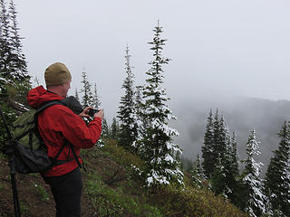 Christmas trees 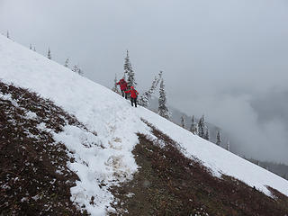 the sole snowpatch on the Crystal Peak trail 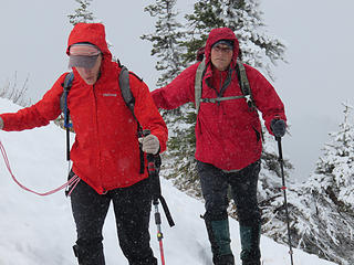 red is real 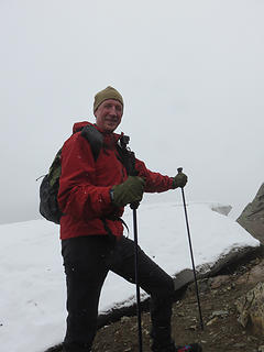 williswall at the ridgetop cornice 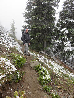 last bit to the top 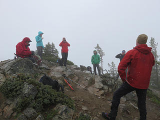 no view today on the top 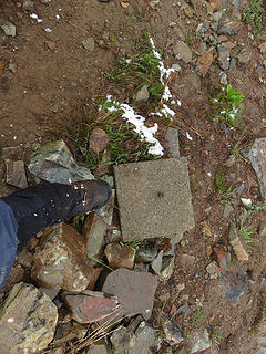 not much evidence of the former lookout 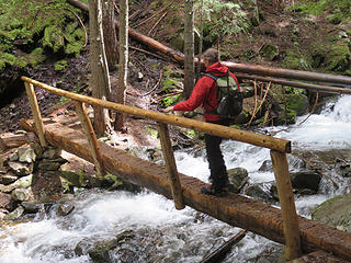 Crystal Creek 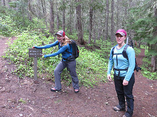 our two doctors, Lydia and Katy  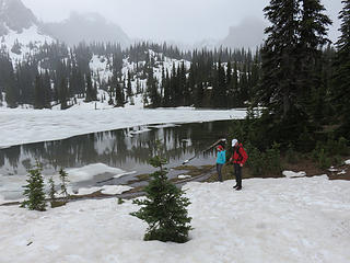 Upper Crystal Lake 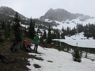 foggy Sourdough Gap (middle distance) 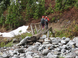 Fryingpan Creek 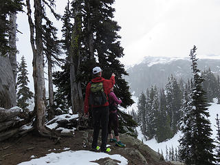 WW points to Panhandle Gap ![" I AM standing straight. You're [i:30b39ef28d]looking [/i:30b39ef28d]crooked!"](https://cloud.nwhikers.net/27872379397_320x240.jpg) " I AM standing straight. You're looking crooked!" 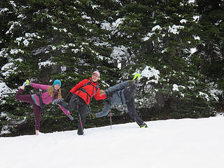 a little snow-ballet, with willis wall defying gravity 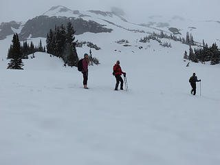 "Winterland" today
Passing rocks and trees like they were standing still
Passing rocks and trees like they were standing still
|
| Back to top |
  
|
|
williswall
poser

Joined: 30 Sep 2007
Posts: 1968 | TRs | Pics
Location: Redmond |
I had a splendid time hanging out with this eclectic group, reminding me that going solo most of the time isn't necessarily necessary. I am grateful that BB invited me along. Here's some pix I snapped along our merry way.
 Snow towards Panhandle Gap  Snow below switchbacks 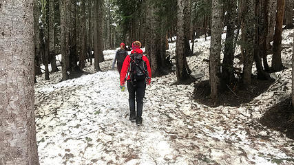 Snow above 5000' 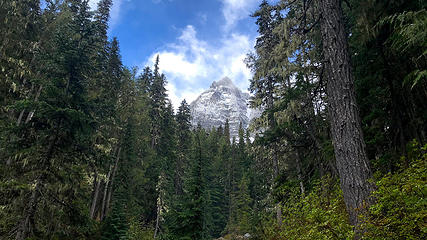 Rare sunbreak 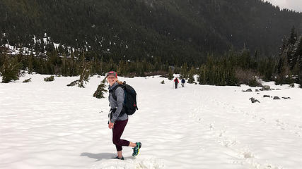 Lydia enjoying winter route to the bridge 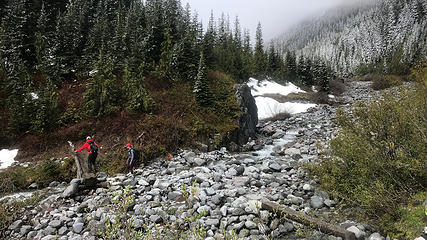 Fryingpan Creek bridge 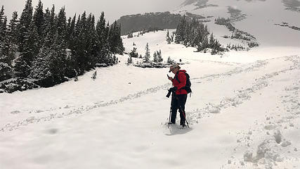 Endrunning the switchbacks 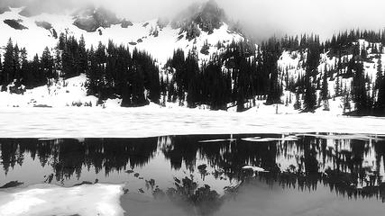 Upper Crystal Lake 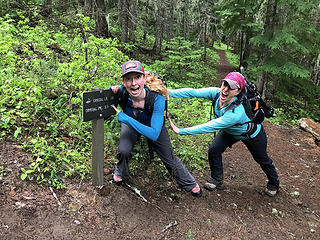 The Girls 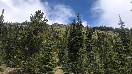 South slopes still clear 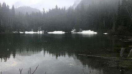 Snowing at Lower Crystal Lake 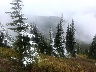 Snow line 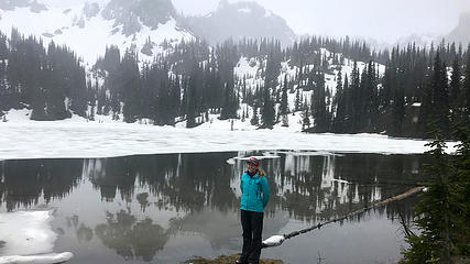 Lydia at Upper Crystal Lake 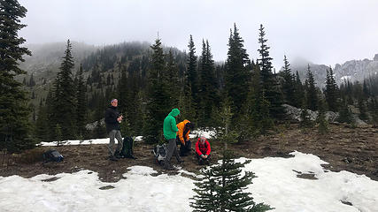 Color coordinated (Upper Crystal Lake) 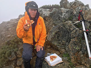 Brush Buffalo eating pizza on Crystal Peak  After hike dinner
|
| Back to top |
|
|
BigBubba
Member

Joined: 11 Jun 2018
Posts: 2 | TRs | Pics
Location: Seattle |
|
BigBubba
Member
|
 Mon Jun 11, 2018 9:52 pm |
|
|
Thanks again for the invite! A great crew as always.
|
| Back to top |
|
|
Brushbuffalo
Member
Joined: 17 Sep 2015
Posts: 1887 | TRs | Pics
Location: there earlier, here now, somewhere later... Bellingham in between |
[quote="BigBubba"]Thanks again for the invite! A great crew as always.
Welcome to the forum, Bubba.
Passing rocks and trees like they were standing still
Passing rocks and trees like they were standing still
|
| Back to top |
|
|
|
|
You cannot post new topics in this forum
You cannot reply to topics in this forum
You cannot edit your posts in this forum
You cannot delete your posts in this forum
You cannot vote in polls in this forum
|
Disclosure: As an Amazon Associate NWHikers.net earns from qualifying purchases when you use our link(s). |


![" I AM standing straight. You're [i:30b39ef28d]looking [/i:30b39ef28d]crooked!"](https://cloud.nwhikers.net/27872379397_45c79f8a4e_h.jpg#1600x1200+https://farm2.staticflickr.com/1734/27872379397_fab1028fae_o.jpg#2048x1536+e19388fe7a_k.jpg#2048x1536+45c79f8a4e_h.jpg#1600x1200+2de734937a_b.jpg#1024x768)


