| Previous :: Next Topic |
| Author |
Message |
Dave Creeden
Member


Joined: 04 Sep 2007
Posts: 99 | TRs | Pics
|
On the beautiful day of June 6th, I set off at dawn with the ambitious goal of climbing Hall Peak and Big Four Mountain via the NW Ridge in a day. I hiked the Big Four Ice Caves trail to its end, then contoured at about 2,000 feet in a clockwise direction northward beneath the steep east flank of Hall Peak. I managed to find a route which avoided most of the brush, bypassing the ascend route Justin used in 2007, continuing towards the dry stream bed Matt and company had used in 2014.
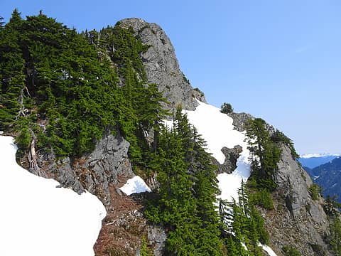
Instead of using their ascent route by beginning up the dry stream bed, I crossed the dry stream bed and made a beeline for tall timber on the north side. With little effort, I crossed through a thin blind of brush which hadn't leafed out yet, thankfully. I quickly latched onto a wildlife trail and milked the intermittent path for all it was worth, avoiding some of the brush. I climbed steep duff, hitting the first patches of snow at about 2,900 feet. I encountered the first sustained patches of snow when I popped up on to the flatter terrain at 3,200 feet. I then veered leftward, with the aim of getting onto the crest of a rib. I found a spot at 3,400 feet to work up some steep snow, cross a moat, then a I hoisted myself onto the crest of the rib via some green belays. There was continuous snow on the rib crest until about 3,800 feet, where the rib became more narrowly defined, next to a deep snow filled gully. Scrambling up the rib involved some class 3 moves, along with climbing through and over small trees.
At about 4,000 feet I began to attempt to work up and leftward, with the goal of crossing above a waterfall. The terrain got steeper and the snow wasnt continuous. I strapped on crampons to ascent several bulges of snow, 70 to 80 degrees in sections, for up to 20 to 30 feet. The crampons also helped climb and traverse bare batches of duff. I eventually worked my way across the stream above the waterfall, which was the most awkward section of the climb of Hall Peak.
One across the stream I could press the accelerator pedal down and crampon my way to the southeast ridge line of Hall at about 4,900 feet. I briefly thought about making an attempt on Big Four first, but reckoned I better bag a sure thing first. I hung a right turn and climbed the remain 500 plus feet to the summit of Hall Peak, arriving 4 hours and 45 minutes after I left.
 Summit of Hall Peak 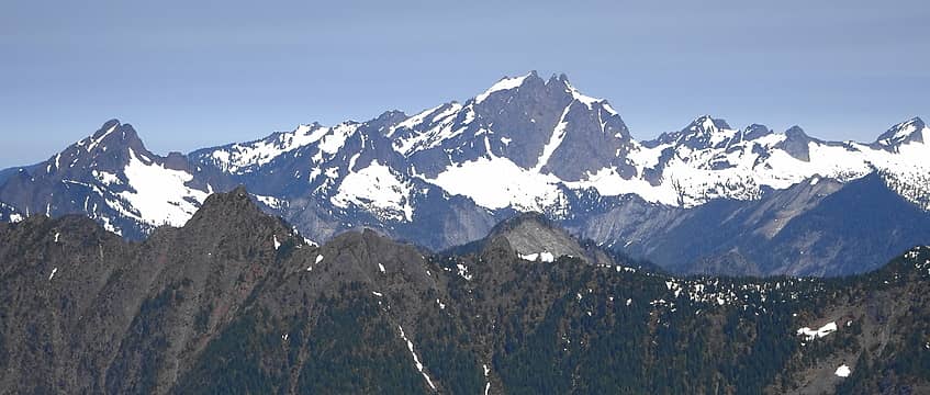 L to R: Big Bear Mountain, Three Fingers & Mount Bullon 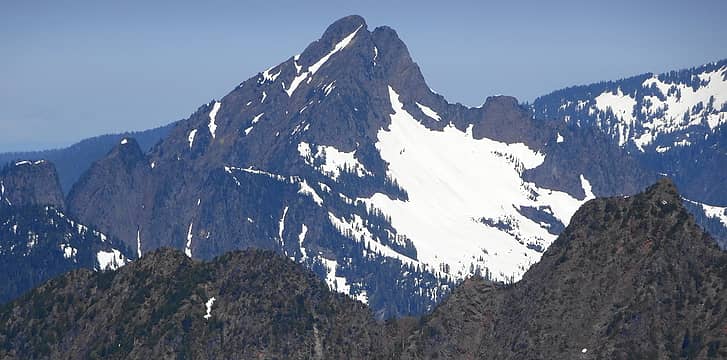 Big Bear Mountain 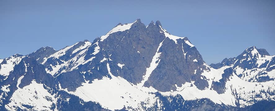 Three Fingers 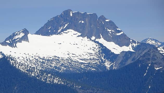 Whitehorse Mountain 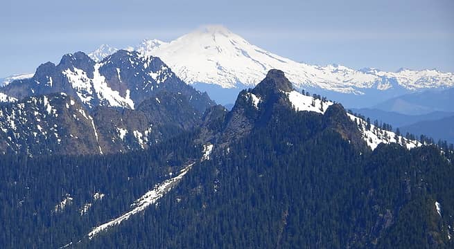 Devils Peak in the foreground, Jumbo Mountain in the middle ground & Mt Baker in the background. 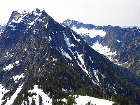 Big Four in the foreground with Vesper Peak in the background 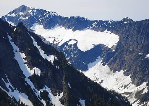 West Ridge of Vesper Peak 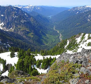 View down Williamson Creek drainage to Spada Lake. 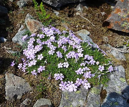 Phlox 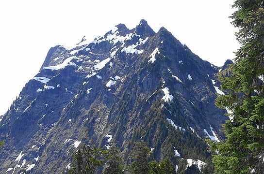 Closeup view of NW Ridge of Big Four.
|
| Back to top |
  
|
|
ozzy
The hard way

Joined: 30 Jul 2015
Posts: 476 | TRs | Pics
Location: University place, wa |
|
ozzy
The hard way
|
 Sun Jun 10, 2018 5:01 pm |
|
|
Damn you covered some pretty gnarly terrain! Nice trip, nice attempt on Big Four as well! Big Four and Monte Cristo Pk are ones I want bad. Thanks for the beta, cheers!
I dont know whats gonna happen, but I wanna have my kicks before the whole shithouse goes up in flames-Mr Mojo Risin
I dont know whats gonna happen, but I wanna have my kicks before the whole shithouse goes up in flames-Mr Mojo Risin
|
| Back to top |
|
|
Matt
Tea, Earl Grey, Hot

Joined: 30 Jan 2007
Posts: 4307 | TRs | Pics
Location: Shoreline |
|
Matt
Tea, Earl Grey, Hot
|
Sun Jun 10, 2018 8:22 pm |
|
|
Well at least you got quite a bit higher on Big Four than we did when we tried the same thing.
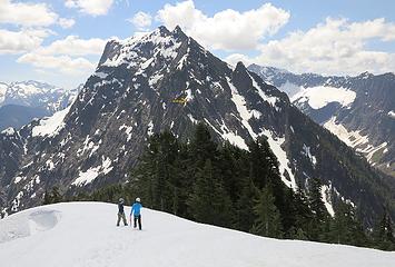 yellow arrow marks where we stopped
As beacons mountains burned at evening. J.R.R. Tolkien
As beacons mountains burned at evening. J.R.R. Tolkien
|
| Back to top |
|
|
Schroder
Member

Joined: 26 Oct 2007
Posts: 6722 | TRs | Pics
Location: on the beach |
|
Schroder
Member
|
Sun Jun 10, 2018 9:06 pm |
|
|
Very similar to one trip I did on Big 4 in 1970. We headed for Big 4 first and backtracked to the saddle and on to Hall. We tried to go from there to Marble Peak but couldn't get over the final gulch to the Marble saddle. We heard some people heading down into Williamson Creek from Marble so we rappelled down to the 45 mine and scrambled down to the creek and fortunately got a ride out with them. A memorable adventure.
|
| Back to top |
|
|
Stefan
Member

Joined: 17 Dec 2001
Posts: 5093 | TRs | Pics
|
|
Stefan
Member
|
Mon Jun 11, 2018 8:20 am |
|
|
Good on you for getting Hall! and good effort on Big 4!
|
| Back to top |
|
|
Justus S.
Member
Joined: 17 Nov 2004
Posts: 1298 | TRs | Pics
Location: WA |
Nice job! Big Four from that side sounds like a real challenge.
|
| Back to top |
|
|
puzzlr
Mid Fork Rocks

Joined: 13 Feb 2007
Posts: 7220 | TRs | Pics
Location: Stuck in the middle |
|
puzzlr
Mid Fork Rocks
|
Tue Jun 12, 2018 9:51 pm |
|
|
That entire west ridge of Big 4 looks way harder than I expected. Thanks for the interesting report. If I ever climb Big 4 it's likely to be an overnight from south -- via that ridge from the Sperry/Vesper saddle.
|
| Back to top |
|
|
|
|
You cannot post new topics in this forum
You cannot reply to topics in this forum
You cannot edit your posts in this forum
You cannot delete your posts in this forum
You cannot vote in polls in this forum
|
Disclosure: As an Amazon Associate NWHikers.net earns from qualifying purchases when you use our link(s). |


