Matt Lemke
High on the Outdoors


Joined: 15 Jul 2010
Posts: 2052 | TRs | Pics
Location: Grand Junction |
|
Matt Lemke
High on the Outdoors
|
 Sun Jul 15, 2018 1:03 pm |
|
|
Last week was my final week off before starting a new job in BC, and I took advantage of the upcoming excellent weather to finish up some of my last remaining Bulger Peaks. I solod Chiwawa Mountain in a total whiteout last Tuesday and made an attempt, but unfortunately failed on Fortress Mountain. While the weather was predicted to improve later in the day Tuesday, the whiteout conditions persisted until sunset.
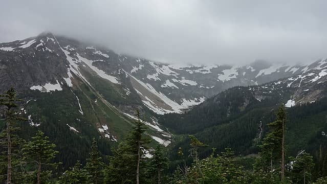
I started from Trinity around 11am, hoping a later start would allow me some better weather, and hiked up the Chiwawa River Trail all the way to the junction with the Red Mountain Trail, which is really just the continuation of the old road to the long abandoned mine. The trail was slightly overgrown in spots, but easy to follow up to treeline where the mine used to be. I waited here for 30 minutes or so eating and hoping the clouds, whose ceiling was only 1000 feet above me at about 7200 feet would lift and allow Chiwawa/Fortress to become visible. That didn't happen, and after some pondering what I would do I decided to at least go up Chiwawa and hope weather would improve later in the evening for Fortress. It's important to note that these two Bulgers have been a thorn in my ass...my nemesis peaks if you like, as they are the only ones I have multiple failed attempts on (if you count driving to the trailhead an attempt). Everyone has those stubborn peaks that gives them trouble for whatever reasons and these two are them for myself. I have actually driven up the Chiwawa River Road 5 times with intentions to climb these two peaks, and for one reason or another, they were not climbed. Luckily other objectives were sometimes able to be done, however other times, I would barely get far from the car. Since the reasons vary greatly I won't bother describing them here to save whatever dignity I have left  Back to Chiwawa...I began traversing towards the southeast face and would ascend the "ledges" route as described on SP. This turned out to be a pretty easy route, I simply ascended to the large bench above the cliffs/waterfall slabs utilizing a weakness on the right edge, and continued on an ascending traverse until I entered the clouds. With the help of my phone GPS, I navigated up now continuous snow to the key ledge at 7600 feet that allowed me to round the rugged south rib of the mountain. Some easy Class 2+ ledge traversing brought me around to the southwest side and I continued up snow, and eventually dry talus until I reached the summit. No views, however I noticed the clouds were thinning and I could barely make out the sun above me.
 A little drizzle 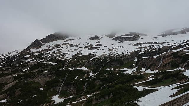 Looking towards Chiwawa 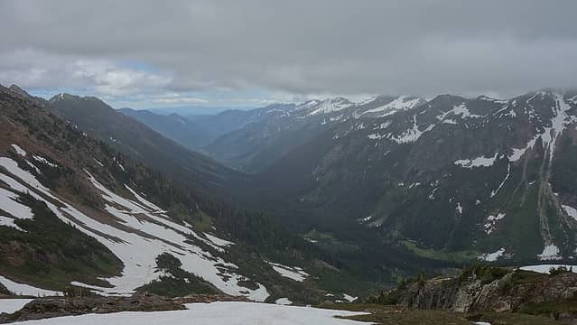 Entering the clouds  I was very happy to finally get one of these two nemesis peaks for Bulger #92. Stay tuned for my next trip report for Mount Logan, Tupshin and Devore which I ascended via Stehekin in a 4 day stretch!
|


 I have to get up there at some point.