| Previous :: Next Topic |
| Author |
Message |
rubywrangler
Member


Joined: 04 Aug 2015
Posts: 511 | TRs | Pics
|
Ruby dog and I spent a couple hot, smoky and buggy days in the Alpine Lakes this week to climb Summit Chief and visit the lakes and tarns nearby. There's a lot of exploring to do up there. I wish we had stayed another day!
To avoid the long PCT switchbacks past Pete Lake, we followed the route described in Matt's 2011 report and exited via the old Escondito ridge trail described by Neek. The off-trail portion of the approach route was very easy, just a couple short (<20ft) brushy sections.
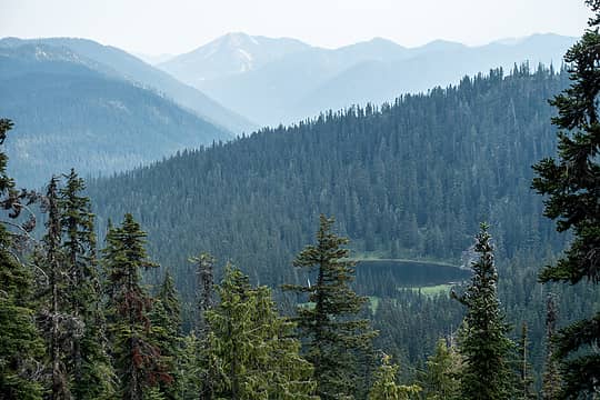 escondito lake 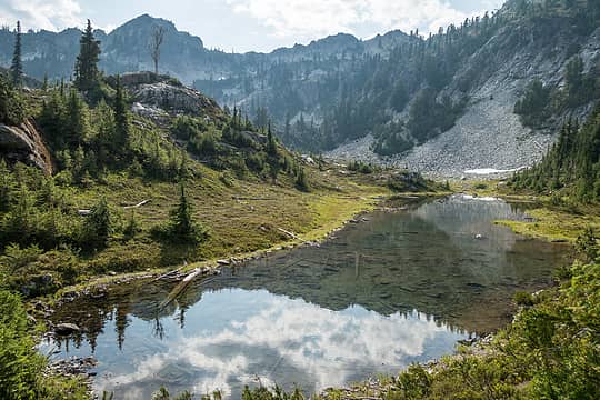 escondito tarns 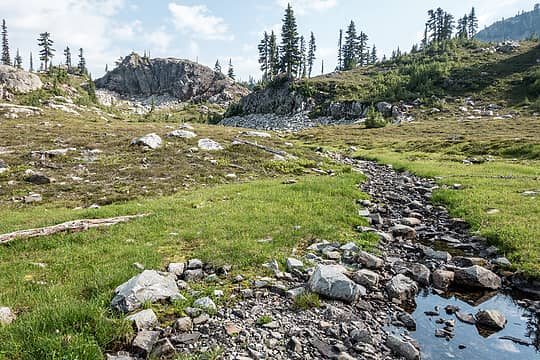 meadow near escondito tarns 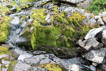 mossy 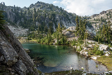 escondito tarns 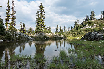 escondito tarns 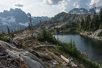 upper vista view 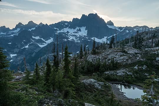 view from dinner spot 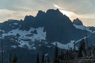 sun setting behind chimney rock 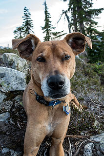 mosquito bite near ruby's eye. her face was covered with bites 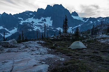 camp 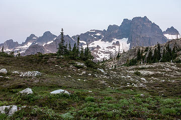 morning "light" on lemah, chimney, overcoat from a meadow above vista lakes 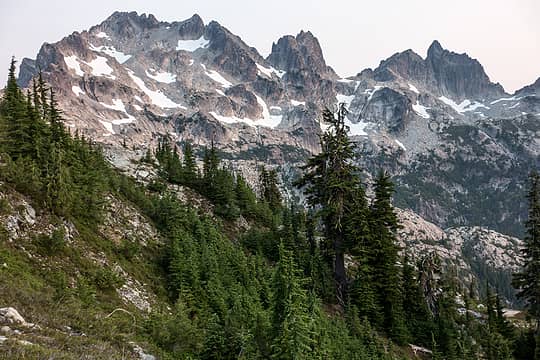 near summit chief pass 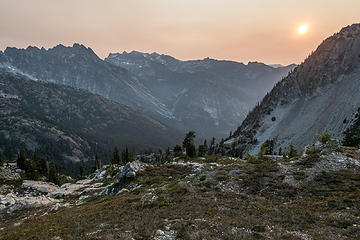 peach sky 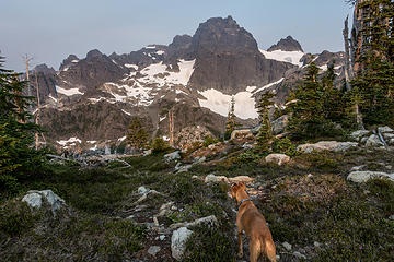 eerie light on chimney rock 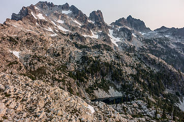 summit chief mtn and lake 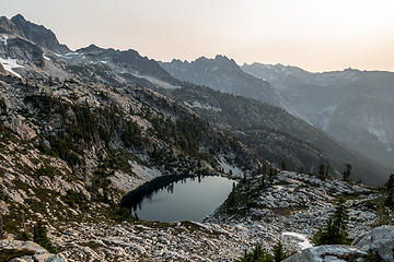 summit chief lake 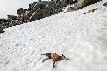 relaxation 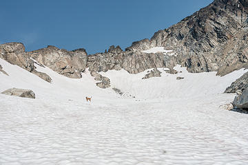 always ahead 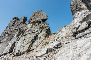 approaching the notch 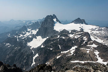 summit view 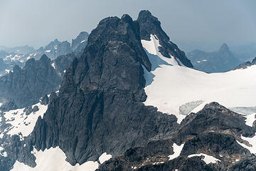 chimney rock 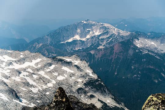 big snow in a smoky blue haze 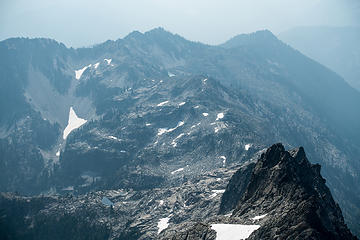 looking toward vista lakes, u-shaped tarn where we ate lunch at lower center 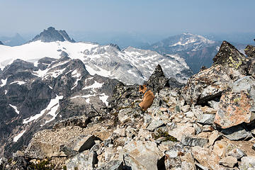 summit nap 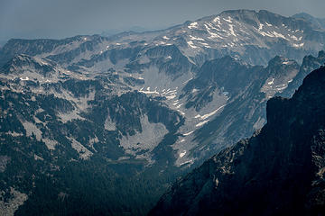 williams, hinman in the haze 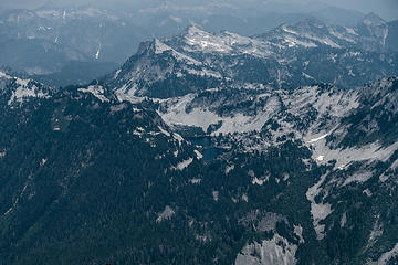 gray crawford  After crossing back through the notch I was both dismayed and delighted to see a little blue sky and puffy clouds. It continued to clear as we worked our way down to the Summit Chief tarns for a lunch break. By the time we got there, the smoke had almost totally cleared, at least in the immediate vicinity. After crossing back through the notch I was both dismayed and delighted to see a little blue sky and puffy clouds. It continued to clear as we worked our way down to the Summit Chief tarns for a lunch break. By the time we got there, the smoke had almost totally cleared, at least in the immediate vicinity.
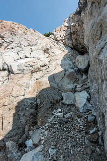 correct gully 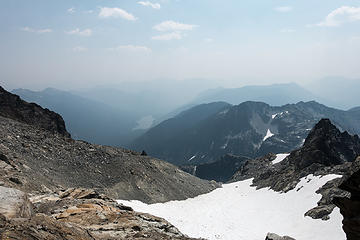 clouds appearing as smoke starts to clear on our descent 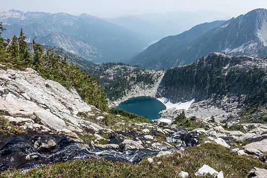 not summit chief lake 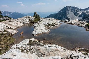 cooling paws in u tarn 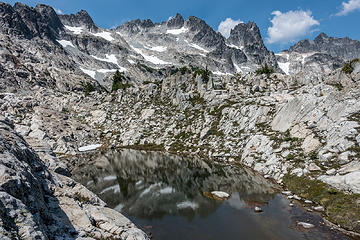 chiefs and tarn 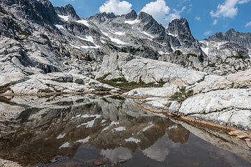 reflection 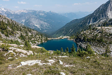 summit chief lake 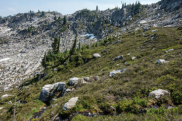 5700' col at upper right. we ascended the green ramps left of it. 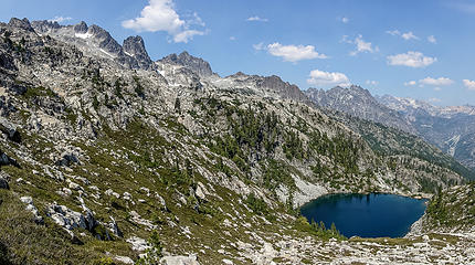 summit chief, middle chief, little big chief, bears breast, daniel, summit chief lake
|
| Back to top |
  
|
|
neek
Member

Joined: 12 Sep 2011
Posts: 2337 | TRs | Pics
Location: Seattle, WA |
|
neek
Member
|
 Fri Aug 10, 2018 5:52 am |
|
|
Cool! Sounds like the lower part of Escondido ridge has filled in a bit. Hope these bugs go away soon. I've been having better luck these past few weeks.
|
| Back to top |
|
|
BigBrunyon
Member

Joined: 19 Mar 2015
Posts: 1456 | TRs | Pics
Location: the fitness gyms!! |
i been up round there!! bugs were real bad on them ridgelines!!! no clothes needed to jump in those tarn lakes but you need em for the bugs!
|
| Back to top |
|
|
awilsondc
Member

Joined: 03 Apr 2016
Posts: 1324 | TRs | Pics
|
Lovely trip! This is another one that's up there on my wish list. Hoping to get it this year or next! Great photos as always. 
|
| Back to top |
|
|
Matt
Tea, Earl Grey, Hot

Joined: 30 Jan 2007
Posts: 4307 | TRs | Pics
Location: Shoreline |
|
Matt
Tea, Earl Grey, Hot
|
Sat Aug 11, 2018 9:40 am |
|
|
Nice trip. Sorry to see the bug bites on Ruby, but she looked very happy rolling on the snow.
As beacons mountains burned at evening. J.R.R. Tolkien
As beacons mountains burned at evening. J.R.R. Tolkien
|
| Back to top |
|
|
puzzlr
Mid Fork Rocks

Joined: 13 Feb 2007
Posts: 7220 | TRs | Pics
Location: Stuck in the middle |
|
puzzlr
Mid Fork Rocks
|
Sat Aug 11, 2018 11:09 pm |
|
|
| rubywrangler wrote: | chimney rock |
Great shot of Chimney Rock, one of many good ones in your report.
Thanks for the info on the Escondido trail. I swore I wouldn't go up those PCT switchbacks again, but this is making me reconsider. I want to get up there for Middle Chief some day.
|
| Back to top |
|
|
rubywrangler
Member
Joined: 04 Aug 2015
Posts: 511 | TRs | Pics
|
After looking at the gps track in his report, I see that my path diverged from Neek's below 4600'. He went ~due south from there, and we stayed on the ridge proper until it hit the trail. So, it's possible that his route is still in good shape.
|
| Back to top |
|
|
D. Inscho
Not bored yet...

Joined: 28 Feb 2010
Posts: 973 | TRs | Pics
Location: Bellingham,WA |
|
D. Inscho
Not bored yet...
|
Thu Aug 16, 2018 7:08 am |
|
|
Lovely and exciting terrain Ruby! So many places to quietly rest one's bones. I believe Contour5 can add more to this body of excellent effort.
http://david-inscho.smugmug.com/
The key to a successful trip is to do the planning during work hours. -- John Muir
My most memorable hikes can be classified as 'Shortcuts that Backfired'. --Ed Abbey
http://david-inscho.smugmug.com/
The key to a successful trip is to do the planning during work hours. -- John Muir
My most memorable hikes can be classified as 'Shortcuts that Backfired'. --Ed Abbey
|
| Back to top |
|
|
|
|
You cannot post new topics in this forum
You cannot reply to topics in this forum
You cannot edit your posts in this forum
You cannot delete your posts in this forum
You cannot vote in polls in this forum
|
Disclosure: As an Amazon Associate NWHikers.net earns from qualifying purchases when you use our link(s). |


