Forum Index > Trip Reports > Citadel & Mons Venus (USGS Mt. Daniel) 8/5-6/2018
 Reply to topic
Previous :: Next Topic
Author Message
Matt
Tea, Earl Grey, Hot


Joined: 30 Jan 2007
Posts: 4307 | TRs | Pics
Location: Shoreline
Matt
Tea, Earl Grey, Hot
PostSun Aug 12, 2018 11:09 pm 
Dates: August 5-6, 2018 Destination: Citadel 7100 & Mons Venus (aka Ares) 6596 via Peggy's Pond, Circle Lake, & Venus Lake Party: Matt, Carla (Dicey) Itinerary: Day 1: Hike via Peggy's Pond to Venus Lake. Side trip to Citadel. Day 2: Side trip to Venus Lake & Mons Venus. Hike back to trailhead. Highlights: Air was very smoky but cleared up somewhat on Monday afternoon. Circle Lake made a fine base camp for the area. Citadel was junky rock but straightforward scrambling. The route over Citadel Pass to Venus Lake was a lot of up and down but interesting scrambling near the Lake. Venus was drop dead gorgeous to see and utterly refreshing to swim. The north ridge of Mons Venus had a notch that I wouldn't have done without a rope.
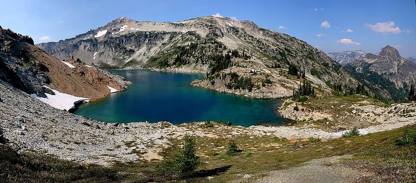
Circle Lake (which is not circular)
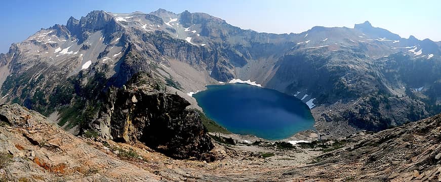
Venus Lake (which is circular)
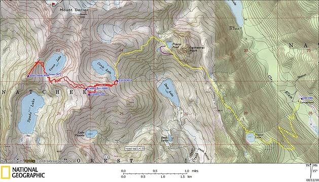
GPS Track
GPS Track
Sunday Tucquala Meadows to Peggy's Pond to Circle Lake (9:30am – 3:15pm) We hiked the trail from Tucquala Meadows to Peggy's Pond, stopping at Squaw and Peggy's to refill water. I had forgotten that the trail around the side of Cathedral is such a rough mess. At the small pass just beyond Peggy's, a distinct bootpath to Circle Lake, climbing to about 6350 feet and traversing around the south side of Point 7020. The boot path was a big help for avoiding the steep gullies the cut downward at some points. Smoke obscured the views, but the route does give a nice perspective down to Deep Lake, and the 1500-foot waterfall that drops from Circle to Deep. We set up our camp on a site just past Circle's outlet.
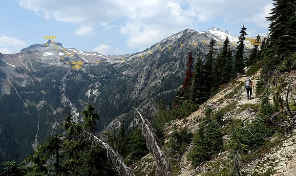
Carla hiking the trail to Peggy's Pond, with the route to Circle Lake and Citadel in the background.
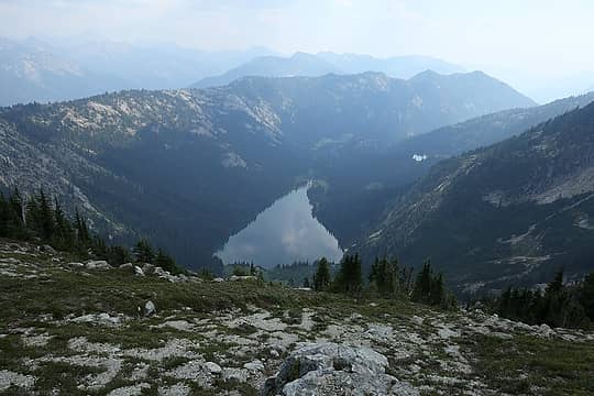
Looking down at Deep Lake from our campsite
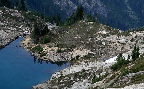
Our campsite, viewed later while returning from Citadel
Circle Lake to The Citadel (4:20-5:35pm) Carla had already done Citadel, so I headed up from camp to try it this evening. The rock looked very junky, but it actually had enough rough-edged or solid stuff that I was able to get all the way to the base of the summit block without kicking anything loose. At the summit block, the leftmost gully has about 50 feet of class 3-4 climbing to the crest, and then a short traverse to the summit. It has some steep spots but good holds so I felt okay climbing it unbelayed. I forgot to take any photos of the actual climbing part. Views from the summit were very smoky, but the ammo can register had entries going all the way back to its 1978.
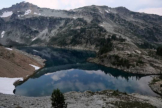
Circle Lake en route to Citadel
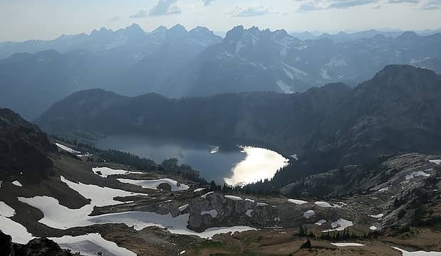
Smoky Spade Lake
Smoky Spade Lake
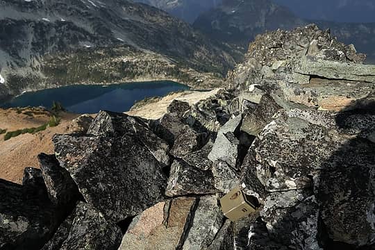
Register perched in the Citadel summit cairn
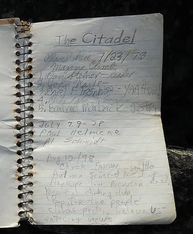
Citadel summit register
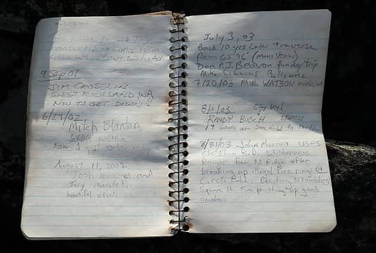
some familiar names, 2001-2003
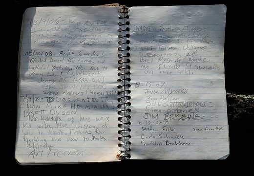
more familiar names, 2006-2009
more familiar names, 2010-2014
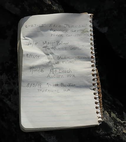
few ascents recently, 2015-2018
Checking Citadel Pass (6:00-7:45pm) Getting down Citadel's summit block consumed much longer than getting up. Since I had brought a 30m rope, I decided to use it for safety's sake. However, the crest was made entirely of piles of loose rock, it took a while to find anything I could trust as an anchor. When I got to the bottom of the gully, however, I found that the rope had wedged absolutely solid between two rocks. So then I climbed back up, repositioned it, and finally was free to depart. I wanted to check Citadel Pass for tomorrow's trip to Venus Lake. It turned out there were cairns and boot path traversing below Citadel at 6600 feet and leading right up to the pass. Then I retraced my path back to camp. Smoky evening light made for some enhanced colors along the way, but then faded out to gray shadows as I descended.
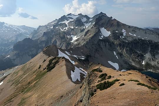
Citadel Pass (low dip in the foreground) viewed from Citadel
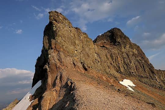
Citadel viewed from Citadel Pass
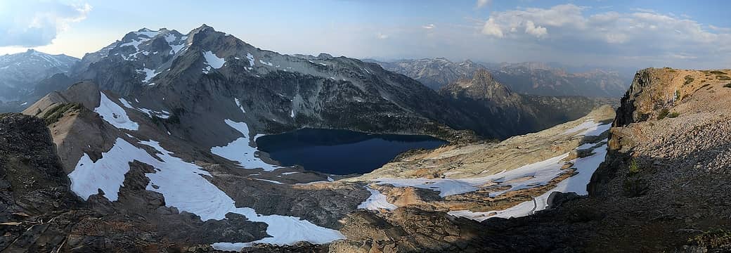
Light and shadows on Daniel, Circle Lake, and Cathedral
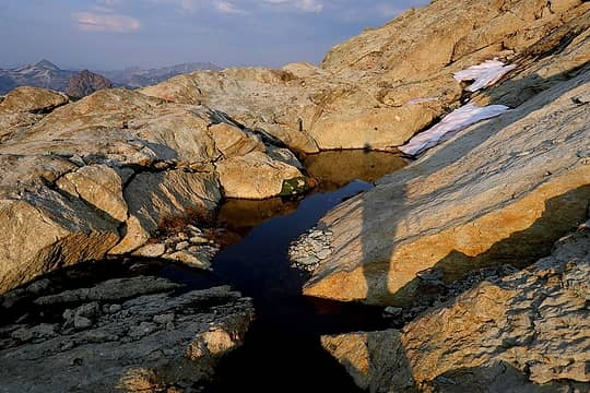
Sunlit tarn on the way back to camp
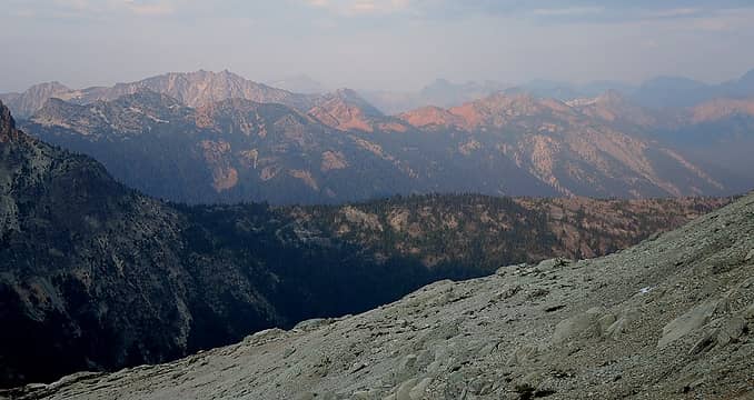
Paddy-Go-Easy crest turning red in the smoky light
TH to Circle Lake: 7.8 miles, 3430 gain, 770 loss, 5:40 hours Round trip to Citadel & Citadel Pass, 2.5 miles, 1300 gain and loss, 3:45 hours Monday Monday morning the sun again played hide and seek with the smoke. The sun rose in a dim red glow at the edge of Cathedral. Later there was some brief reddish alpenglow, but then a thicker layer of smoke shaded it out again.
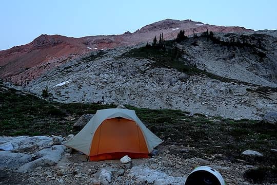
Some weirdly pink faint alpenglow
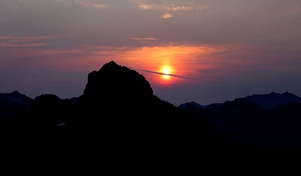
Cloud-pierced sunrise
Circle Lake to Venus Lake Monday's trip to Mons Venus had a lot of ups and downs – up 800 feet to Citadel Pass, down 1200 to Venus Lake, up 900 to Mons Venus, and then all the same in reverse. From Citadel Pass, the descent to Venus Lake is dirt and scree for the top half, and then granite slabs and steps for the bottom half. On our descent, I made the mistake of angling across the scree, which stretched out the misery. It would have been better to walk along the crest and then drop straight down. Lower down we worked our way through rocky slabs and walls, finding that the best route worked around the righthand side of most everything.
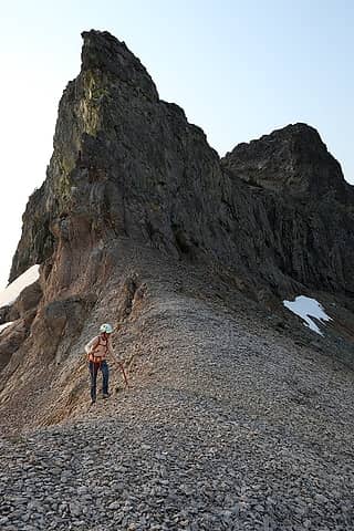
Carla at Citadel Pass
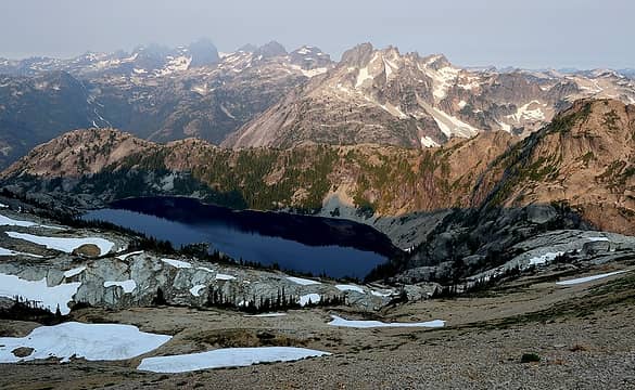
Smoky morning colors above Spade Lake
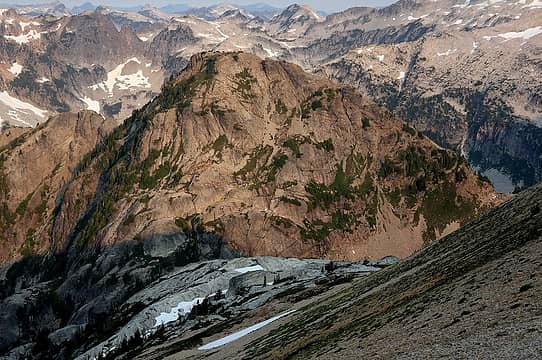
Scree and granite dropping down to Venus, with Mons Venus on the opposite side (our route went up the righthand ridge crest)
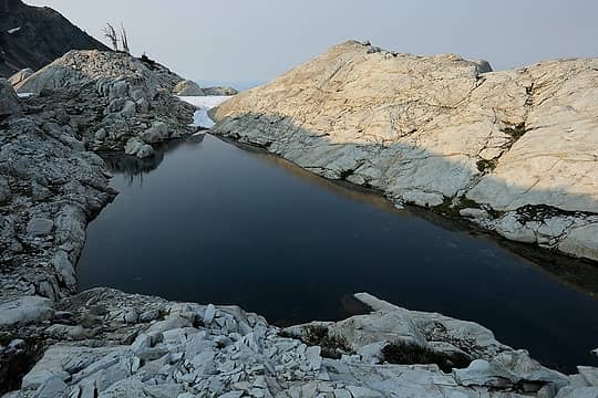
A tarn among the slabs
Venus Lake is in such a deep steep basin that we couldn't even see it till we were down to about 6200 feet, but it was worth the wait, deep clear water beautifully reflecting the sky and peaks.
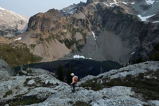
Finally in sight of Venus
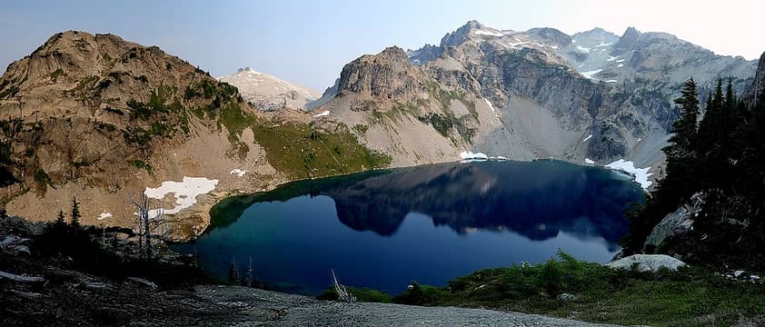
Venus Lake with Mons Venus & Daniel
Mons Venus We ascended the north ridge of Mons Venus. Getting to the ridge was easy; a nice way trail leads to the col. The ridge itself was a mess: some steep steps at the bottom, then decent scrambling up meadows, then junky rock, then looser steeper rock, and then an impasse at the notch just north of the summit. I rappelled off the notch (on another detached rock anchor that would take a pull only in one direction), followed by an easy scramble to the wider summit. Carla stayed behind, since she'd been to the summit before.
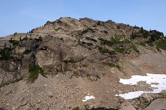
Looking up Mons Venus from the Venus outlet, with the notch visible at the top
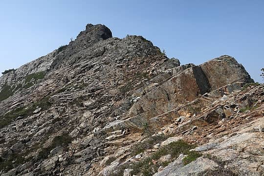
Some of the junkier rock going up
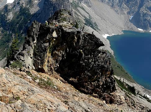
Carla waiting at the notch where I rappelled
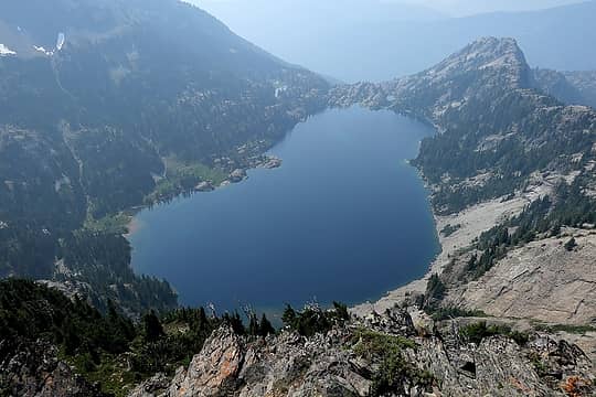
Summit views were smoky, but this location finally provided a full view of Venus Lake reclining in its deep basin.
Spade Lake
Spade Lake
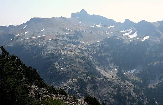
The ridge we descended from Citadel Pass
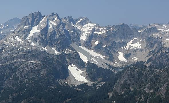
Looking across at Bears Breast and a corner of Lake Rebecca
Venus Lake!
Venus Lake!
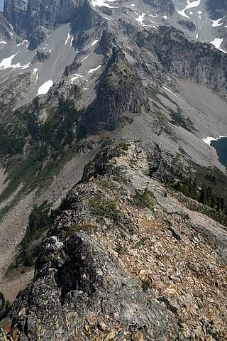
Going back down the junky steep north ridge
I returned to the notch by climbing up some steep steps to one side of the rappel. (It might be possible to bypass the notch by getting off the crest earlier and then into the dirty gully in the middle of the notch, but the sides of the crest were quite steep. Randy reports that he climbed the east face on ramps and talus.) Venus Lake to Circle Lake Back at Venus Lake, I enjoyed one of the most refreshing swims ever. The water was a just-slightly-cool temperature that was perfect for this hot day. When I first jumped in, the water effervesced with this delightful feeling of tiny bubbles tingling all across my skin. And the crystal clear water was wonderful both to look at and to float in. The return to camp went smoothly, with a more direct line up the scree. A stronger west wind had pushed back the smoke enough for better lighting on Circle Lake as well.
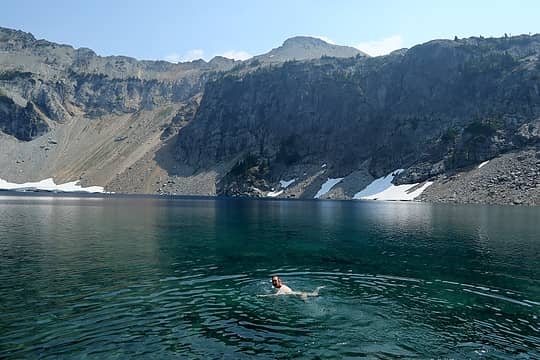
Refreshing swim in Venus Lake
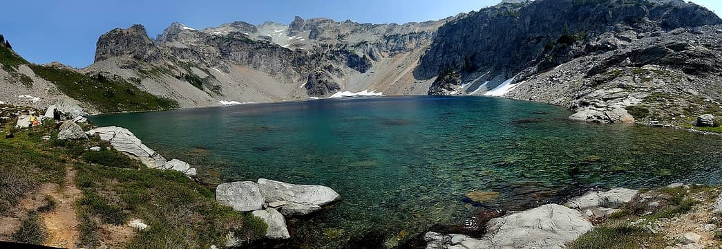
Crystal clear water and colors of Venus Lake
Circle Lake
Circle Lake
Mons Venus Round Trip: 6.1 miles, 3210 gain & loss, 8:30 hours Circle Lake to Tucquala Meadows Trailhead Back at camp, I mostly wished we could stay for another day in this beautiful remote area, but we both had commitments in town the next morning. A brisk wind had even temporarily blown the smoke and mosquitos away. The horse-graded trail down from Cathedral Pass seemed to take forever. At least the Salmon La Sac Road seems to have been graded this year and was the smoothest I've ever driven on it.
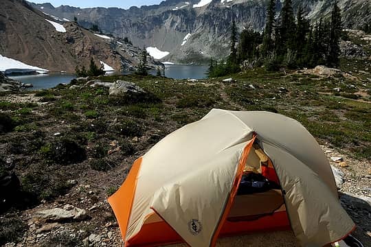
Windblown tent where we didn't want to leave
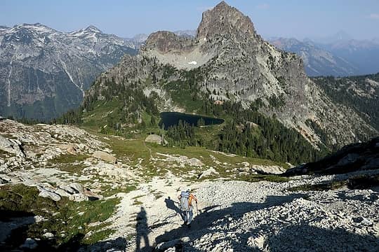
Our shadows hiking back to Peggy's Pond
Circle Lake to TH: 7.4 miles, 720 gain, 3380 loss, 4:45 hours Total Trip: 23.7 miles, 8660 gain

“As beacons mountains burned at evening.” J.R.R. Tolkien
Back to top Reply to topic Reply with quote Send private message
yukon222
Member
Member


Joined: 12 Mar 2007
Posts: 1893 | TRs | Pics
yukon222
Member
PostMon Aug 13, 2018 11:22 am 
Nice looking trip, Matt. Too bad the smoke was hanging around but your views were still quite good. I'm not surprised to read your comments about the final summit traverse to Citadel being "a bit loose". When we scrambled out there in 2008, it seemed like every movement resulted in another rock dissolving away. Sure is a fine perch out there though!!

Back to top Reply to topic Reply with quote Send private message
Bootpathguy
Member
Member


Joined: 18 Jun 2015
Posts: 1791 | TRs | Pics
Location: United States
Bootpathguy
Member
PostMon Aug 13, 2018 7:51 pm 
Matt wrote:
Circle Lake
Circle Lake
Is there a ghost in that image? Very strange

Experience is what'cha get, when you get what'cha don't want
Back to top Reply to topic Reply with quote Send private message
Matt
Tea, Earl Grey, Hot


Joined: 30 Jan 2007
Posts: 4307 | TRs | Pics
Location: Shoreline
Matt
Tea, Earl Grey, Hot
PostMon Aug 13, 2018 11:10 pm 
I didn't notice the ghost previously myself. It's a stitched photo, and Carla is walking downhill in the foreground wearing an orange shirt and pack.

“As beacons mountains burned at evening.” J.R.R. Tolkien
Back to top Reply to topic Reply with quote Send private message
GaliWalker
Have camera will use


Joined: 10 Dec 2007
Posts: 4930 | TRs | Pics
Location: Pittsburgh
GaliWalker
Have camera will use
PostTue Aug 14, 2018 7:00 am 
Lovely!

'Gali'Walker => 'Mountain-pass' walker bobbi: "...don't you ever forget your camera!" Photography: flickr.com/photos/shahiddurrani
Back to top Reply to topic Reply with quote Send private message
   All times are GMT - 8 Hours
 Reply to topic
Forum Index > Trip Reports > Citadel & Mons Venus (USGS Mt. Daniel) 8/5-6/2018
Jump to:   
Search this topic:

You cannot post new topics in this forum
You cannot reply to topics in this forum
You cannot edit your posts in this forum
You cannot delete your posts in this forum
You cannot vote in polls in this forum