| Previous :: Next Topic |
| Author |
Message |
Kim Brown
Member


Joined: 13 Jul 2009
Posts: 6899 | TRs | Pics
|
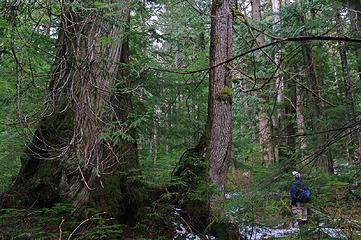 Jim checking out da treez 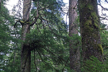 Epicormic branches 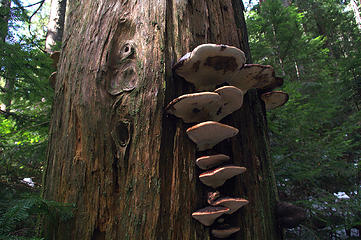 fungus amungus2 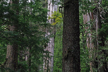 Doug-fir, gorgeous snag, hemlock cedar 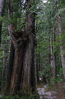 funny cedar 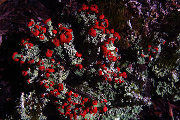 Matchstick cladonia detail 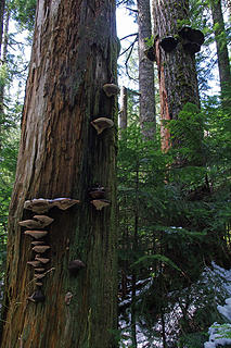 two trees and fungus
"..living on the east side of the Sierra world be ideal - except for harsher winters and the chance of apocalyptic fires burning the whole area."
Bosterson, NWHiker's marketing expert
"..living on the east side of the Sierra world be ideal - except for harsher winters and the chance of apocalyptic fires burning the whole area."
Bosterson, NWHiker's marketing expert
|
| Back to top |
  
|
|
iron
Member

Joined: 10 Aug 2008
Posts: 6392 | TRs | Pics
Location: southeast kootenays |
|
iron
Member
|
 Tue Apr 07, 2015 8:52 am |
|
|
|
| Back to top |
|
|
puzzlr
Mid Fork Rocks

Joined: 13 Feb 2007
Posts: 7220 | TRs | Pics
Location: Stuck in the middle |
|
puzzlr
Mid Fork Rocks
|
Tue Apr 07, 2015 10:19 am |
|
|
I have to say I wasn't aware of this NRCA. Thanks for the report.
| Kim Brown wrote: | | Natural Resource Conservation Areas - the state's equivalent of wilderness |
Never thought of it that way. But wilderness without the sometimes onerous restrictions for trail building and maintenance.
|
| Back to top |
|
|
JimK
Member

Joined: 07 Feb 2002
Posts: 5606 | TRs | Pics
Location: Ballard |
|
JimK
Member
|
Tue Apr 07, 2015 1:10 pm |
|
|
I've just started to look through my photos. Here are a few for now. Kim does like to work on her yoga poses.
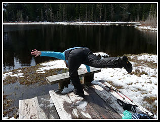 Kim's Yoga Pose 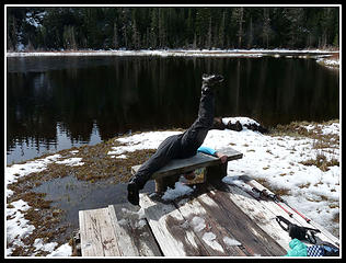 Yoga Pose Fail! 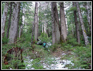 Old Growth Forest
|
| Back to top |
|
|
puzzlr
Mid Fork Rocks
Joined: 13 Feb 2007
Posts: 7220 | TRs | Pics
Location: Stuck in the middle |
|
puzzlr
Mid Fork Rocks
|
Tue Aug 14, 2018 7:23 pm |
|
|
I'm reviving an old TR that might be better left alone, but I recently came across a copy of an old newspaper column about Ashland Lakes that I thought was interesting and relevant. I only scanned the parts of the paper with story content. Unfortunately, the Seattle Times pictorial sections aren't in the online archive, AFAIK, so no link.
The text on the intro page is | Quote: | | It was a day in the mid 1930's when Ernie Wolcott, well-known Pacific Northwest outdoorsman, first saw the beautiful little lake pictured on today's cover and these pages.
Wolcott was in an airplane, flying over a section of the west slope of the Cascade Mountains, northeast of Seattle.
A few miles southeast of Pilchuck Mountain and over the stream which tumbles from the Ashland Lakes into the Pilchuck River, Wolcott looked down and was surprised to see a tiny lake. A waterfall plunged more than 200 feet over a granite ledge into the lake. Just below the lake's outlet, Wolcott could see through the trees and dense undergrowth a second waterfall. with a drop of some 400 feet.
Wolcott could not find the lake on any of his maps. He marked the spot on one, however, promptly named it Twin Falls Lake and found that it is only 36 air miles from the heart of Seattle.
Wolcott's immediate desire was to make his way on foot to the lake and its falls. It was not, however, until 1948 that he made his first attempt. Although the Jake is only a few miles off the Mountain loop Highway, east of Granite Falls, Wolcott found those miles exceedingly rough, and his first tries at brush-whacking his way alone to the lake failed.
Five years ago, Wolcott and four other men finally made it. In 1957, the lake was stocked with trout, and since then, Wolcott has made several trips to Twin Falls lake. including one this year on which he made the photographs on the following pages |
|
| Back to top |
|
|
JimK
Member
Joined: 07 Feb 2002
Posts: 5606 | TRs | Pics
Location: Ballard |
|
JimK
Member
|
Tue Aug 14, 2018 8:55 pm |
|
|
The log was still there 52 years later though without the moss.
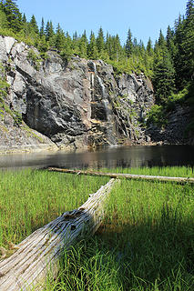 Twin Falls Lake
|
| Back to top |
|
|
Brian Curtis
Trail Blazer/HiLaker

Joined: 16 Dec 2001
Posts: 1696 | TRs | Pics
Location: Silverdale, WA |
Thanks for posting this.
Milt Tanggard, mentioned as a Trail Blazer in the article, is still a Trail Blazer. Though he does live at a different address now. 
that elitist from silverdale wanted to tell me that all carnes are bad--Studebaker Hoch
that elitist from silverdale wanted to tell me that all carnes are bad--Studebaker Hoch
|
| Back to top |
|
|
Sculpin
Member

Joined: 23 Apr 2015
Posts: 1384 | TRs | Pics
|
|
Sculpin
Member
|
Wed Aug 15, 2018 7:09 am |
|
|
I read somewhere that the plunge pool/lake at the bottom of the falls could not have been formed by the creek that currently flows in. The theory is that during the ice age, the valleys of the Stilly and the Skagit were blocked by the Puget Sound Lobe of the continental glacier. The water backed up until it overflowed the ridge at this location. So that's pretty neat!
Between every two pines is a doorway to the new world. - John Muir
Between every two pines is a doorway to the new world. - John Muir
|
| Back to top |
|
|
Schroder
Member

Joined: 26 Oct 2007
Posts: 6720 | TRs | Pics
Location: on the beach |
|
Schroder
Member
|
Wed Aug 15, 2018 7:44 am |
|
|
Also interesting to note is that the trail went from the end of a logging spur directly to the falls. I got there once in 10 minutes via a logging road up Wilson Creek on the Pilchuck River side.
|
| Back to top |
|
|
contour5
Member

Joined: 16 Jul 2003
Posts: 2963 | TRs | Pics
|
|
contour5
Member
|
Wed Aug 15, 2018 9:13 pm |
|
|
Epic collaborative effort on this post. Great stuff!
|
| Back to top |
|
|
Kim Brown
Member
Joined: 13 Jul 2009
Posts: 6899 | TRs | Pics
|
I bet you're right sculpin. From the looks of that gorgeous valley where the 2nd falls plunge into, there must have been a lot of glacier gouging!
We have the Pilchuck Audubon Society and Signpost's Louise Marshall to thank for saving the area around the lakes and falls from logging. Louise discussed hiking up there from the Mtn Loop up Black Creek. I don't think it was a built trail.
"..living on the east side of the Sierra world be ideal - except for harsher winters and the chance of apocalyptic fires burning the whole area."
Bosterson, NWHiker's marketing expert
"..living on the east side of the Sierra world be ideal - except for harsher winters and the chance of apocalyptic fires burning the whole area."
Bosterson, NWHiker's marketing expert
|
| Back to top |
|
|
Brian Curtis
Trail Blazer/HiLaker
Joined: 16 Dec 2001
Posts: 1696 | TRs | Pics
Location: Silverdale, WA |
A group of Trail Blazers went in to Twin Falls in 1954:
"Sunday - August 1 - After an early breakfast we left Island at 6:00 A.M. on a bearing of 155 true, we hailed Twin Falls Lake after 2 hours. Another hour to walk down the cliffs, and we were on the lake at 9:00 A.M. We found it barren, its size about 4 acres, surrounded on three sides by cliffs. A waterfall about 200 ft. at the inlet. There was a waterfall of unknown height (guess 150-200 ft.) at the outlet. Water temp. 58 on the surface, bottom 2/3 rock, 1/3 mud. If stocked, not more than 500 R.B. or "cutts". We left the lake at 11:30 and arrived at the island at 2:30. After eating we left the island at 4:00. Passed Pinnacle at 6:00 P.M. Arrived at the car at 10:30 P.M. Flashlights the last hour out. We wuz robbed! Thanks to Paul Butler and his Paul Revere ride with batteries and cables, we arrived at Seattle at 6:00 A.M. Monday. Members on the trip were Joe De Santo, Jack Brandmier, and Charley Yadon."
that elitist from silverdale wanted to tell me that all carnes are bad--Studebaker Hoch
that elitist from silverdale wanted to tell me that all carnes are bad--Studebaker Hoch
|
| Back to top |
|
|
|
|


