| Previous :: Next Topic |
| Author |
Message |
alpinista55
Member


Joined: 11 Jul 2018
Posts: 10 | TRs | Pics
|
Our friends and family group has done an extended backpacking trip every August for the past several years. Weve done trips to the Colorado Rockies, the Wind River range, and several spots in the southern Sierra Nevada. This summer my daughter Jamie asked for more trees, so we brought it back to our home range, and planned two hikes in the North Cascades, with a day off in Leavenworth in between. For our first trip we chose a portion of the Alpine Lakes High Route know as the Foss Lakes Loop.
We arrived at the West Fork Foss River trailhead trailhead (1645) at about 6:00 pm after placing a shuttle car at the Necklace Valley trailhead. We hiked the short 1.5 miles to Trout Lake to camp for the night. We started the steep climb to Copper Lake at 6:30 am the next morning, hoping to make our evening camp above Chetwood Lake at the famous tarn (8.85 mi, 5354). The trail was in great shape to Big Heart Lake, and the boot track over the Atrium Ridge was easy to follow, but it was a tough workout, giving up hard-earned elevation dropping into Big Heart, and again on Atrium Ridge. We made camp at the tarn at 5:30 pm, having seen no other hikers since Big Heart.
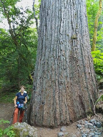 Big old growth cedars 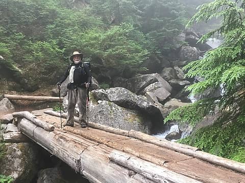 Alpinista55, Senior member of the crew 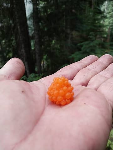 Berries were abundant 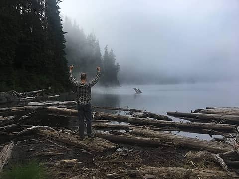 Copper Lake 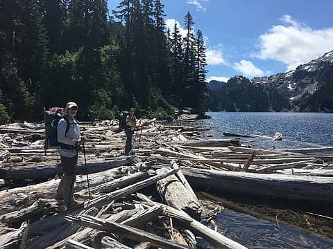 Big Heart Logjam 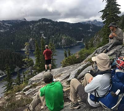 Big Heart from the Atrium 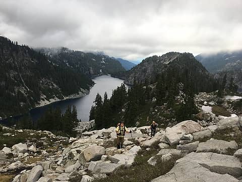 Last bit before the tarn 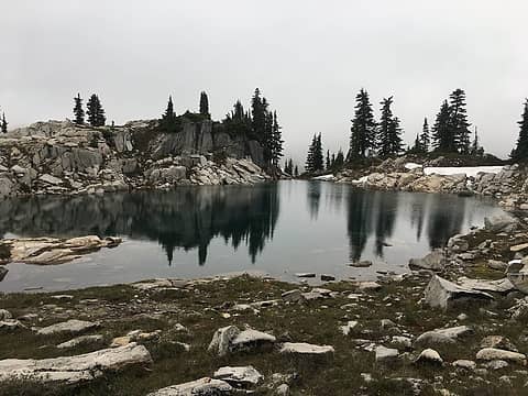 Tarn above Chetwood Lake 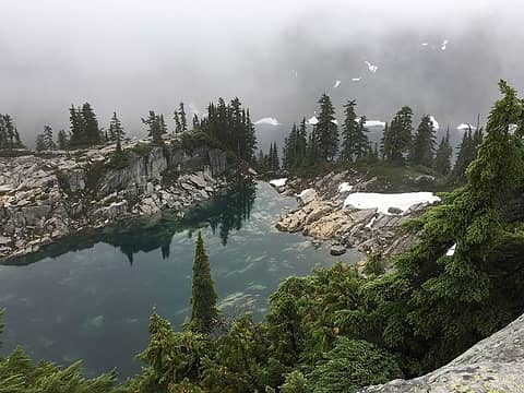 The tarn from above 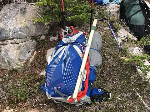 30+ pound loads 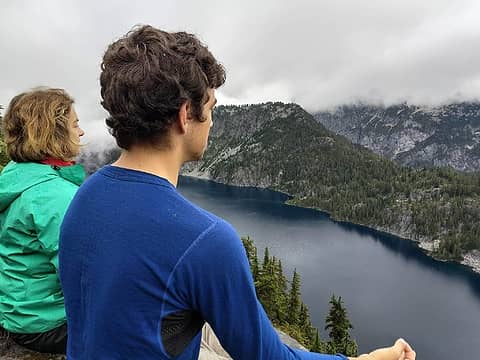 Meditation on Angeline Lake 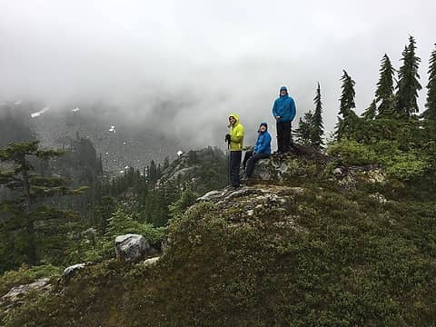 A day in the mists 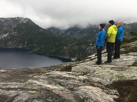 Misty mountains  Cubans! 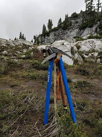 Never used these... 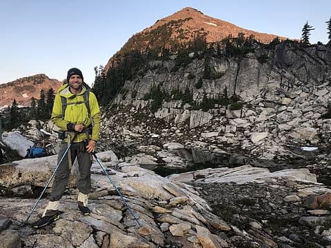 Dawn start 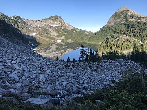 Climbing above Chetwood 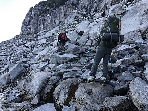 Talus, lots and lots of talus 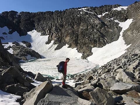 Iron Cap Lake 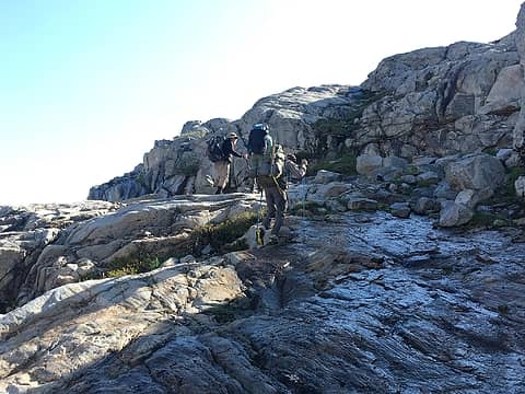 Up the slabs 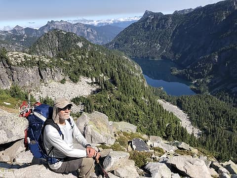 Otter Lake 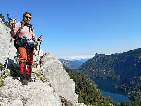 Great views 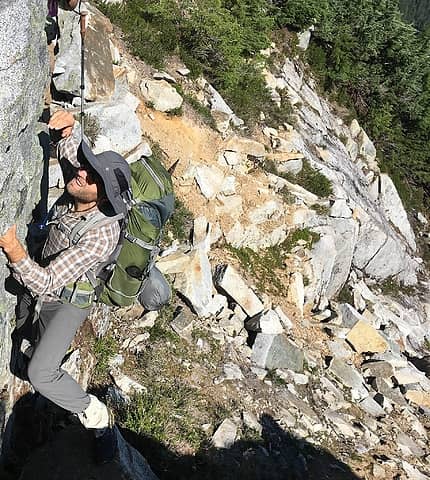 Spicy terrain 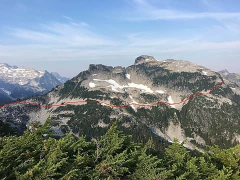 East side route 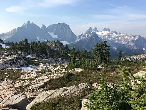 The Tank Lakes tableland 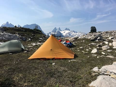 Tank Lakes camp 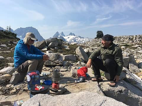 The kitchen 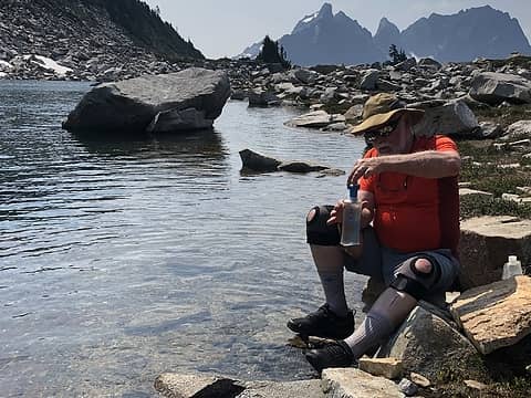 Water stop 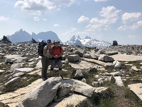 Ready to descend 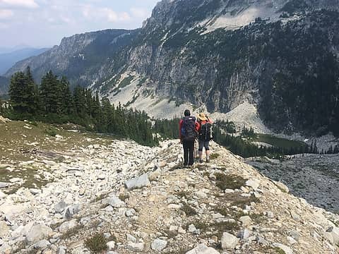 The moraaine 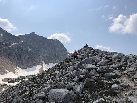 Knife edge 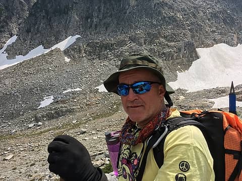 Survival 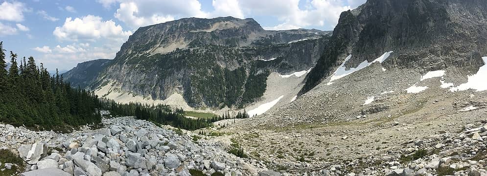 Necklace Valley 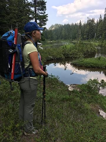 Opal Lake area 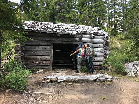 Cabin in Necklace Valley 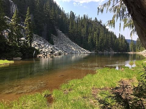 Jade Lake 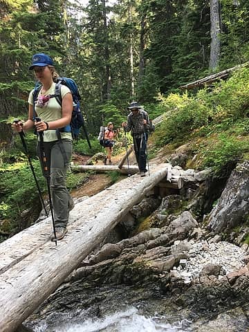 Final stretch
|
| Back to top |
  
|
|
awilsondc
Member

Joined: 03 Apr 2016
Posts: 1324 | TRs | Pics
|
Very cool trip! I went to Tank Lakes a few weeks ago and it was awesome, but I really wanted to do the exact loop you did, just didn't have the time. Looks like you had a great time, thanks for sharing! 
|
| Back to top |
|
|
MackAttack
Member

Joined: 31 May 2011
Posts: 112 | TRs | Pics
|
How were the bugs? I was near there 2 weekends ago and got eaten alive. Hoping they're starting to taper.
|
| Back to top |
|
|
alpinista55
Member
Joined: 11 Jul 2018
Posts: 10 | TRs | Pics
|
The bugs were not too bad, but we all had permethrin treated long-sleeved shirts and pants and head nets. Our second hike, to Buck Creek Pass and vicinity, had lots of flies.
|
| Back to top |
|
|
Schroder
Member

Joined: 26 Oct 2007
Posts: 6720 | TRs | Pics
Location: on the beach |
|
Schroder
Member
|
 Wed Aug 15, 2018 12:10 pm |
|
|
I never heard the name Atrium Ridge before. Who coined that term?
|
| Back to top |
|
|
RichP
Member

Joined: 13 Jul 2006
Posts: 5634 | TRs | Pics
Location: here |
|
RichP
Member
|
Wed Aug 15, 2018 12:14 pm |
|
|
|
| Back to top |
|
|
fyodorova
Member

Joined: 29 Apr 2012
Posts: 93 | TRs | Pics
|
Great report and great trip. We were camped at the Chetwoot tarn the day after you, Saturday the 4th. We watched a thunderstorm boil over Summit Chief and move towards the Tanks. You must have had a great show from over there.
|
| Back to top |
|
|
DIYSteve
seeking hygge

Joined: 06 Mar 2007
Posts: 12655 | TRs | Pics
Location: here now |
|
DIYSteve
seeking hygge
|
Thu Aug 16, 2018 12:52 pm |
|
|
Good TR and pics BTW, that's the E half of the ALHR
|
| Back to top |
|
|
jefcla
Mountain runner

Joined: 27 Aug 2018
Posts: 1 | TRs | Pics
|
|
jefcla
Mountain runner
|
Mon Aug 27, 2018 10:30 pm |
|
|
Great trip report. My wife and I saw your group on the way in. Sitting at the top overlooking Tank Lake wondered about your route as we looked at the lakes below.
|
| Back to top |
|
|
alpinista55
Member
Joined: 11 Jul 2018
Posts: 10 | TRs | Pics
|
Trail runners were totally fine for us, although I will admit that the soles of my feet were sore after all that talus walking by trips end. But we have been doing long off-trail hikes in trail runners for years in the Winds, southern Sierras and in the Colorado front range. The only time my footwear seemed sub-optimal was on steep heather, where a mountain boot would have been a better platform, but I'll sacrifice a bit for reduced weight on my feet any day.
|
| Back to top |
|
|
Ski
><((((°>

Joined: 28 May 2005
Posts: 12831 | TRs | Pics
Location: tacoma |
|
Ski
><((((°>
|
Fri Sep 14, 2018 6:24 pm |
|
|
Very cool.
But I am not fooled by the fake tree in the first photo! That tree isn't a tree at all - it doesn't have any roots! It's a stage prop that the Forest Service moves around now and then to fool the tourists!
It's in another photo here somewhere on the site. Fake tree! 
"I shall wear white flannel trousers, and walk upon the beach.
I have heard the mermaids singing, each to each."
"I shall wear white flannel trousers, and walk upon the beach.
I have heard the mermaids singing, each to each."
|
| Back to top |
|
|
Arthur
Member

Joined: 15 Aug 2011
Posts: 76 | TRs | Pics
|
|
Arthur
Member
|
Thu Jun 03, 2021 11:30 pm |
|
|
I thought the Foss Tree (in the first photo) was a Douglas Fir. With roots buried in avalanche debris.
Theres a similar-sized cedar a little north of the Foss Tree that has now fallen. Another hidden treasure.
|
| Back to top |
|
|
|
|


