| Previous :: Next Topic |
| Author |
Message |
Silas
Member


Joined: 14 Aug 2012
Posts: 77 | TRs | Pics
|
|
Silas
Member
|
 Wed Aug 15, 2018 10:03 pm |
|
|
Disclaimer: smoke from recent marijuana legalization obstructed many-a-view during this trip as you, the reader, will see in the following pictures.
Without further ado, the cast and characters of the expedition:
Name: Bullet
Profession: Retired high school math teacher
Favorite Mountain House: Beef stroganoff fortified with two oatmeals
Favorite book: The Poisonwood Bible
Olympic Peak: Pulitzer, known for eloquent diction, prose, and a cold lake
Name: Milkmaid
Profession: Builder, work party leader
Favorite Mountain House: San Francisco freeze dried kale and stale pantry bulgur
Favorite book: How to not lock your keys in the car at the Quinault Ranger Station, for Dummies
Olympic Peak: Hamilton, great peak, better musical
Name: Honey
Profession: cultivator of vine maple
Favorite Mountain House: Rice and Chicken
Favorite book: Trout Fishing in America
Olympic Peak: Mystery, elusive, beautiful
Name: Red Beard
Profession: cartographer
Favorite Mountain House: Breakfast Skillet
Favorite book: CRUNK: the complete history of Atlanta-based rap
Olympic Peak: Zinhorf
Day 1: We left early to drive from Seattle to Port Angeles for permits at the WIC and dropped a car at Sol Duc before meeting up with our fourth crew member in Quinault. Locked keys in the car delayed our departure. Keys were retrieved. A flat tire delayed our departure. Air was pumped. We hit the Irely Lake Trailhead around 4pm to start the ascent up to Three Lakes. What did our backpacks have in common with a Colorado real estate mogul? Lots and lots of Mountain Houses. Packs were still heavy though as we trudged up into the 90 degree heat. We camped near the first of the Three Lakes and were greeted like an old friend by flies and mosquitos. Bullet had hundreds of bug bites by now.
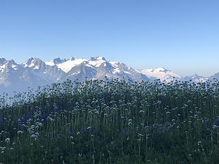
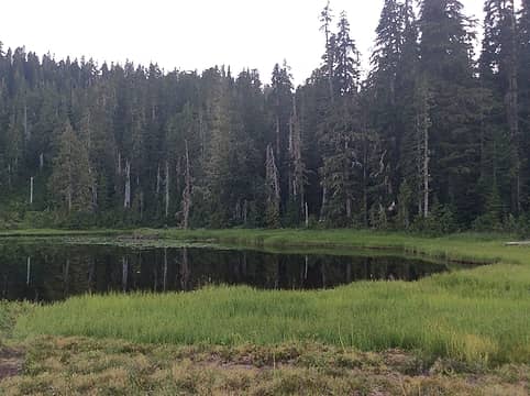 Beautiful Three Lakes 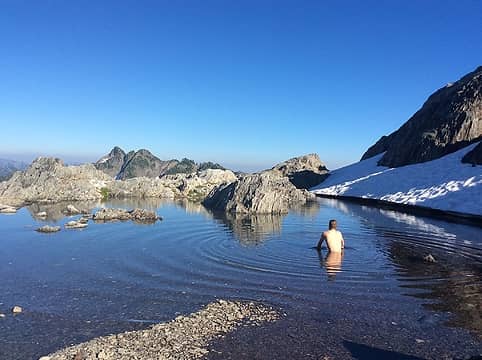 Nice view of Zinhorf 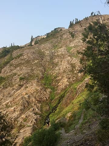 Skyline Trail 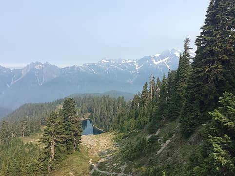 Ya Beauty! 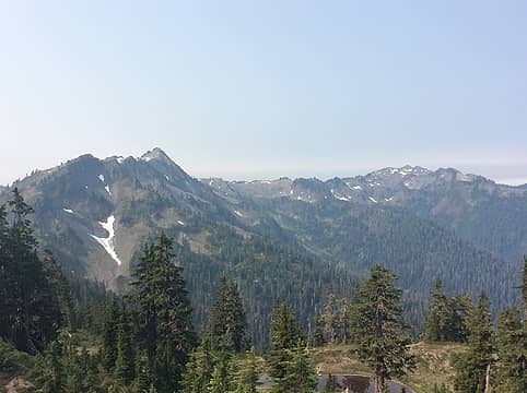 From whence we came 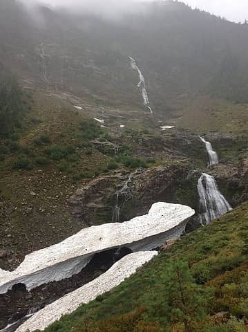 Looking for the trail 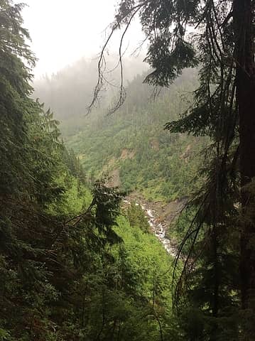 THE TRAIL! 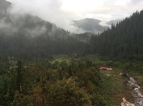 Wet Elwa Basin 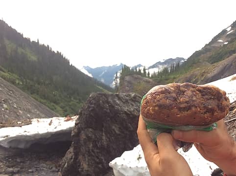 The infamous PB and J Bullet. So many calories. 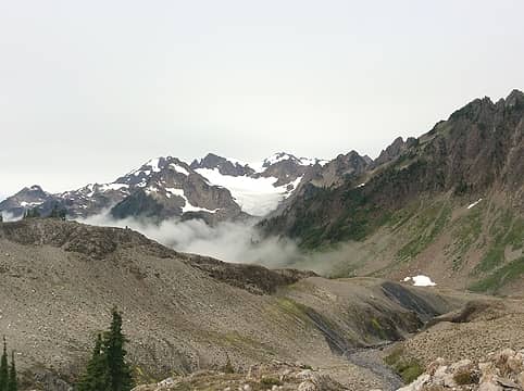 Queets Basin 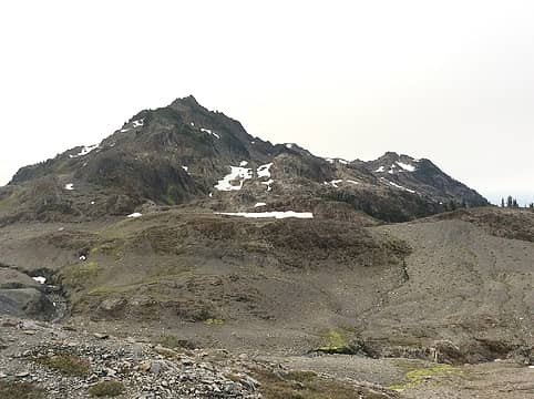 Mt. Queets 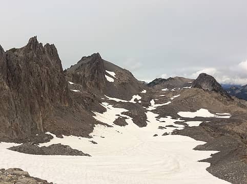 Snow Canyon on the BRT 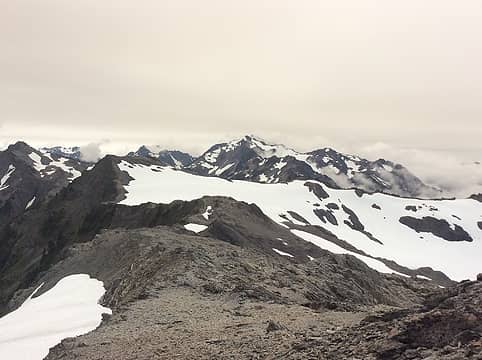 Bear Pass 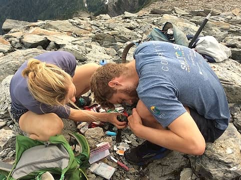 Ticks! 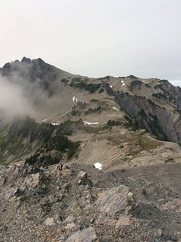 Lone Tree Pass 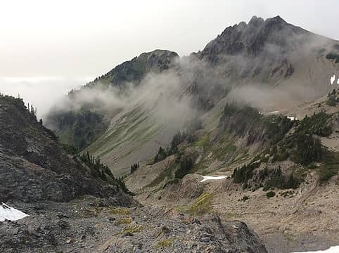 Elk Herd 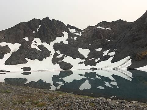 Pulitzer 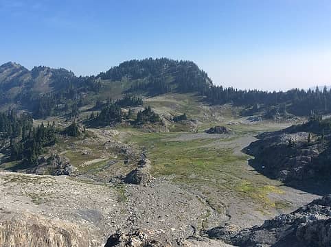 Ferry Basin 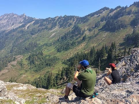 Looking at bears 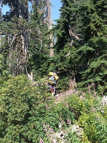 Cream Lake Interstate 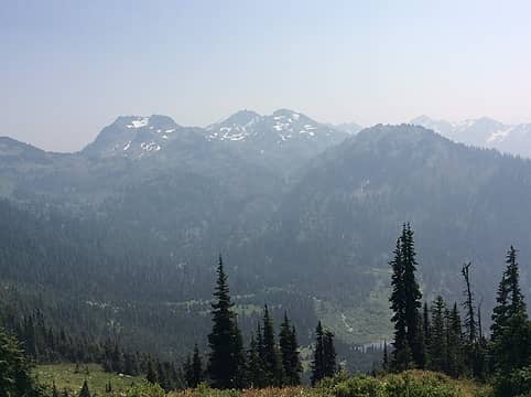 Looking back at Pulitzer and Ferry 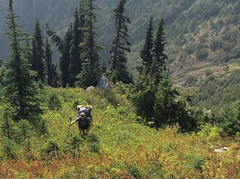 Retrieving the lost pack. 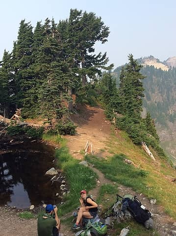 Boston Charlie's. Not the best water during the trip. 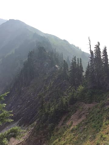 Catwalk in smoke. 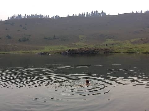 Heart Lake 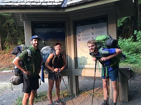 Made it!  Trip casualty.
|
| Back to top |
  
|
|
Kim Brown
Member
Joined: 13 Jul 2009
Posts: 6899 | TRs | Pics
|
Well! All I can say is, I am looking forward to more reports from you guys! 
"..living on the east side of the Sierra world be ideal - except for harsher winters and the chance of apocalyptic fires burning the whole area."
Bosterson, NWHiker's marketing expert
"..living on the east side of the Sierra world be ideal - except for harsher winters and the chance of apocalyptic fires burning the whole area."
Bosterson, NWHiker's marketing expert
|
| Back to top |
|
|
omhk
Member
Joined: 02 Oct 2015
Posts: 33 | TRs | Pics
|
|
omhk
Member
|
Wed Aug 15, 2018 10:18 pm |
|
|
Great photos, and a really fun TR to read
|
| Back to top |
|
|
Fatrick
Member

Joined: 09 Aug 2011
Posts: 27 | TRs | Pics
|
|
Fatrick
Member
|
Thu Aug 16, 2018 3:31 pm |
|
|
Enjoyed the trip report! The snow finger trail can be hard to find, glad you stuck with it. It took me 3 trips before locating the proper route. The first two times I gave up and just came down on the other side of the river...not the longest bush whack I've ever done, but darn close. The trail is much better.
|
| Back to top |
|
|
bobbi
stillaGUAMish

Joined: 13 Jul 2006
Posts: 8012 | TRs | Pics
Location: olympics! |
|
bobbi
stillaGUAMish
|
Thu Aug 16, 2018 7:03 pm |
|
|
fantabulous! great adventure! I enjoyed your prose and photos 
bobbi ૐ
"Today is your day! Your mountain is waiting. So
get on your way!" - Oh, the Places Youll Go! By Dr. Seuss
bobbi ૐ
"Today is your day! Your mountain is waiting. So
get on your way!" - Oh, the Places Youll Go! By Dr. Seuss
|
| Back to top |
|
|
k_arc
Member
Joined: 17 Aug 2018
Posts: 1 | TRs | Pics
|
|
k_arc
Member
|
Fri Aug 17, 2018 3:06 pm |
|
|
Great TR & photos! I like your method of story-telling.
We're eyeing the Bailey in a couple of weeks although were thinking to go from north-to-south. So the gulleys along the Mt. Carrie - Stephen Traverse weren't too bad? Saw a TR from another hiker earlier this year who turned around out there. Thanks!
|
| Back to top |
|
|
Silas
Member
Joined: 14 Aug 2012
Posts: 77 | TRs | Pics
|
|
Silas
Member
|
Fri Aug 17, 2018 9:41 pm |
|
|
k_arc, the gullies south of Mt. Carrie were not too bad. There was a pretty steep one, but we luckily went up it; could be worse going down? I read that trip report also. Maybe it was an early season hike and the snow made it sketchy. The one gully that was hard to navigate was just south of 11 Bull Basin. We ended up climbing up above it and then descending into 11 Bull. Let me know if you have any more questions.
|
| Back to top |
|
|
RodF
Member

Joined: 01 Sep 2007
Posts: 2593 | TRs | Pics
Location: Sequim WA |
|
RodF
Member
|
Mon Aug 20, 2018 10:49 pm |
|
|
Re: Elwha Basin way trail, please report difficulties locating the trail out of Elwha Basin to the Elwha Snowfinger at the "Please email us your trail report" link on the Olympic NP Trail Conditions page. This is actually a hazard for those trying to found their way down from Dodwell-Rixon or Bear Passes in deteriorating weather or approaching darkness.
This trail, which has existed since USFS built it in 1920, needs to be marked and minimally maintained. Many of us have been trying to convince the Park of this for three years. Park has refused to allow WTA volunteers to do it. More visitors need to help us request minimal maintenance of it be allowed, or it will be lost.
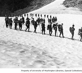 The Mountaineers on Elwha Snowfinger 1920
"of all the paths you take in life, make sure a few of them are dirt" - John Muir
"the wild is not the opposite of cultivated. It is the opposite of the captivated - Vandana Shiva
"of all the paths you take in life, make sure a few of them are dirt" - John Muir
"the wild is not the opposite of cultivated. It is the opposite of the captivated - Vandana Shiva
|
| Back to top |
|
|
RAW-dad
Member

Joined: 07 Jul 2017
Posts: 119 | TRs | Pics
Location: Oregon |
|
RAW-dad
Member
|
Tue Aug 21, 2018 7:47 am |
|
|
Great TR.
Re. 11 Bull Basin - you most definitely need to return. Here's the view last year:
 Olympus morning
|
| Back to top |
|
|
Fatrick
Member
Joined: 09 Aug 2011
Posts: 27 | TRs | Pics
|
|
Fatrick
Member
|
Tue Aug 21, 2018 8:03 am |
|
|
| RodF wrote: | | please report difficulties locating the trail out of Elwha Basin to the Elwha Snowfinger at the "Please email us your trail report" |
Just sent our report from August 11th. It would be great to mark the route from the old trail, across the lower basin, to the more obvious way trail above. Happy Hollow could use a good trimming too...would be a shame to lose that shelter.
|
| Back to top |
|
|
|
|
You cannot post new topics in this forum
You cannot reply to topics in this forum
You cannot edit your posts in this forum
You cannot delete your posts in this forum
You cannot vote in polls in this forum
|
Disclosure: As an Amazon Associate NWHikers.net earns from qualifying purchases when you use our link(s). |


