| Previous :: Next Topic |
| Author |
Message |
cartman
Member


Joined: 20 Feb 2007
Posts: 2800 | TRs | Pics
Location: Fremont |
|
cartman
Member
|
 Mon Aug 27, 2018 9:21 pm |
|
|
 The view we would have had... 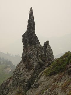 Approaching Mordor 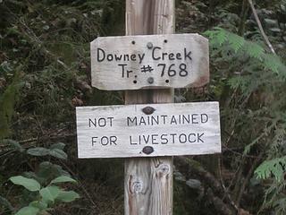 Trailhead 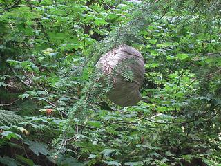 Wasp nest 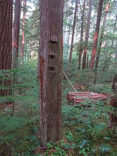 Turn off here  This fine trail switchbacks under old growth forest,
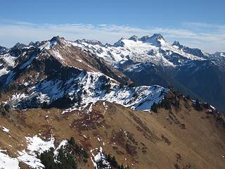
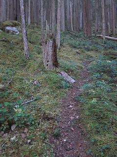 Old trail 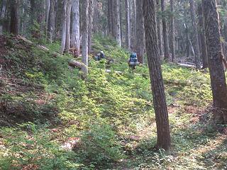 Higher on the trail 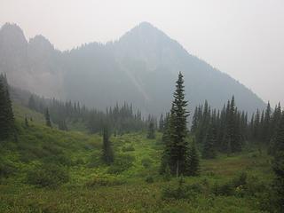 Downey 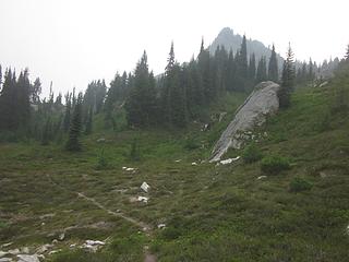 Meadow trail 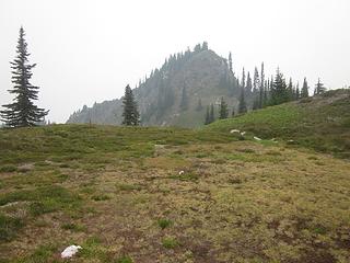 Meadows and bump 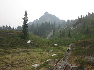 More meadows and point 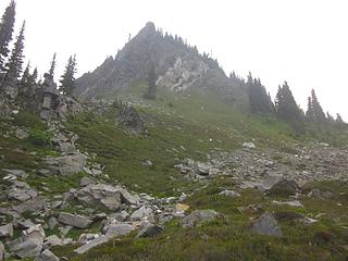 Pointy 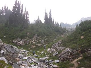 Meadow gully 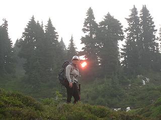 Haylee and rising sun 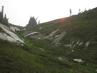 Another gentle gully 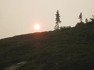 Morning sun in the haze 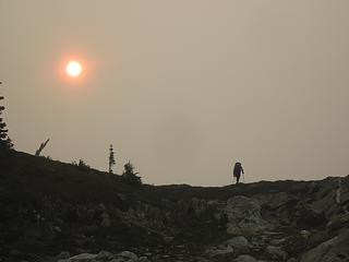 Haylee and sun 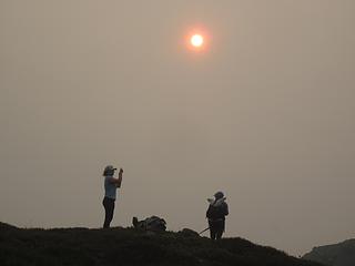 Sun and peeps 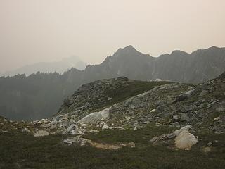 Around the bend 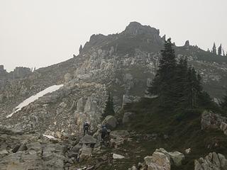 Scrambling around Midway 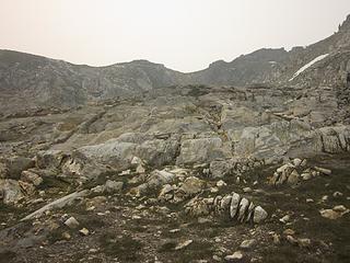 Easy scrambling here 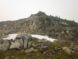 Below Midway 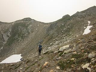 Haylee starts the choss cross 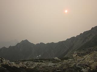 The Apocalypse 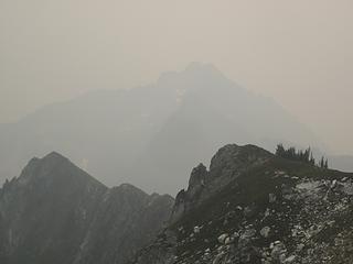 Not Pilot and Pilot 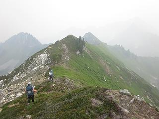 Now on Pilot's ridge 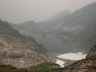 Unnamed lake 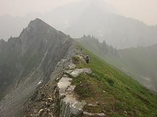 To the next bump 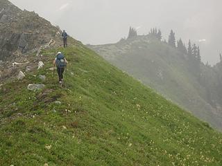 Haylee and Brenda 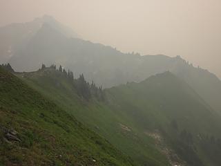 Lotsa ridge 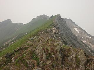 Looking back at Midway 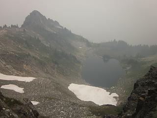 The lake from directly above 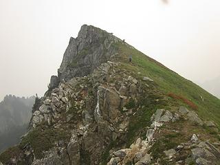 Up de bump 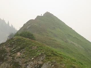 Da bump 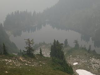 Downey Lake 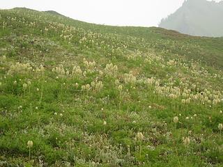 Western anemone 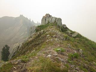 Trending east 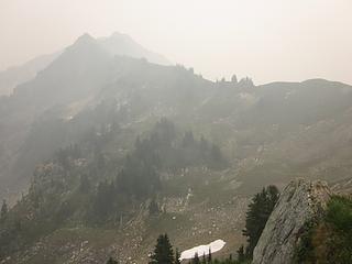 The route to Pilot 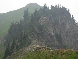 View back to the crux descent 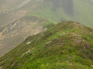 Descending to the saddle 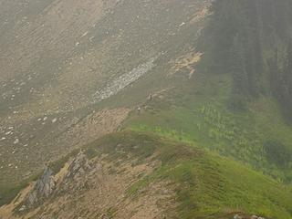 Haylee and Brenda at the saddle 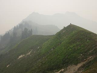 Waiting 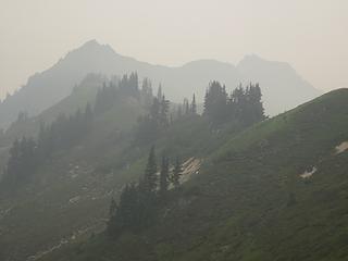 The summits of Pilot 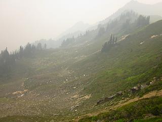 Basin below 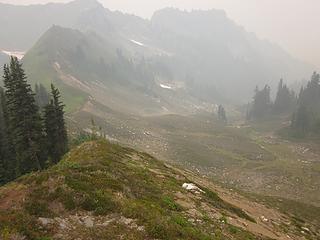 Basin and saddle behind 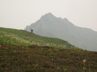 Brenda and anemone 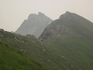 Forging on 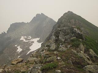 The west side 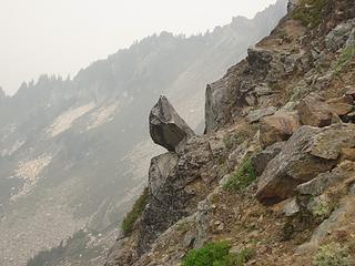 Balanced rock 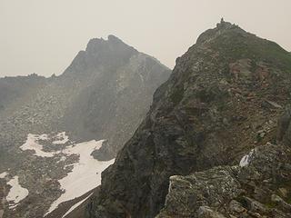 Brenda tops out on the bump  The false western summit, true summit beyond 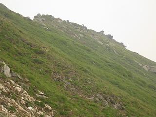 Brenda climbing to the true summit 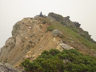 Brenda just below the top 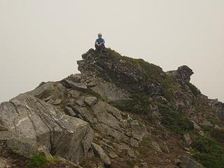 Brenda on the summit 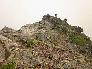 At the top of Pilot 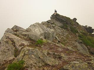 Pilot summit, 7088' The view we would have had... 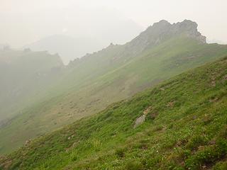 Traversing back 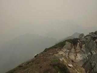 Look! Views 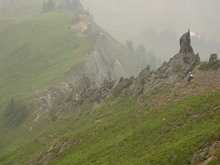 Down to the false summit low point 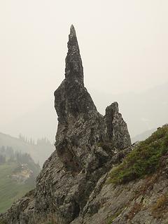 Piercing 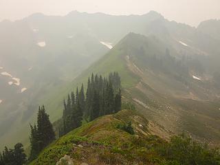 Descending to the saddle 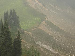 Haylee chillin' 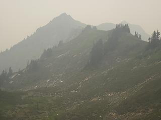 Oh look, more up 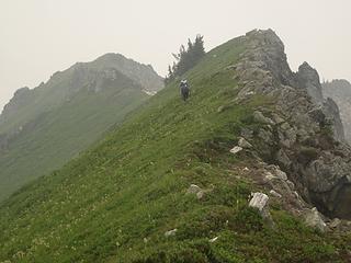 Past the crux, over the bump 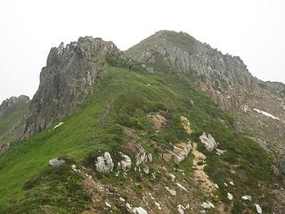 Starting up Midway 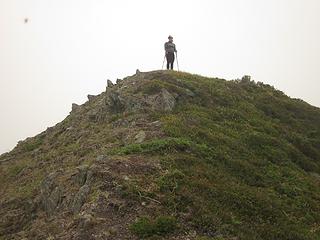 Haylee on the summit of Midway 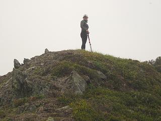 Haylee at the top 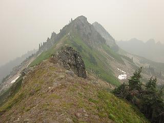 Back to the ridge 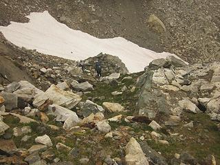 Easy descent 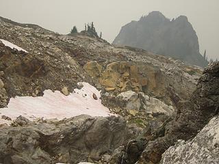 Next 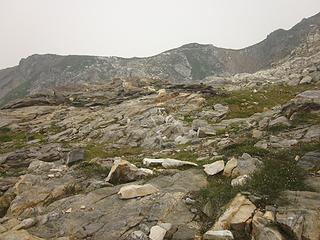 Looking back at the ridge 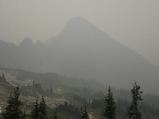 Mordor!! Or, Downey 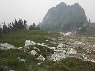 Relaxing meadows 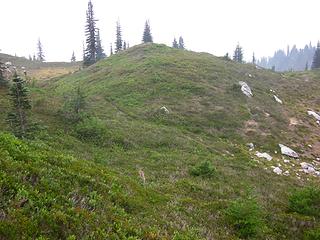 Aaaaand...back to the trail 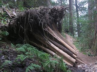 Ginormous rootball 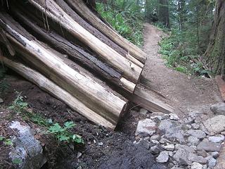 Giant crosscut  .
Since we missed the close up views of the Ptarmigan Traverse, who wants to go back...?
18 miles, ~7700' gain
Eric J. Johnson .
Since we missed the close up views of the Ptarmigan Traverse, who wants to go back...?
18 miles, ~7700' gain
Eric J. Johnson
|
| Back to top |
  
|
|
Matt
Tea, Earl Grey, Hot

Joined: 30 Jan 2007
Posts: 4307 | TRs | Pics
Location: Shoreline |
|
Matt
Tea, Earl Grey, Hot
|
Mon Aug 27, 2018 10:44 pm |
|
|
Glad you finally made it to Pilot, despite the smoke.
As beacons mountains burned at evening. J.R.R. Tolkien
As beacons mountains burned at evening. J.R.R. Tolkien
|
| Back to top |
|
|
cascadetraverser
Member

Joined: 16 Sep 2007
Posts: 1407 | TRs | Pics
|
Pretty cool ridge ramble in the smoke. Cool trail discovery!
|
| Back to top |
|
|
raising3hikers
Member
Joined: 21 Sep 2007
Posts: 2344 | TRs | Pics
Location: Edmonds, Wa |
| cascadetraverser wrote: | | Cool trail discovery! |

|
| Back to top |
|
|
Sculpin
Member

Joined: 23 Apr 2015
Posts: 1384 | TRs | Pics
|
|
Sculpin
Member
|
Tue Aug 28, 2018 5:50 pm |
|
|
Superbly crafted TR!  I may not crest the peaks but the trail and meadows sure look appealing.
If you post your question about the origin of the trail in the history forum, you never know who might materialize to answer.
I may not crest the peaks but the trail and meadows sure look appealing.
If you post your question about the origin of the trail in the history forum, you never know who might materialize to answer.
Between every two pines is a doorway to the new world. - John Muir
Between every two pines is a doorway to the new world. - John Muir
|
| Back to top |
|
|
Prosit
Member
Joined: 08 May 2011
Posts: 130 | TRs | Pics
|
|
Prosit
Member
|
Tue Aug 28, 2018 8:21 pm |
|
|
Well told TR. Unfortunate for the smoke; it's a nice area. Downey lake is full of Cutthroat, and you're right that the views from Pilot are worth going back for.
|
| Back to top |
|
|
geyer
Member

Joined: 23 May 2017
Posts: 463 | TRs | Pics
Location: Seattle |
|
geyer
Member
|
Tue Aug 28, 2018 8:51 pm |
|
|
I hope you brought your facemasks!
I think I had heard you talk about this area before. Nice that you got to revisit and tag the summit
|
| Back to top |
|
|
cartman
Member
Joined: 20 Feb 2007
Posts: 2800 | TRs | Pics
Location: Fremont |
|
cartman
Member
|
Wed Aug 29, 2018 12:30 pm |
|
|
Anyone know if Pilot or the area nearby has been used as an alternate route to Cub Lake and Dome Peak? This is easy terrain as far as we went, seems far more interesting than Downey/Bachelor, and no brush.
The crux would be getting past Pilot to Cub Lake. On the map it looks like one could drop south to ~5500' and traverse quite a ways, then descend toward the creek draining Itswoot Lake and up to Cub, or maybe even trying to run the ridge west of Cub and then down on the other side.
|
| Back to top |
|
|
Arthur
Member

Joined: 15 Aug 2011
Posts: 76 | TRs | Pics
|
|
Arthur
Member
|
Tue Aug 27, 2019 3:12 pm |
|
|
The majority of the trail maintenance on the Downey Creek trail is done by volunteers. Mike has been the motivator for most of the trail maintenance that Downey has received in the last decade. His crew cut that cedar last year using crosscut saws.
We also spent a few days this year clearing logs and cutting brush. One crew spent 2 days clearing 2 logs. Cutting with handsaws is not quick! The photos tell part of the story.
Downey Creek - April 25th
Downey Ck - April 26th
The clearing did not get finished this year because there werent enough hands helping. If you can help and have some time available next Spring, send me your contact information and Ill get it to Mike.
|
| Back to top |
|
|
|
|
You cannot post new topics in this forum
You cannot reply to topics in this forum
You cannot edit your posts in this forum
You cannot delete your posts in this forum
You cannot vote in polls in this forum
|
Disclosure: As an Amazon Associate NWHikers.net earns from qualifying purchases when you use our link(s). |


