| Previous :: Next Topic |
| Author |
Message |
geyer
Member


Joined: 23 May 2017
Posts: 463 | TRs | Pics
Location: Seattle |
|
geyer
Member
|
 Tue Aug 28, 2018 8:26 pm |
|
|
Dates: August 25-26, 2018
Distance: 24 miles (some of that was skiing)
Accum. Elevation Gain: 8600'
Total Humans Seen: lottts of PCT thru-hikers, 5 people on Walupt Lake Trail, 0 off-trail
Did I ski?: You betcha
Ever since I started backcountry skiing, I've wanted to do a Goat Rocks traverse. I've also had my eye on scrambling Gilbert Peak lately (lots of prominence!). Well, it's August, so I'm clearly not getting a ski traverse in. And with the Miriam Fire, the easy approach to Gilbert was out as well...
But the little devil sitting on my left shoulder had this thought: "You know, geyer - there are still glaciers and snowfields that could be skied."  It was Friday night at 7:00 pm and I was still at the office when this little idea popped into my head. So I quickly asked a few friends (no takers), ran home, packed up my overnight bag and threw my skis into my car. 9:30 pm departure. Sign of an adventure in the making. I arrived at the Walupt Lake Trailhead a touch before 1 am and took a brief 4 hour nap in the parking area. And so it began
Day 1: Walupt Lake to Conrad Basin,
Distance: 13 miles
Elevation Gain: 5700'
Elevation Loss: 3200'
For that first half mile of hiking, I was grimacing and already telling myself I would never put myself through such agony again. I don't have the exact numbers, but it was probably 40+ lbs once accounting for the ~14lb ski setup. I haven't carried a bag that heavy since...well, since going down that doggone boulder field from the Eldorado area [shudders]. Somehow, that initial shock only lasted that first half mile, and from then on, the weight didn't really hurt all that much... until it did.
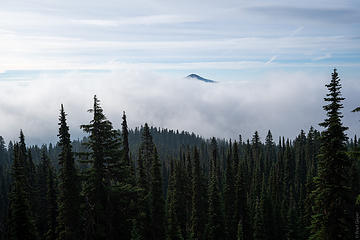
It was an ok day - occasionally blue sky, but high cloud cover. Nothing like the "mostly sunny" that NOAA predicted. Better than nothing, I suppose. The initial leg of the trail was mostly empty, crossing paths with only a pair of hunters and the smell of smoke still lingered. When I got to Nannie Peak, there was a low layer of clouds on the other side of the ridge, just low enough to see the tips of the surrounding mountains. Sheep lake was cool enough for a brief photo stop, watching the fog drift across the top of the water.
It was Friday night at 7:00 pm and I was still at the office when this little idea popped into my head. So I quickly asked a few friends (no takers), ran home, packed up my overnight bag and threw my skis into my car. 9:30 pm departure. Sign of an adventure in the making. I arrived at the Walupt Lake Trailhead a touch before 1 am and took a brief 4 hour nap in the parking area. And so it began
Day 1: Walupt Lake to Conrad Basin,
Distance: 13 miles
Elevation Gain: 5700'
Elevation Loss: 3200'
For that first half mile of hiking, I was grimacing and already telling myself I would never put myself through such agony again. I don't have the exact numbers, but it was probably 40+ lbs once accounting for the ~14lb ski setup. I haven't carried a bag that heavy since...well, since going down that doggone boulder field from the Eldorado area [shudders]. Somehow, that initial shock only lasted that first half mile, and from then on, the weight didn't really hurt all that much... until it did.
It was an ok day - occasionally blue sky, but high cloud cover. Nothing like the "mostly sunny" that NOAA predicted. Better than nothing, I suppose. The initial leg of the trail was mostly empty, crossing paths with only a pair of hunters and the smell of smoke still lingered. When I got to Nannie Peak, there was a low layer of clouds on the other side of the ridge, just low enough to see the tips of the surrounding mountains. Sheep lake was cool enough for a brief photo stop, watching the fog drift across the top of the water.
 Nannie Peak views  tiny tarn near the trail 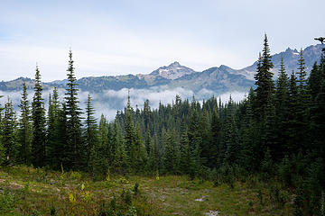 first views of the Goat Rocks 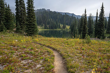 sheep lake arrival 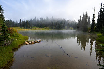 dun.dun.dun. dun duun. du duuun.... SMOOOKE ON THE WAAATER 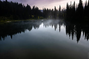 sheep lake 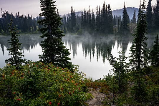 sheep lake 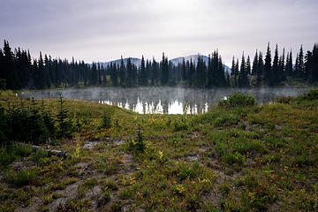 injected a bit of color into this 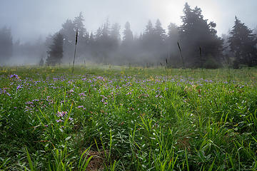 foggy flowers 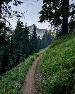 trail views 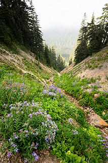 flowery gully 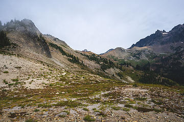 trail to Cispus pass 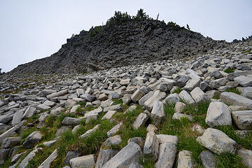 cool geology brought on by cooling of magma into basalt columns. There's some fun physics behind why 120 degrees is the angle that the columns separate into, but I'll leave that to you to look up... ![Looking back on the trail to Cispus Pass [before]](https://cloud.nwhikers.net/44334573391_360x240.jpg) Looking back on the trail to Cispus Pass [before] 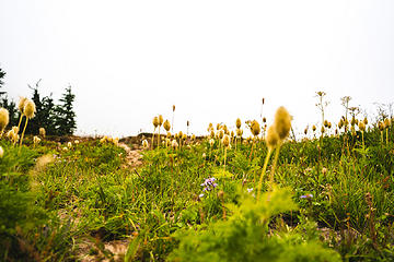 floofy puff-balls that I can't remember the name of 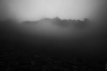 goat citadel in the clouds 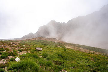 some views emerge at the 2nd pass 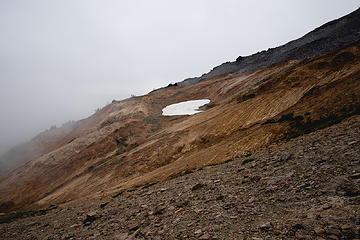 Look! snow! should i ski it? 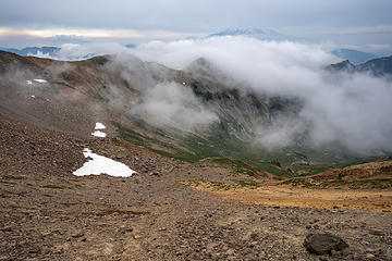 Cispus basin views 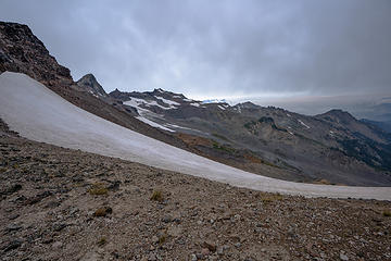 you can see rainier and Little T 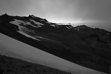 b&W 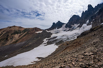 views to the southeast. Goat Citadel & glacier 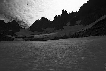 b&W views on the snowfield below the glacier 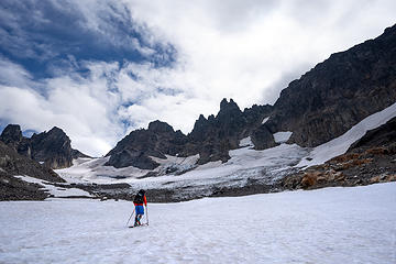 going up for a lap 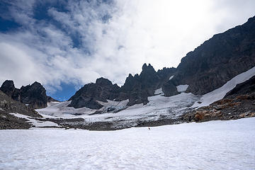 tiny brad skis back down 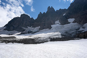 looking up  my would-be route to the col if it wasn't broken up 
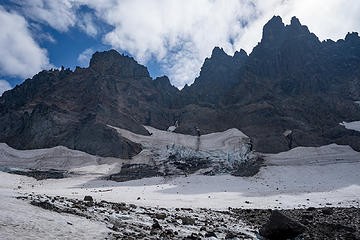 glacier has some deep crevasses 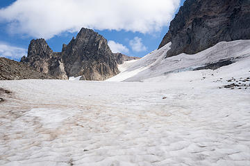 up 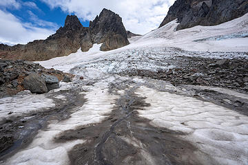 up 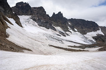 finally at the end of the glacier to the next pass 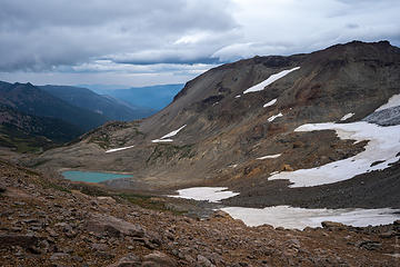 views over the pass to Conrad Basin 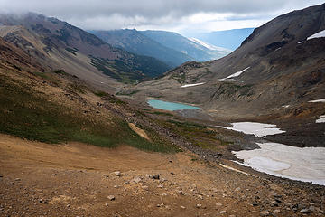 conrad basin 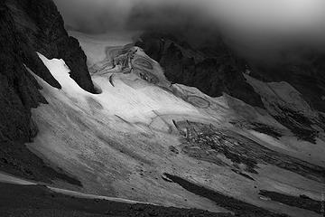 B&W of the goat citadel glacier 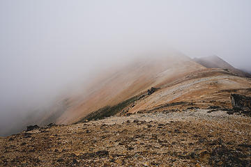 Wind whipped up on the ridge and brought some clouds, leading to a lot of this view 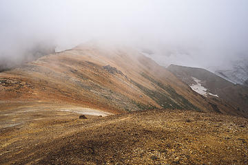 you could say i really liked the colors up there 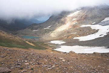 a little splash of light 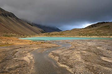 basin views of the moraine lake 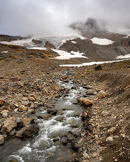 glacial streams make leading lines too easy 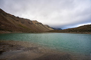 that color, though  b&w of teh braided stream 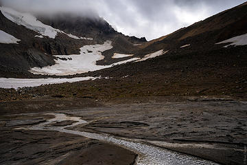 color version 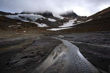 I thoroughly enjoy this view 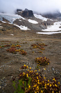 little yellow flowers 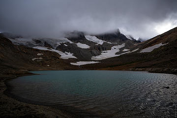 nightfall 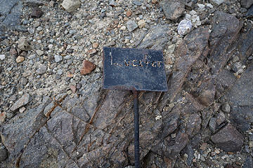 Anyone have any ideas why this might be here? Mystery 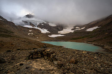 My pathetic little rock shelter 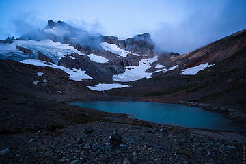 morning blue hour 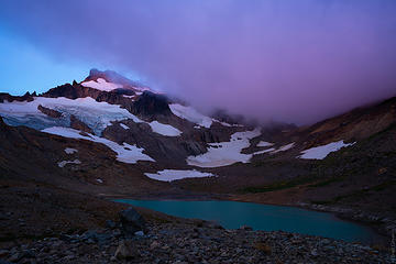 some twilight color 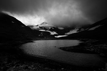 b&w of the lake and Gilbert 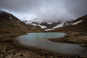 color version less dramatic 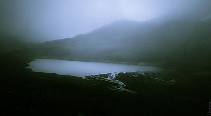 view of the lake in the fog 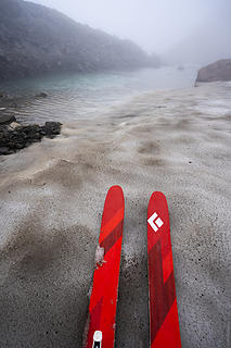 skied down from the pass and saw this tarn, ripe for a pond skim. but I was too cold  
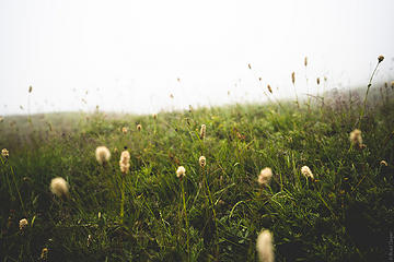 moody grass pictures 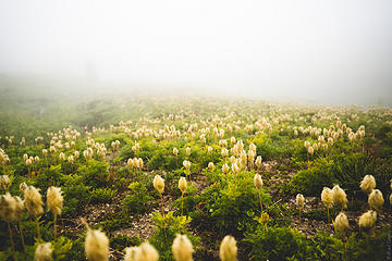 more floofs 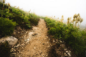 trail floofs ![looking at the trail to cispus pass [after]](https://cloud.nwhikers.net/42526822780_360x240.jpg) looking at the trail to cispus pass [after] 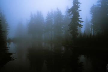 the tarn was especially moody 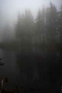 in a ping pong ball 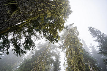 don't forget to look up! 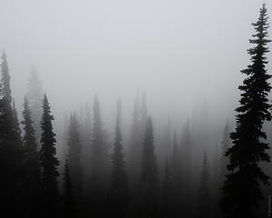 foggy pines
|
| Back to top |
  
|
|
General ****
Member

Joined: 26 May 2014
Posts: 167 | TRs | Pics
Location: Clark County, SW WA |
geyer,
What a fantastic trip report, thank you.
That was an amazing route you went on, and your photography is fantastic.
I don't think we'll be going into the Basen via this route, but it sure looks beautiful.
The General primarily backpacks solo.
The General primarily backpacks solo.
|
| Back to top |
|
|
geyer
Member
Joined: 23 May 2017
Posts: 463 | TRs | Pics
Location: Seattle |
|
geyer
Member
|
Tue Aug 28, 2018 8:39 pm |
|
|
| General **** wrote: | | I don't think we'll be going into the Basen via this route, but it sure looks beautiful. |
Haha well, I figured it wasn't the route most people would want to take. A little bit further and up/down-ier than most people would want, especially compared to the standard route in. Thanks for the compliment on the photography!
|
| Back to top |
|
|
texasbb
Misplaced Texan

Joined: 30 Mar 2009
Posts: 1153 | TRs | Pics
Location: Tri-Cities, WA |
|
texasbb
Misplaced Texan
|
Tue Aug 28, 2018 8:59 pm |
|
|
Very nice. I love it up there. I grieved a bit this year with the South Fork road washed out. Thanks for the story and pics!
|
| Back to top |
|
|
General ****
Member
Joined: 26 May 2014
Posts: 167 | TRs | Pics
Location: Clark County, SW WA |
I've seen the puffy flowers in other areas of the Goat Rocks and I think they might be called Snow Grass.
However, I would get a second opinion as I could be wrong.
The General primarily backpacks solo.
The General primarily backpacks solo.
|
| Back to top |
|
|
texasbb
Misplaced Texan
Joined: 30 Mar 2009
Posts: 1153 | TRs | Pics
Location: Tri-Cities, WA |
|
texasbb
Misplaced Texan
|
Tue Aug 28, 2018 9:30 pm |
|
|
| General **** wrote: | | I've seen the puffy flowers in other areas of the Goat Rocks and I think they might be called Snow Grass. |
Western Pasque Flower, aka Anemone Occidentalis, aka Hippies on a Stick, aka Mouse on a Stick.
ETA: aka Floofs. 
|
| Back to top |
|
|
General ****
Member
Joined: 26 May 2014
Posts: 167 | TRs | Pics
Location: Clark County, SW WA |
texasbb,
Thanks for the clarification, I like the nickname, "Hippies on a Stick", I don't think I will remember Anemone Occidentalis... but they sure are pretty!
The General primarily backpacks solo.
The General primarily backpacks solo.
|
| Back to top |
|
|
Bootpathguy
Member
Joined: 18 Jun 2015
Posts: 1790 | TRs | Pics
Location: United States |
Easily, the most magnificent and unique waterfall in the entire state of Washington.
Experience is what'cha get, when you get what'cha don't want
Experience is what'cha get, when you get what'cha don't want
|
| Back to top |
|
|
BigBrunyon
Member
Joined: 19 Mar 2015
Posts: 1458 | TRs | Pics
Location: the fitness gyms!! |
Goin' big out there! You get what you give!! Keep givin'!!!
|
| Back to top |
|
|
GaliWalker
Have camera will use

Joined: 10 Dec 2007
Posts: 4930 | TRs | Pics
Location: Pittsburgh |
|
GaliWalker
Have camera will use
|
Wed Aug 29, 2018 5:21 am |
|
|
Pretty! Some beautiful pictures in there.  I never visited the Goat Rocks when I lived in Washington, and it remains one of the ones that got away.
|
| Back to top |
|
|
RichP
Member

Joined: 13 Jul 2006
Posts: 5634 | TRs | Pics
Location: here |
|
RichP
Member
|
Wed Aug 29, 2018 5:59 am |
|
|
Some of those pics look more like Alaska than Washington. Nice exploration .
|
| Back to top |
|
|
Tomlike
Member

Joined: 22 Jun 2010
Posts: 407 | TRs | Pics
|
|
Tomlike
Member
|
Wed Aug 29, 2018 9:14 am |
|
|
fun stuff! nice report to a lesser visited corner of the Goats
The windiest night I've ever spent (by far!) in the mountains was above Cispus Pass seven years ago. We had all 12 guy lines staked out on my Supermid and we still thought the thing was going to blow away during the night
|
| Back to top |
|
|
fourteen410
Member

Joined: 23 May 2008
Posts: 2629 | TRs | Pics
|
Thanks for the eye candy! Love that area. If you haven't been to Warm Lake before, it's definitely worth a return visit. The moraine lake in your pictures has often been referred to as Cold Lake (likely for good reason).
|
| Back to top |
|
|
geyer
Member
Joined: 23 May 2017
Posts: 463 | TRs | Pics
Location: Seattle |
|
geyer
Member
|
Wed Aug 29, 2018 1:02 pm |
|
|
| fourteen410 wrote: | | The moraine lake in your pictures has often been referred to as Cold Lake (likely for good reason). |
Ahh I had seen that before but had forgotten!
Yes, warm lake definitely will be on the bucket list after this weekend
|
| Back to top |
|
|
texasbb
Misplaced Texan
Joined: 30 Mar 2009
Posts: 1153 | TRs | Pics
Location: Tri-Cities, WA |
|
texasbb
Misplaced Texan
|
Wed Aug 29, 2018 7:03 pm |
|
|
| geyer wrote: | | Yes, warm lake definitely will be on the bucket list after this weekend |
Early in the season is highly recommended. Warm Lake is best when it's still cold.
|
| Back to top |
|
|
|
|
You cannot post new topics in this forum
You cannot reply to topics in this forum
You cannot edit your posts in this forum
You cannot delete your posts in this forum
You cannot vote in polls in this forum
|
Disclosure: As an Amazon Associate NWHikers.net earns from qualifying purchases when you use our link(s). |


![Looking back on the trail to Cispus Pass [before]](https://cloud.nwhikers.net/44334573391_0aa2b88d02_h.jpg#1600x1066+https://farm2.staticflickr.com/1861/44334573391_2208862039_k.jpg#2048x1365+0aa2b88d02_h.jpg#1600x1067+954756648d_b.jpg#1024x683)


![looking at the trail to cispus pass [after]](https://cloud.nwhikers.net/42526822780_6be382ef10_h.jpg#1600x1066+https://farm2.staticflickr.com/1896/42526822780_bbdc085e13_k.jpg#2048x1365+6be382ef10_h.jpg#1600x1067+3c9255387d_b.jpg#1024x683)


