| Previous :: Next Topic |
| Author |
Message |
RichP
Member


Joined: 13 Jul 2006
Posts: 5634 | TRs | Pics
Location: here |
|
RichP
Member
|
 Wed Aug 22, 2018 7:14 am |
|
|
Over in Idaho this week and the air is definitely better than almost all of Washington. A little shift in the wind direction could easily change that though.
|
| Back to top |
  
|
|
gb
Member

Joined: 01 Jul 2010
Posts: 6310 | TRs | Pics
|
|
gb
Member
|
Wed Aug 22, 2018 7:30 am |
|
|
That will change for Idaho.
Things are finally looking better for Western Washington, Oregon, and Western British Columbia. After the smoke departs Thursday, there could be a brief return of BC smoke Monday-Tuesday, then nothing except local smoke adjacent to individual fires through the end of the month from looking at the Windy site and comparing that to the position of more significant fires.
California south of Mammoth Lakes looks good on a line to about Provo, Utah. South of that all looks good. Colorado smoke will be from Colorado fires. North of that line all the smoke from BC, Washington, Northern and Central Idaho, and Montana will flow more or less due east. Smoke from the Southern Oregon and Northern California fires should draw a bit out to sea on a southerly track and then circulate in the Inland Basin from San Francisco/Tahoe or maybe Mammoth and then eventually work east across Northern Nevada and Utah north of Price or Provo.
In BC, smoke will flow to the east across the province, so the Rockies will not be great.
|
| Back to top |
|
|
AlpineRose
Member
Joined: 08 May 2012
Posts: 1953 | TRs | Pics
|
| Quote: | | Perhaps our nwhiker resident atmospheric scientist can elaborate. |
Thanks, gb. It can't happen soon enough. I wasn't sure where to post these observations, so I will on this thread, just based on its title.
For the last day and a half, all of western WA has had worse air quality ( unhealthy/very unhealthy) than eastern WA (USG/unhealthy). That's still the case as we speak. Last night by 7pm, nearly all of western WA had reached the hazardous level.  There is enough smoke over the Western Pacific, that air quality is expected to stay bad in western WA until tomorrow, before the westerly flow pushes most of the smoke out of the area. It's interesting to observe the differences in air quality between Neah Bay and nearby Cheeka Peak, which is at 1600 ft. Often Neah Bay, at sea level, has had better air quality by a level or two.
The air quality levels to which I refer are from WA's Dept of Ecology Air Monitoring site.
WA air quality There is enough smoke over the Western Pacific, that air quality is expected to stay bad in western WA until tomorrow, before the westerly flow pushes most of the smoke out of the area. It's interesting to observe the differences in air quality between Neah Bay and nearby Cheeka Peak, which is at 1600 ft. Often Neah Bay, at sea level, has had better air quality by a level or two.
The air quality levels to which I refer are from WA's Dept of Ecology Air Monitoring site.
WA air quality
|
| Back to top |
|
|
treeswarper
Alleged Sockpuppet!
Joined: 25 Dec 2006
Posts: 11278 | TRs | Pics
Location: Don't move here |
|
treeswarper
Alleged Sockpuppet!
|
Wed Aug 22, 2018 2:15 pm |
|
|
Actually you are incorrect at this moment. Twisp was reported to be in the 400s. I suspect the fire blew up. Here is the facebook post.
I wonder if this is coming in early because something just pushed a TON of smoke into downtown Twisp. Can't see the tree on the ridge across the street. This is the first time I wasn't able to see that particular landmark. DON'T GO OUT WITHOUT A MASK! We are currently at 454 at Twisp Town Hall's Purple Air meter!
It's looking a bit smokier here also, but I need to mow the grass. Life goes on.
Try not to panic. There's always something worse and lookk on the bright side--Maybe people will start moving away! 
What's especially fun about sock puppets is that you can make each one unique and individual, so that they each have special characters. And they don't have to be humananimals and aliens are great possibilities
What's especially fun about sock puppets is that you can make each one unique and individual, so that they each have special characters. And they don't have to be humananimals and aliens are great possibilities
|
| Back to top |
|
|
glenoid
Member
Joined: 30 Oct 2012
Posts: 307 | TRs | Pics
|
|
glenoid
Member
|
Wed Aug 22, 2018 5:19 pm |
|
|
Downhere in Pomeroy we have enjoyed a clean air summer. We have had only two bad days of smoke. Once from the fire near the Dalles (one morning only), and again last Monday when it was quite bad four 24 hours. Nice blue skies came back yesterday. Today a little hazy. Now if we can do something about the day it was 111 degrees. Today was a pleasant 93 degrees.
|
| Back to top |
|
|
pasayten
Class of 65...

Joined: 18 Aug 2011
Posts: 536 | TRs | Pics
Location: Winthrop, WA |
|
pasayten
Class of 65...
|
Thu Aug 23, 2018 6:08 am |
|
|
|
| Back to top |
|
|
gb
Member
Joined: 01 Jul 2010
Posts: 6310 | TRs | Pics
|
|
gb
Member
|
Sun Sep 09, 2018 5:35 pm |
|
|
It is finally going to really rain:
NWS: | Quote: | | .SHORT TERM...Satellite and radar imagery show a cold front
extending from central Vancouver Island southwestward into the
coastal waters. This front will move onshore late this afternoon
and through the overnight. Rainfall amounts with the front will
average 0.5 to 1.0 inches on the western Olympic Peninsula and
northern Cascades and 0.2 to 0.5 inches elsewhere. Winds will be
locally breezy ahead of the front with a few gusts to around 25
mph. |
At 5:00pm September 9th, 1.17 to 1.25" has fallen on the West Slopes of the Olympics and Baker has about .4" after receiving that much two days ago as well.
It would look that rainfall amounts by Wednesday PM should be in the .4" to 2" range depending on North/South and East/West. The fires should see quite a bit of slowing. Hopefully, the convergence zone extends up the Suiattle.
|
| Back to top |
|
|
Brucester
Member
Joined: 02 Jun 2013
Posts: 1102 | TRs | Pics
Location: Greenwood |
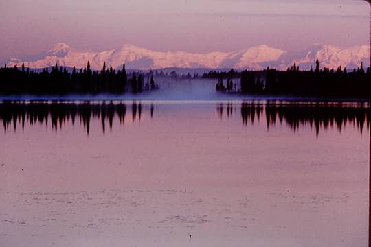
Mt Hood!
Passed by a few hours ago.... Good visibility!
|
| Back to top |
|
|
gb
Member
Joined: 01 Jul 2010
Posts: 6310 | TRs | Pics
|
|
gb
Member
|
Tue Sep 11, 2018 5:59 pm |
|
|
| gb wrote: | It is finally going to really rain:
NWS: | Quote: | | .SHORT TERM...Satellite and radar imagery show a cold front
extending from central Vancouver Island southwestward into the
coastal waters. This front will move onshore late this afternoon
and through the overnight. Rainfall amounts with the front will
average 0.5 to 1.0 inches on the western Olympic Peninsula and
northern Cascades and 0.2 to 0.5 inches elsewhere. Winds will be
locally breezy ahead of the front with a few gusts to around 25
mph. |
At 5:00pm September 9th, 1.17 to 1.25" has fallen on the West Slopes of the Olympics and Baker has about .4" after receiving that much two days ago as well.
It would look that rainfall amounts by Wednesday PM should be in the .4" to 2" range depending on North/South and East/West. The fires should see quite a bit of slowing. Hopefully, the convergence zone extends up the Suiattle. |
Rainfall amounts have generally already reached these amounts .4" south and east and 2" West slopes except in the southeast and near Washington Pass. But it appeared much of that area has had .2-.3" today with more yet to come. To help even more, mountain humidities are very high at 93-98%. The Miriam fire should see a dousing as the low begins to move inland Friday.
|
| Back to top |
|
|
treeswarper
Alleged Sockpuppet!
Joined: 25 Dec 2006
Posts: 11278 | TRs | Pics
Location: Don't move here |
|
treeswarper
Alleged Sockpuppet!
|
Tue Sep 11, 2018 9:09 pm |
|
|
About 3 drops fell here. According to my friend's phone, the Aeneas Valley, Wauconda, Curlew, etc. were getting a lot of lightning strikes.
What's especially fun about sock puppets is that you can make each one unique and individual, so that they each have special characters. And they don't have to be humananimals and aliens are great possibilities
What's especially fun about sock puppets is that you can make each one unique and individual, so that they each have special characters. And they don't have to be humananimals and aliens are great possibilities
|
| Back to top |
|
|
gb
Member
Joined: 01 Jul 2010
Posts: 6310 | TRs | Pics
|
|
gb
Member
|
Wed Sep 12, 2018 7:44 am |
|
|
| treeswarper wrote: | | About 3 drops fell here. According to my friend's phone, the Aeneas Valley, Wauconda, Curlew, etc. were getting a lot of lightning strikes. |
My quote was about the Cascades and Olympics. There was lightning in the Puget Sound basin yesterday but it did not appear to reach the Cascades. NE Washington is a different story. There were many strikes yesterday in that area and I would imagine it is still dry, albeit cool.
|
| Back to top |
|
|
|
|


