| Previous :: Next Topic |
| Author |
Message |
Matt Lemke
High on the Outdoors


Joined: 15 Jul 2010
Posts: 2052 | TRs | Pics
Location: Grand Junction |
|
Matt Lemke
High on the Outdoors
|
 Wed Sep 19, 2018 9:18 pm |
|
|
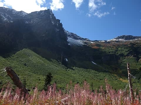
I'll try to make this short and sweet, but on Monday and Tuesday this week, Josh and I took advantage of the awesome weather and climbed Fortress and Buck. The clear, crisp, smoke free air, along with the fresh snow made this trip possibly one of the most scenic climbs I've ever done in the Cascades. Fortress and Buck were Bulger numbers 98 and 99 for me, which Josh finished number 100, and became the 71st person to complete the list, when we summitted Buck Mountain at 2:25PM on the 18th. Congrats Josh!!
I picked Josh up in Lynnwood around 6am Monday and by 10:45 we were starting up the Buck Creek Trail from the end of the Chiwawa River Road (which is now re-opened). We made quick time getting most of the way up the trail, and when we reached the small basin eading up to Pass No Pass, we veered right and hiked 700 feet up on mostly bare grasses and heather to a flat spot only 100 feet below the pass where we dropped our packs. Here we split up, and I ascended the standard SW face of Fortress. Since Josh had done Fortress years before, he scrambled up the NE ridge of Helmet Butte while I did Fortress.
The initial ascent from the pass was up steep grass, but the angle decreased as I got higher. When I finally got my first view of Fortress, I could see how much fresh snow I had to deal with. Only wearing tennis shoes, I mentally prepared myself for wet feet and continued up the ridge. When I arrived at the base of the upper slopes, I did some class 4 slab scrambling to try and stay on dry rock in an effort to keep my feet dry, however the final 500 feet was mostly class 2 talus, and I was forced to step in the fresh snow more often. Glacier Peak was towering mightily behind Helmet Butte from my vantage and Bonanza dominating the view to the right. From the summit, I was in total awe at the beauty of the area with the fresh snow, and looking over to Buck, it appeared as if there was much more snow over yonder. I certainly hoped my shoes would hold up!
I didn't stay on the summit long as it was getting a little late and I am sure Josh was waiting, since his ascent was much shorter. I made good time down and by 5:30 we started back down to the trail. After consuming our weights worth of fresh amazing blueberries, we hiked the rest of the way to Buck Creek Pass and I was shocked to see nearly a dozen people around. Many of them were hunters. Just as we arrived at the pass, the sunset lighting on Buck and Glacier Peak were out of this world! We chatted with a guy who clearly had the best camp spot with a perfect view of Glacier, but unfortunately we had to drop into the trees about 100 feet to the actuall ,ow spot in the pass and find a clear spot to pitch the tent. We found a spot right next to the small spring, which at least allowed us close access to water. We photographed the sunset, pitched the tent and made dinner. By 8:30 I was asleep.
 Cleator from the trail 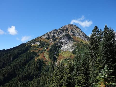 Helmet Butte 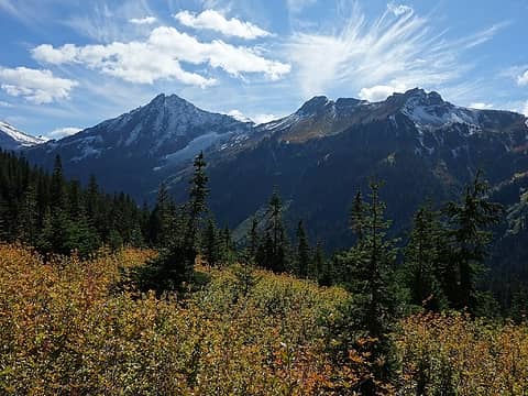 Buck from route to Pass No Pass  Ascending to Pass No Pass 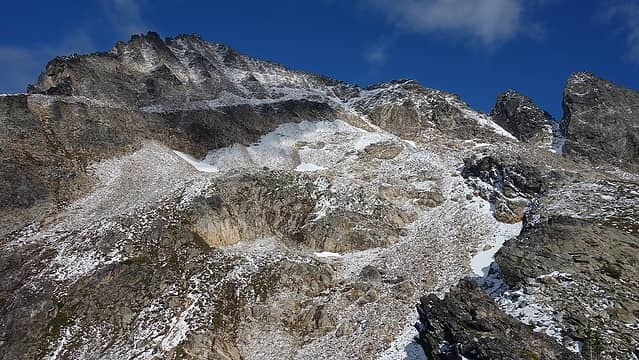 First view of Fortress 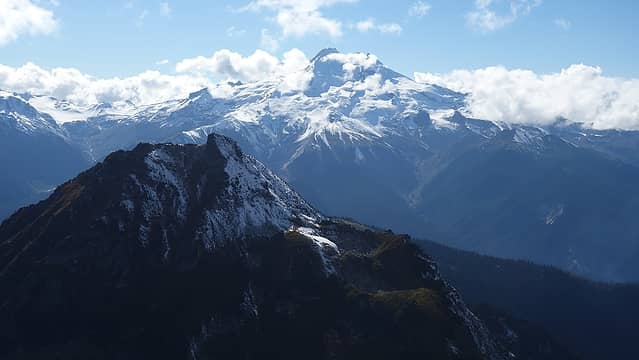 Glacier and Helmet Butte 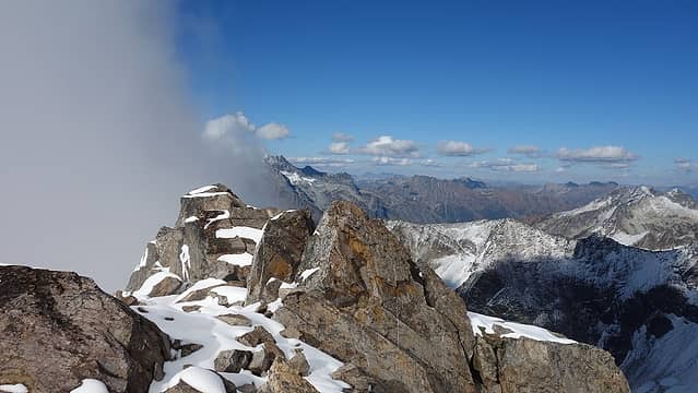 Some clouds as I summit 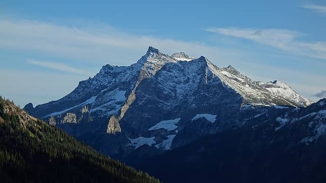 Sunset on Buck  Glowing! 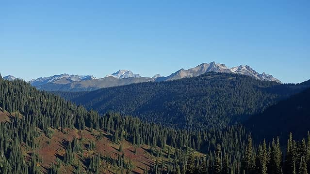 Dome and Sinister 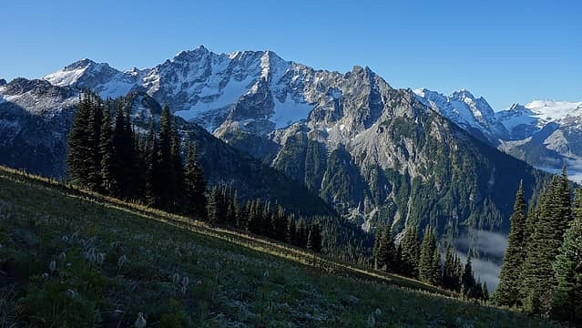 Cirque Peak looking amazing 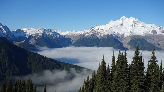 Glacier Peak and Upper Suiattle 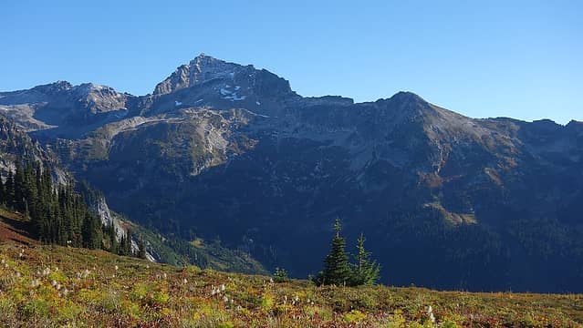 Fortress Mountain 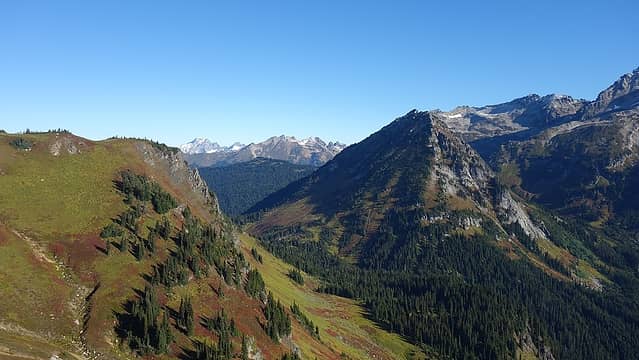 Buck Creek Pass from High Pass Trail 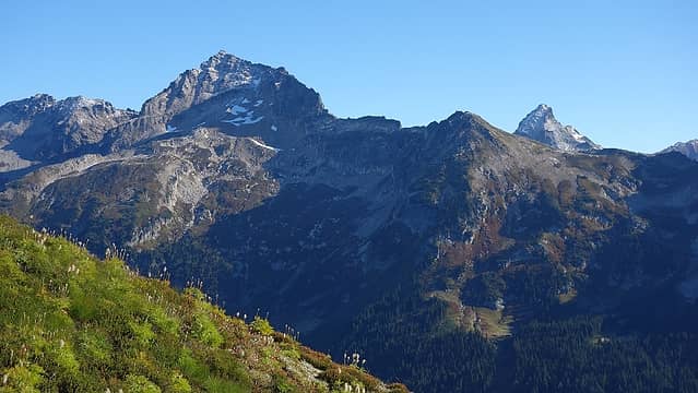 Fortress 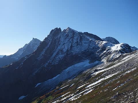 Mount Cleator 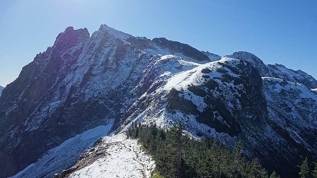 Cleator 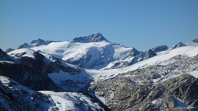 Clark Peak 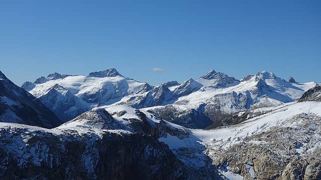 Clark and Luahna 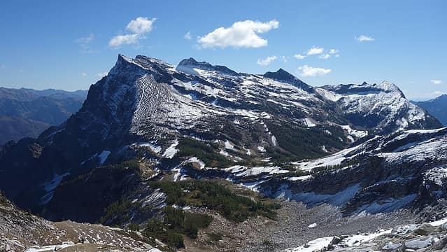 Buck from 7600' Pass SW of Berge 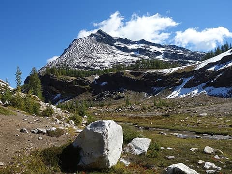 Looking up the west slopes of Buck 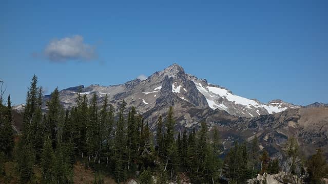 New angle on Fortress 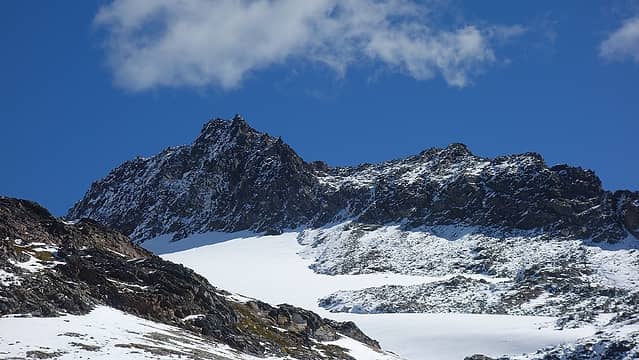 Rugged sub-summit just to the south 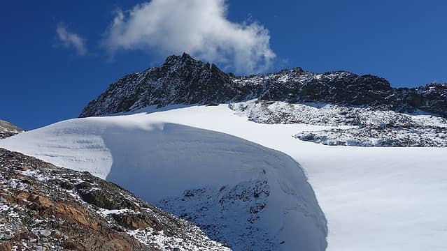 Remnants of the glacier 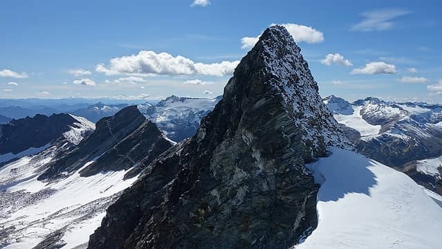 If this was the true summit Buck would be much harder! 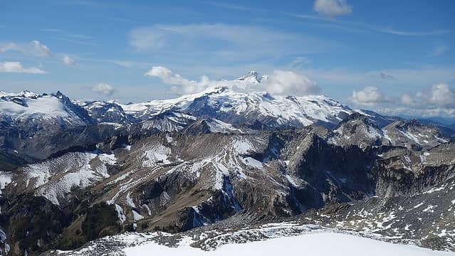 Glacier Peak 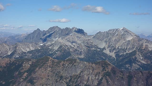 Maude, 7FJ, Fernow 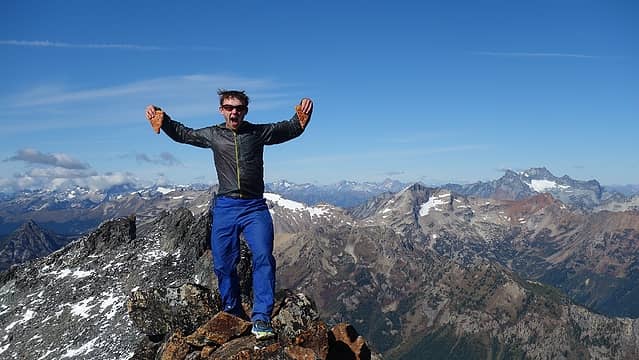 Josh celebrating 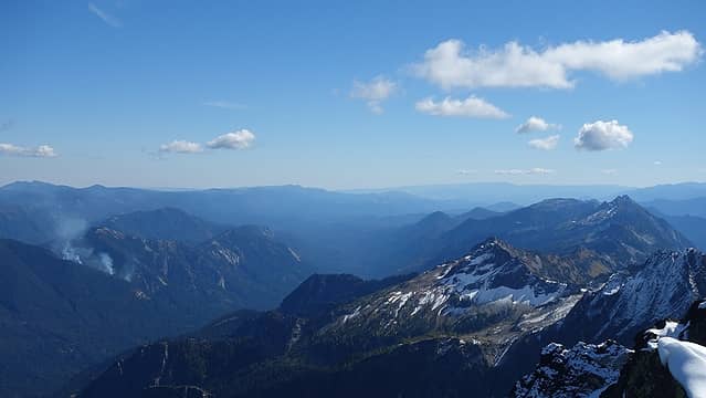 Fire above Chiwawa valley 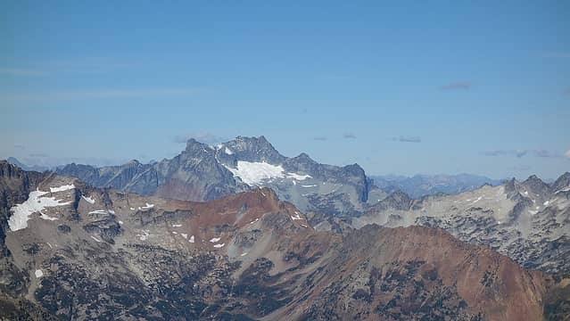 Bonanza 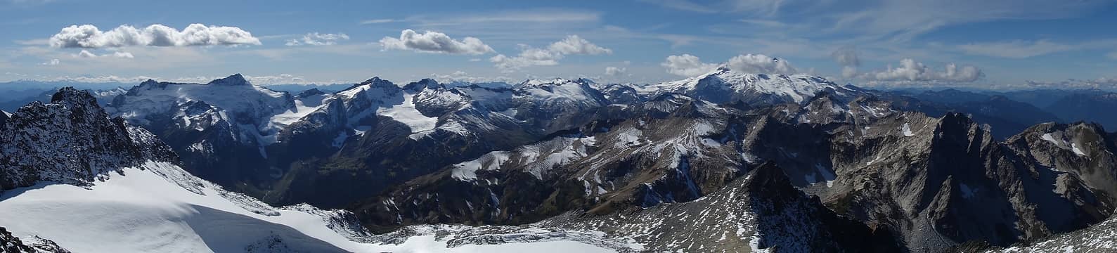 Summit pano 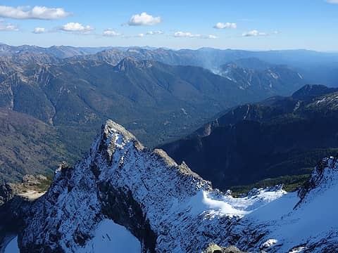 North face of the west ridge 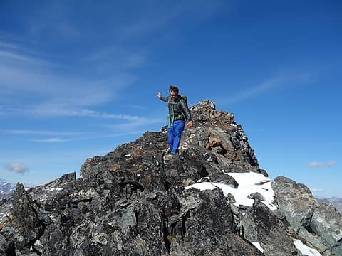 Josh scrambling down 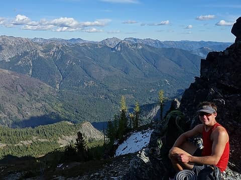 Resting at the 7140' notch 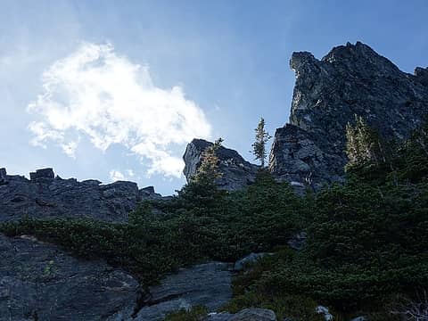 Look for this feature when ascending this route 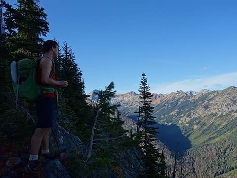 Descending the lower west ridge
|
| Back to top |
  
|
|
RichP
Member

Joined: 13 Jul 2006
Posts: 5634 | TRs | Pics
Location: here |
|
RichP
Member
|
Thu Sep 20, 2018 6:40 am |
|
|
Congrats to Josh!  A perfect way to finish. Your pics are stunning, Matt. A perfect way to finish. Your pics are stunning, Matt.  Just a hop, skip, and jump for you to finish too.
|
| Back to top |
|
|
Nancyann
Member

Joined: 28 Jul 2013
Posts: 2319 | TRs | Pics
Location: Sultan Basin |
|
Nancyann
Member
|
Thu Sep 20, 2018 7:31 am |
|
|
Congratulations, Josh, and thank you, Matt for the glorious photos. To me, Glacier Peak always looks its best with a fresh cost of snow.
|
| Back to top |
|
|
HitTheTrail
Member

Joined: 30 Oct 2007
Posts: 5458 | TRs | Pics
Location: 509 |
I always knew Josh could do it.
|
| Back to top |
|
|
Steve
Phlogiston Purveyor
Joined: 29 Jan 2002
Posts: 769 | TRs | Pics
Location: Bothell |
|
Steve
Phlogiston Purveyor
|
Tue Sep 25, 2018 11:29 am |
|
|
Apparently no problems with the nearby forest fires. I was thinking of doing the Buck Creek Pass trip with my dog when I return home in a week.
Despair is only for those who see the end beyond all doubt.
Despair is only for those who see the end beyond all doubt.
|
| Back to top |
|
|
AlpineRose
Member
Joined: 08 May 2012
Posts: 1953 | TRs | Pics
|
Congratulations, Josh. Is Josh the youngest person to complete the Bulgers?
|
| Back to top |
|
|
Matt Lemke
High on the Outdoors
Joined: 15 Jul 2010
Posts: 2052 | TRs | Pics
Location: Grand Junction |
|
Matt Lemke
High on the Outdoors
|
Tue Sep 25, 2018 6:12 pm |
|
|
| AlpineRose wrote: | | Congratulations, Josh. Is Josh the youngest person to complete the Bulgers? |
Until Jake finishes next year yes!
|
| Back to top |
|
|
Brushbuffalo
Member

Joined: 17 Sep 2015
Posts: 1887 | TRs | Pics
Location: there earlier, here now, somewhere later... Bellingham in between |
Congratulations, Josh! And in advance, to you too, Matt!
How wonderful to view your stunning pictures with such blue skies after this smoky late summer.
It looks like that small fire you photographed was growing between the first and second shot. Hopefully both external and internal moisture are of sufficiently high levels now to prevent more flare-ups.
Passing rocks and trees like they were standing still
Passing rocks and trees like they were standing still
|
| Back to top |
|
|
|
|
You cannot post new topics in this forum
You cannot reply to topics in this forum
You cannot edit your posts in this forum
You cannot delete your posts in this forum
You cannot vote in polls in this forum
|
Disclosure: As an Amazon Associate NWHikers.net earns from qualifying purchases when you use our link(s). |


