| Previous :: Next Topic |
| Author |
Message |
cartman
Member


Joined: 20 Feb 2007
Posts: 2800 | TRs | Pics
Location: Fremont |
|
cartman
Member
|
 Fri Oct 12, 2018 9:58 pm |
|
|
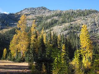 The larch meadow 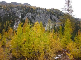 Larches everywhere 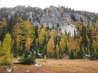 Larchy meadow 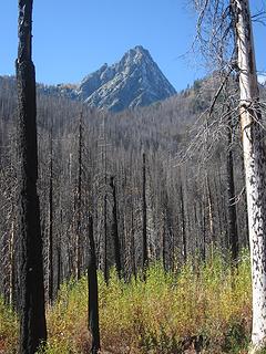 Devils Smokestack 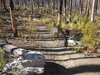 Myrtle Lake turnoff 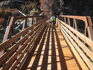 New bridge 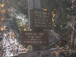 Junction 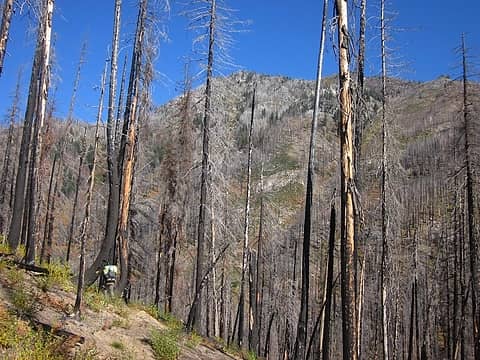 Connector trail 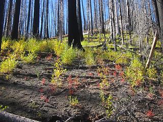 Color in the burn 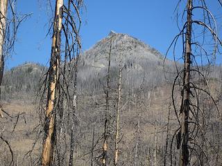 Gopher 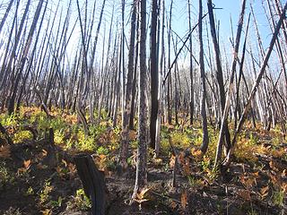 Larch Lakes trail burn 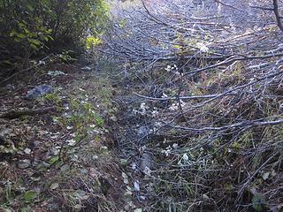 Larch Lakes trail needs maintenance 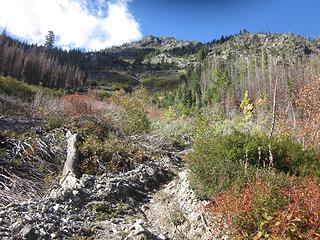 Lost the trail 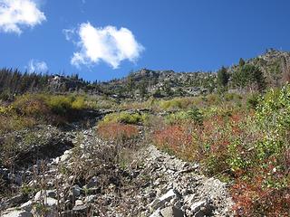 Higher in the gully 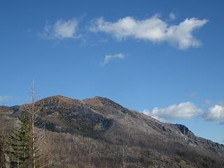 Duncan Hill 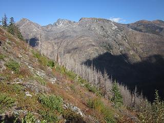 Gopher, Choral, 7363, Duncan Hill 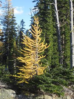 Larch 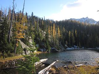 Lower Larch Lake 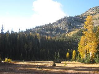 Into the meadow The larch meadow 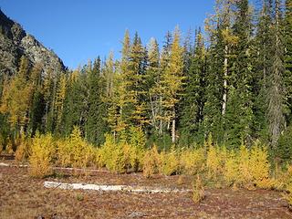 The larch nursery 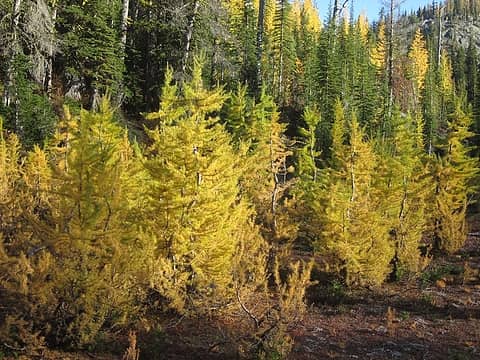 Middle school  Upper larch lake 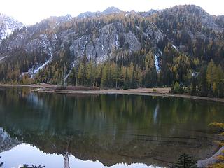 Reflection 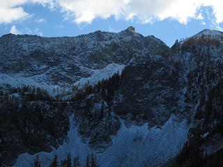 Fall snow 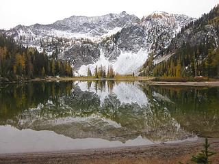 Shore reflection 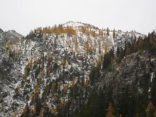 Ridge larches 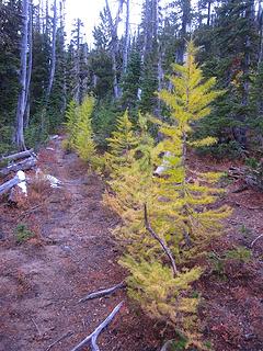 Trail north 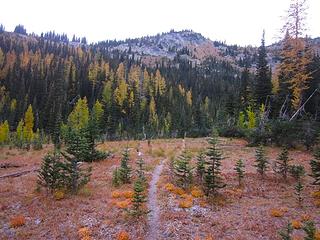 Meadow trail 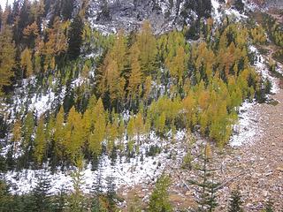 Larches 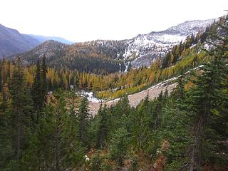 View 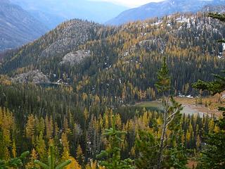 Larch Lakes 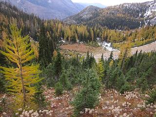 Meadow larches 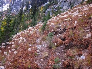 Western anemone on the trail 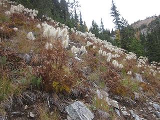 Hillside anemone 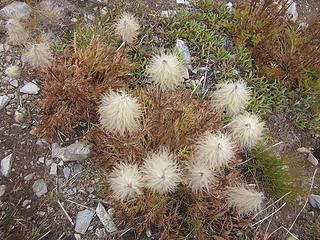 Western anemone 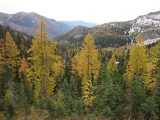 Larch vista 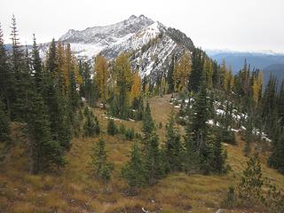 Looking back to Fifth of July Mtn 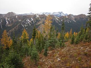 Dakobeds and larches 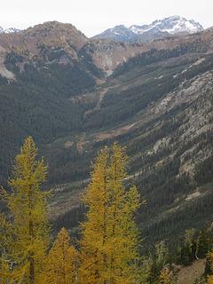 Carne Mtn and Rock Creek Valley 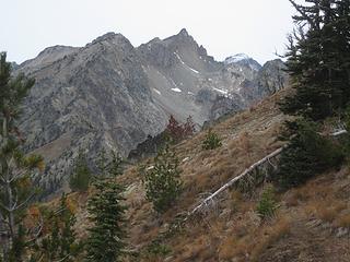 Chilly 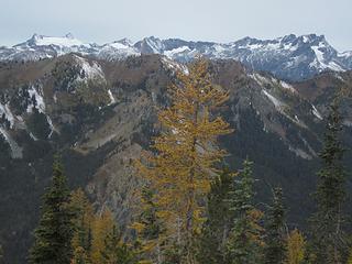 The Dakobeds 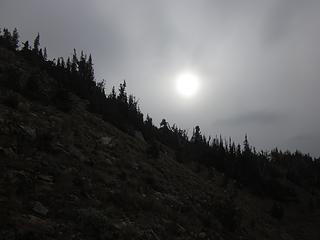 "Partly sunny" 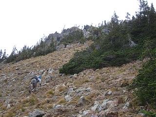 Scrambling 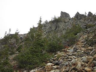 Krummholz 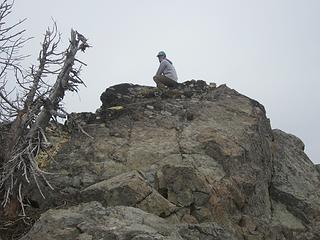 Brenda on the false summit 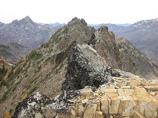 That one is higher 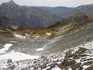 Pretty north basin 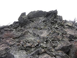 Summit block  Pomas summit register 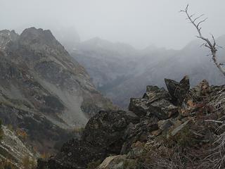 Approaching storm 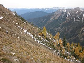 Traversing 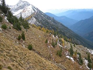 And back to the trail 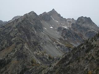 Last look at Chilly 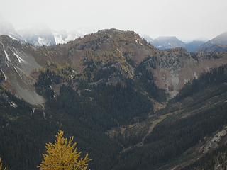 Carne Mtn. 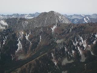 Old Gib 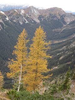 Larches and Carne 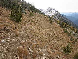 Pomas Mtn trail 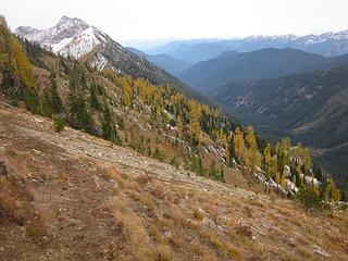 Trail and larches 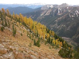 Larches on the slope 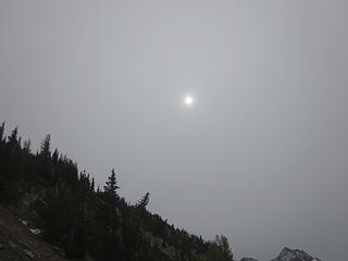 Still partly sunny 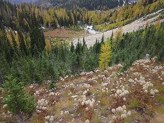 Return to Magicland 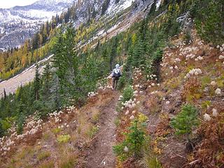 Fairyland 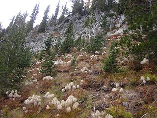 Poofs  Magical 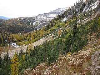 I wanna stay 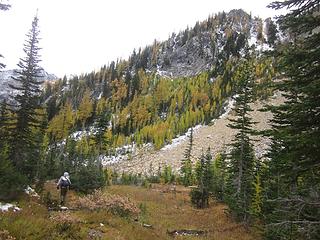 Back to the meadows 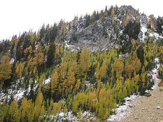 Slope larches 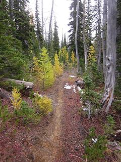 Trail to the lake 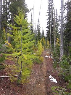 Trail larches 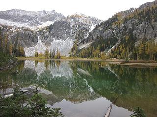 Mountain reflection 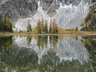 The other side 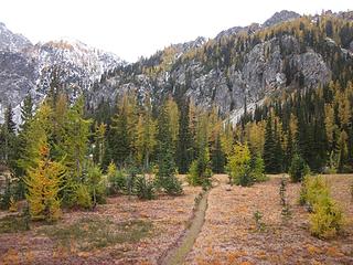 Trail to camp 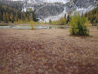 Let's see what's over there 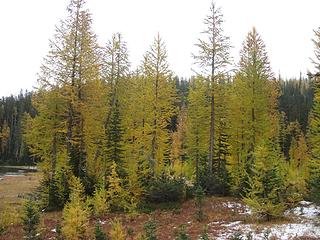 Larch Land Larchy meadow 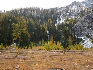 Around the lake 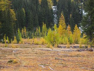 Larch grove 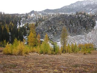 Looking back 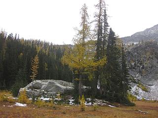 Boulder and tall larch 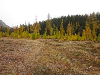 More larches 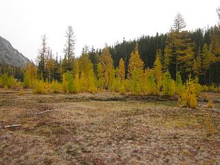 Inviting 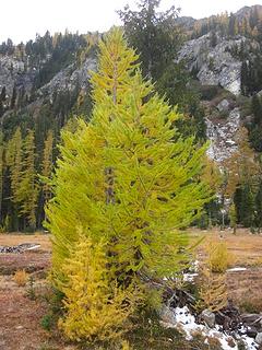 Larch 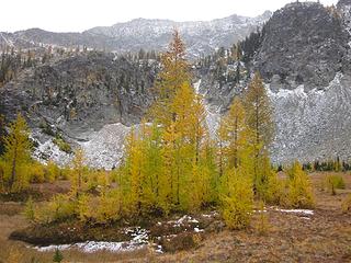 Another larch grove 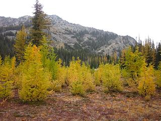 Into the grove 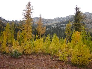 Surrounded Larches everywhere 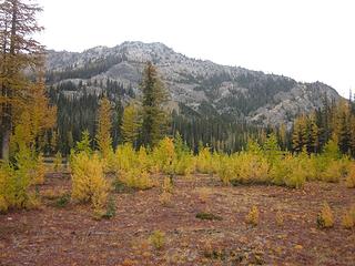 Baby larches 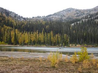 Upper Larch Lake, from the other side 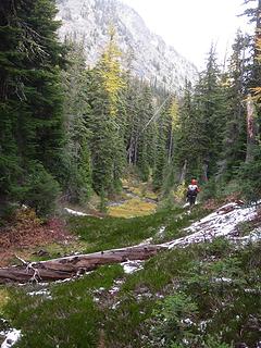 Path 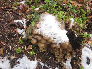 Snowshroom 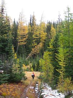 Entering the lower meadow 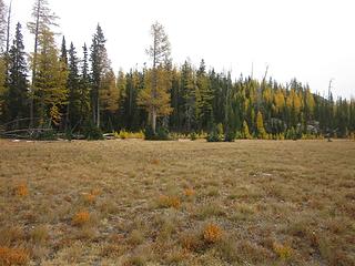 Expansive 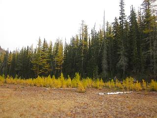 Nursery time 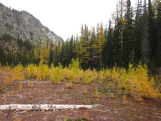 Babes 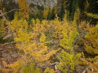 A gaggle of little ones 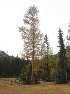 Patriarch 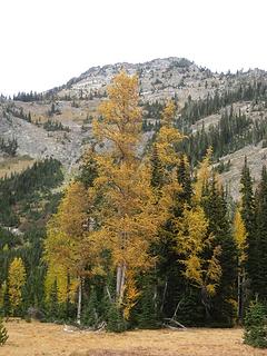 Another big 'un 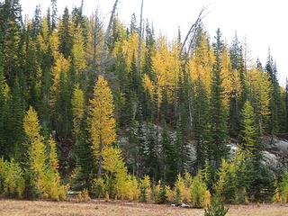 Slope larches 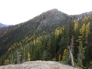 Mixed in  Trail larches 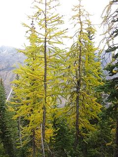 Trail larches 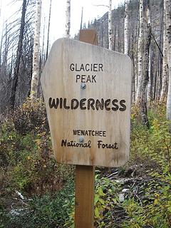 Goodbye GPW
|
| Back to top |
  
|
|
Brushbuffalo
Member

Joined: 17 Sep 2015
Posts: 1887 | TRs | Pics
Location: there earlier, here now, somewhere later... Bellingham in between |
Very nice, Eric. You consistently capture what must be the best "larchiness" year after year.
Your middle name should be 'larch'.
Passing rocks and trees like they were standing still
Passing rocks and trees like they were standing still
|
| Back to top |
|
|
Bootpathguy
Member
Joined: 18 Jun 2015
Posts: 1788 | TRs | Pics
Location: United States |
| cartman wrote: | The other side |
Very nice!  Like how you captured the water "ring" of a rising fish
Experience is what'cha get, when you get what'cha don't want
Experience is what'cha get, when you get what'cha don't want
|
| Back to top |
|
|
HitTheTrail
Member

Joined: 30 Oct 2007
Posts: 5455 | TRs | Pics
Location: 509 |
| cartman wrote: | | This is one of the most unique places I've ever seen in nearly twenty years roaming the Cascades. It's so wonderful I don't want to leave. Even my normal summit yearning is suspended by the magic of this spot. |
I tend to agree with this statement.
However, that narrow trail along the steep hard bare slope going out toward Pomas Pass made me nervous. If you were too distracted taking in the surrounding beauty and misstepped you would tumble all the way down into Rock Creek!
|
| Back to top |
|
|
Navy salad
Member

Joined: 09 Sep 2008
Posts: 1865 | TRs | Pics
Location: Woodinville |
Wow! Thanks for the thorough trip report! This must have taken a while to put together!
|
| Back to top |
|
|
Ski
><((((°>

Joined: 28 May 2005
Posts: 12829 | TRs | Pics
Location: tacoma |
|
Ski
><((((°>
|
Sat Oct 13, 2018 1:51 pm |
|
|
excellent!
"I shall wear white flannel trousers, and walk upon the beach.
I have heard the mermaids singing, each to each."
"I shall wear white flannel trousers, and walk upon the beach.
I have heard the mermaids singing, each to each."
|
| Back to top |
|
|
ReubenD
Member

Joined: 29 Sep 2013
Posts: 33 | TRs | Pics
Location: Seattle |
|
ReubenD
Member
|
Mon Oct 15, 2018 8:05 pm |
|
|
I was excited to post a TR for this one thinking that it seemingly doesn't get a lot of traffic, but I guess you beat me to it by a week, cartman.  Our route differed slightly in that we went skipped Myrtle lake and headed directly to Larch Lakes for the first night. The lake froze partially overnight, but the sun was warm and we lazed around taking pictures and eating a warm breakfast. Larches are definitely peaking right now.
The second day we headed up the Garland Peak trail towards the junction with the Cow Creek Meadows trail and got some more larches along the ridge above the lake. The trail along here is well maintained and easy to follow once you get to the other side of the Larch Lakes meadow.
Looking down on Cow Creek Meadows from an overlook was kind of sad. It looks a week or so past prime colors and especially depressed with the burn all around it. The trail going down to the meadow from the Garland junction is in need of maintenance, with lots of burned blowdowns slowing our progress. The meadow itself is very beautiful, however, and there look to be some nice camping spots in the woods just next to it.
The trail down from Cow Creek Meadows had occasional blowdowns and suffered from some erosion, but it went fairly quick and soon we were at Myrtle Lake.
We didn't stay long, wanting to ford the Entiat (not realizing there was a new bridge!), and made short work of the trail back to catch burgers in Leavenworth for dinner.
Our route differed slightly in that we went skipped Myrtle lake and headed directly to Larch Lakes for the first night. The lake froze partially overnight, but the sun was warm and we lazed around taking pictures and eating a warm breakfast. Larches are definitely peaking right now.
The second day we headed up the Garland Peak trail towards the junction with the Cow Creek Meadows trail and got some more larches along the ridge above the lake. The trail along here is well maintained and easy to follow once you get to the other side of the Larch Lakes meadow.
Looking down on Cow Creek Meadows from an overlook was kind of sad. It looks a week or so past prime colors and especially depressed with the burn all around it. The trail going down to the meadow from the Garland junction is in need of maintenance, with lots of burned blowdowns slowing our progress. The meadow itself is very beautiful, however, and there look to be some nice camping spots in the woods just next to it.
The trail down from Cow Creek Meadows had occasional blowdowns and suffered from some erosion, but it went fairly quick and soon we were at Myrtle Lake.
We didn't stay long, wanting to ford the Entiat (not realizing there was a new bridge!), and made short work of the trail back to catch burgers in Leavenworth for dinner.
|
| Back to top |
|
|
grannyhiker
Member

Joined: 29 Jul 2006
Posts: 3519 | TRs | Pics
Location: Gateway to the Columbia Gorge |
Thank you for sharing the wonderful photos!
During the Wolverine Fire I was checking maps every day to see what was happening to Larch Lakes. I'm so glad to see the larches survived! Although I expected it, it was still shocking to see poor Cow Creek Meadow! Although I'm glad those baby larches at the edge of the meadow are evidently doing fine.
Any chance of getting WTA to help before those burnt over trails (like the Larch Lakes trail) are completely gone?
May your trails be crooked, winding, lonesome, dangerous, leading to the most amazing view.--E.Abbey
May your trails be crooked, winding, lonesome, dangerous, leading to the most amazing view.--E.Abbey
|
| Back to top |
|
|
|
|
You cannot post new topics in this forum
You cannot reply to topics in this forum
You cannot edit your posts in this forum
You cannot delete your posts in this forum
You cannot vote in polls in this forum
|
Disclosure: As an Amazon Associate NWHikers.net earns from qualifying purchases when you use our link(s). |


