| Previous :: Next Topic |
| Author |
Message |
Michael Lewis
Taking a nap

Joined: 27 Apr 2009
Posts: 629 | TRs | Pics
Location: Lynnwood, WA (for now) |
I had an over-the-road (long haul) trucking job during the summer. Hauling trailers for 10-11 hour shifts as a team meant the truck was constantly moving and didn't leave much room/time for exercise but when I was solo I could use my spare time to get out. Did some hikes when I just so happened to shut down in a town/rest stop nearby. I managed to see cool places I never would have without the opportunity that truck driving presented.
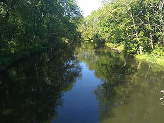
Pohatcong River
Chicago
Moab area
Leg Benchmark (WY)
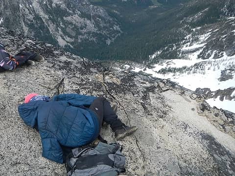
Timpanogos (UT)
Black Peak (CA)
Star Peak (NV)
Pohatcong River, New Jersey
The first hike I did was during what they call a "34 hour Reset." After 70 hours driving in 8 days we are required to shut down for 34 hours. I was still in training and my instructor was taking a nap so I spent some time to see what the Garden State was all about. Flowers did abound and greenery was more present than my evergreen roots allowed me to believe.
 Pohatcong River 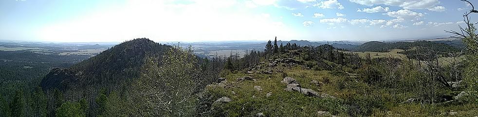 Leg pano 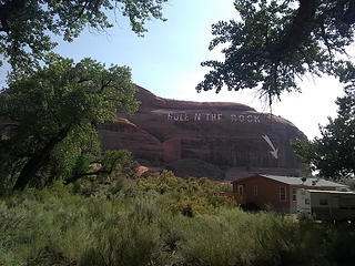 Hole N the Rock 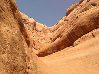 pitch 1 flipflops 0 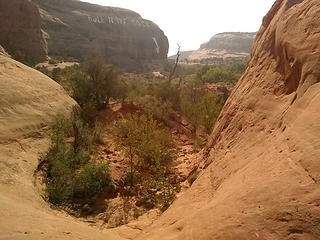 bowl 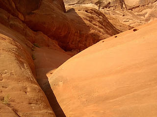 A little sketch for flipflops 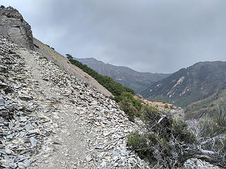 gloomy start 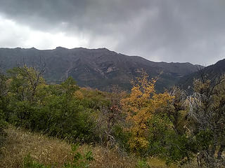 Timpanogos 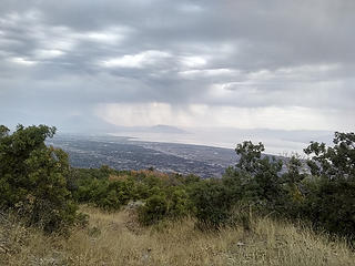 breaking storms 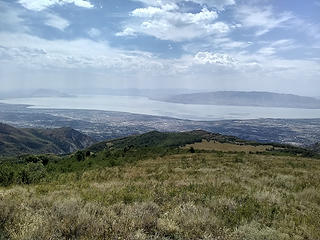 sun break 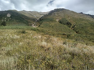 Route up 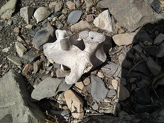 vertibral process? 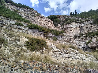 dry fall area 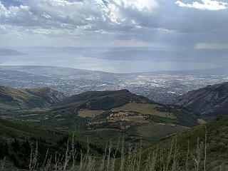 turn around point 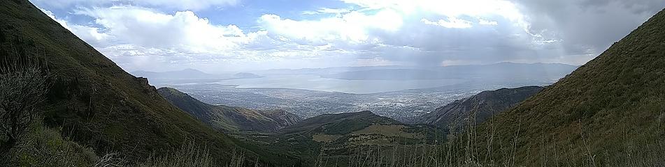 Timp Pano 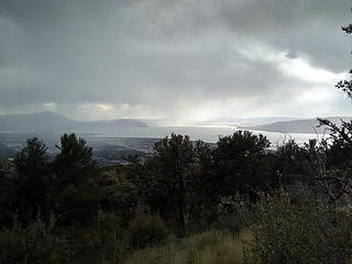 Storms are back 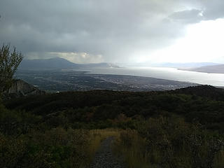 wet 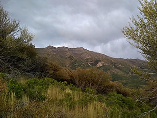 gloomy finish 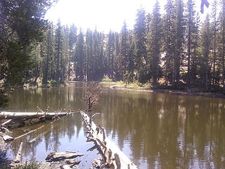 West Lake 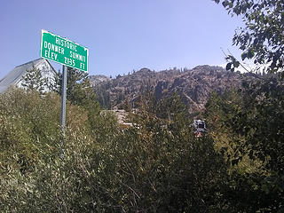 donner pass  Truckee down there  Donner
|
| Back to top |
  
|
|
Ski
><((((°>

Joined: 28 May 2005
Posts: 12832 | TRs | Pics
Location: tacoma |
|
Ski
><((((°>
|
 Mon Nov 05, 2018 6:00 am |
|
|
get it where you can find it! 
"I shall wear white flannel trousers, and walk upon the beach.
I have heard the mermaids singing, each to each."
"I shall wear white flannel trousers, and walk upon the beach.
I have heard the mermaids singing, each to each."
|
| Back to top |
|
|
timberghost
Member

Joined: 06 Dec 2011
Posts: 1332 | TRs | Pics
|
|
| Back to top |
|
|
Gimpilator
infinity/21M

Joined: 12 Oct 2006
Posts: 1684 | TRs | Pics
Location: Edmonds, WA |
What an interesting and varied assortment of hikes. I enjoy your writing style. Missed hiking with you this summer, but glad to see you managed to get some peaks despite the demanding job.
|
| Back to top |
|
|
Roly Poly
Member
Joined: 02 Jan 2013
Posts: 713 | TRs | Pics
|
This is fantastic, Michael. So happy for you!
|
| Back to top |
|
|
puzzlr
Mid Fork Rocks

Joined: 13 Feb 2007
Posts: 7220 | TRs | Pics
Location: Stuck in the middle |
|
puzzlr
Mid Fork Rocks
|
Mon Nov 05, 2018 3:25 pm |
|
|
I really enjoy hiking up peaks that standout from the roads like Black Butte. We did that as a compensation hike after failing to get up Shasta because of weather.
|
| Back to top |
|
|
Brushbuffalo
Member

Joined: 17 Sep 2015
Posts: 1887 | TRs | Pics
Location: there earlier, here now, somewhere later... Bellingham in between |
Creative way to make the most of each opportunity. Very fine!
Was there once a lookout on Black Butte?
Edit:
Google Earth shows a square foundation on top, part of which is shown in Michael's picture.
Passing rocks and trees like they were standing still
Passing rocks and trees like they were standing still
|
| Back to top |
|
|
Sculpin
Member

Joined: 23 Apr 2015
Posts: 1383 | TRs | Pics
|
|
Sculpin
Member
|
Tue Nov 06, 2018 8:59 am |
|
|
"Truck-n-hike, that is a little different! I certainly understand the rationale.
I just got back from helping my mother move from Harlingen, TX, to Columbia, MO, an 18-hour drive in a U-haul through way too much of Texas (the roads are terrible!). The entire stretch is a trail desert.  I have read that there is almost no public land in Texas because of land grants when it was under Mexican control.
My bro-in-law and I managed to have a little fun as we went around Corpus Christi. The impressive pile of harbor dredgings became "Corpus Ridge." A vast sand and gravel operation became the "Corpus Badlands." And of course, the biggest freeway overpass became "Corpus Pass." Once we got over the "pass," we asked Siri to tell us our elevation, and she replied with 6.50 feet. I guess she was programmed to give at least three significant digits, but not to determine significant figures. I have read that there is almost no public land in Texas because of land grants when it was under Mexican control.
My bro-in-law and I managed to have a little fun as we went around Corpus Christi. The impressive pile of harbor dredgings became "Corpus Ridge." A vast sand and gravel operation became the "Corpus Badlands." And of course, the biggest freeway overpass became "Corpus Pass." Once we got over the "pass," we asked Siri to tell us our elevation, and she replied with 6.50 feet. I guess she was programmed to give at least three significant digits, but not to determine significant figures. 
| Brushbuffalo wrote: | | Was there once a lookout on Black Butte? |
I dunno, but I might be climbing it on Friday; if I do I will poke around.
Between every two pines is a doorway to the new world. - John Muir
Between every two pines is a doorway to the new world. - John Muir
|
| Back to top |
|
|
Fletcher
Member

Joined: 29 Jul 2009
Posts: 1870 | TRs | Pics
Location: kirkland |
|
Fletcher
Member
|
Wed Nov 07, 2018 6:17 pm |
|
|
Awesome that you were able to get some hikes and peaks in Mike!
|
| Back to top |
|
|
Redwic
Unlisted Free Agent

Joined: 23 Feb 2009
Posts: 3292 | TRs | Pics
Location: Going to the Prom(inence) |
|
Redwic
Unlisted Free Agent
|
Sun Nov 11, 2018 6:52 pm |
|
|
60 pounds lighter but not 60 points brighter.
|
| Back to top |
|
|
|
|


