| Previous :: Next Topic |
| Author |
Message |
jask
Member


Joined: 21 Nov 2014
Posts: 47 | TRs | Pics
Location: Pacific Northwest and Norway |
|
jask
Member
|
 Fri Nov 30, 2018 2:57 am |
|
|
This year's trip in July started at Deer Park and ended in the parking lot on the Elwha. I always like to plan for part of the trip to be cross-country, and because we attempted the same hike in 2014 going the opposite direction but were forced down by bad weather, it seemed like a good idea to try and do it right this time.
We followed Cameron Creek to the upper ford where we crossed, but instead of continuing by trail to Cameron Pass, veered off to the right and ended up in a big, open basin where plenty of water is available.
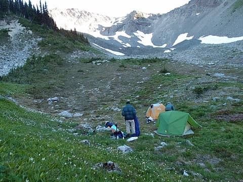 shortcut: up the ridge to the right 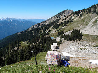 overlooking lk 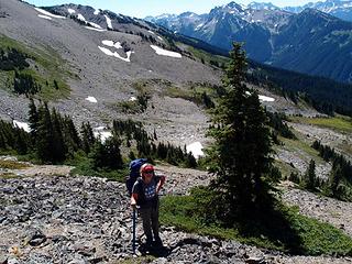 trail visible in background 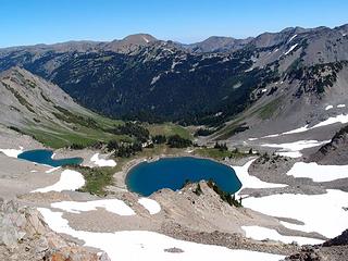 looking down on Lk. Lillian 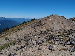 ridge above Lillian 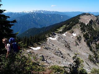 Windfall Peak in background 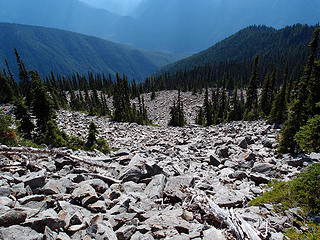 Elwha valley & ridge we followed down 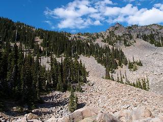 you need to like rocks if you do this trip 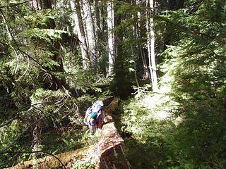 heading down to the Elwha
|
| Back to top |
  
|
|
RodF
Member

Joined: 01 Sep 2007
Posts: 2593 | TRs | Pics
Location: Sequim WA |
|
RodF
Member
|
Fri Nov 30, 2018 3:47 pm |
|
|
Very nice. Imagine it's much easier route to do this way, than to pack water most of the way up from the Elwha to Windfall Peak? Thanks for sharing!
"of all the paths you take in life, make sure a few of them are dirt" - John Muir
"the wild is not the opposite of cultivated. It is the opposite of the captivated - Vandana Shiva
"of all the paths you take in life, make sure a few of them are dirt" - John Muir
"the wild is not the opposite of cultivated. It is the opposite of the captivated - Vandana Shiva
|
| Back to top |
|
|
meck
Member

Joined: 31 Dec 2010
Posts: 920 | TRs | Pics
|
|
meck
Member
|
Fri Nov 30, 2018 7:56 pm |
|
|
Sounds like a wonderful trip jask! I take it the smoke had cleared out (or rather had not arrived) at that time?
*Just say NO to Rent-Seeking, don't give up the concept of "ownership"*
*Just say NO to Rent-Seeking, don't give up the concept of "ownership"*
|
| Back to top |
|
|
jask
Member
Joined: 21 Nov 2014
Posts: 47 | TRs | Pics
Location: Pacific Northwest and Norway |
|
jask
Member
|
Sat Dec 01, 2018 7:37 am |
|
|
The air was clear as a bell. Water from the base of Windfall Peak is available before it tumbles down into the Lost River drainage. Rod F - I think going up Stony Creek from the Elwha was easier than going down. When we did that trip in the opposite direction we exited via Lake Lillian/Obstruction Point. It was kind of a nice trip except for the weather.
|
| Back to top |
|
|
Pyrites
Member
Joined: 16 Sep 2014
Posts: 1884 | TRs | Pics
Location: South Sound |
|
Pyrites
Member
|
Sat Dec 01, 2018 7:21 pm |
|
|
Flat out gorgeous.
Keep Calm and Carry On?
Heck No.
Stay Excited and Get Outside!
Keep Calm and Carry On?
Heck No.
Stay Excited and Get Outside!
|
| Back to top |
|
|
|
|


