| Previous :: Next Topic |
| Author |
Message |
Gimpilator
infinity/21M


Joined: 12 Oct 2006
Posts: 1684 | TRs | Pics
Location: Edmonds, WA |
Earlier this year, I told my friend Matthias that I would like to join him for his list finish of the Arizona P2ks, on Pinnacle Ridge. There are 73 peaks and roughly a dozen or less people have finished the list so far. Pinnacle Ridge is generally considered to be the toughest one, with route finding difficulty, horribly dense brush, and sketchy exposed scrambling at the end, which requires some technique. Greg and I saw Pinnacle Ridge from Mount Turnbull this last May, and it left an impression on me.
Matthias had made an attempt at the peak before and was able to get all the way to the summit pinnacle, but wasnt sure what to do after that. I told him I wanted to bring a rope and other gear, just in case, to make sure we got it. None of his other hiking friends wanted to do the peak, because of its reputation. As it turned out my buddy Greg K was happy to join us, and I knew he would make a strong addition to our team. Gregs always up for anything.
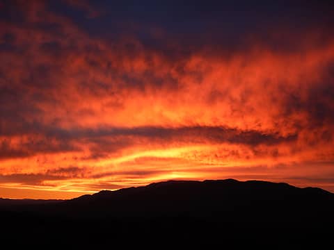 sunrise 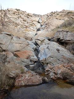 wet dryfall 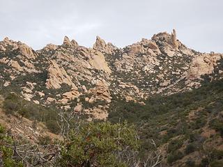 pinnacles east of the main peak 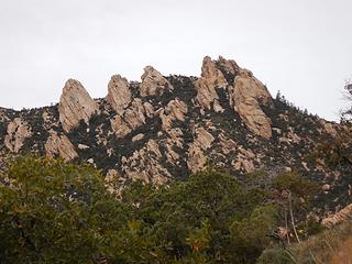 the main group of pinnacles 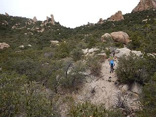 traverse below the saddle 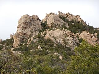 chute entrance left of center 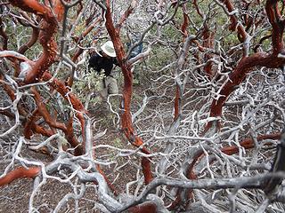 manzanita nirvana 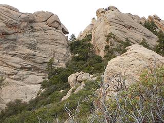 chute 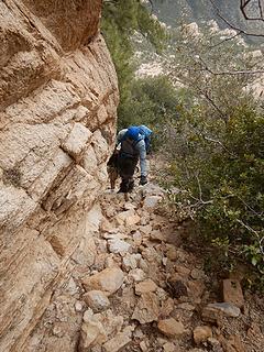 right side 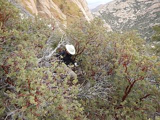 center 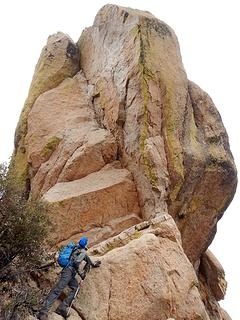 Greg directly underneath the actual summit 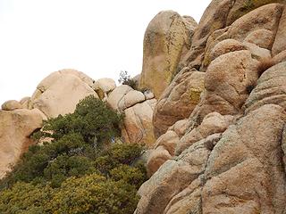 traverse along the west base 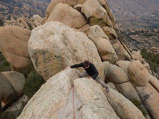 Matthias on the final move 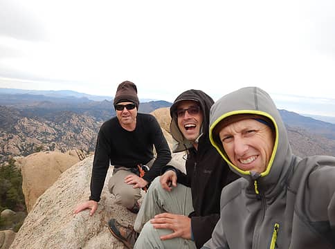 Pinnacle Ridge summit
|
| Back to top |
  
|
|
neek
Member

Joined: 12 Sep 2011
Posts: 2336 | TRs | Pics
Location: Seattle, WA |
|
neek
Member
|
 Mon Dec 17, 2018 8:22 pm |
|
|
In Arizona, bush whacks you! Cool report, and congrats to Matthias.
|
| Back to top |
|
|
awilsondc
Member

Joined: 03 Apr 2016
Posts: 1324 | TRs | Pics
|
Nice job fellas! 
|
| Back to top |
|
|
Jake Robinson
Member

Joined: 02 Aug 2016
Posts: 521 | TRs | Pics
|
Sounds like a tricky peak and a fun little routefinding puzzle. Congrats to everyone on the successful climb and to Matthias for the list finish!
| Gimpilator wrote: | | On a ledge below a slanting chimney, I suggested we put our harnesses on. I figured this might be the last spot where it was easy to do so. Even if they werent needed, its not a bad practice. |
Definitely a good practice, I was reminded of this recently when I has to put my harness on in a weird exposed spot. Wasn't too much fun.
|
| Back to top |
|
|
puzzlr
Mid Fork Rocks

Joined: 13 Feb 2007
Posts: 7220 | TRs | Pics
Location: Stuck in the middle |
|
puzzlr
Mid Fork Rocks
|
Mon Dec 17, 2018 10:39 pm |
|
|
Nicely detailed report. That looks like a really fun peak. Congrats on the successful summit.
| Gimpilator wrote: | manzanita nirvana |
This is a fine bushwhacking shot. They're hard to get.
|
| Back to top |
|
|
iron
Member

Joined: 10 Aug 2008
Posts: 6392 | TRs | Pics
Location: southeast kootenays |
|
iron
Member
|
Tue Dec 18, 2018 10:14 pm |
|
|
looks like gaiter terrain
|
| Back to top |
|
|
Michael Lewis
Taking a nap
Joined: 27 Apr 2009
Posts: 629 | TRs | Pics
Location: Lynnwood, WA (for now) |
|
| Back to top |
|
|
|
|
You cannot post new topics in this forum
You cannot reply to topics in this forum
You cannot edit your posts in this forum
You cannot delete your posts in this forum
You cannot vote in polls in this forum
|
Disclosure: As an Amazon Associate NWHikers.net earns from qualifying purchases when you use our link(s). |


