| Previous :: Next Topic |
| Author |
Message |
Gimpilator
infinity/21M


Joined: 12 Oct 2006
Posts: 1684 | TRs | Pics
Location: Edmonds, WA |
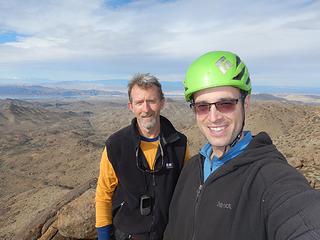
Very few people have climbed as many peaks in the Vegas area as Tracy Foutz. I started asking myself a year or two ago, Who is this guy?. He must be a bit of a local legend. After years of studying maps and subsequently visiting some very obscure locations, every time I pull out a register, Tracy Foutz has been there. Often he was the only one, or just one of two ascents in the last few decades. Because achieving obscurity is something we share an interest in, I wanted to meet him.
After a year of texting and emails, we found an open window. We agreed to go to the newly established Gold Butte National Monument. This group of peaks is sandwiched between the Virgin and Colorado rivers and Lake Mead. The straight line distance is not far from Las Vegas, however the bodies of water make it one of the more remote parts of Nevada. A common concern for people visiting the area is running out of gas.
Just two days before we were set to launch, Bob Burd invited me to join his group, who were also going to that area. Of course. I should have known. Bob is always two steps ahead of me. He seems to anticipate where Im going and get there first. Signing desert registers days or weeks after him has become the norm. Pretty funny.  December 10
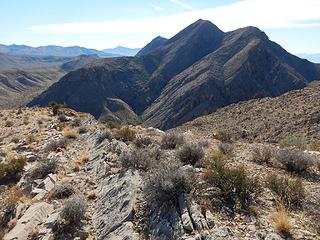
Jumbo Peak - 5761
Anyhow, Tracy and I would both be bringing our vehicles for added safety. I met him at Whitney Pocket and we drove to the starting point for Jumbo Peak, which is the highest in the area. Tracy had climbed Jumbo previously with Courtney Purcell, but was graciously willing to repeat it. He brought his rope and I carried a bunch of webbing.
The approach hike is relatively short. After weaving in and around some tall boulders with narrow corridors we were faced with the chimney. Tracy went up and I followed. There are a couple of tricky spots tall involving chockstones. Near the top it was more like a cave. I mantled up between two chockstones and then traversed onto a down-sloping chock-stone ledge which spans the chimney but is open to exposure on both sides.
It was at this point that I realized that I left the webbing down with my pack, so I went back down to get it. When I got back up to the ledge, Tracy was ready to climb and trailed the rope for me. Above the chock-stone ledge is a steep slab with scant holds. Theres a gap between this slab and a vertical wall. With a big step up, Tracy got onto the slab and climbed up the gap, using both the corner of the slab and the wall on the side. At the top of the slab, the gap widens and theres more exposure.
Tracy climbed off the slab side and onto the top of the wall where there was a sling anchor. Soon after he was ready to belay me up. I found this climb to be awkward, even with a belay. The first few moves were the most insecure and I was very glad to have a belay.
December 10
Jumbo Peak - 5761
Anyhow, Tracy and I would both be bringing our vehicles for added safety. I met him at Whitney Pocket and we drove to the starting point for Jumbo Peak, which is the highest in the area. Tracy had climbed Jumbo previously with Courtney Purcell, but was graciously willing to repeat it. He brought his rope and I carried a bunch of webbing.
The approach hike is relatively short. After weaving in and around some tall boulders with narrow corridors we were faced with the chimney. Tracy went up and I followed. There are a couple of tricky spots tall involving chockstones. Near the top it was more like a cave. I mantled up between two chockstones and then traversed onto a down-sloping chock-stone ledge which spans the chimney but is open to exposure on both sides.
It was at this point that I realized that I left the webbing down with my pack, so I went back down to get it. When I got back up to the ledge, Tracy was ready to climb and trailed the rope for me. Above the chock-stone ledge is a steep slab with scant holds. Theres a gap between this slab and a vertical wall. With a big step up, Tracy got onto the slab and climbed up the gap, using both the corner of the slab and the wall on the side. At the top of the slab, the gap widens and theres more exposure.
Tracy climbed off the slab side and onto the top of the wall where there was a sling anchor. Soon after he was ready to belay me up. I found this climb to be awkward, even with a belay. The first few moves were the most insecure and I was very glad to have a belay.
 Jumbo summit 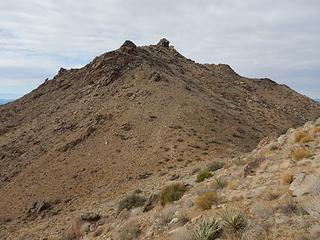 Jumbo 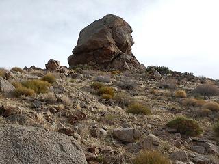 Packard summit block 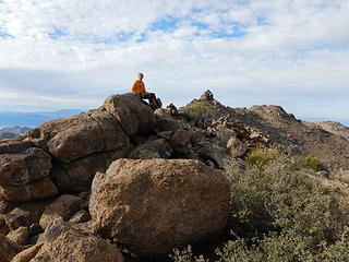 Packard summit 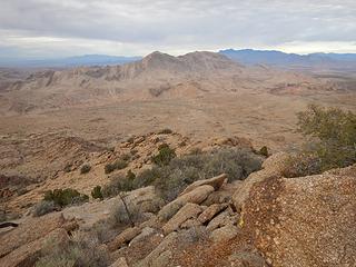 Tramp Ridge 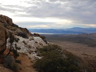 quartz from a gold mine appears as snow 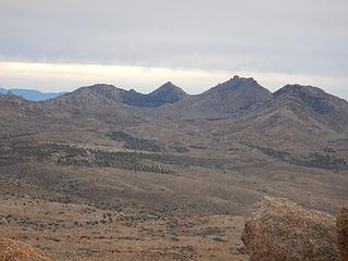 Packard and Jumbo 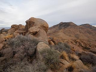 summit rock and Mica behind 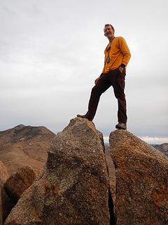 Gold Butte summit 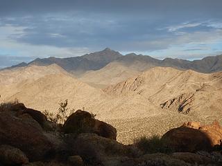 Bonelli 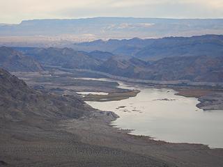 mouth of the Colorado River 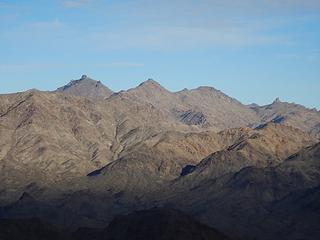 Jumbo and Packard 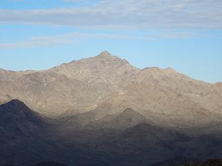 Bonelli 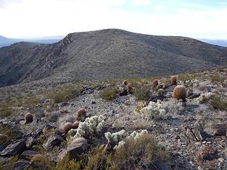 Gold Cross 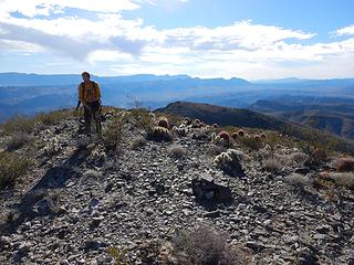 Gold Cross summit 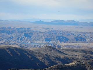 Tracy says Squaw Peak is a good scramble 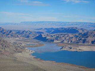 muddy waters 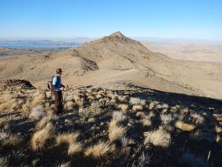 looking back at Gold Butte 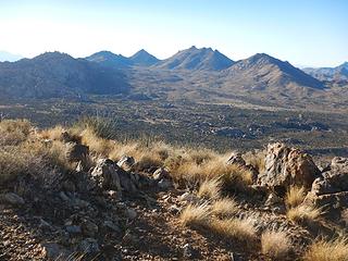 Packard and Jumbo again 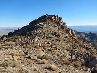 Mica 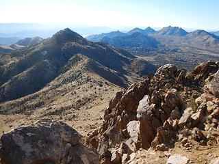 tempting south peak 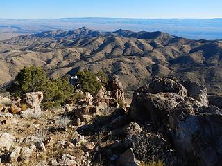 Azure Ridge 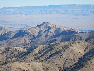 Azure Ridge zoom 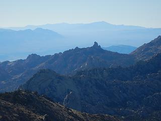 Point 5102
|
| Back to top |
  
|
|
Gimpilator
infinity/21M
Joined: 12 Oct 2006
Posts: 1684 | TRs | Pics
Location: Edmonds, WA |
Lime Ridge 4112
I had the idea to combine a couple of peaks for the remainder of the day, but as we were nearing the starting point, Tracy told me he was feeling the combined effort of our trip and might just explore Lime Canyon while I went for the peaks. That was fine with me and I left the car unlocked for him should he return before me.
I started with the lesser of the two and went up a southeast ridge. There was some nice solid limestone along the way which I scrambled on, but this could be easily avoided. There were no further difficulties. After passing a false summit I found the benchmark and remains from the survey, but no register.
 Lime Canyon Peak up next 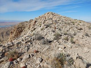 false summit 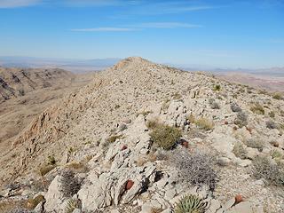 Lime Ridge 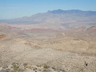 Virgin 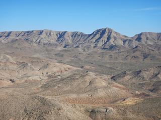 Tramp Ridge 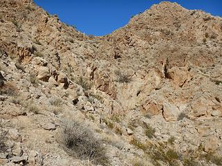 below the big dryfall 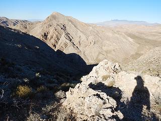 looking back at Lime Ridge 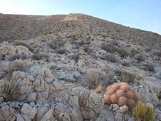 getting steep 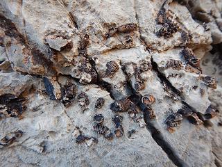 fossils 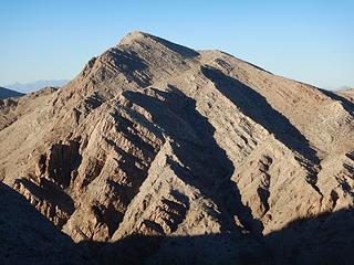 Lime Ridge 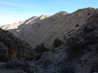 Tramp Ridge up next 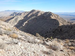 Tramp Ridge 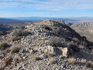 summit 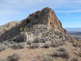 step 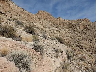 crappy east side traverse 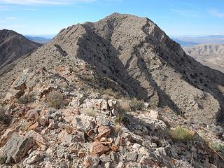 looking back at the south peak 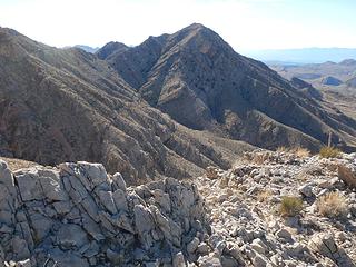 south peak 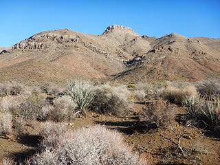 Azure 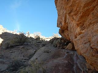 easy passage 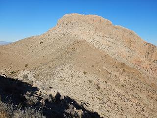 Azure 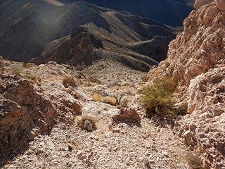 looking down the loose gully 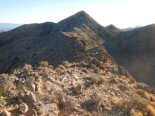 south peak 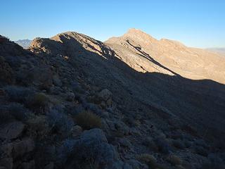 looking back at the main peak  Houston we have a problem 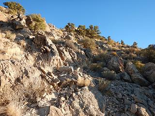 steep loose traverse 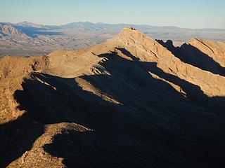 Azure 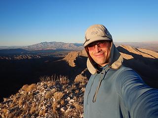 Azure south peak summit 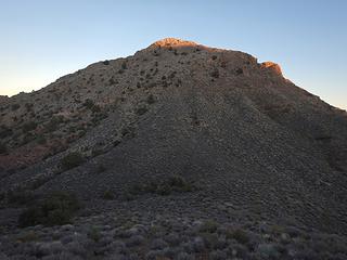 last light on the south peak 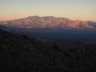 Virgin alpenglow 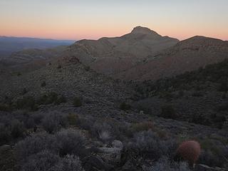 Azure
|
| Back to top |
|
|
Abert
Member

Joined: 02 Sep 2010
Posts: 588 | TRs | Pics
Location: Sequim |
|
Abert
Member
|
 Thu Dec 20, 2018 4:00 pm |
|
|
Thanks for posting. Your trip reports have rapidly become a valuable resource for visits to the Southwest. I always check to see if you have a report on a peak I'm considering. Really helpful in making an effort/difficulties/reward judgment as to whether something is worth doing.
|
| Back to top |
|
|
Gimpilator
infinity/21M
Joined: 12 Oct 2006
Posts: 1684 | TRs | Pics
Location: Edmonds, WA |
Thanks David. That pretty much makes my day to hear that my beta is getting used. Contributing to the pool of information I draw from is the number one motivator. I see you did Longridge recently as well as others in that area. Isn't that a fun one?
|
| Back to top |
|
|
|
|
You cannot post new topics in this forum
You cannot reply to topics in this forum
You cannot edit your posts in this forum
You cannot delete your posts in this forum
You cannot vote in polls in this forum
|
Disclosure: As an Amazon Associate NWHikers.net earns from qualifying purchases when you use our link(s). |


