| Previous :: Next Topic |
| Author |
Message |
kitya
Fortune Cookie


Joined: 15 Mar 2010
Posts: 842 | TRs | Pics
Location: Duvall, WA |
|
kitya
Fortune Cookie
|
 Sun Nov 25, 2018 5:08 pm |
|
|
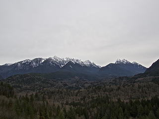
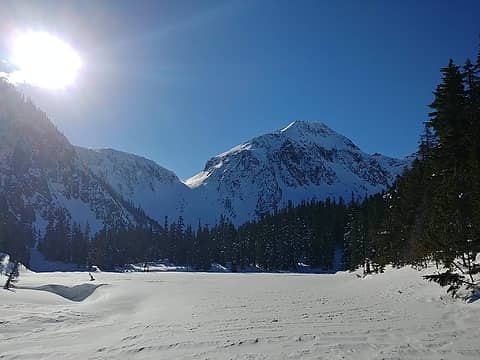
Moolock 24 nov 2018.
This hike is often praised for the views, but as usual for me in Middle Fork area I didn't get to see any (previously I snowshoed West Green, South Bessemer etc. - and every time there was barely any visibility). The snow level is pretty high, a few inches of snow at around 3000 ft, but there was no need for snowshoes until around 4000 ft. No human footprints, but lots of deer and bunnies. I have never seen so many bunny prints, looked like they had a huge gathering the night before.
The road part is boring and tedious, but it does get better - higher up portion of the road seems to be not used anymore and is now so overgrown, I actually lost where the road is in places. Trees are getting bigger too. Not sure if it means more logging soon or they will finally let this mountain return to a more natural state. Snow is very unconsolidated and going was slow. The last scramble part is very steep. Previous trip reports seem to indicate going up boulder field, but there is not enough snow on the field yet and falling through into boulders is not fun. I went through the trees instead and had to crawl/veggie belay with Cookie in some places.
15 miles, 4560 feet gain.
https://connect.garmin.com/modern/activity/3183461192
|
| Back to top |
  
|
|
Malachai Constant
Member

Joined: 13 Jan 2002
Posts: 16093 | TRs | Pics
Location: Back Again Like A Bad Penny |
Old trail on Si no snow no people all the way to top. Saw a couple folks on way down.
"You do not laugh when you look at the mountains, or when you look at the sea." Lafcadio Hearn
"You do not laugh when you look at the mountains, or when you look at the sea." Lafcadio Hearn
|
| Back to top |
|
|
BigBrunyon
Member

Joined: 19 Mar 2015
Posts: 1458 | TRs | Pics
Location: the fitness gyms!! |
I HUCK TO LODGE LAKE YESTERDAY. WAS UP AT LODGE
|
| Back to top |
|
|
Justus S.
Member
Joined: 17 Nov 2004
Posts: 1298 | TRs | Pics
Location: WA |
Was going to do a quick hike up to Bridal Veil Falls but got curious about the new logging area a short way up the trail and went up there instead. ok views toward Gunn, North Index, Town Wall from the new roads. They did a reasonable job covering the start of the road with debris so no one was going up this road.
 Toward Gunn 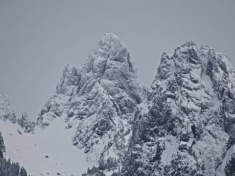 Gunn 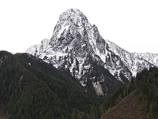 North Index 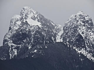 Baring
|
| Back to top |
|
|
RichP
Member

Joined: 13 Jul 2006
Posts: 5634 | TRs | Pics
Location: here |
|
RichP
Member
|
Fri Dec 28, 2018 11:15 am |
|
|
On a visit to Seattle for the holidays I did a couple of local hikes with my daughter now that she is old enough (4) and willing to put in some miles and elevation.
Little Si 12-24-18
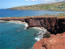
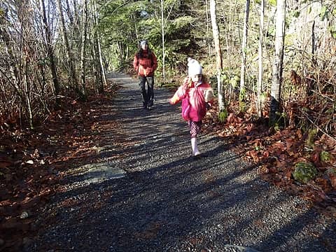 Still fresh and full of energy. 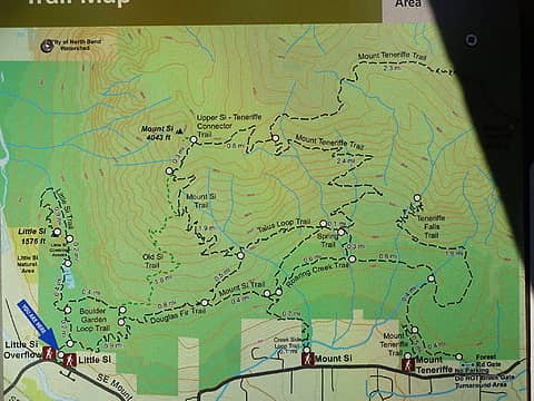 Trailhead map. 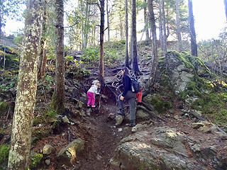 Last bit to the top. The inspiration was a piece of chocolate at the summit which I hid before she got there. 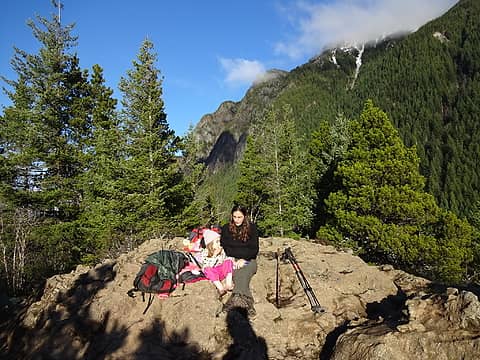 Con mami. 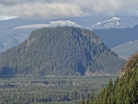 Fuller Mtn. 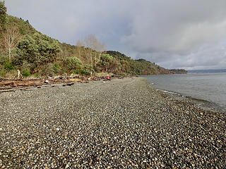 Over a mile of public beach. 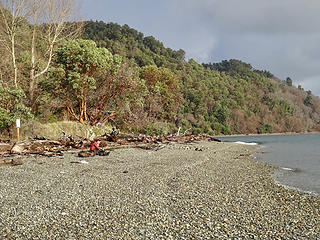 Madrone forest is common in this part of the world. 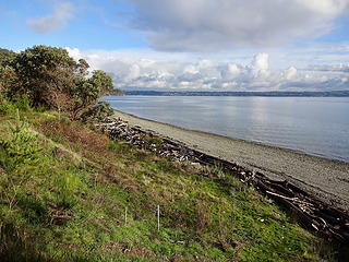 Beach from camping area. 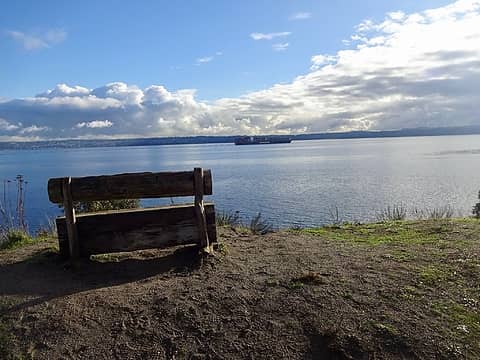 Shipping lane to Port of Tacoma. 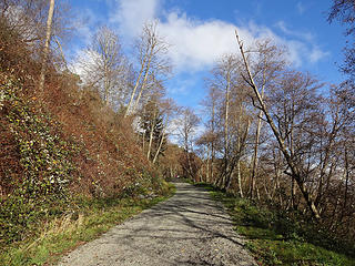 Gated gravel access road down to the beach. 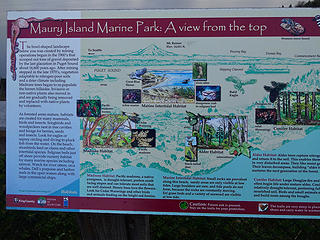 Sign at overlook above. 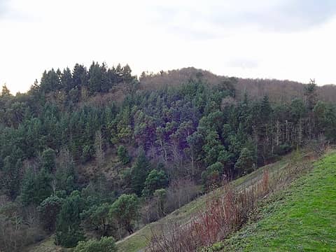 The highpoint of Maury Island, 492.' Of course I had to tag it. 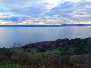 View from overlook on SW 248th St. A one-mile trail leads down to the beach from here as well. There is a good view of Mt Rainier when it's not cloudy.
|
| Back to top |
|
|
H. Hound
Member

Joined: 09 May 2003
Posts: 1205 | TRs | Pics
Location: Exit 32 |
|
H. Hound
Member
|
Mon Dec 31, 2018 4:45 am |
|
|
Coal Creek, Doughty and Far County Falls 12-30-18. Hey at least it isn't Tiger again....
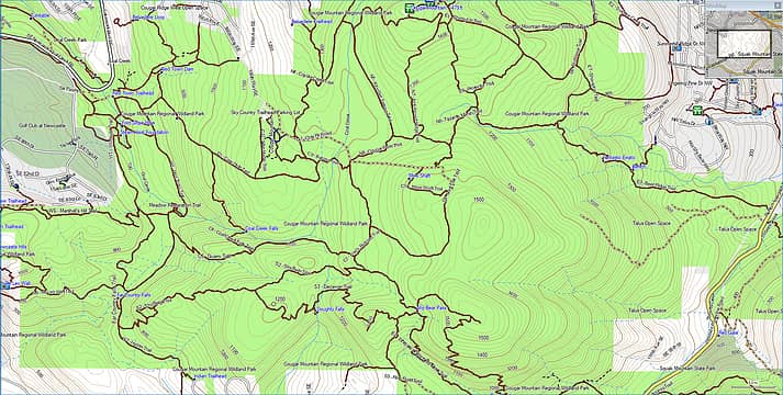 Untitled-1 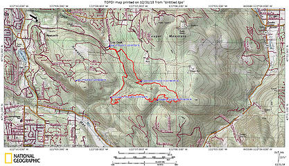 Track Log 6.75 miles Around 1100 feet in gain
|
| Back to top |
|
|
Nancyann
Member
Joined: 28 Jul 2013
Posts: 2319 | TRs | Pics
Location: Sultan Basin |
|
Nancyann
Member
|
Mon Dec 31, 2018 6:54 pm |
|
|
Went to Shaw Lake with Triciaann and Hiking Partner today.
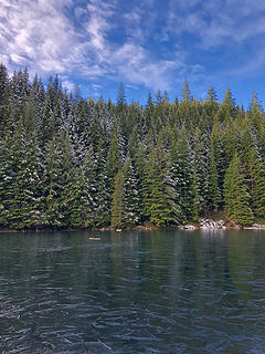 Shaw Lake 12/31/18 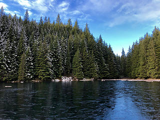 Shaw Lake 12/31/18 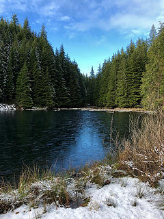 Shaw Lake 12/31/18 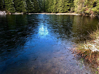 Shaw Lake 12/31/18 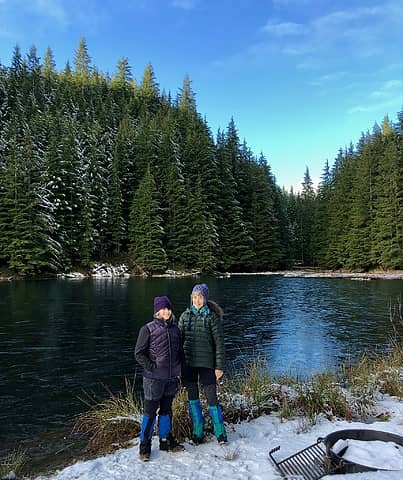 Shaw Lake 12/31/18
|
| Back to top |
|
|
Joe
Member
Joined: 29 Jun 2002
Posts: 819 | TRs | Pics
Location: Kent |
|
Joe
Member
|
Mon Jan 28, 2019 6:53 pm |
|
|
Methow Valley XC Skiing 1/24/ - 1/27/2019
1/24- Short ski trip on the Mazama Trails
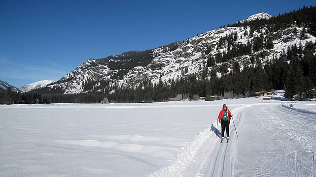 barb skiing 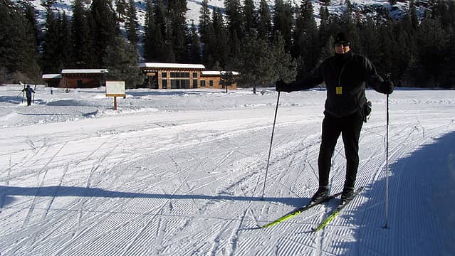 trying out my new skis 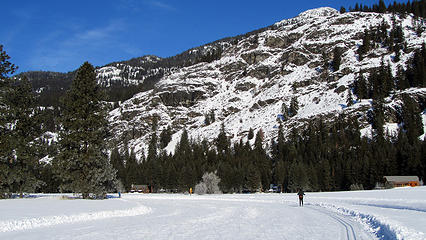 Mazama trails 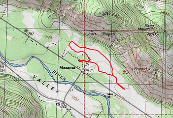 Mazama-route 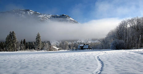 MVCT views near Browns Farm 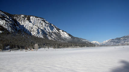 MVCT views near Browns Farm 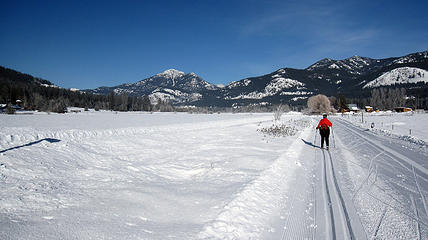 Barb skiing on MVCT 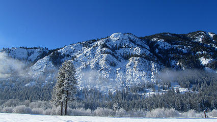 MVCT views near Browns Farm 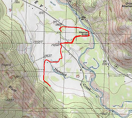 MVCT-route 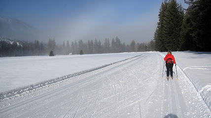 Barb sking toward Cow Beach warming hut 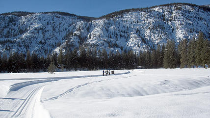 early winters views 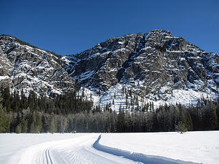 Goat Wall 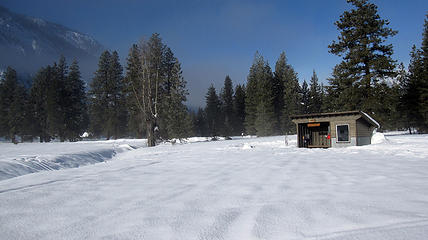 Cow Beach warming hut 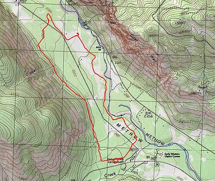 Early-Winters-route 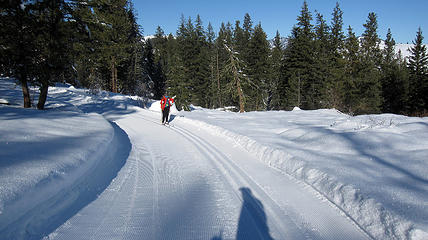 barb on overland trail 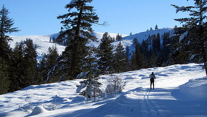 skiing overland trail 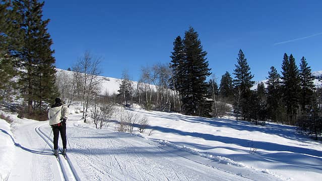 skiing sunnyside trail 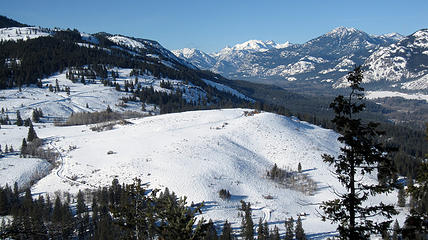 view from sun mountain lodge 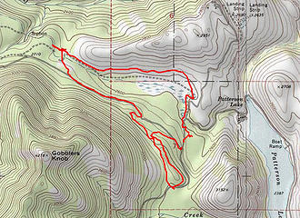 sun-mtn-route
|
| Back to top |
|
|
Jake Robinson
Member
Joined: 02 Aug 2016
Posts: 521 | TRs | Pics
|
Tried to climb Hinman this weekend but we didn't like the snow conditions, turned around at Opal Lake. There's a good trench up the Necklace Valley trail now. We were able to drive to within 1/2 mile of the TH with 4WD.
 Opal Lake looking towards La Bohn Gap
|
| Back to top |
|
|
RichP
Member
Joined: 13 Jul 2006
Posts: 5634 | TRs | Pics
Location: here |
|
RichP
Member
|
Sat Mar 16, 2019 4:58 pm |
|
|
I returned to Green Gulch in The Chief Joseph Wildlife Area south of Asotin again today. I forgot my lunch so it was a shorter hike than expected. Still quite a bit of snow in the upper canyon area but it should be melting soon as temps were in the 60's when I got back to the car.
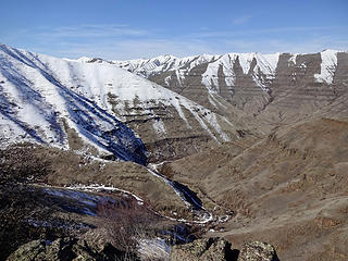 Green Gulch. 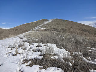 Point 2814. 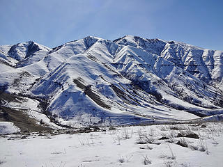 Mt Wilson. 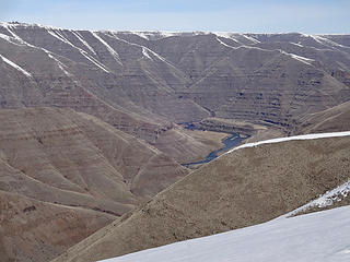 The Grande Ronde River. 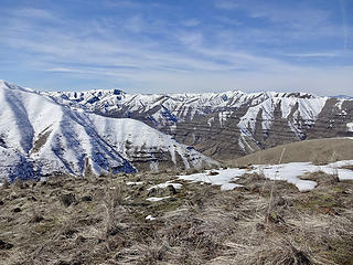 Across Joseph Creek. 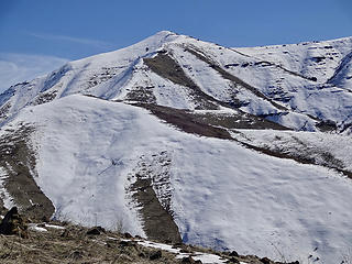 Point 4148. 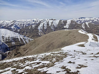 The ridge I'm walking back down to the mouth of Green Gulch. 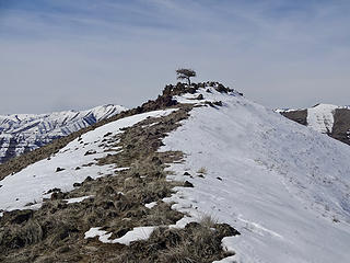 A lone tree on the way down from Point 2814. 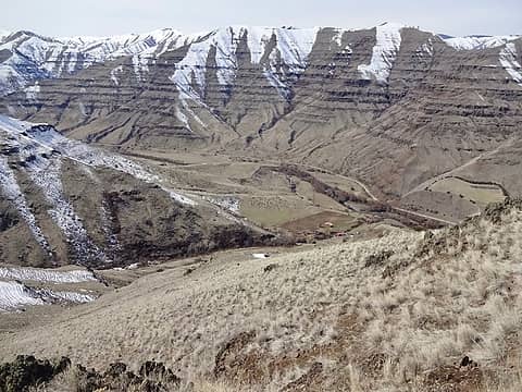 Joseph Creek and the mouth of Green Gulch. 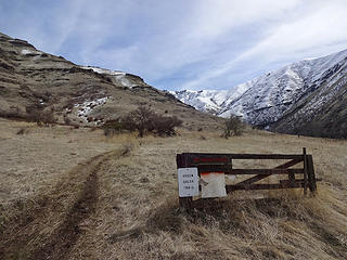 Trailhead.
|
| Back to top |
|
|
awilsondc
Member

Joined: 03 Apr 2016
Posts: 1324 | TRs | Pics
|
I hiked Mt. Rose (ONP) yesterday. I stopped at Potlatch State Park along the way because it looked pretty with dawn colors. Snow started at around the 2000 ft mark. Microspikes were fine for me (early am) but the snow was getting very soft on my way down. It felt good to push hard for the first time in months, and to not have to carry a bunch of crap with me. Photography slowed me down a tad. 94' up 55' down.
 Potlatch State Park1 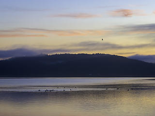 Potlatch State Park 2 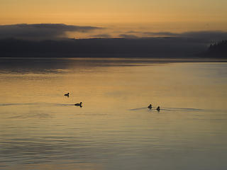 Potlatch State Park 3 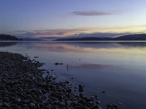 Potlatch State Park 4 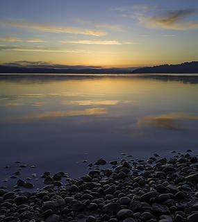 Potlatch State Park 5 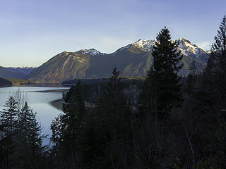 Rose, Copper, Ellinor, Washington 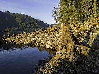 golden stumps 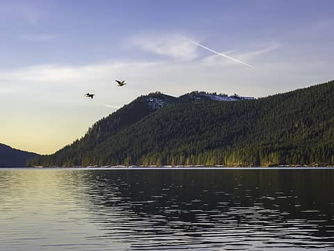 flight 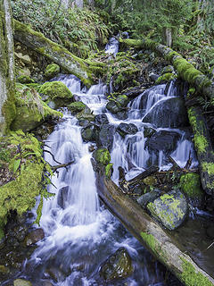 waterfall 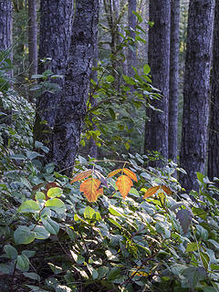 illuminated 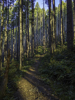 trail 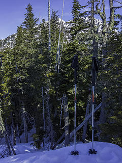 summit 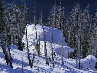 pillow 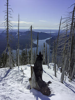 burnt 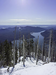 lake 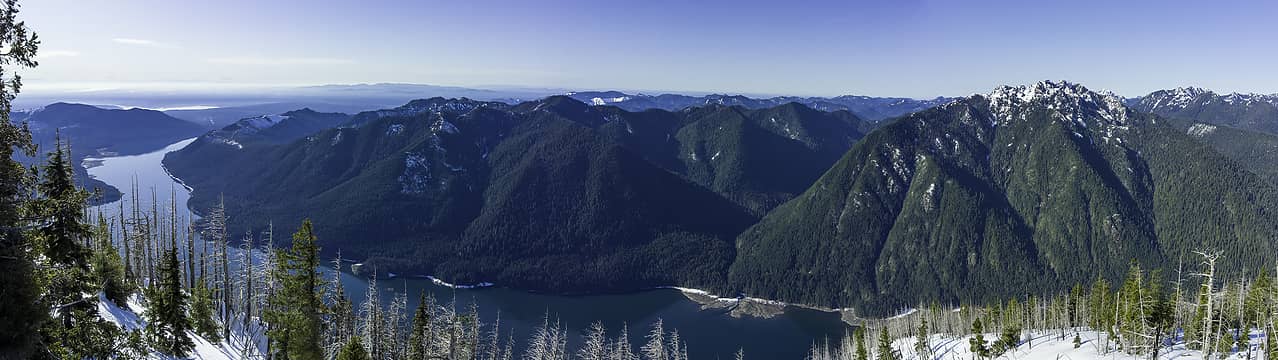 panorama
|
| Back to top |
|
|
Michael Lewis
Taking a nap
Joined: 27 Apr 2009
Posts: 629 | TRs | Pics
Location: Lynnwood, WA (for now) |
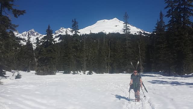 Josh heading out for views 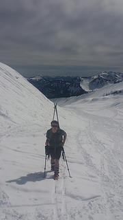 Josh ascending RR grade 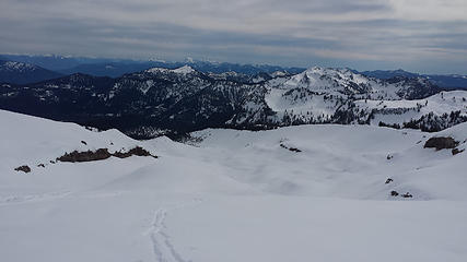 Looking down RR grade 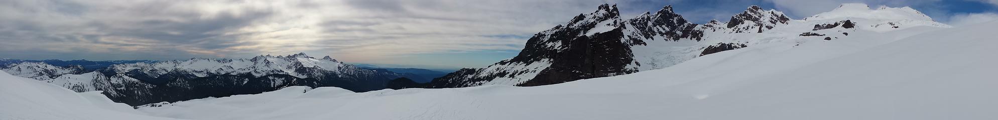 Deming Pano
|
| Back to top |
|
|
Nancyann
Member
Joined: 28 Jul 2013
Posts: 2319 | TRs | Pics
Location: Sultan Basin |
|
Nancyann
Member
|
Fri Mar 29, 2019 9:04 pm |
|
|
Good to see a TR from you guys!
Today we made a quick trip up the Icicle Ridge Trail. It was great to feel some of that Eastern Washington sun wash the mildew off. 
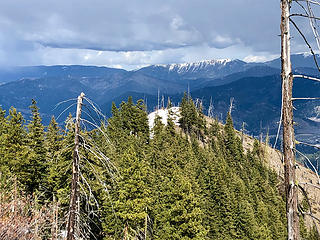 Icicle Ridge Trail 3/29/19 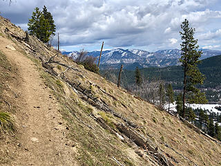 Icicle Ridge Trail 3/29/19 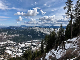 Icicle Ridge Trail 3/29/19 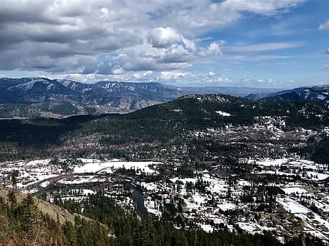 Icicle Ridge Trail 3/29/19 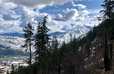 Icicle Ridge Trail 3/29/19 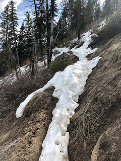 Icicle Ridge Trail 3/29/19 
|
| Back to top |
|
|
Chief Joseph
Member

Joined: 10 Nov 2007
Posts: 7709 | TRs | Pics
Location: Verlot-Priest Lake |
Nice! Been pretty sunny over here in Idaho too...soon back to the gloom of WWa...lol.
Good report And pics!
Go placidly amid the noise and waste, and remember what comfort there may be in owning a piece thereof.
Go placidly amid the noise and waste, and remember what comfort there may be in owning a piece thereof.
|
| Back to top |
|
|
Malachai Constant
Member
Joined: 13 Jan 2002
Posts: 16093 | TRs | Pics
Location: Back Again Like A Bad Penny |
Mailbox, no snow until summit for half a dozen steps. A nice flowers by Creek trilliums, wood violets, and bleeding hearts.
"You do not laugh when you look at the mountains, or when you look at the sea." Lafcadio Hearn
"You do not laugh when you look at the mountains, or when you look at the sea." Lafcadio Hearn
|
| Back to top |
|
|
|
|


