| Previous :: Next Topic |
| Author |
Message |
Gimpilator
infinity/21M


Joined: 12 Oct 2006
Posts: 1684 | TRs | Pics
Location: Edmonds, WA |
January 9
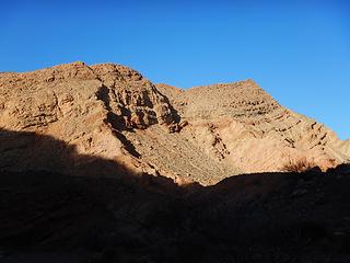
Red Needle 1957
Matt came for a visit. I picked him up at the airport, we hit the taqueria, and immediately drove to Red Needle. I have scoped out this tower several times. Its a short drive from my house, but the rock on the upper tower is sketchy and I knew it would take a more experienced climber to lead it. It has only been climbed a couple of times and the guidebook calls it an aid climb because they used a ladder to get past the overhang below the chimney. My friend Tracy is the guy who brought the ladder on that trip. I told him I was hoping to do it without a ladder and he was curious to hear how it worked out.
Matt led the lower mudstone class 3 and 4 ledges on eastern side with ease, but when he reached the base of the northern chimney, he called down that it was tricky and the upper conglomerate was just as rotten as it looks. He found a chockstone and I suggested slinging it. Without the chockstone the route might be too committing, because its a very narrow loose chimney with an overhang below it and no good footing at that transition. When it was my turn, I struggled badly and I was impressed with Matts leading ability.
The upper portion of the tower is split down the middle and the chimney has a sort of passage way between the two towers. Going through that to the south side of the tower, you turn right into an awful rotten gully, open at the bottom to mid-air. This gully puts you within a few feet of the summit, but requires care because a lot of material is ready to move or just peel off the walls.
When I got to the top, we took a closer inspection of the existing sling anchor. It was an old section of climbing rope with a 6 inch gap where the sheath was completely gone. Four or five narrow white sections of core did not inspire our confidence. Had someone cut off a portion of their rope to get down this tower? We were able to tie-off the broken section, and tested it before rappelling, but whoever climbs this next ought to bring some new webbing along, at least 20.
Pinnacle - 2000
After 2 rappels (Matt only one), there was some daylight left, so I showed Matt the scramble route up Pinnacle, which I had done once previously.
1-10
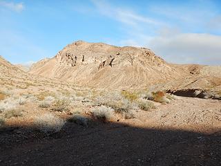
Mine View Peak 2132
The route we planned for the day included 6 peaks as well as Anniversary Narrows and Bowl of Fire. To avoid the private property issue, we hiked to the narrows indirectly which took us past little Mine View Peak. Its not very big, but does have nice views and an interesting upper ridge.
Anniversary Narrows
For years, I have heard that Anniversary is one of the best non-technical slots in Nevada. It was exciting to finally see it. Even before we got to the canyon, we passed through colorful layers of rock and stone and also found abundant large chunks of some kind of crystal.
It would have been smart for me to read the guidebook again before launching this route, because I totally missed the turnoff for Endless Peak and Capuchin Peak at the very mouth of the narrows. I remember looking at the steep ramp and wondering if that was the way or if there might be something better as the map indicated.
Once we were in the narrows, several potholes held stinging cold water from recent rain. Matt managed to stem past a few of them, but I waded all with boots off. Once I realized that I missed the access for Endless and Capuchin, I was unwilling to backtrack through the frigid potholes.
Anniversary Narrows Peak 3074
Beyond the narrows we went through a system of washes to where we could easily gain a saddle north of our next peak. Matt found fossils below the saddle. We came into the sunlight and were flabbergasted by the panorama below us. The Bowl of Fire was larger than I imagined and just begging for exploration.
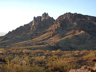
 Endless 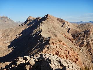 Southgate 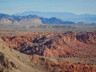 Virgin 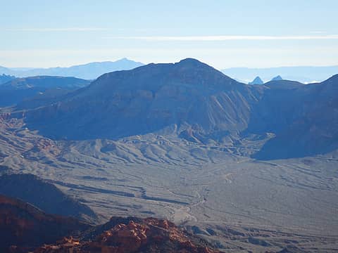 Northshore 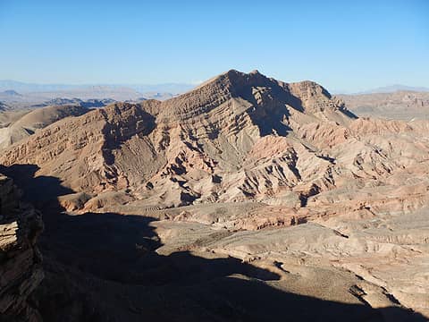 Endless 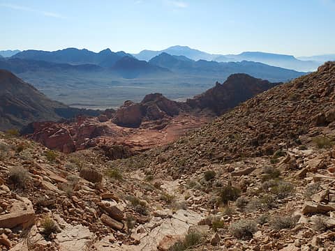 down 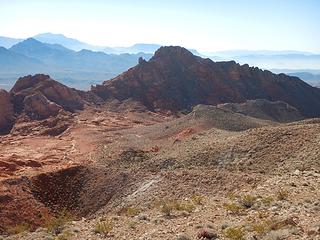 Polytick 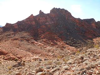 Polytick 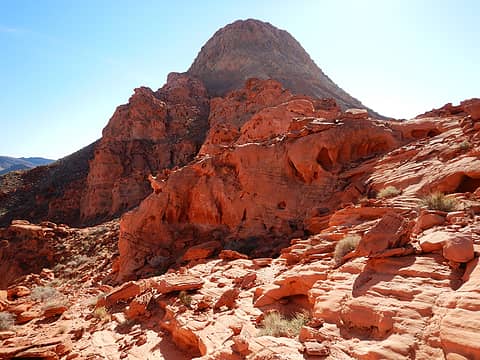 Murphys looking sexy 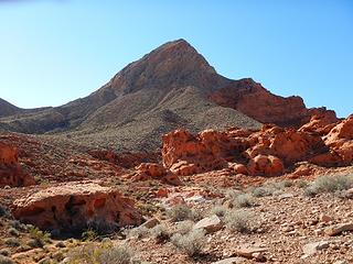 Murphys 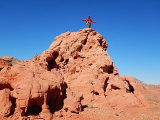 Red Cap summit 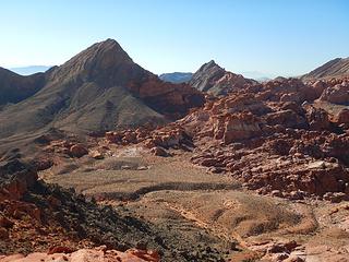 Murphys and Polytick 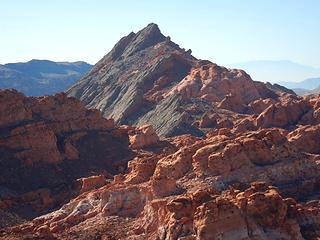 Polytick 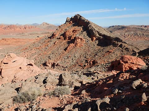 Peak 2474  4 ascents in 10 years 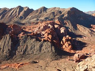 ANP 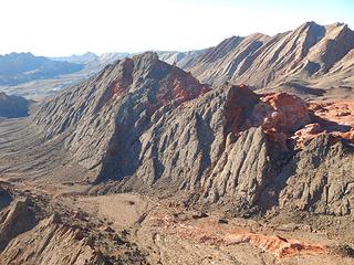 Polytick 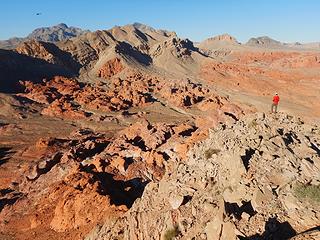 Muddy, Southgate, Northgate 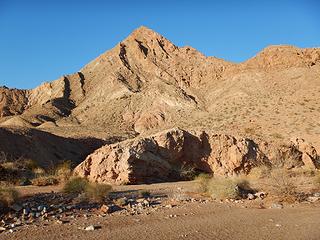 Murphys 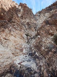 white dryfall 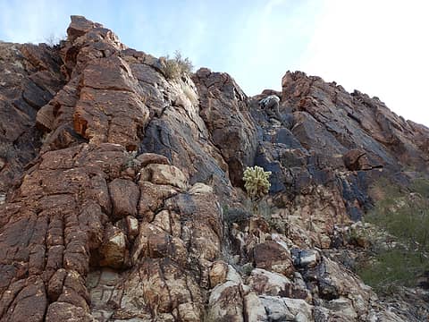 Matt climbing 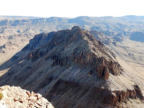 Peak 3318 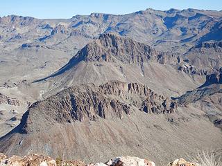 Peerless and Peak 3380  Negrohead 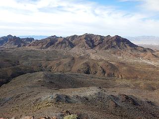 Hardy 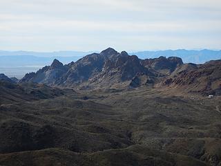 Oatman Benchmark 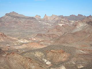 tower 4942 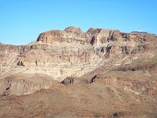 Battleship which I did with Josh in 2018 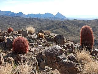 Boundary Cone in the distance 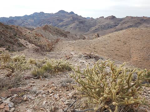 Nutt Benchmark  Peak 4406  Peak 4205 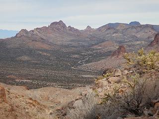 Union Benchmark and cane Benchmark 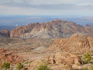 Peak 4205 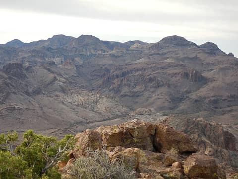 Nutt 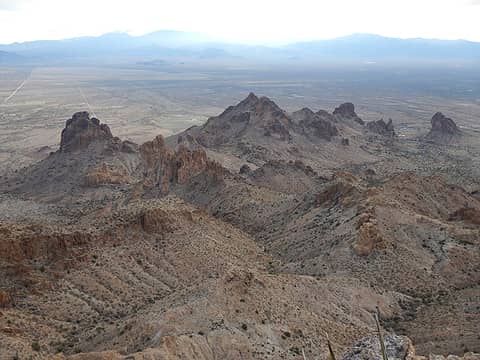 Peak 3833 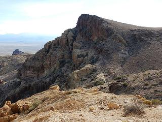 House 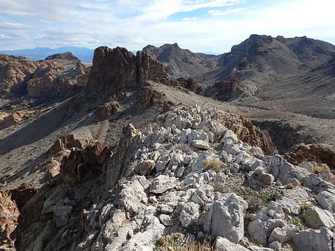 Peak3980 and House 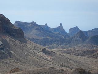 tower 4942 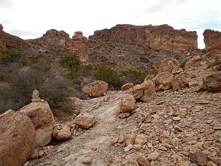 El Castillo 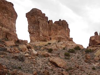 Kor's Castle
|
| Back to top |
  
|
|
Gimpilator
infinity/21M
Joined: 12 Oct 2006
Posts: 1684 | TRs | Pics
Location: Edmonds, WA |
1-13
Carsons Benchmark 3760
We had a single day between big rainstorms. We decided to go for one of the more coveted peaks on our list, Kelbaholt. Since it had rained heavily during the night, we would do Carsons first and let the rocks on Kelbaholt dry out a bit.
 northern sub peaks of Kelbaholt 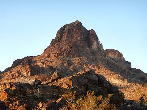 Lost Arch Mine Peak 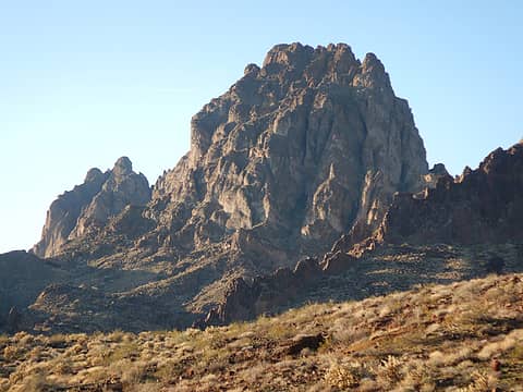 Kelbaholt 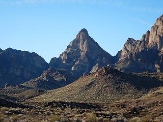 Peak 3323 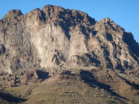 Kelbaholt 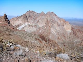 Kelbaholt group  Turtle 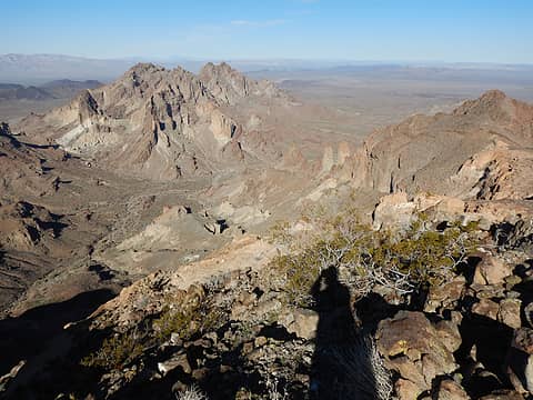 Kelbaholt 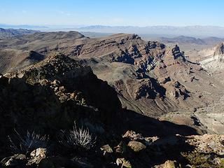 Peak 3585 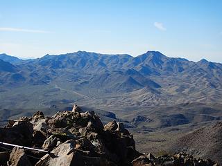 Peak 4245 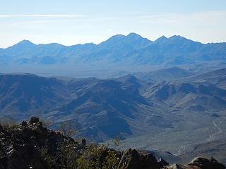 Turtle 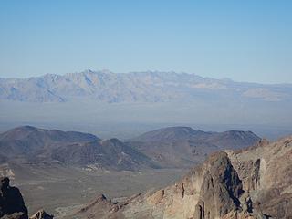 Old Woman range 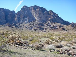 Kelbaholt 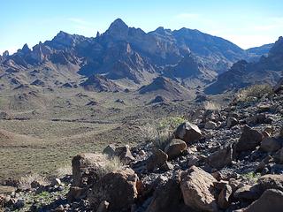 Carsons 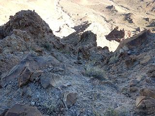 came up this 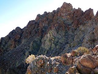 summit left of center from turn around point 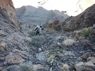 going down 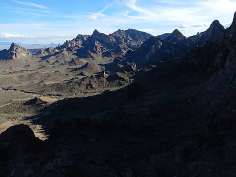 Carsons 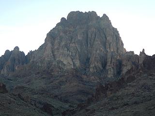 Kelbaholt 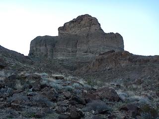 Mexican Hat 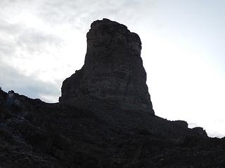 and profile 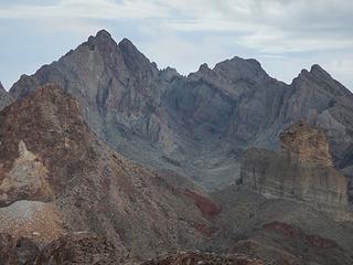 Lost Arch, Kelbaholt, Mexican Hat 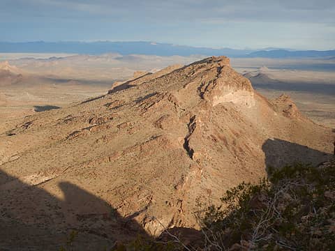 Peak 2483 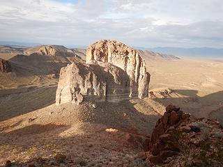 Mexican Hat 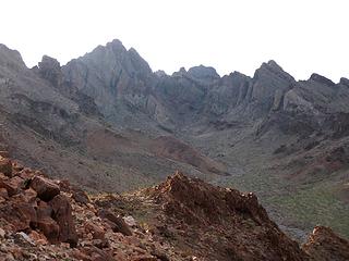 Kelbaholt  up this way  came up this 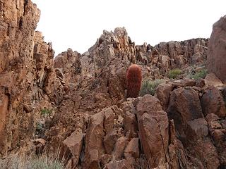 almost there 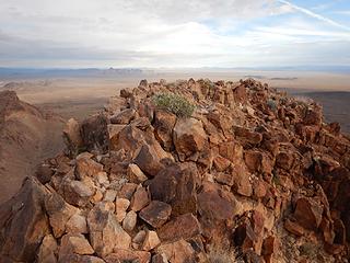 summit 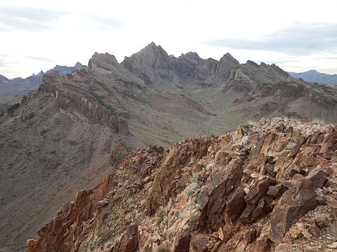 Kelbaholt 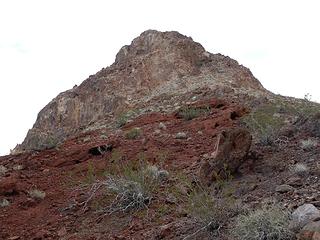 looking back 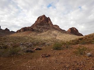 the peak viewed from camp 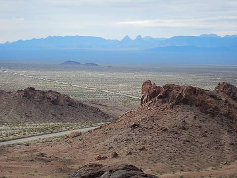 Umpah and Mopah 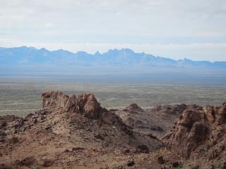 Carsons and Kelbaholt 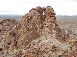 lower north crag  It would also be funny to do Coyote Skull and Dog Skull in the same day, since they are on opposite sides of the valley. It would also be funny to do Coyote Skull and Dog Skull in the same day, since they are on opposite sides of the valley.
 Coyote skull 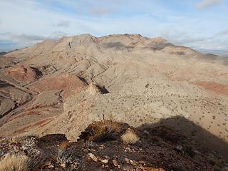 Sunrise 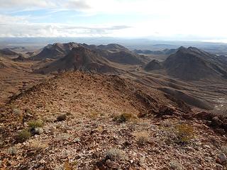 next 3 peaks 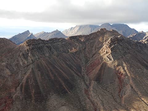 Unity with Hanging-Valley and Knife Edge behind 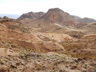 The Triple 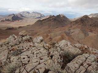 Frenchman group, Division, Unity, Coyote Skull 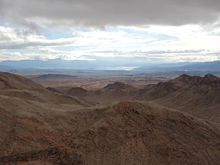 Lake Mead 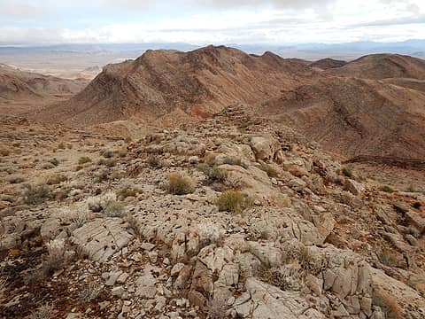 The Double 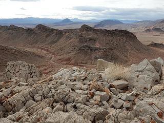 Mineview 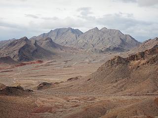 Frenchman 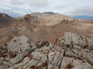 Sunrise 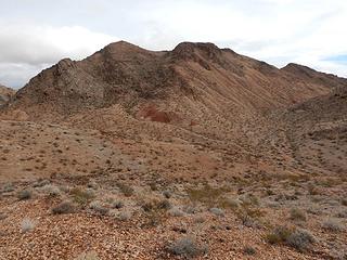 The Double 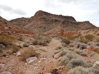 Mineview 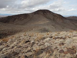 North Twin 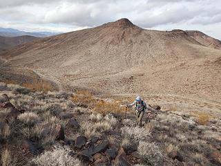 Dog Skull 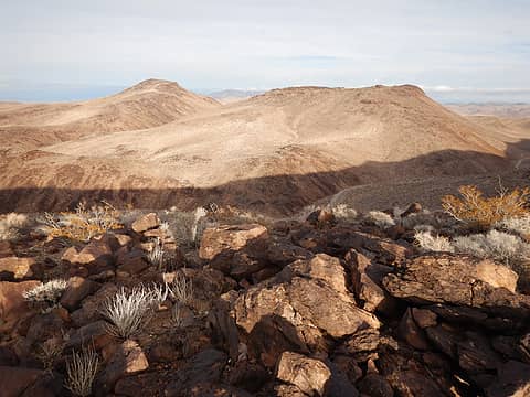 Dog Skull and North Twin 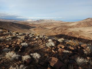 out this wash 
|
| Back to top |
|
|
Fletcher
Member

Joined: 29 Jul 2009
Posts: 1870 | TRs | Pics
Location: kirkland |
|
Fletcher
Member
|
 Fri Jan 18, 2019 5:30 pm |
|
|
Some of the best looking scenery from any of your desert TRs. Wish I could have been there!
|
| Back to top |
|
|
Sculpin
Member

Joined: 23 Apr 2015
Posts: 1383 | TRs | Pics
|
|
Sculpin
Member
|
Sat Jan 19, 2019 8:32 am |
|
|
The Turtles!
"Mind-bending towers" indeed. Did you camp at the little BLM campground where the Mohawk Springs trail starts?
I am a little confused on where the Turtles start and end in your TR, since I don't remember the peak names. I probably would have been lying awake all night during a rainstorm worrying about whether I could get back across Chemehuevi Wash.
Between every two pines is a doorway to the new world. - John Muir
Between every two pines is a doorway to the new world. - John Muir
|
| Back to top |
|
|
belowfellow
Transplant

Joined: 22 Feb 2009
Posts: 261 | TRs | Pics
Location: Seattle |
Couldn't have told the tale better myself. Great trip all around. I am hooked on the Mojave. Thanks for everything Adam!
|
| Back to top |
|
|
John Morrow
Member

Joined: 03 Apr 2007
Posts: 1526 | TRs | Pics
Location: Roslyn |
| Sculpin wrote: | | "Mind-bending towers" indeed. Did you camp at the little BLM campground where the Mohawk Springs trail starts? |
I think that is where they started. Very craggy up there compared to west of Mopah, and I've really only seen it from the road.
| belowfellow wrote: | | Great trip all around. I am hooked on the Mojave. Thanks for everything Adam! |
Yeah, I get it!
Thanks for the great beta you two.
John
Tell me, what is it you plan to do with your one wild and precious life?-Mary Oliver
A nation that continues year after year to spend more money on military defense than on programs of social uplift is approaching spiritual doom.
― MLK Jr.
Tell me, what is it you plan to do with your one wild and precious life?-Mary Oliver
A nation that continues year after year to spend more money on military defense than on programs of social uplift is approaching spiritual doom.
― MLK Jr.
|
| Back to top |
|
|
Eric Hansen
Member

Joined: 23 Mar 2015
Posts: 866 | TRs | Pics
Location: Wisconsin |
Twenty years ago I worked up through Anniversary Narrows and slept in the upper end where it opens up. In the morning I moved east. Bowl of Fire was stunning from that angle, from above.
|
| Back to top |
|
|
|
|
You cannot post new topics in this forum
You cannot reply to topics in this forum
You cannot edit your posts in this forum
You cannot delete your posts in this forum
You cannot vote in polls in this forum
|
Disclosure: As an Amazon Associate NWHikers.net earns from qualifying purchases when you use our link(s). |


