| Previous :: Next Topic |
| Author |
Message |
rstoddard24
BBQWingz


Joined: 30 Dec 2016
Posts: 74 | TRs | Pics
|
Olympic Coast UPWC Route
March 30-31, 2019
New FKT 16:42
Dave Swoish and Ryan Stoddard
Ryans Strava link; Daves Strava link
Summary:
Dave and I left from Shi Shi TH at noon on Saturday, running south and arriving at Oil City TH at 4:42am for a new fastest time of 16:42. Our strategy involved using the lowest tide cycle to make all crossings from Point of Arches to Cape Johnson in a single low tide, then use the next mid-low tide in the early morning to make Diamond Rock Crossing. This plan involved two crossings at ~2ft above recommended level but they went smooth for us. Read on to learn more (I included many details perhaps only interesting to those attempting the route):
The Route
Washington has ~60 miles of protected wilderness coastline on the Olympic Coast from Shi Shi Beach in the North to Oil City in the South. To quote Adventures Northwest magazine: "This epic coastline can be hiked in three separate traverses...With some logistical heroics you could do the whole thing in one glorious shot." In 2014, Heather Anderson proposed the entire section as an Ultrapedestrian Wilderness Challenge Route and it has since been completed by a dozen or so runners. Most have been blocked by at least 1 high tide and thus completion times in the 24-30hr range are typical. This route isnt your ordinary 60 mile trail run actually less than 5% of the route is nice running trail. The route is mostly beach running and although there is some firm sand to be found for nice running, more often there is soft sand, mushy sand, pebbles/gravel, medium rocks, boulders, or kelp and algae covered tidelands. There are also some overland trails to bypass some impassible cliffy headlands accessing these trails often requires using ropes and ladders to climb eroding bluffs, and then the trails themselves are notoriously muddy. Perhaps the most interesting aspect of the route is timing the tides many of the headland crossings have no passable overland routes and require a low tide to cross on the beach. Trying to blaze your own overland route thru bushes and cliffs is not a great option previous FKT holder (John Barrickman 18:00) did just this to bypass Diamond Rock; he is vague on the details but says he could have died and this was the worst decision of his life.
I was intrigued due to the unique timing elements of this route and because it is a nice long route that can be completed at any time while mountain adventure routes are still under feet of snow. Dave and I matched schedules on this weekend which had an OK but not perfect tide pattern we had only 1 low-low tide (1.2 min) to work with, and the other was just a mid-low tide (going down to 3.7 min). Also, the low-low tide occurred in the afternoon, which meant leaving at noon and doing the entire South coast in the dark.
North Beach
We left Seattle after work Fri, camping along the way at Lyre River campground. Kristin and Kelli came along for the adventure, there were down to help us out with the car shuttle and then get in a 20mi training run themselves in the Hoh rainforest while we did our thing (thanks so much you two!!!) Saturday we fueled up at Café by the Bay in Sekiu while making final preparations, then we were dropped off at Shi Shi in time for our casual noon start time
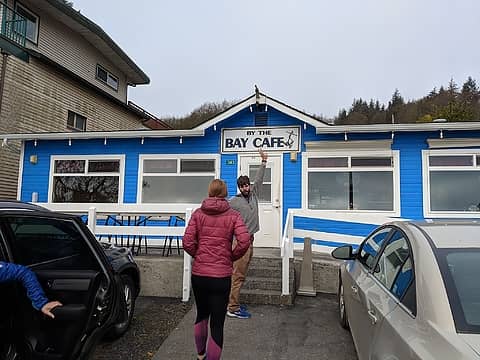 Awesome Breakfast! 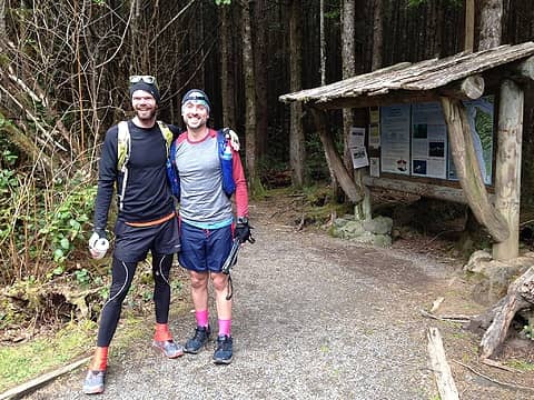 looking fresh 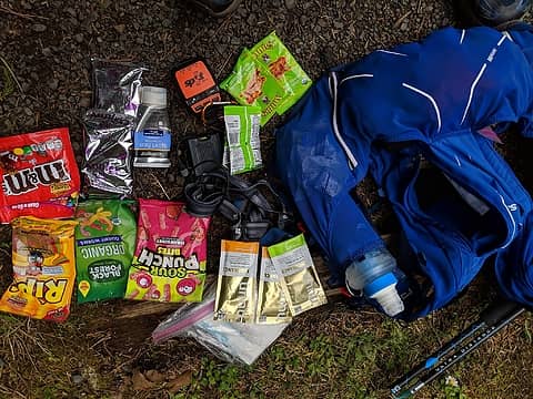 Dave's kit. So much candy! 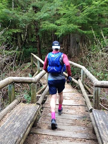 trail to Shi Shi 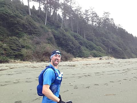 stoked to be at the beach 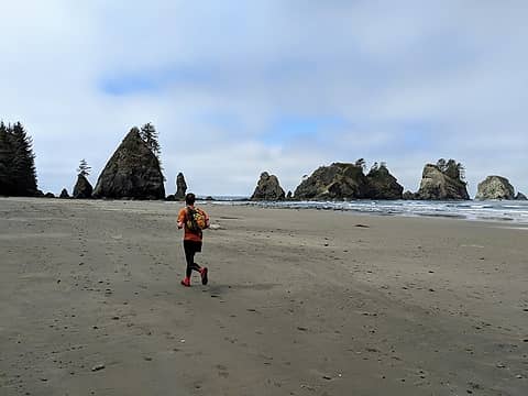 get a move on while you still can 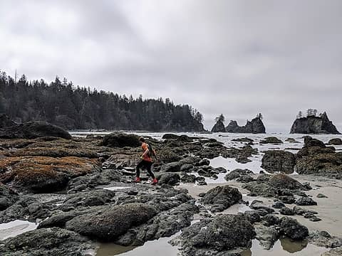 Point of Arches crossing  The real fun begins at Yellow Banks the section between Yellow Banks and Ceder creek is about 6 miles of straight rocks. Doing all the rock hopping made this feel more like a mountain run than I was expecting We just kept moving and arrived at Ceder creek at still above 4mph average! The real fun begins at Yellow Banks the section between Yellow Banks and Ceder creek is about 6 miles of straight rocks. Doing all the rock hopping made this feel more like a mountain run than I was expecting We just kept moving and arrived at Ceder creek at still above 4mph average!
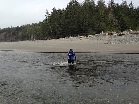 Ozette River ford 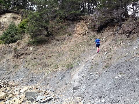 one of the optional overland crossings cut off some distance 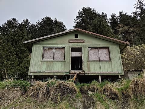 Makah Ranger station 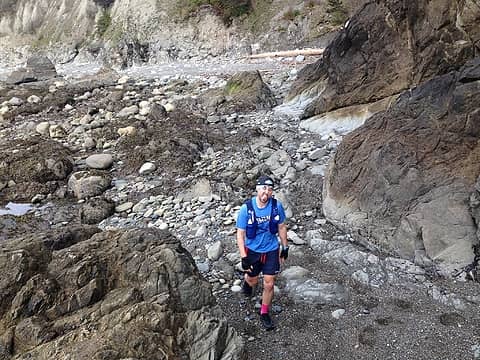 some tidelands  lots of random beach crap 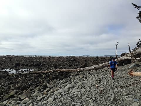 some of the "medium rocks" 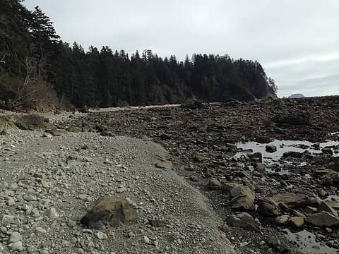 sometimes there were choices for which type of rocks 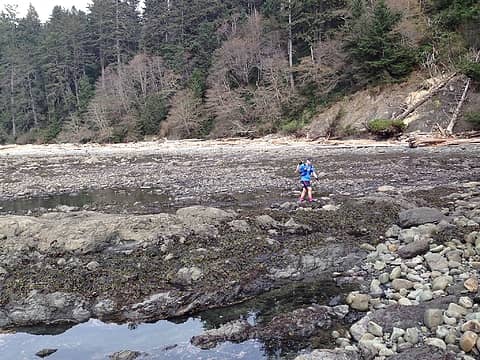 tidelands 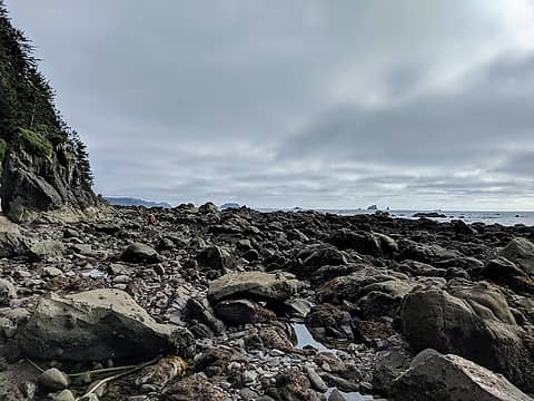 "trail running" 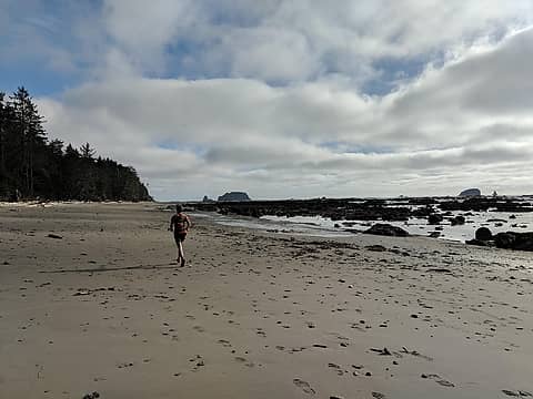 finally on sand again 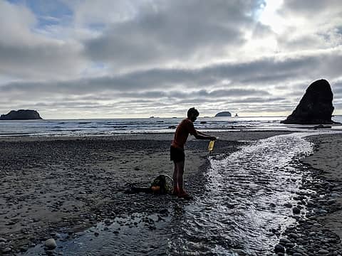 refilling water at Ceder Creek 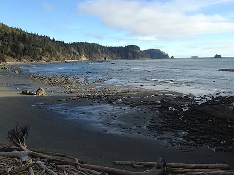 Cape Johnson in sight! 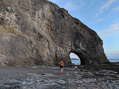 Hole in the Wall 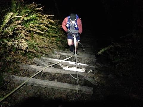 typical South section overland trail entrance/exit
 zimmertr zimmertr
zimmertr |
| Back to top |
  
|
|
iron
Member

Joined: 10 Aug 2008
Posts: 6392 | TRs | Pics
Location: southeast kootenays |
|
iron
Member
|
 Mon Apr 01, 2019 8:41 pm |
|
|
|
| Back to top |
|
|
awilsondc
Member

Joined: 03 Apr 2016
Posts: 1324 | TRs | Pics
|
 Pretty incredible fellas... hats off to you! Thanks for the write up. Keep being fast. Pretty incredible fellas... hats off to you! Thanks for the write up. Keep being fast. 
|
| Back to top |
|
|
Jake Robinson
Member
Joined: 02 Aug 2016
Posts: 521 | TRs | Pics
|
Congrats guys! Love your discussion of all the logistics/planning, very helpful info for anyone wanting to try this route. Great photos too!
|
| Back to top |
|
|
Matt Lemke
High on the Outdoors

Joined: 15 Jul 2010
Posts: 2052 | TRs | Pics
Location: Grand Junction |
|
Matt Lemke
High on the Outdoors
|
Mon Apr 01, 2019 9:15 pm |
|
|
Now that's one cool objective! Nice work guys.
Strava looks like an interesting site... never seen it before
|
| Back to top |
|
|
|
|
You cannot post new topics in this forum
You cannot reply to topics in this forum
You cannot edit your posts in this forum
You cannot delete your posts in this forum
You cannot vote in polls in this forum
|
Disclosure: As an Amazon Associate NWHikers.net earns from qualifying purchases when you use our link(s). |


