| Previous :: Next Topic |
| Author |
Message |
Ancient Ambler
Member


Joined: 15 May 2007
Posts: 1092 | TRs | Pics
Location: Bainbridge Island |
Met up with DaveB at 07:30 AM on 04-16-2019 for a quick trip over to the northeastern Olympics for a hike to Camp Handy and a check on access to trailheads in the area. Weather was looking good, with partial clearing over the Olympics and a lot more blue sky to the northeast.
Found some bad washboard on the steep downhill road toward the bridge across the Dungeness at Dungeness Forks. Best to take it slow and easy, given the big drop-offs on the north side of the road. Other than that, the road was in good shape with no snow all the way out to the spur road to the THs for Baldy and Tyler. Drove out to the end of the spur road with no access problems. Stopped to get some pix, one of snowy Peak 6753 and the Dungeness valley, and the other of the snowy false summit of Baldy above Mueller creek and basin. The snow level appears to be well above the Dungeness river elevation and far above the ~3200 foot elevation at the end of the spur road.
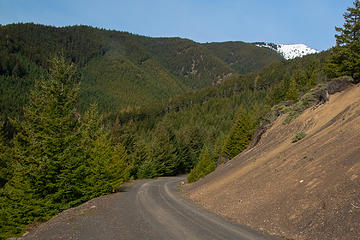 1 label Baldy false summit from Baldy/Tyler spur road 04-16-2019 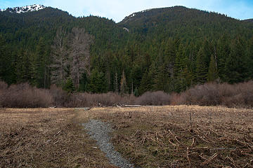 1 label view west from Camp Handy 04-16-2019 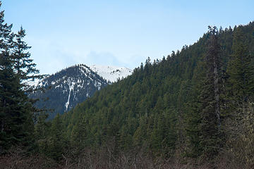 1 label view southwest from Camp Handy 04-16-2019 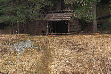 Camp Handy shelter 04-16-2019 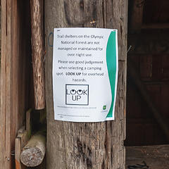 Sign on Camp Handy shelter 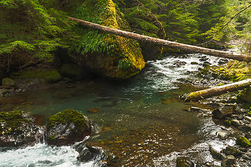 fern rock and Dungeness River
|
| Back to top |
  
|
|
Geezer
Member

Joined: 10 Apr 2015
Posts: 25 | TRs | Pics
|
|
Geezer
Member
|
 Fri Apr 19, 2019 3:18 pm |
|
|
One can now drive to the Silver Lake Way trail, but I suspect there is still plenty of snow on the trails above 4000 feet and feet of snow above 4500 feet as these trails in this area do not melt out fast.
|
| Back to top |
|
|
Ancient Ambler
Member
Joined: 15 May 2007
Posts: 1092 | TRs | Pics
Location: Bainbridge Island |
| Geezer wrote: | | One can now drive to the Silver Lake Way trail, but I suspect there is still plenty of snow on the trails above 4000 feet and feet of snow above 4500 feet as these trails in this area do not melt out fast. |
I agree with you, Geezer. It is still early days for mountain hiking in the Olympics and, while getting all the way to the TH by vehicle is convenient, snow will still be encountered at some point on many trails, requiring hikers to have and use snow navigation and snow travel skills and equipment. Hikers should also keep in mind that the northeastern Olympics have less annual precipitation than other parts of the Olympics, so the absence of snow at 3000 feet on the Dungeness trail does not mean that you'll now find snow-free trails in other parts of the Olympics at that elevation.
|
| Back to top |
|
|
reststep
Member
Joined: 17 Dec 2001
Posts: 4757 | TRs | Pics
|
|
reststep
Member
|
Sat Apr 20, 2019 9:29 pm |
|
|
"The mountains are calling and I must go." - John Muir
|
| Back to top |
|
|
braincloud
Summit Seeker

Joined: 30 Jul 2008
Posts: 186 | TRs | Pics
Location: The crooked path |
FYI - I camped at Goat Lake last night. Trail is snow free until about 4500. Lake is still snowed in but there are a couple of bare spots to toss a tent. Beautiful clear and calm night.
Didnt make it to any peaks up there, the routes are under some visibly collapsing cornices.
|
| Back to top |
|
|
archerbrown
are we there yet
Joined: 22 Jan 2009
Posts: 42 | TRs | Pics
Location: Seattle |
Love that hike...nothing like a little elevation gain...
.
|
| Back to top |
|
|
|
|


