| Previous :: Next Topic |
| Author |
Message |
FiresideChats
Member


Joined: 20 Jan 2014
Posts: 363 | TRs | Pics
Location: San Juan Islands |
Downey Creek is wide open, with the dedicated trail crew clearing the last blowdowns. Lovely walking all the way to Bachelor. What a great view of Buckindy and her craggy ridge! That was a nice surprise that I didn't remember from the trail guide. Poked my nose up the steep Bachelor switchbacks and you could hike a long, long way up there before you hit snow, I think.
|
| Back to top |
  
|
|
awilsondc
Member

Joined: 03 Apr 2016
Posts: 1324 | TRs | Pics
|
Just a few photos from a sunset hike up Mount Ellinor on Easter. Great steps up the winter route and the glissade chute is getting deep, but no rocks poking through.
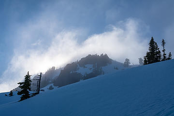 breaking free from the clouds 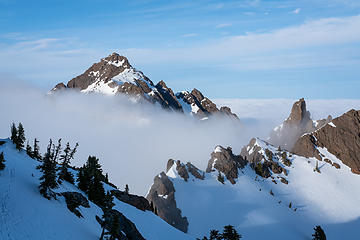 first views of Washington 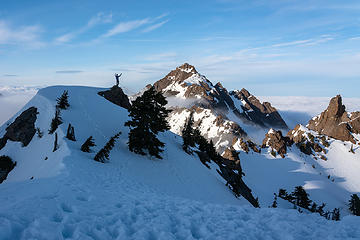 golden hour selfie 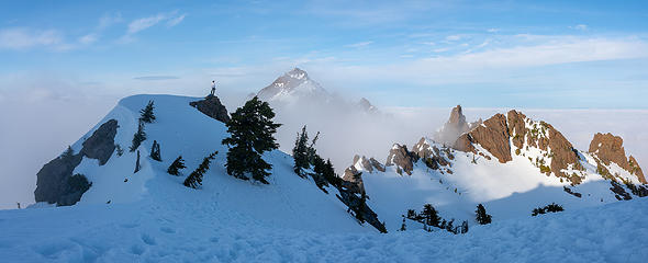 Am I Dreaming? 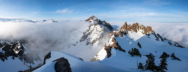 golden hour 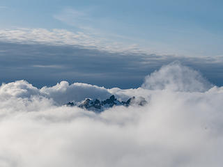 Cruiser 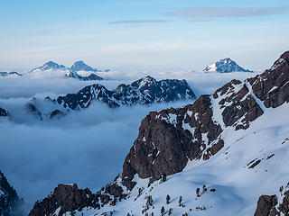 A-03085 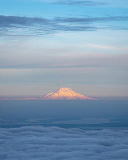 Rainier alpenglow 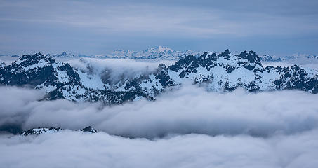 Olymus, Crusier, Cub 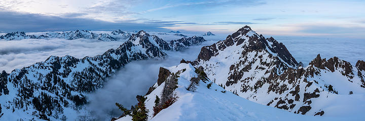 Summit panorama 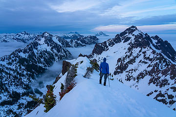 blue hour selfie
|
| Back to top |
|
|
olderthanIusedtobe
Member
Joined: 05 Sep 2011
Posts: 7708 | TRs | Pics
Location: Shoreline |
 I did Elinor years ago, can't quite remember what it looks like up there. Beautiful pics. When I did it I also traversed over and hit Washington. Seeing your pics kinda makes me want to do that again. I did Elinor years ago, can't quite remember what it looks like up there. Beautiful pics. When I did it I also traversed over and hit Washington. Seeing your pics kinda makes me want to do that again.
|
| Back to top |
|
|
neek
Member

Joined: 12 Sep 2011
Posts: 2337 | TRs | Pics
Location: Seattle, WA |
|
neek
Member
|
 Sun Apr 28, 2019 11:23 pm |
|
|
Decent conditions on Trappers Peak today
|
| Back to top |
|
|
Bootpathguy
Member
Joined: 18 Jun 2015
Posts: 1790 | TRs | Pics
Location: United States |
| neek wrote: | | Decent conditions on Trappers Peak today |
This is worthy of a full blown trip report.
Regardless, thanks for the report on conditions
Experience is what'cha get, when you get what'cha don't want
Experience is what'cha get, when you get what'cha don't want
|
| Back to top |
|
|
mike
Member

Joined: 09 Jul 2004
Posts: 6397 | TRs | Pics
Location: SJIsl |
|
mike
Member
|
Wed May 01, 2019 1:07 pm |
|
|
Ben Lawers and Beinn Ghlas
|
| Back to top |
|
|
mosey
Member

Joined: 18 Dec 2018
Posts: 163 | TRs | Pics
|
|
mosey
Member
|
Sun May 05, 2019 11:47 am |
|
|
Never really considered the climbing access trail above Deception Crags to be a destination of its own, but puzzlr's report of going up the MMM ridge looked really fun. I just went to the vista at the bottom of the difficult section, however. I could see plenty of snow above 3900' and I wasn't sure the route would be clear.
This has to be one of my favorite ridge walks in recent memory and props to all of the nwhikers that built this trail. Definitely will spend a day going up MMM and around all of the peaks in thaw season.
Also noticed some graffiti on the northernmost ridge of Truck Mountain on the highest road. TM!, I'm assuming it wasn't someone helpfully labeling the mountain though. Lame.
Edit: it stands for Ten Million and they predictably just got out of a stint in jail according to their instagram lmao
|
| Back to top |
|
|
kiliki
Member
Joined: 07 Apr 2003
Posts: 2324 | TRs | Pics
Location: Seattle |
|
kiliki
Member
|
Wed May 15, 2019 3:10 pm |
|
|
Is there anything better than the Hoh in May? Along the Hoh River Trail yesterday.
 Hoh 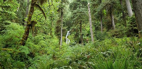 Hoh1
|
| Back to top |
|
|
Chief Joseph
Member

Joined: 10 Nov 2007
Posts: 7703 | TRs | Pics
Location: Verlot-Priest Lake |
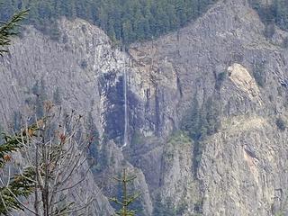
Having hiked extensively on the MLH it's difficult for me to find a new hike. I have always wanted to explore the old road between upper Elliot creek-Goat lake trail to Bedal creek and FS road 4096 and yesterday I got it done. I began my trek solo at the Elliot creek-Goat lake TH, staying to the left on the upper trail for about 3/4 mile to the old road that splits off the trail to the left and east. I expected heavy over-growth and blow downs but found neither for the first 1.5 miles to the water crossing of upper Elliot creek. There is a nice waterfall there but unfortunately I discovered I forgot to put the SD card back into my camera, so no pics.  I had to scramble down a pretty steep bank and then veggie belay up an even steeper bank on the other side. I was able to cross easily with no wet feet. The trail-road then becomes pretty thick with vegetation for the duration (maybe another 1.5 miles?) and at one spot the trail pretty much peters out for about 100 yards, but I just followed the same general direction and the game trail. The game trail is pretty distinct the entire way, I doubt that humans rarely venture down this path, only crazy, adventure seekers such as myself.
Speaking of "game" I encountered quite a bit of fresh bear, cougar, and coyote scat, so if you do try this trail, you might want to bring protection (I didn't). From all the recent talk of cougars and attacks, I found myself looking up and to my back trail more than usual. I need to find a 2 legged cougar for companionship, for strength in numbers, and one that I can hopefully outrun.
I had to scramble down a pretty steep bank and then veggie belay up an even steeper bank on the other side. I was able to cross easily with no wet feet. The trail-road then becomes pretty thick with vegetation for the duration (maybe another 1.5 miles?) and at one spot the trail pretty much peters out for about 100 yards, but I just followed the same general direction and the game trail. The game trail is pretty distinct the entire way, I doubt that humans rarely venture down this path, only crazy, adventure seekers such as myself.
Speaking of "game" I encountered quite a bit of fresh bear, cougar, and coyote scat, so if you do try this trail, you might want to bring protection (I didn't). From all the recent talk of cougars and attacks, I found myself looking up and to my back trail more than usual. I need to find a 2 legged cougar for companionship, for strength in numbers, and one that I can hopefully outrun.  So, next I came across a bit of pink flagging and heard some roaring water and thought, "Damn, I hope I can cross it, because I really didn't want to return the way I came". There is another large waterfall here at the crossing of Bedal creek, I was able to cross the narrow rapids easily but this time my feet got soaked, o' well.
So, about another 45 minutes I finally came to FS road #4096 and the TH for Bedal Creek-Bedal Peak, it's clearly marked, but I was tired so will save that for another time. So, I proceeded down the road, moving large rocks from the road as I walked and hoping I could catch a ride at the bottom where 4096 intersects the MLH. Did not happen. Two vehicles came by but were not offering me and my muddy boots a lift. O' well, I need the exercise anyway. It seemed and eternity walking the road back to the Elliot creek-Goat lake TH, but car to car it was only about 5 hours, including a couple of 10 minute stops.
If you decide to hike this (highly unlikely) I would suggest 2 vehicles, or at least a bike at one end, or simply return the way you came, probably turning around at the Bedal creek crossing-waterfall. One things nearly guaranteed, you won't see another human, more likely a bear.
So, next I came across a bit of pink flagging and heard some roaring water and thought, "Damn, I hope I can cross it, because I really didn't want to return the way I came". There is another large waterfall here at the crossing of Bedal creek, I was able to cross the narrow rapids easily but this time my feet got soaked, o' well.
So, about another 45 minutes I finally came to FS road #4096 and the TH for Bedal Creek-Bedal Peak, it's clearly marked, but I was tired so will save that for another time. So, I proceeded down the road, moving large rocks from the road as I walked and hoping I could catch a ride at the bottom where 4096 intersects the MLH. Did not happen. Two vehicles came by but were not offering me and my muddy boots a lift. O' well, I need the exercise anyway. It seemed and eternity walking the road back to the Elliot creek-Goat lake TH, but car to car it was only about 5 hours, including a couple of 10 minute stops.
If you decide to hike this (highly unlikely) I would suggest 2 vehicles, or at least a bike at one end, or simply return the way you came, probably turning around at the Bedal creek crossing-waterfall. One things nearly guaranteed, you won't see another human, more likely a bear. 
Go placidly amid the noise and waste, and remember what comfort there may be in owning a piece thereof.
Go placidly amid the noise and waste, and remember what comfort there may be in owning a piece thereof.
|
| Back to top |
|
|
olderthanIusedtobe
Member
Joined: 05 Sep 2011
Posts: 7708 | TRs | Pics
Location: Shoreline |
Tried a couple trails this week I hadn't done previously, along Hwy 20. First up was Panther Creek. The creek was beautiful and the trail actually stays right by it for several miles (takes a bit at the beginning to get to it--first you go up, then you lose pretty much all of the elevation you gained). 4th of July Pass didn't do much for me. I got a late start, was past my turn around time, so didn't get beyond the pass far enough for a clear view of Pyramid/Snowfield, etc.
|
| Back to top |
|
|
olderthanIusedtobe
Member
Joined: 05 Sep 2011
Posts: 7708 | TRs | Pics
Location: Shoreline |
I was kinda worn out from Panther Creek, but I'm nothing if not stubborn. The next day I went up Thunder Creek. I didn't exactly have a pre-determined destination, just figured I'd go for a while and then turn around. I got to Junction Camp. I was a bit tired but felt ok getting there. On the way back I felt like crap. I had planned to hike 3 days in a row, but nixed that and cut it short a day. Unlike Panther Cr., the Thunder Cr. trail is almost never within sight of its namesake. That was fairly disappointing. Got a few nice views of it. The section approaching Junction Camp, along Fisher Creek, was by far my favorite part of the day. Mostly overcast so I had limited views of peaks above me.
edited--there was a Park Service guy scouting for cedar logs to use for a bridge, I shoulda asked but I'm assuming it's to replace the washed out bridge to the McAlester camp site.
Saw a bear both days. Bear #2 was too quick to get a decent picture of.
|
| Back to top |
|
|
RichP
Member

Joined: 13 Jul 2006
Posts: 5634 | TRs | Pics
Location: here |
|
RichP
Member
|
Tue May 28, 2019 9:45 am |
|
|
Suntop and Kelly Butte. 5-27. Lots of ticks on Kelly Butte so check yourself well.
Both roads are snow-free and in good shape. A few minor snow patches remain near the top of Kelly Butte.
 Falls across 410. 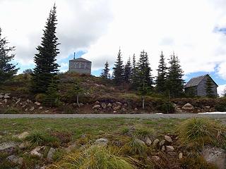 Suntop lookout. 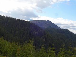 Kelly Butte. 1000' and 1.5 miles. 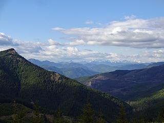 Cascade Crest peaks on the drive up.  Interesting rocks at the beginning of the steep section.  Some lingering snow near the top.  Kelly Butte Lookout. 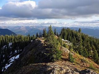 South. 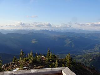 North. 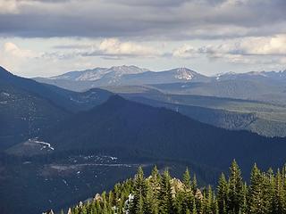 Raven Roost and Fifes Peaks. 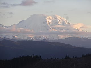 Rainier finally came out at the end of the day.
|
| Back to top |
|
|
Nancyann
Member
Joined: 28 Jul 2013
Posts: 2318 | TRs | Pics
Location: Sultan Basin |
|
Nancyann
Member
|
Sat Jun 01, 2019 6:09 pm |
|
|
Ive seen Heather and Glasses Lakes from high on the PCT on Grizzly Peak and have always wanted to visit them. Yesterday made it as far as Heather but too lazy to tromp through the snow up to Glasses. Saw no one the entire day.
 Heather Lake Trail 5/31/19 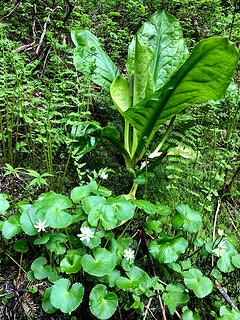 Heather Lake Trail 5/31/19 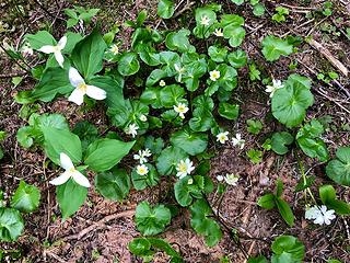 Heather Lake Trail 5/31/19 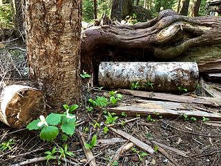 Heather Lake Trail 5/31/19 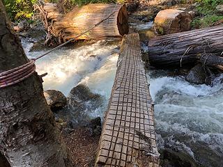 Heather Lake Trail 5/31/19 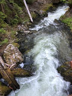 Heather Lake Trail 5/31/19 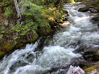 Heather Lake Trail 5/31/19 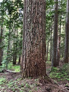 Heather Lake Trail 5/31/19 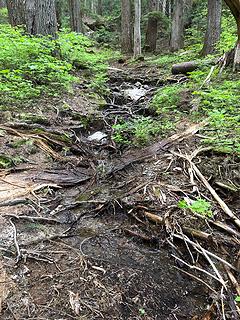 Heather Lake Trail 5/31/19 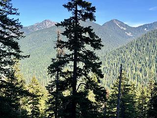 Heather Lake Trail 5/31/19 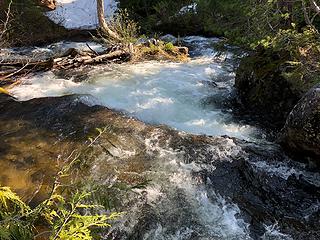 Heather Lake Trail 5/31/19 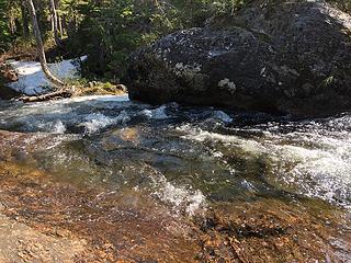 Heather Lake Trail 5/31/19 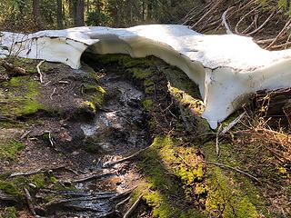 Heather Lake Trail 5/31/19 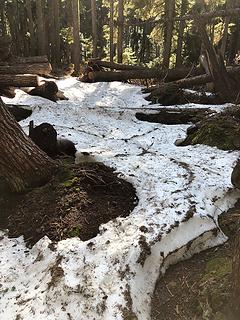 Heather Lake Trail 5/31/19 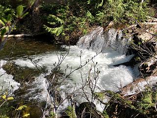 Heather Lake Trail 5/31/19 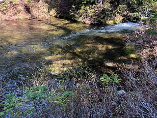 Heather Lake Trail 5/31/19 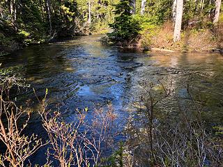 Heather Lake Trail 5/31/19 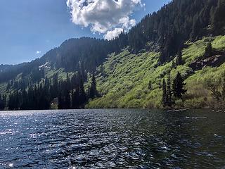 Heather Lake 5/31/19 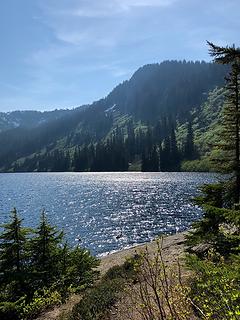 Heather Lake 5/31/19 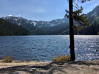 Heather Lake 5/31/19
|
| Back to top |
|
|
H. Hound
Member

Joined: 09 May 2003
Posts: 1205 | TRs | Pics
Location: Exit 32 |
|
H. Hound
Member
|
Sun Jun 02, 2019 3:40 am |
|
|
Crater Lake, The Money Creek one 6-1-19
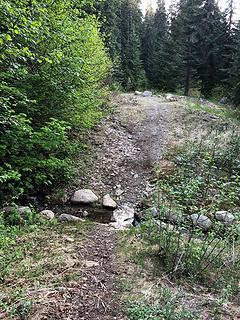
Money Creek Road is open to the end now. It does get a bit rough at the switchback tho. The boot path isn't as obvious as it used to be either.
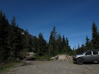 New end of Money Creek road 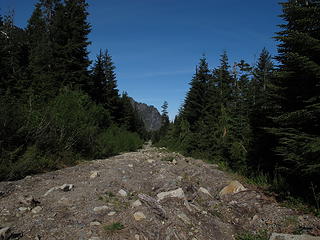 Reclaimed road
|
| Back to top |
|
|
RichP
Member
Joined: 13 Jul 2006
Posts: 5634 | TRs | Pics
Location: here |
|
RichP
Member
|
Sun Jun 02, 2019 5:49 am |
|
|
Thanks H. Hound. I never thought we'd see that road open again.
|
| Back to top |
|
|
|
|


