| Previous :: Next Topic |
| Author |
Message |
Matt Lemke
High on the Outdoors


Joined: 15 Jul 2010
Posts: 2052 | TRs | Pics
Location: Grand Junction |
|
Matt Lemke
High on the Outdoors
|
 Mon May 20, 2019 11:37 am |
|
|
On a last minute whim, I took a flight back to Seattle for the weekend again after working the last week in Tucson. I called up Josh and asked if he wanted to do Ballard and he agreed to so I bought the flights right away. It was yet another night flight arriving in Seattle around midnight early Saturday morning. I took an Uber back to my parents house and borrowed my sisters car for the weekend, got to Lynnwood to pick up Josh around 1:20am and we were off to Bellingham to pick up my skis. It was occurring to me I would be climbing yet another peak without any sleep!
We drove over to Mazama, and found a spot to take a 1 hour nap in the car. By 7am we started driving up the Harts Pass Road. We were able to drive up to an elevation of 5250 feet, stopping about 3 miles from Harts Pass due to a deeper snow patch covering the road in a low rider vehicle. High clearance 4WD vehicles were getting up another mile or so, to within 2 miles of the pass. We saddled up with skis and started walking shortly before 8am, hoping to be able to ski down the road on the opposite side of the pass a bunch. We made quick work walking the first 3 miles to Harts Pass, which we were able to find mostly bare ground along the edge of the road. Once at the pass at 6200 feet, there was 2 feet of snow on the ground, contrary to ranger reports stating there would be 4-5 feet. We switched into our ski boots and put the skis on, and after a quick snack we started skiing down the road heading down into the Slate Creek Valley on the west side of the pass.
Unfortunately we would only get about a mile, back down to about 5200 feet before the snow disappeared, and we ditched the skis. For the next 4.5 miles, the walk on the Slate Creek Road down to the gate at 3800 feet was quick and dry. A fair amount of debris and trees/rocks was on the road so if anyone plans to drive down this way shortly after the snow melts, bring a chainsaw and an attitude for ground clearing.
We continued the additional mile (about 9.5 miles total from the car) beyond the gate, curving left towards the south as the old road continued a gentle traverse to the bridge over South Fork Slate Creek at 4000 feet. This bridge at some point had been rebuilt directly over top of the old bridge. We stashed our overnight gear here as it was only noon by this point and we knew we would have plenty of daylight to make it up and down before dark.
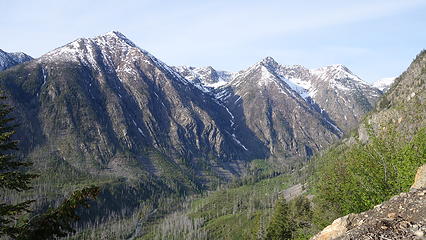
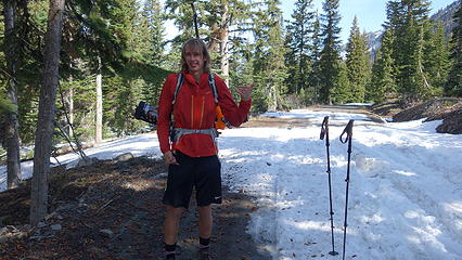 Starting out from where we parked 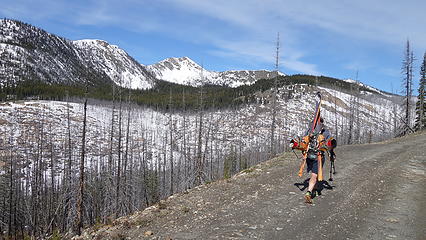 Walking up the road to Harts Pass 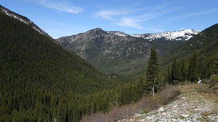 View hiking down the Slate Creek Road 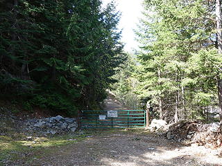 Road closure gate at 3800 feet 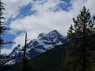 First views of the slopes of Ballard 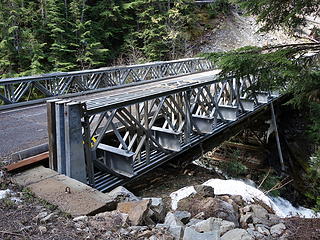 Bridge over South Fork Slate Creek 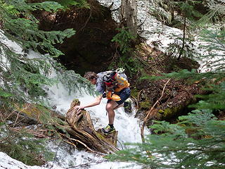 Josh crossing one of the two streams 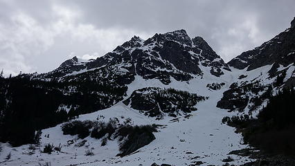 View of Ballard from the 4900 foot basin 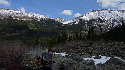 Tatie Peak across the valley to the east 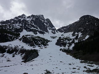 This gully sure looks inviting, but would lead you to the lower N peak 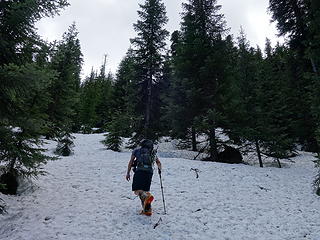 Starting up good snow 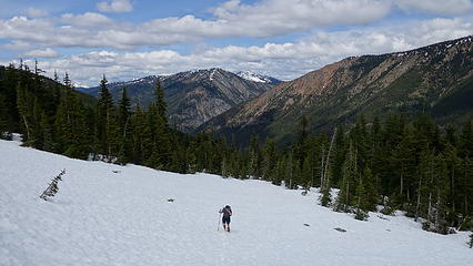 Traversing the east slopes 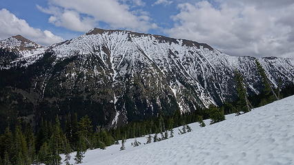 View east 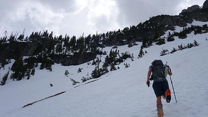 Headed for 6200 foot bench on east ridge (visible at center left) 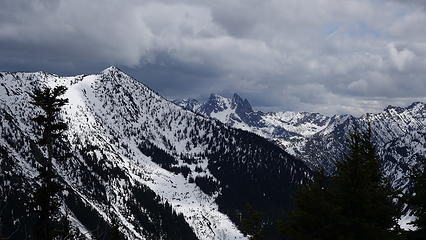 The Needles? to the south 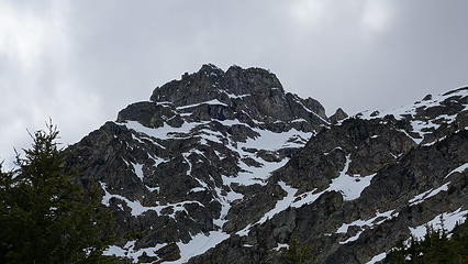 View of Ballard from the ridge at 6200 feet 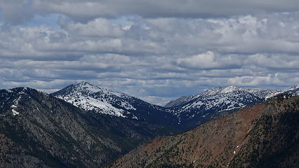 View north of Tamarack Peak (center right) 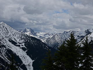 View south towards The Needles 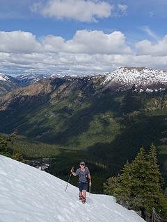 Josh ascending the ridge 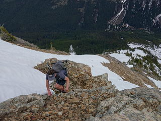 Josh scrambling up one of the rock bands 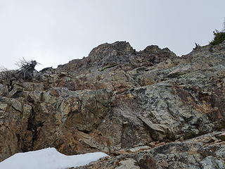 Class 3 scrambling 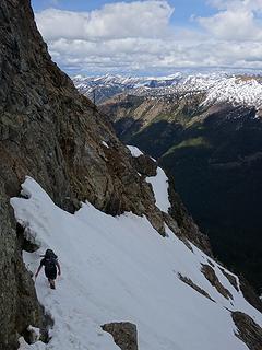 Avoiding the moats! 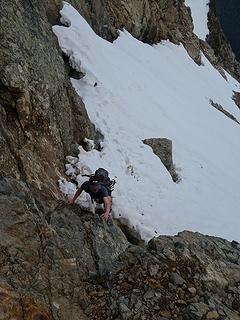 Class 4 section 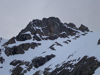 Mount Ballard 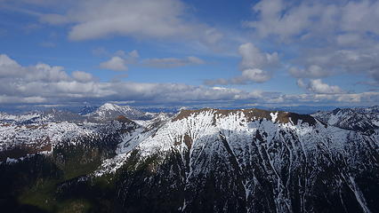 Pasayten Bulgers, Robinson at center right 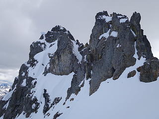 Nearing the 8150 foot col 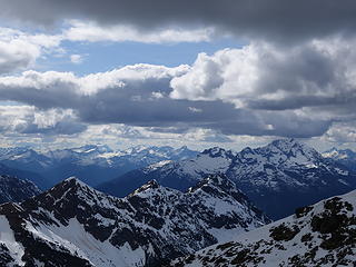 Jack Mountain 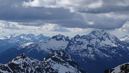 Jack and Luna 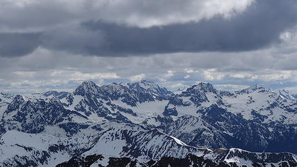 Mesahchie, Logan and Forbidden 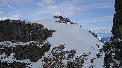 Josh happy to be at the col 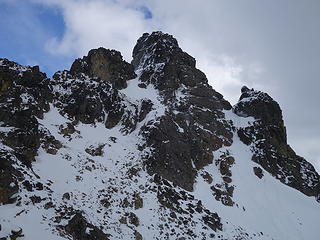 West side of the summit block of Ballard 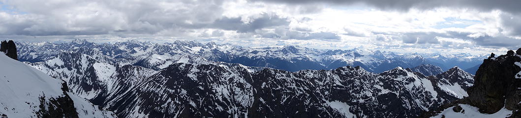 Summit Pano 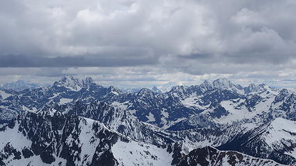 Black, Glacier Peak and Goode 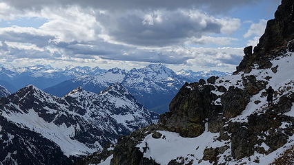 Josh traversing towards the summit block 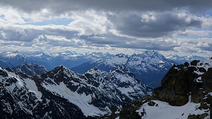 Another view of Jack 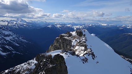 Ballard North Peak from summit 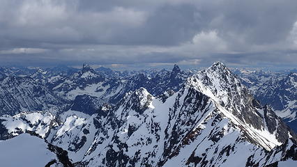 Tower, Golden Horn and Azurite (This one is my favorite!) 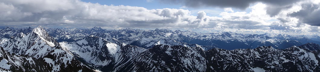 Summit pano with Azurite on left 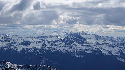 Inspiration Traverse peaks from summit 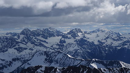 Logan and Forbidden from the summit 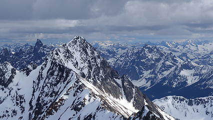 Traverse to Azurite 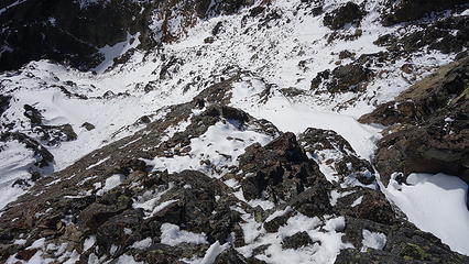 Looking down the route I scrambled to reach the summit 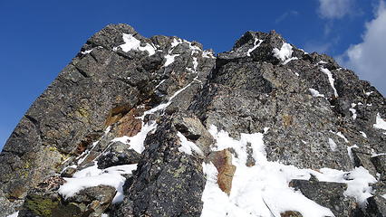 Summit block view as I descended 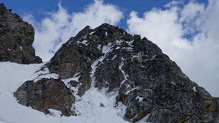 This route on NW side of summit block was likely easier 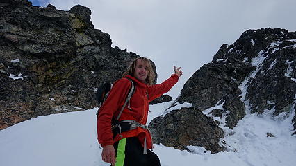 Me thinking I'm cool.....(I'm not) 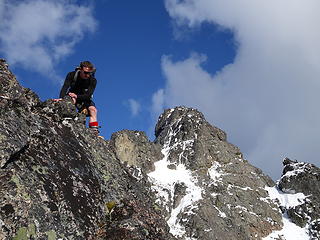 Josh making a step down as we head back to the col with Ballard behind 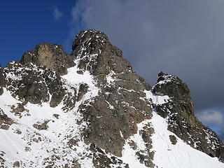 Afternoon sun hitting the west side of Ballard 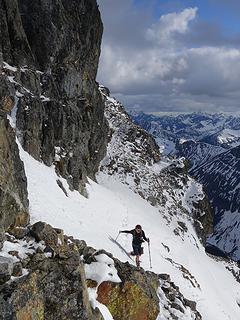 Traversing back to the col 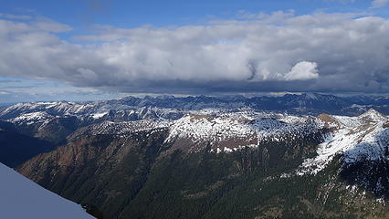 Pasayten Peaks 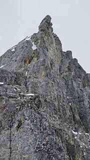 Small tower just north of Ballard 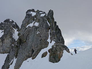 Josh at the col 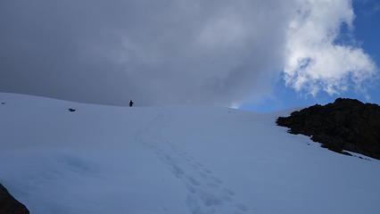 Descending the upper ridge 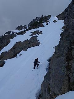 Steeper snow at about 7200 feet 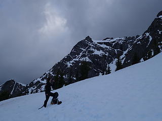 Back on the lower ridge near the 6200 foot bench 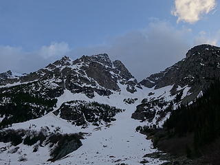 View again from the 4900 foot basin 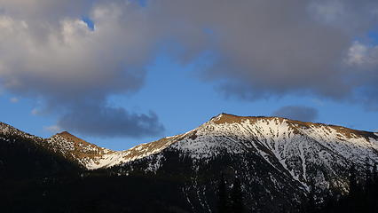 Sunset on Tatie Peak 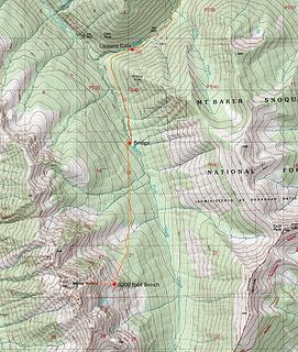 Map of our route
|
| Back to top |
  
|
|
Josh Journey
a.k.a Josh Lewis

Joined: 01 Nov 2007
Posts: 4836 | TRs | Pics
|
Despite not making the summit this was a fantastic trip! I've soloed things like the NE Buttress of Goode, low 5th with icy ledges and fresh powder; however this was a bit spicier than usual. To make matters worse there was some confusion on my part when I was advised to take a lower ledge (there were two, I took the one slightly lower). After throwing a dozen boulders down and meticulously edging my way in ski boots followed by an extremely dicey section with no holds I felt that it was time to bail. Even a 1% chance of a fall is far too great.
 Harts Pass road Views 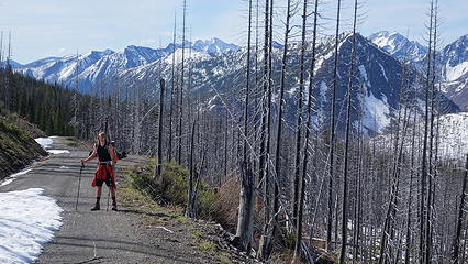 Hiking to Harts Pass 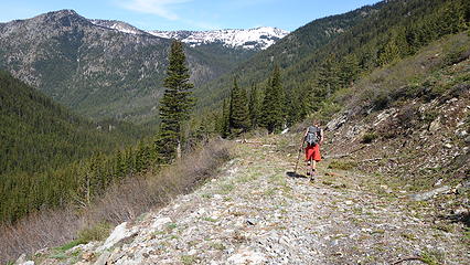 Blow Down beyond Harts Pass 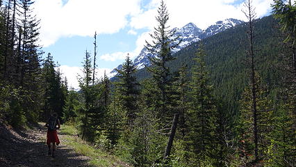 Almost to the Bridge 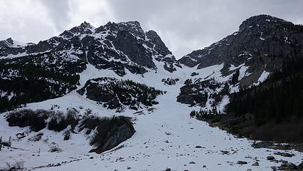 First Major Opening 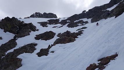 Steep Snow to the Col 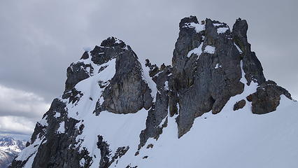 Summit Block 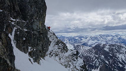 Ledge past the Col 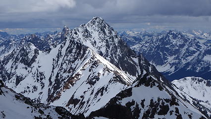 Azurite Peak 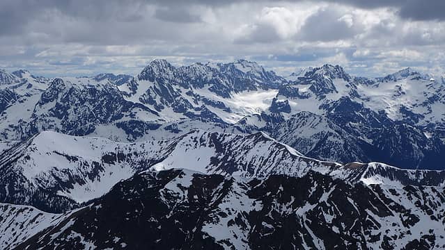 Mount Logan area 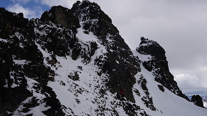 Steep Summit Ending 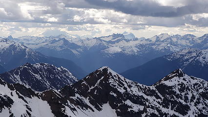 Baker and Shuksan 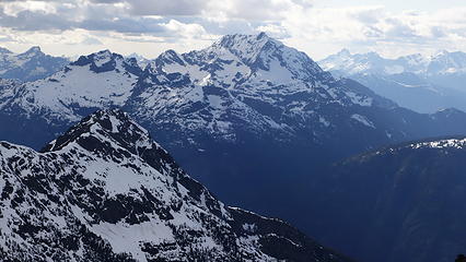 Jack Mountain 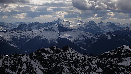 Snowfield Peak Area 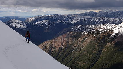 High Above the Valleys 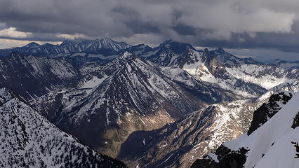 Washington Pass Area 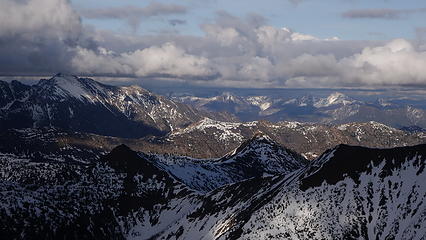 Gloomy Weather to the East 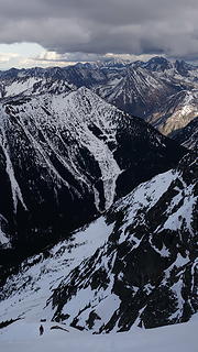 Deep into the Mountains 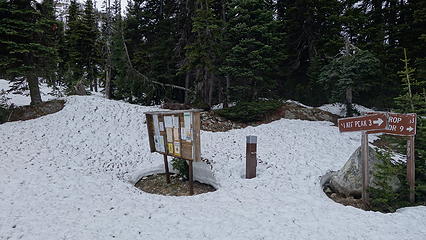 Harts Pass Snow Depth 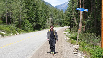 Walking Down...
|
| Back to top |
|
|
Jake Robinson
Member

Joined: 02 Aug 2016
Posts: 521 | TRs | Pics
|
You guys got some great photos! I loved the views up there. Thanks for the conditions update too.
|
| Back to top |
|
|
neek
Member

Joined: 12 Sep 2011
Posts: 2338 | TRs | Pics
Location: Seattle, WA |
|
neek
Member
|
Tue May 21, 2019 10:10 am |
|
|
right on 
|
| Back to top |
|
|
Mike Collins
Member
Joined: 18 Dec 2001
Posts: 3097 | TRs | Pics
|
| Josh Calico wrote: | | edging my way in ski boots followed by an extremely dicey section with no holds I felt that it was time to bail. Even a 1% chance of a fall is far too great |
You made the right decision. You would do more than chip a tooth on a fall with this peak. In my writeup I described "...ledgettes with fingertip holds on Class 4 rock."
|
| Back to top |
|
|
Nancyann
Member
Joined: 28 Jul 2013
Posts: 2319 | TRs | Pics
Location: Sultan Basin |
|
Nancyann
Member
|
Tue May 21, 2019 10:51 am |
|
|
Thanks for the conditions update. Beautiful late afternoon pictures! Glad you made the right decision to turn around, Josh.
Have fun in Indonesia, Matt, sounds like a great adventure!
|
| Back to top |
|
|
Stefan
Member

Joined: 17 Dec 2001
Posts: 5093 | TRs | Pics
|
|
Stefan
Member
|
Tue May 21, 2019 1:09 pm |
|
|
Does anyone know of the road and conditions down to Chancellor? Does it require a 4WD vehicle? Only motorbikes? Only bikes? I understand you would know only from last year. Just trying to gage access to Chancellor. Thanks!
|
| Back to top |
|
|
Brushbuffalo
Member

Joined: 17 Sep 2015
Posts: 1887 | TRs | Pics
Location: there earlier, here now, somewhere later... Bellingham in between |
| Stefan wrote: | | Does anyone know of the road and conditions down to Chancellor? Does it require a 4WD vehicle? |
Stefan, when I was down the road last fall to hike to Cady Point, the continuation of the road to Chancellor was blocked by a sturdy locked gate.
Passing rocks and trees like they were standing still
Passing rocks and trees like they were standing still
|
| Back to top |
|
|
Brushbuffalo
Member
Joined: 17 Sep 2015
Posts: 1887 | TRs | Pics
Location: there earlier, here now, somewhere later... Bellingham in between |
Excellent sport and report, gentlemen!
From reading other accounts and seeing your pictures, I wonder if snow covering the loose rock makes this climb easier and safer.. Of course, that ease could be cancelled if recent snow is on the summit block such as you had.
You are right, you had fantastic lighting for super pictures.
Let's see.... long flight, long drive, very little sleep, long climb, Oreos for dinner, tiring hike back out, long drive again, then LONG flight to Indonesia,....
The climb may have been the easy part!
( nice ski boot tan, Josh.  That from Sherman Peak a few weeks ago?) That from Sherman Peak a few weeks ago?)
Passing rocks and trees like they were standing still
Passing rocks and trees like they were standing still
|
| Back to top |
|
|
Matt Lemke
High on the Outdoors
Joined: 15 Jul 2010
Posts: 2052 | TRs | Pics
Location: Grand Junction |
|
Matt Lemke
High on the Outdoors
|
Wed May 29, 2019 3:10 am |
|
|
| Brushbuffalo wrote: | | nice ski boot tan, Josh. That from Sherman Peak a few weeks ago?) |
Yeah it was. ..i have the same tan lol!
I haven't lost my ability to run on no sleep just quite yet! 😅
|
| Back to top |
|
|
|
|
You cannot post new topics in this forum
You cannot reply to topics in this forum
You cannot edit your posts in this forum
You cannot delete your posts in this forum
You cannot vote in polls in this forum
|
Disclosure: As an Amazon Associate NWHikers.net earns from qualifying purchases when you use our link(s). |


