| Previous :: Next Topic |
| Author |
Message |
Fletcher
Member


Joined: 29 Jul 2009
Posts: 1870 | TRs | Pics
Location: kirkland |
|
Fletcher
Member
|
 Mon May 20, 2019 11:37 am |
|
|
Dave and I brought home the bacon yesterday. What a route and what a day! I'm embarrassed to admit that this was my third attempt on this route in as many months.. but third time was a charm.
Quick route info:
1. Take Bacon Creek Road to where it crosses Bacon Creek and take spur 1064 to first fork, either park here (1000 ft) or take a right and drive to turnaround at next switchback (1200 ft), road is not driveable beyond this point.
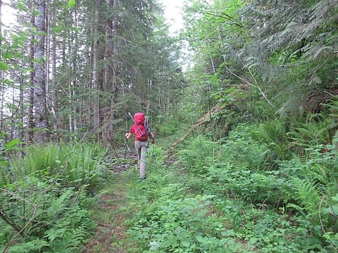
2. Hike dilapidated spur 1064 for a few hundred yards until you reach some orange flagging, turn right here and begin shwack
3. follow path of least resistance 2600 ft uphill to ridge, take ridge to Pt 4800
4. drop 500 ft into obvious basin to the west, ascend obvious snow gully to 6000 ft and "Diobsud Creek Glacier"
5. Ascend easy glacier and moderate snow slopes to Bacon Peak summit
Dave and I met up at the usual Ash Way park and ride at 4am and I was running off of the usual 2.5 hours of sleep. We would have made better time to the trailhead had I not stupidly cruised by the turnoff for highway 530. By 6:45 am, we were geared up and moving.
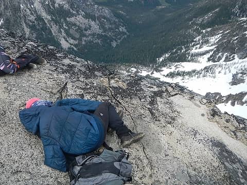
 starting out 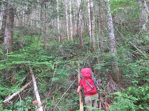 start of the shwack 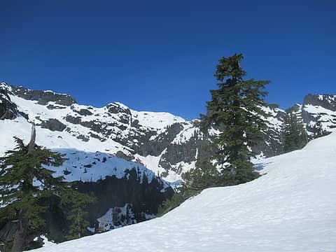 first view of Electric Butte 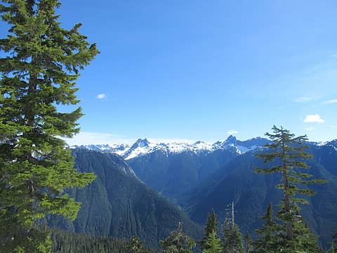 first views of Despair and Triumph 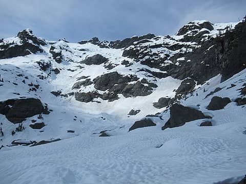 basin 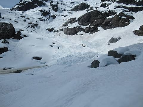 debris 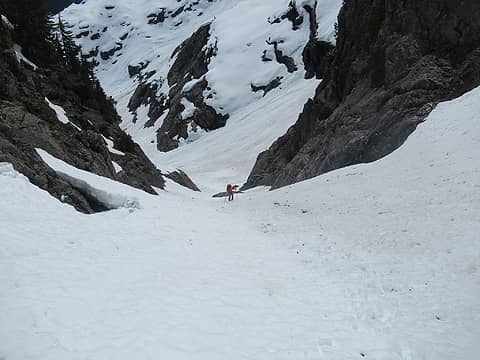 Dave climbing the gully 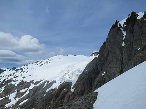 there she is 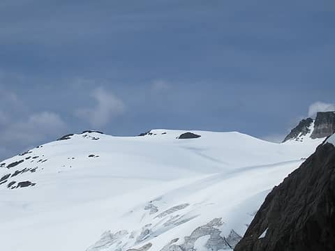 pleasant travel ahead 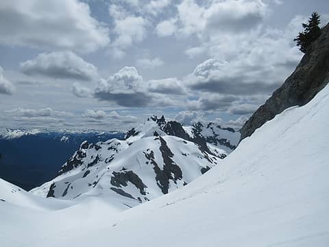 Electric and Logger Buttes 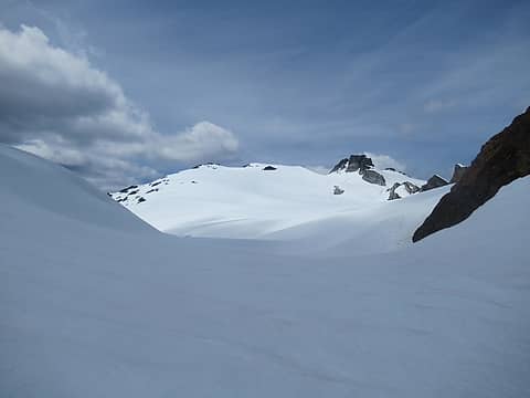 glacier ahead 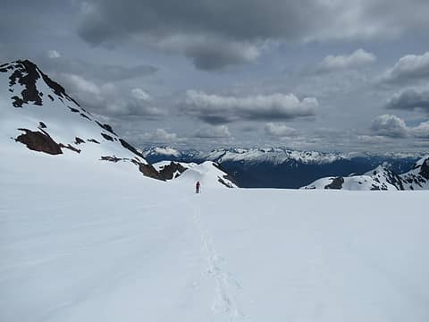 Dave getting it 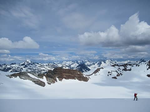 what a place 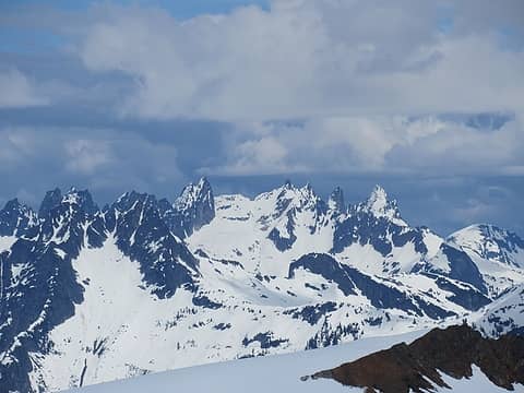 Southern Pickets 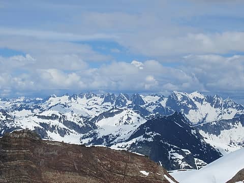 Northern Pickets 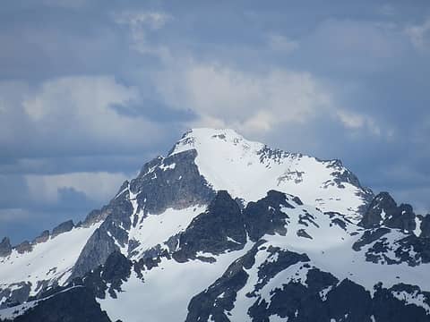 Blum 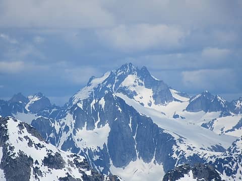 Bear and Redoubt 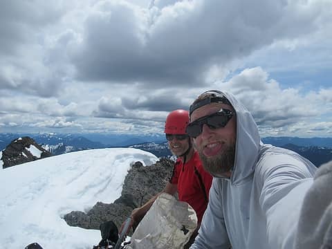 summitshot 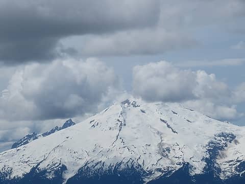 Baker 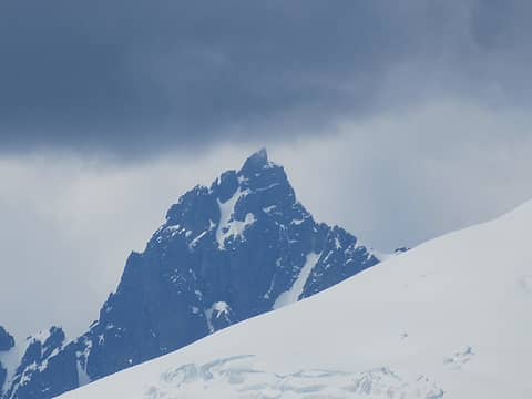 hey babe 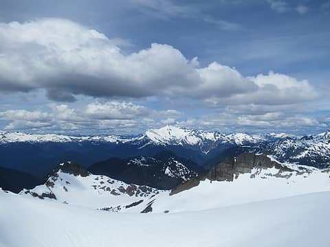 Shuksan 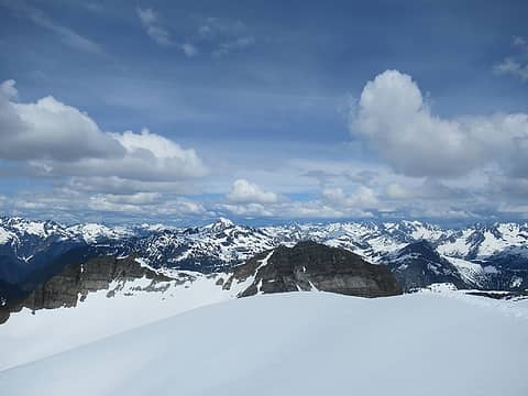 too many peaks to name 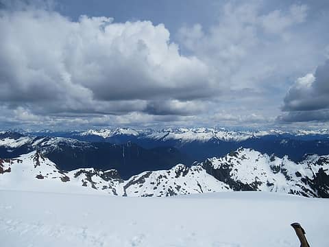 in every direction 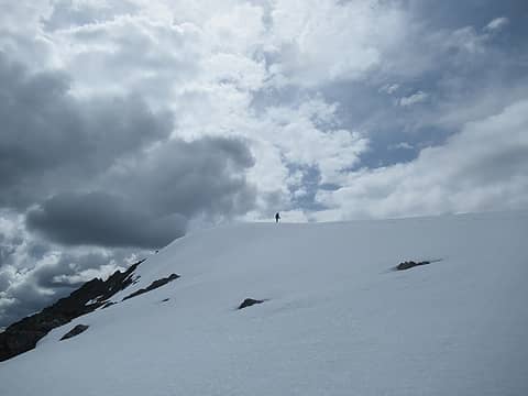 Dave leaving the summit 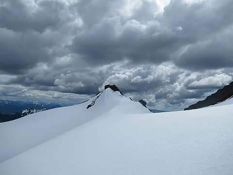 south peak 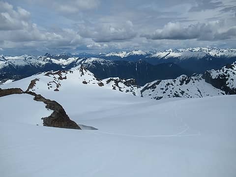 descending with views 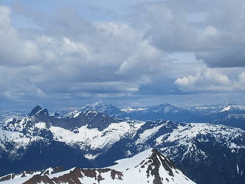 Triumph, Thornton, Jack, and Crater 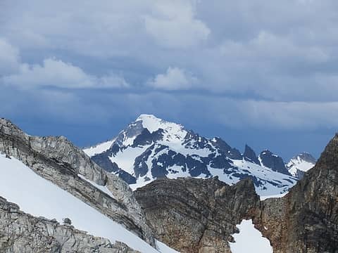 Blum again 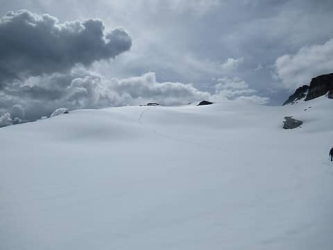 our tracks and incoming clouds 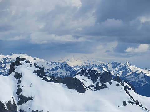 incoming weather on Glacier Peak 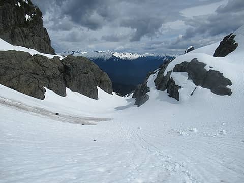 quick descent 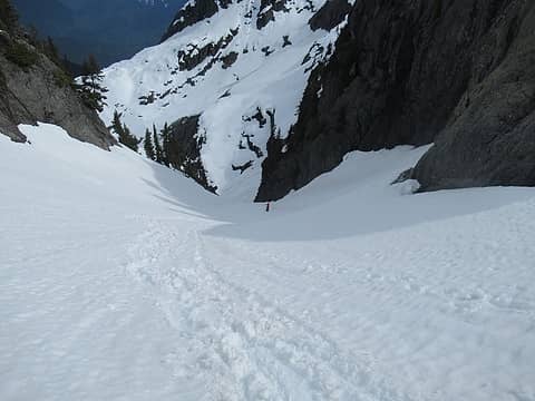 quick descent 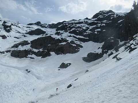 passing back through the avalanche funnel 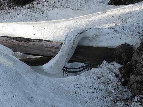 interesting melt patterns 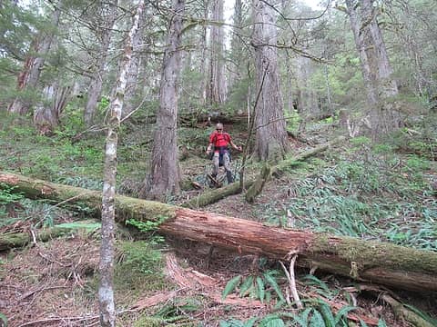 some of the pleasant terrain on the deproach 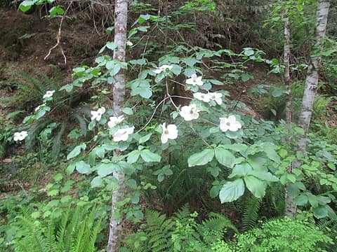 whats this? 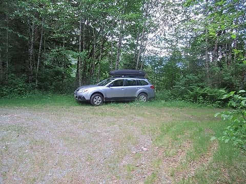 a welcome sight 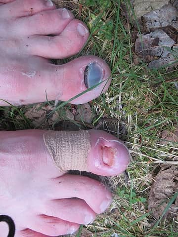 thankful that these guys were able to take me to the top of Bacon Peak
|
| Back to top |
  
|
|
Gimpilator
infinity/21M

Joined: 12 Oct 2006
Posts: 1684 | TRs | Pics
Location: Edmonds, WA |
Very few reports for this peak. Thanks.  Give those dogs a break!
|
| Back to top |
|
|
wade63
guitarman

Joined: 21 Jun 2018
Posts: 126 | TRs | Pics
Location: Orcas Island |
|
wade63
guitarman
|
Mon May 20, 2019 11:59 am |
|
|
Thanks for the report. We're planning a trip into berdeen and Green Lake. I've tried to get in there a few times one trip up Bacon Creek bushwhack hell and last year circumventing Mount Watson ran into bad weather. We're shooting for Mid August and this time we'll try heading up the ridge on the bacon Creek Side I think.
|
| Back to top |
|
|
Michael Lewis
Taking a nap
Joined: 27 Apr 2009
Posts: 629 | TRs | Pics
Location: Lynnwood, WA (for now) |
| Quote: | | Give those dogs a break! |
 I second that
I keep thinking about this route so I'm glad to see there's interest in it.
I second that
I keep thinking about this route so I'm glad to see there's interest in it.
 NicoleH NicoleH
NicoleH |
| Back to top |
|
|
rstoddard24
BBQWingz

Joined: 30 Dec 2016
Posts: 74 | TRs | Pics
|
thanks for the report. we were considering for this coming weekend if conditions are good, and your TR is very timely and helpful!
also for your "what's this" photo..my sister says "thats dogwood - duh!"
|
| Back to top |
|
|
Fletcher
Member
Joined: 29 Jul 2009
Posts: 1870 | TRs | Pics
Location: kirkland |
|
Fletcher
Member
|
Tue May 21, 2019 11:21 am |
|
|
*bump for video addition
Id be curious to hear from anyone else who has done this route. Obviously someone has been up there in the last few years, evidenced by the flagged route that we followed. The flagging gives you a good idea of where to leave the road, but after that, pick your poison and follow the path of least resistance. The flags don't always lead you to the best route.
|
| Back to top |
|
|
Brushbuffalo
Member

Joined: 17 Sep 2015
Posts: 1887 | TRs | Pics
Location: there earlier, here now, somewhere later... Bellingham in between |
| Fletcher wrote: | | The flags don't always lead you to the best route. |
Ain't it the truth? Same goes for cairns on alpine routes...sometimes.
But the worst are blazes....only total greenhorns or idiots ever make blazes.
Passing rocks and trees like they were standing still
Passing rocks and trees like they were standing still
|
| Back to top |
|
|
Mike Collins
Member
Joined: 18 Dec 2001
Posts: 3097 | TRs | Pics
|
| Fletcher wrote: | whats this? |
Cornus nuttallii or Pacific Dogwood. It is in the same genus as the lowly 4" tall bunchberry plant. I happened upon your trip report while researching a climb of Bacon Peak. I was atop Watson Peak yesterday and bonded with Bacon Peak.
|
| Back to top |
|
|
cascadetraverser
Member

Joined: 16 Sep 2007
Posts: 1407 | TRs | Pics
|
What a great alternative to the above the Diobsud brush thrash approach. Yet another great report from you Fletcher....
|
| Back to top |
|
|
|
|


