| Previous :: Next Topic |
| Author |
Message |
freddyfredpants
saucy


Joined: 08 Jul 2018
Posts: 40 | TRs | Pics
Location: Seattle |
I took a 5 day stroll through the Glacier Peak Wilderness during the first week of July to tag some peaks. I wanted to avoid the lake ferry to maximize the bag to travel ratio, and avoid Swamp Creek to maximize the fun factor. Crucially, Matt Lemke had commented a while back that the Bonanza Dark Traverse could be soloed. I wanted to go and check out whether that would be true for me.
Itinerary:
Day 1: Phelps Creek TH to Fernow
Day 2: Copper, Buckskin, and down to Holden Village
Day 3: Hike up to Holden Pass and Martin Peak
Day 4: Bonanza via MGG, traverse to Dark, and make my way towards North Star
Day 5: North Star and hike out to Phelps Creek TH
Day 1: Phelps Creek to Fernow
9:30 am start from Phelps Creek, taking the trail up to Leroy Basin. A few years ago I had tagged Fernow going over the 7600 col above the lake to use the snowfield, so I ended up doing that again. Later in the season I gather that going down the 7200 col NW of the unnamed lake to pass the toe of the buttress and cross the moraine is the better way to get to the waterfall area on Fernows W face. Snow level on Gloomy Glacier was a little lower this time but workable.
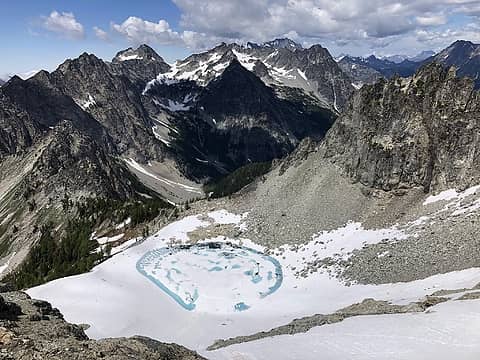 The unnamed lake. Cousin of Gloomy Lake? 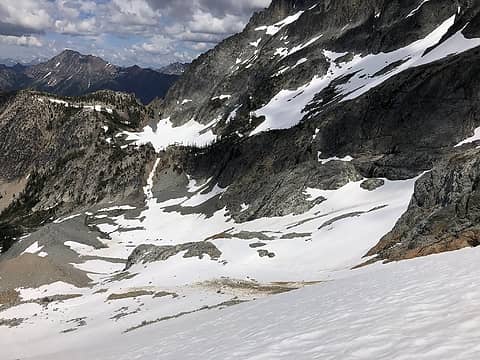 Gloomy Glacier crossing 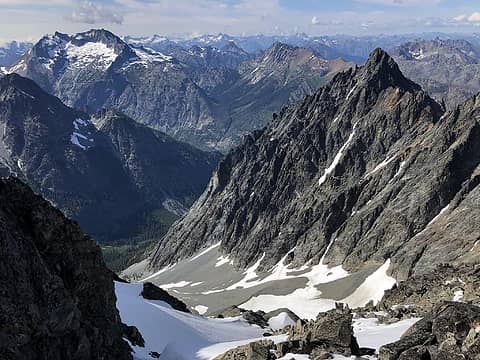 Just below summit of Fernow, looking towards Copper and Bonanza 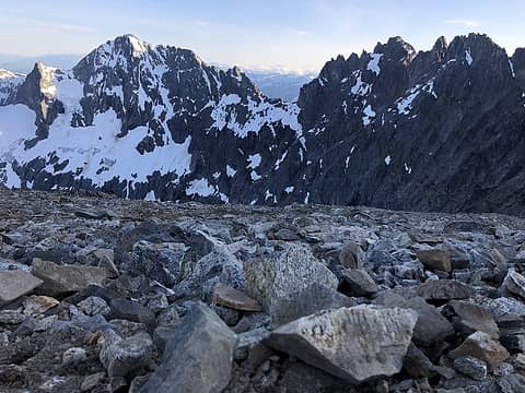 Maude and 7FJ 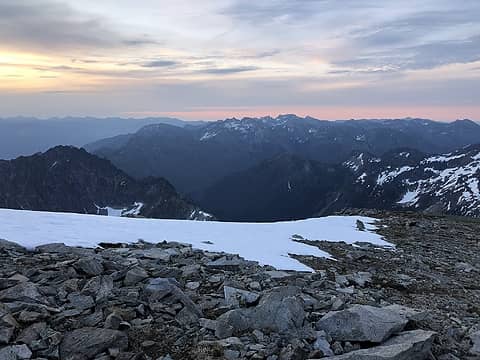 Dawn from camp. Buckskin on left. 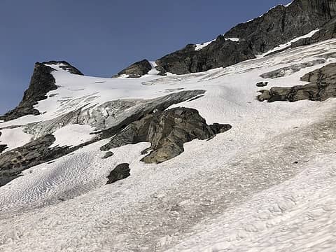 Looking back up to the camp ridge. 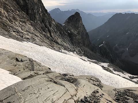 Looking towards the 7200' saddle 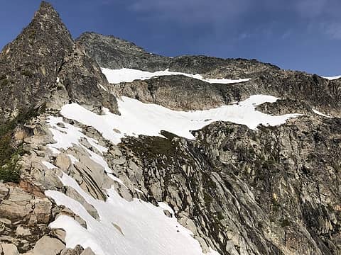 Last ~1500' of Copper 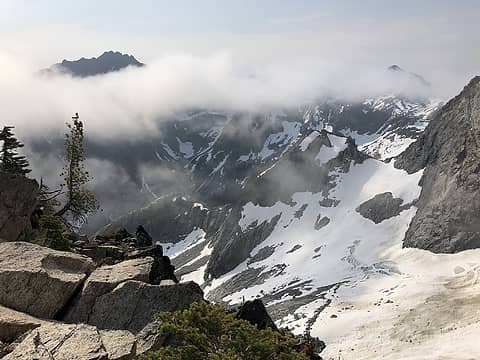 Buckskin in clouds 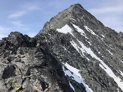 Last bit of Copper 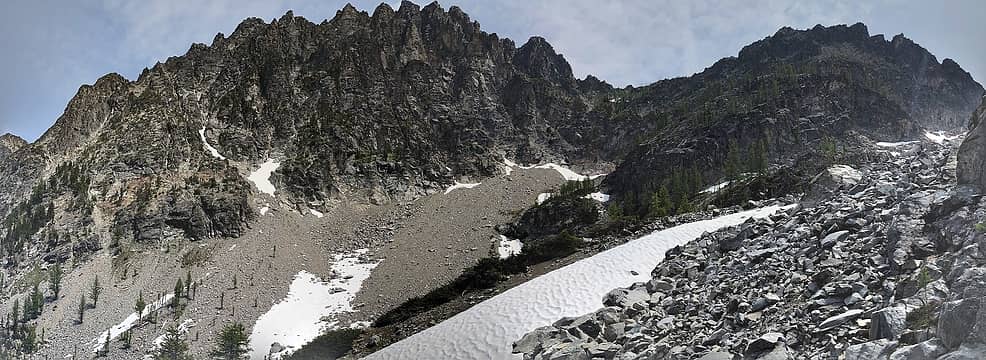 Buckskin's improbable W face. A chossy gully can be found on the left. 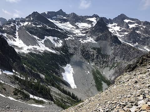 Fernow and Copper seen from partway up Buckskin 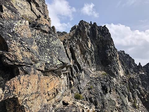 Lots of this was encountered. 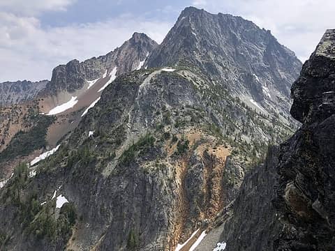 Martin seen from partway up W ridge 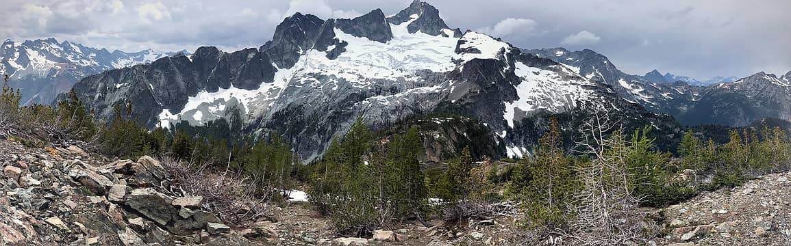 Bonanza from Martin 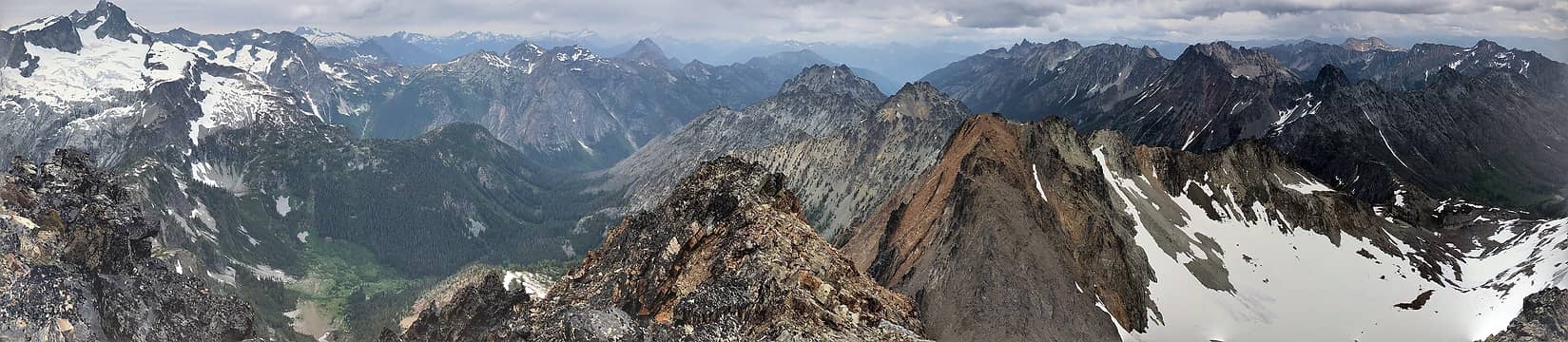 Pano from top of Martin. 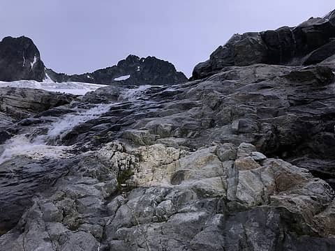 Waterfall section 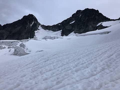 Mary Green Glacier 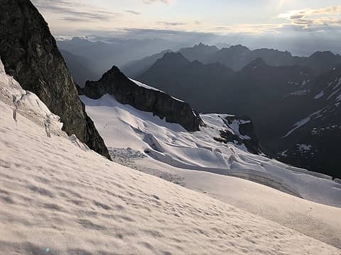 Behold! 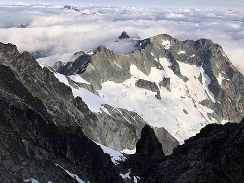 Edge of the marine layer 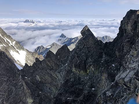 The first 100' of ridge from the gully to the south 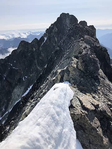 Some au cheval on snow 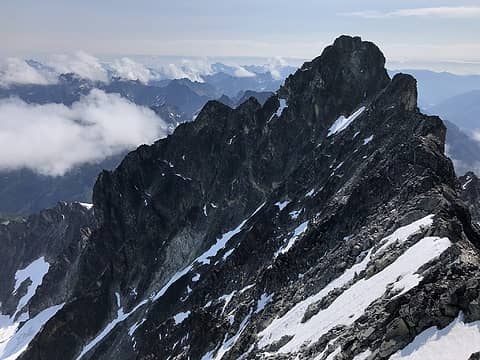 Bonanza from West Bonanza 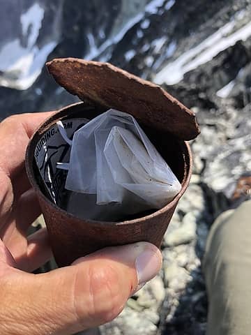 The Can 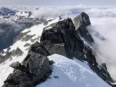 Edge of the marine layer and Glacier Peak 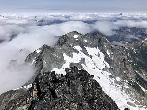 Dark 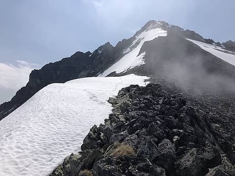 Looking up the ridge towards West Bonanza 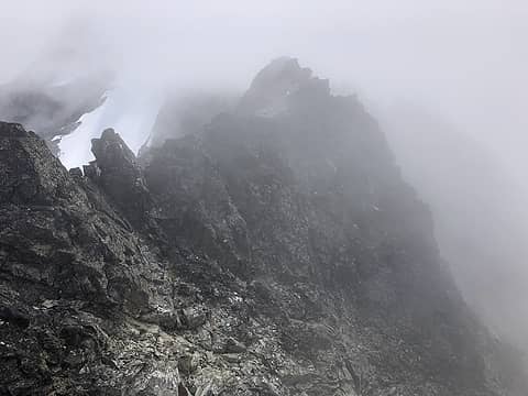 Lots of this 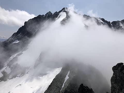 West Bonanza 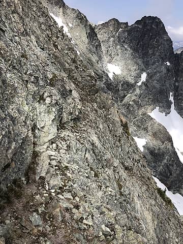 A seductive goat ledge 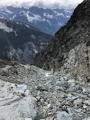 Some gully choss 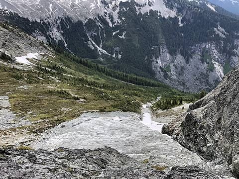 Looking down on the exit apron 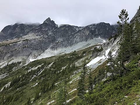 Looking back towards the exit from Dark 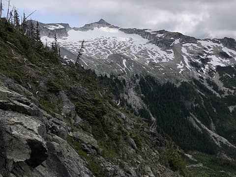 North Star 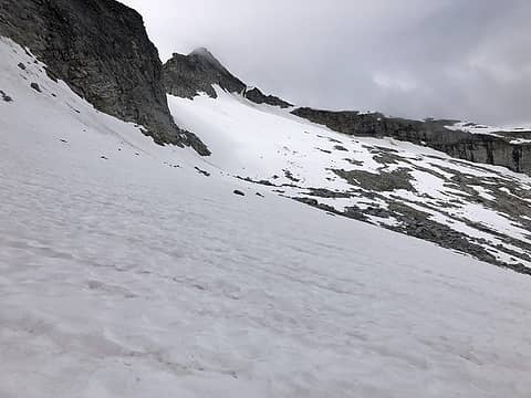 Crossing Grant Glacier to North Star 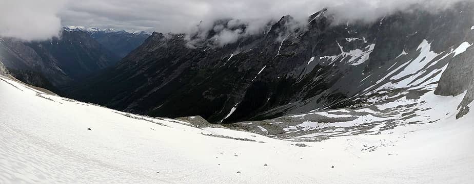 Moody hills 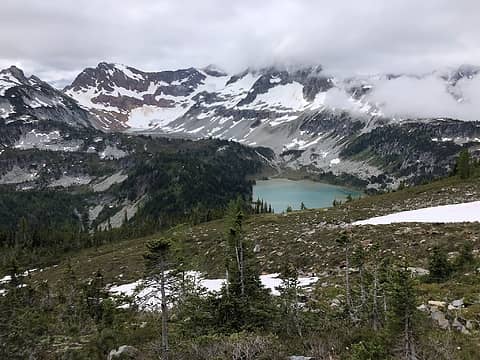 Lyman Lakes 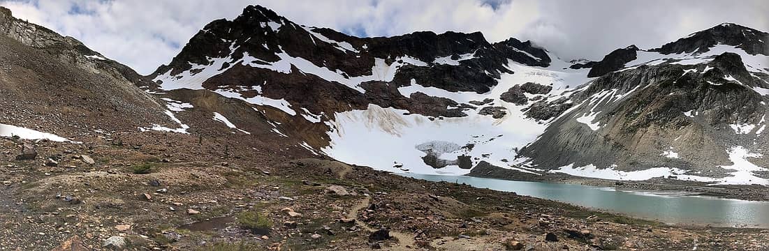 Chiwawa and upper Lyman Lake 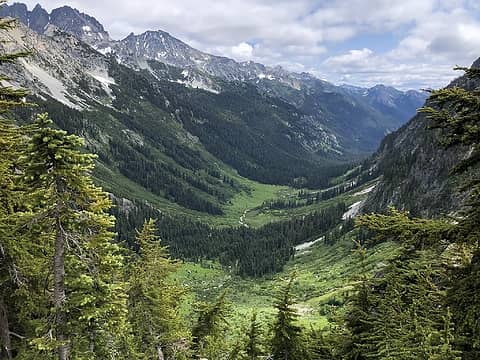 Spider Meadows
|
| Back to top |
  
|
|
raising3hikers
Member

Joined: 21 Sep 2007
Posts: 2344 | TRs | Pics
Location: Edmonds, Wa |
Impressive trip in iffy conditions. Look forward to see what you do next
|
| Back to top |
|
|
Jake Robinson
Member
Joined: 02 Aug 2016
Posts: 521 | TRs | Pics
|
Thanks for the detailed writeup of this incredible trip! I've only covered a little of the ground you did but it's enough to know how much determination and skill it took to pull this off.
|
| Back to top |
|
|
Brushbuffalo
Member

Joined: 17 Sep 2015
Posts: 1887 | TRs | Pics
Location: there earlier, here now, somewhere later... Bellingham in between |
Very bold trip, nicely accomplished.
| freddyfredpants wrote: | | reaching the trail at Toilet Camp [ from sign Toilet>Camp>] |
Love it!
Passing rocks and trees like they were standing still
Passing rocks and trees like they were standing still
|
| Back to top |
|
|
RichP
Member

Joined: 13 Jul 2006
Posts: 5634 | TRs | Pics
Location: here |
|
RichP
Member
|
 Sat Jul 13, 2019 1:30 pm |
|
|
Man, you really move. 
|
| Back to top |
|
|
iron
Member

Joined: 10 Aug 2008
Posts: 6392 | TRs | Pics
Location: southeast kootenays |
|
iron
Member
|
Sat Jul 13, 2019 2:11 pm |
|
|
|
| Back to top |
|
|
silence
Member

Joined: 25 Apr 2005
Posts: 4420 | TRs | Pics
|
|
silence
Member
|
Sat Jul 13, 2019 2:28 pm |
|
|
PHOTOS
FILMS
Keep a good head and always carry a light bulb. Bob Dylan
|
| Back to top |
|
|
Justus S.
Member
Joined: 17 Nov 2004
Posts: 1298 | TRs | Pics
Location: WA |
Enjoyed the report. Solid work!
|
| Back to top |
|
|
KTizzle89
Member
Joined: 04 Aug 2017
Posts: 10 | TRs | Pics
|
Epic trip man! Good bumping into ya on Martin
|
| Back to top |
|
|
Zinge
Member
Joined: 18 Jul 2019
Posts: 4 | TRs | Pics
|
|
Zinge
Member
|
Thu Jul 18, 2019 8:57 pm |
|
|
Awesome trip! Great to run into you on top of Bonanza, here's a pic of you heading over to the west summit (zoom in):
-Eric G.
|
| Back to top |
|
|
Matt Lemke
High on the Outdoors

Joined: 15 Jul 2010
Posts: 2052 | TRs | Pics
Location: Grand Junction |
|
Matt Lemke
High on the Outdoors
|
Fri Jul 19, 2019 7:33 am |
|
|
Dude nice work getting the Bonanza-Dark traverse! That was fun eh? That section immediately after the rap off Bonanza was indeed the toughest part, good you didn't have a ledge blow out on you! Perhaps Josh and I cleaned the bad ones off...but it sure was good I belayed Josh across that part and I had a bomber cam very close to where he fell so the pendulum fall wasn't too big.
Interesting return route you had...I will look into that more in case I ever feel the need to repeat Dark 
|
| Back to top |
|
|
Alden Ryno
Member
Joined: 04 Jun 2019
Posts: 150 | TRs | Pics
Location: Issaquah, WA |
Extremely impressive and enjoyable to read!
I love seeing routes "cobbled" together to fit the need.
I've toyed with the idea of the Dark-Bonanza traverse, yet I think that I've developed other plans for each of them. Kudos!!
|
| Back to top |
|
|
NorthwestWanderer
Member

Joined: 28 May 2016
Posts: 113 | TRs | Pics
Location: Montana |
Epic trip. Great work and great pics.
|
| Back to top |
|
|
|
|
You cannot post new topics in this forum
You cannot reply to topics in this forum
You cannot edit your posts in this forum
You cannot delete your posts in this forum
You cannot vote in polls in this forum
|
Disclosure: As an Amazon Associate NWHikers.net earns from qualifying purchases when you use our link(s). |


![[url=https://lh3.googleusercontent.com/cAs-cNqsY62Agfh62pr2INzN8YFulWKgPGwiP8XHwbtwDVK6FE8JyOnvKhASw6hAEf8zU_Gh3job1DlA9cpJLVuOSNMshlljCSNYK66PKS4PMn7zaiCvbxPaBv8goeXSaQbv6ksQ=s0]View Original[/url]](https://cloud.nwhikers.net/ec2abefb72d6bf96dfdb91cb5c5dfc7d_r.jpg#1200x1600+https://lh3.googleusercontent.com/cAs-cNqsY62Agfh62pr2INzN8YFulWKgPGwiP8XHwbtwDVK6FE8JyOnvKhASw6hAEf8zU_Gh3job1DlA9cpJLVuOSNMshlljCSNYK66PKS4PMn7zaiCvbxPaBv8goeXSaQbv6ksQ=s0#2736x3648)