| Previous :: Next Topic |
| Author |
Message |
neek
Member


Joined: 12 Sep 2011
Posts: 2335 | TRs | Pics
Location: Seattle, WA |
|
neek
Member
|
 Thu Aug 01, 2019 6:20 pm |
|
|
This route is pure Glacier Peak Wilderness goodness. Aside from the trail to Image Lake, it spans a lonely area, and I think its ruggedness will keep it that way. Also, the only significant peak is Bannock Mountain, and the lakes are few and far between (Bath Lakes are hardly worth it as a destination), so there's not a lot of popular appeal. You have to understand what you are getting into. I did the trip in three days but most will probably want to take a little longer and enjoy the scenery a bit more.
Day 1: Suiattle River Trail to Miner's Ridge and Image Lake
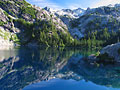
The high route is described from west to east in Routes and Rocks, but I wanted to do it counter-clockwise, saving Bath Lakes for the last day. So I began along the unspectacular Suiattle River trail, passing about 20 people on their way out. After nine miles I turned up the Miner's Ridge Trail. I didn't really want to camp at Image Lake, but due to the 1pm start couldn't get much further. Most sites were already occupied, and the lookout crew, who I met near the lake, said the weekend was much busier. Mosquitoes were out in full force. After setting up camp I hung out at the lake with a bug net on. Sunset wasn't very colorful, but it's impossible to not get a good photo from Image Lake.
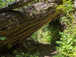 Big tree over Suiattle River Trail at 2 mi, with 7' clearance 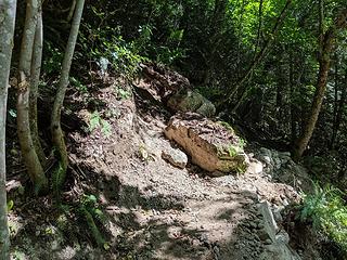 Sign at trailhead says impassable by stock due to landslide, but if this is what it refers to, a trivial path around has been cleared 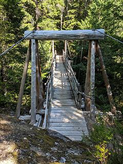 Bridge over Canyon Creek at mile 6; large campsite nearby 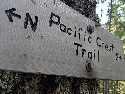 PCT junction at mile 6.5; in retrospect I should have gone S a short distance to check out the new bridge 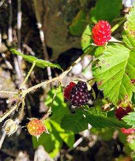 I found a blackberry, but I eated it 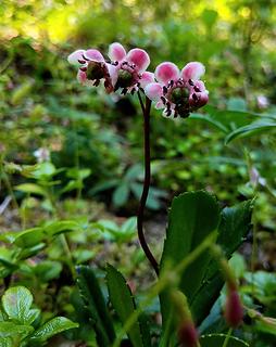 Pipsissewa 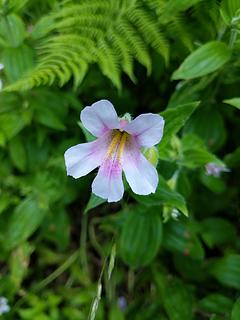 Monkeyflower 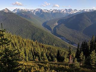 Looking up the Suiattle River valley. Note the Flower Dome burn on the left 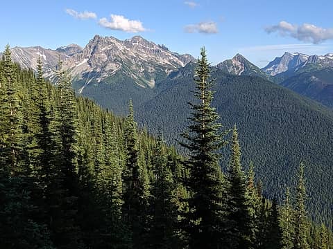 Fortress, Helmet Butte, Buck 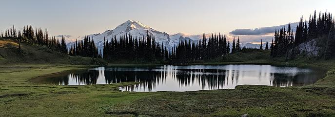 Image Lake 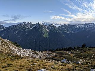 There's the high route, with Bannock in the clouds on the right 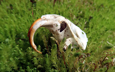 Rodent skull 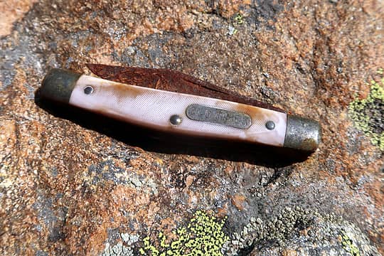 Found near Canyon Lake. Left it there as a relic. 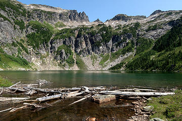 Bannock Mountain from Canyon Lake 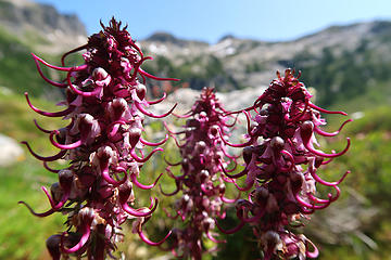 Elephant's Head 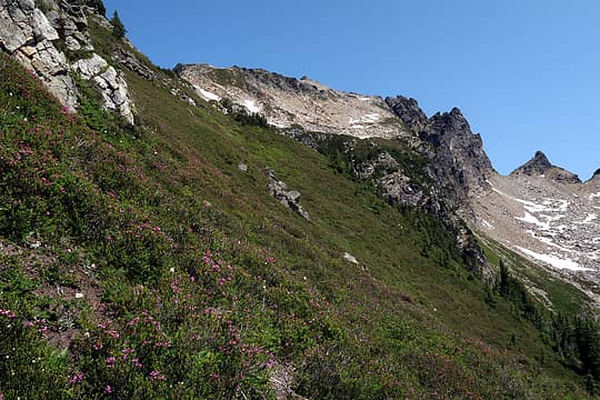 Heading up Bannock 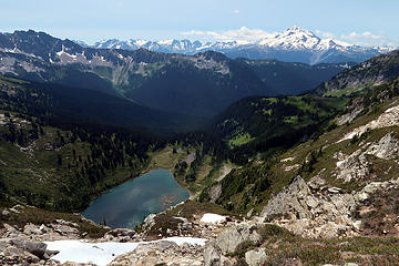 Looking down on Canyon Lake from the summit of Bannock 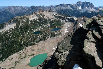 Bannock Lakes!! 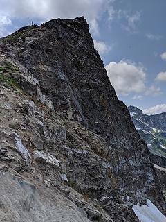 The back side of Totem 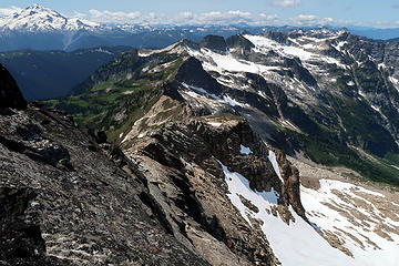 The north side of Totem Ridge 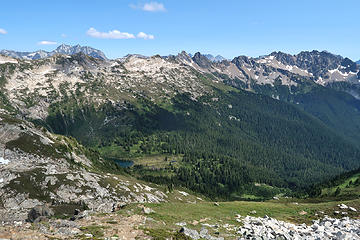 Looking east from Totem Point 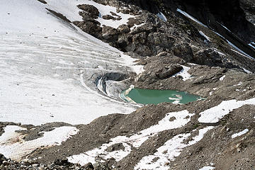 Glacial pond 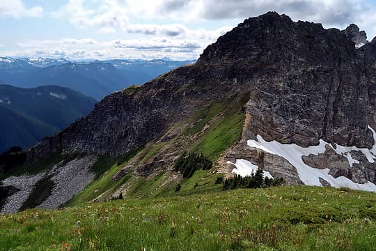 The ledge across the first significant wall. Cross the saddle to the end of the meadow and turn left 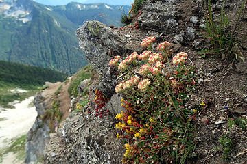 Flowers along the ledge 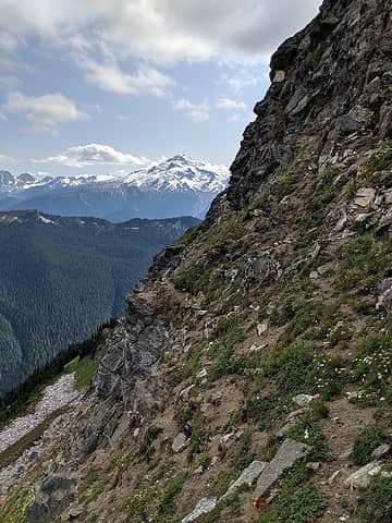 Nice goat trail along the ledge 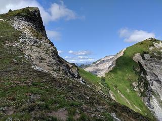 Looking back 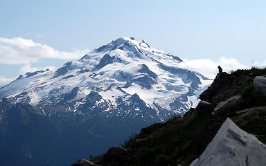 Ground squirrel enjoying the view 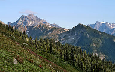 Fortress 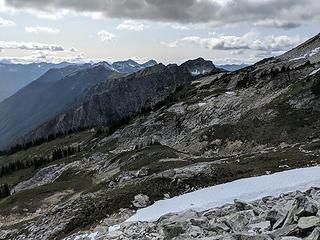 The terrain ahead, and the Great Wall coming into view 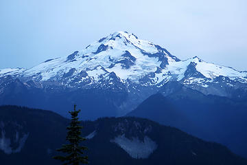 Went to bed with a nice view of Glacier 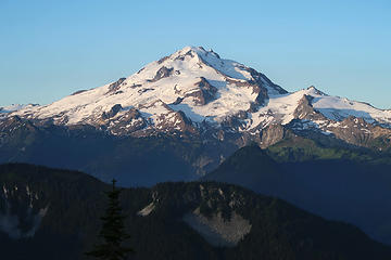 Woke up to a nice view of Glacier 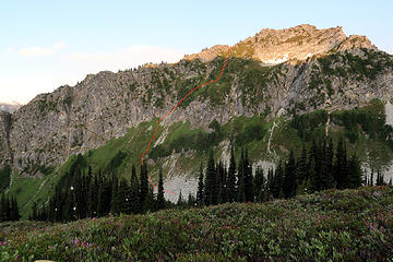 Route up the wall 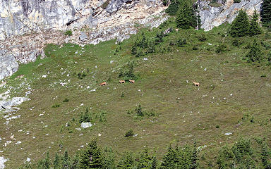 4 Deer crossing near the base of the wall 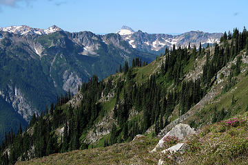 Sloan 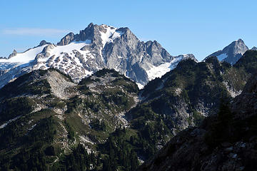 Dome 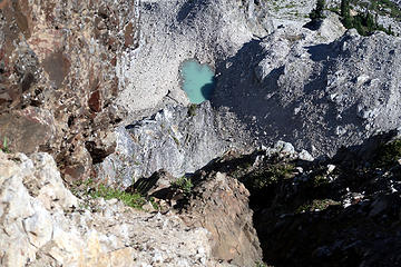 Way down there 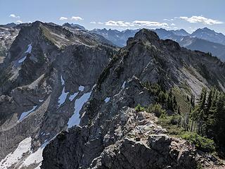 Looking back 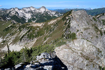 Can't quite run the ridge, but down a gully to the SE gets you pretty close 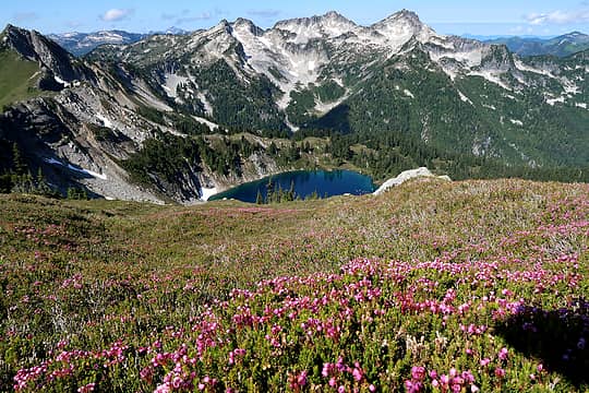 The point overlooking Upper Bath Lake 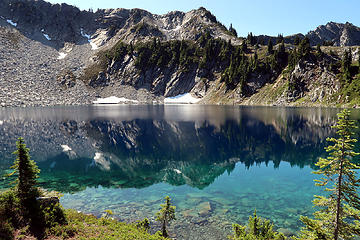 Upper Bath Lake 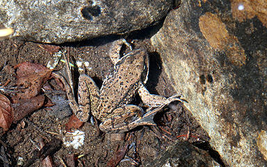 Frog, taking a Bath 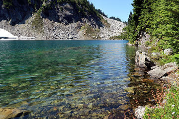 Lower Bath Lake, I think 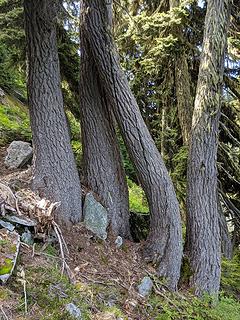 Wavy 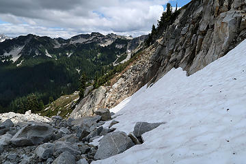 Made it across the snow 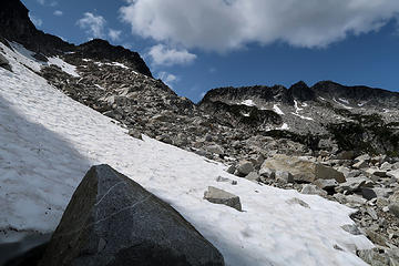 Heading up to the gap 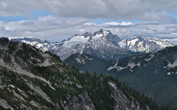 Dome and Sinister 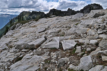 The great bench 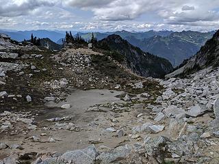 Nice flat terrain like this made me happy 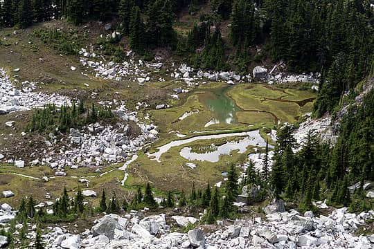 Mosquito Hatchery 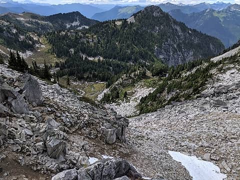 Descending into the Mosquito Hatchery 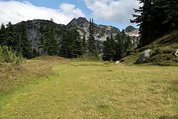 Lawn 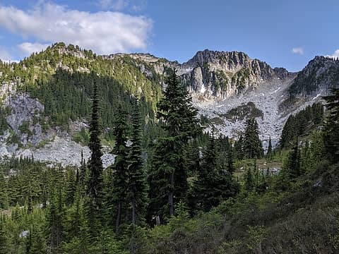 Sulphur. I climbed it a few years ago: up the talus and around the back side 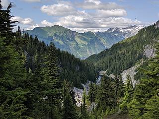 The brief and only view of Sulphur Mountain Lake 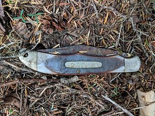 The second Old Timer found. What are the chances! 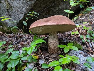 Shroom 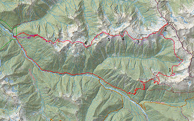 Purple=planned, red=actual
 zimmertr zimmertr
zimmertr |
| Back to top |
  
|
|
RichP
Member

Joined: 13 Jul 2006
Posts: 5633 | TRs | Pics
Location: here |
|
RichP
Member
|
Thu Aug 01, 2019 6:25 pm |
|
|
Awesome! Thanks for the diagram on The Great Wall. I've been holding out on this one but it might happen soon thanks to your great beta.  Old knives? Yep, I've found a few.
|
| Back to top |
|
|
raising3hikers
Member

Joined: 21 Sep 2007
Posts: 2344 | TRs | Pics
Location: Edmonds, Wa |
|
| Back to top |
|
|
fourteen410
Member

Joined: 23 May 2008
Posts: 2628 | TRs | Pics
|
|
| Back to top |
|
|
NorthwestWanderer
Member

Joined: 28 May 2016
Posts: 113 | TRs | Pics
Location: Montana |
Bannock area is the prettiest place in the country. Nice TR
Bannock lakes look a lot more welcoming than when I was there this june lol
|
| Back to top |
|
|
awilsondc
Member

Joined: 03 Apr 2016
Posts: 1324 | TRs | Pics
|
|
| Back to top |
|
|
cascadetraverser
Member

Joined: 16 Sep 2007
Posts: 1407 | TRs | Pics
|
Well done! Excellent TR. You covered all lot of ground in 3 days....Good on you to cross the Great Wall with ease. That is some beautiful and remote country.
|
| Back to top |
|
|
Tom
Admin
Joined: 15 Dec 2001
Posts: 17851 | TRs | Pics
|
|
Tom
Admin
|
Thu Aug 01, 2019 9:37 pm |
|
|
Nice trip but seems like a lot of mileage for the number of lakes to be bagged.  As far as route note #1, in 2006 I don't recall problems staying on trail from Canyon to Image and I was hoofing it pretty fast trying to get to Image before dark.
|
| Back to top |
|
|
Nancyann
Member
Joined: 28 Jul 2013
Posts: 2316 | TRs | Pics
Location: Sultan Basin |
|
Nancyann
Member
|
Thu Aug 01, 2019 10:10 pm |
|
|
Impressive effort and lots of great pictures, especially the dark red paintbrush with Glacier Peak in the background. Hiking Partner says Bath Lakes are worth it if you like to fish. 
|
| Back to top |
|
|
Brushbuffalo
Member

Joined: 17 Sep 2015
Posts: 1887 | TRs | Pics
Location: there earlier, here now, somewhere later... Bellingham in between |
Very fine reporting! Any evidence of the former lookout on Bannock? That one made Image Lake seem close-in.
| RichP wrote: | | Old knives? Yep, I've found a few. |
Me too, and lost a few also. But on the plus side overall. Going to start a new thread in Trail Talk.
Passing rocks and trees like they were standing still
Passing rocks and trees like they were standing still
|
| Back to top |
|
|
contour5
Member

Joined: 16 Jul 2003
Posts: 2963 | TRs | Pics
|
|
contour5
Member
|
Thu Aug 01, 2019 11:12 pm |
|
|
Some mighty nice pictures for a fast guy. Thanks for the detailed report. This is another area I haven't even failed attempting to get to yet...
|
| Back to top |
|
|
iron
Member

Joined: 10 Aug 2008
Posts: 6392 | TRs | Pics
Location: southeast kootenays |
|
iron
Member
|
Thu Aug 01, 2019 11:49 pm |
|
|
|
| Back to top |
|
|
GaliWalker
Have camera will use

Joined: 10 Dec 2007
Posts: 4929 | TRs | Pics
Location: Pittsburgh |
|
GaliWalker
Have camera will use
|
Fri Aug 02, 2019 5:25 am |
|
|
|
| Back to top |
|
|
Sculpin
Member

Joined: 23 Apr 2015
Posts: 1382 | TRs | Pics
|
|
Sculpin
Member
|
Fri Aug 02, 2019 8:36 am |
|
|
This one has been on my short list for way too long!
| neek wrote: | Monkeyflower |
The flower color is very different from a typical Lewis monkeyflower, suggesting this might be a hybrid.
Between every two pines is a doorway to the new world. - John Muir
Between every two pines is a doorway to the new world. - John Muir
|
| Back to top |
|
|
MangyMarmot
Member

Joined: 06 Apr 2012
Posts: 474 | TRs | Pics
|
|
| Back to top |
|
|
|
|
You cannot post new topics in this forum
You cannot reply to topics in this forum
You cannot edit your posts in this forum
You cannot delete your posts in this forum
You cannot vote in polls in this forum
|
Disclosure: As an Amazon Associate NWHikers.net earns from qualifying purchases when you use our link(s). |


 Case in point: