| Previous :: Next Topic |
| Author |
Message |
RAW-dad
Member


Joined: 07 Jul 2017
Posts: 119 | TRs | Pics
Location: Oregon |
|
RAW-dad
Member
|
 Thu Aug 15, 2019 8:37 am |
|
|
Last summer, accompanied by my patch-making daughter and her friend, I set out to do a high country off-trail route from Del Monte Ridge to Obstruction Point via Gunsight pass, Deception basin, Graywolf pass, the northern Cameron traverse and Lake Lillian, but was thwarted on the third day by my rusty old knees. `  We ended up getting to Deception basin via Gunsight (not easy) and then headed out Royal Creek. It was a great trip, but disappointing. This year, with my older and wiser knees, but sadly not my daughter (she had to work!), I headed back for another shot focusing on the Cameron traverse.
Day 1 (8/7) started out early with a drive up to Obstruction Point, where I started out the Elk Mountain trail bound for Deer Park by 6:45. This is such a fun trail with that top-of-the-world sort of feeling to it with views near and far. I could see nearly all of my route, which was exhilarating and a bit daunting. Soon I was at Deer Park, where I replenished water and headed down toward Three Forks. Id been on this trail 3 times before and seen a pack train twice and sure enough, along came another. This one was led by a skillful horsewoman, who was leading 5 or 6 horses/mules down to Three Forks to provision a trail crew that was camped there. Thank you for all that you do!! Soon made it to Three Forks and then on to Graywolf Camp with its brand-new privy. Gotta love a new privy! We ended up getting to Deception basin via Gunsight (not easy) and then headed out Royal Creek. It was a great trip, but disappointing. This year, with my older and wiser knees, but sadly not my daughter (she had to work!), I headed back for another shot focusing on the Cameron traverse.
Day 1 (8/7) started out early with a drive up to Obstruction Point, where I started out the Elk Mountain trail bound for Deer Park by 6:45. This is such a fun trail with that top-of-the-world sort of feeling to it with views near and far. I could see nearly all of my route, which was exhilarating and a bit daunting. Soon I was at Deer Park, where I replenished water and headed down toward Three Forks. Id been on this trail 3 times before and seen a pack train twice and sure enough, along came another. This one was led by a skillful horsewoman, who was leading 5 or 6 horses/mules down to Three Forks to provision a trail crew that was camped there. Thank you for all that you do!! Soon made it to Three Forks and then on to Graywolf Camp with its brand-new privy. Gotta love a new privy!  Found a spot off to the side, which proved to be lucky as there were eventually 4 parties at the site, one with about 6 tents! After 13 miles and 4500 ft of elevation loss, I hit the hay early and slept like a marmot. Found a spot off to the side, which proved to be lucky as there were eventually 4 parties at the site, one with about 6 tents! After 13 miles and 4500 ft of elevation loss, I hit the hay early and slept like a marmot.
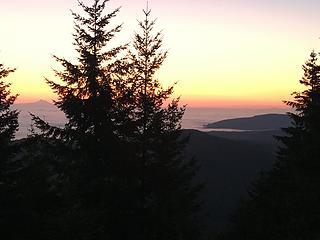 1_Mt Baker sunrise 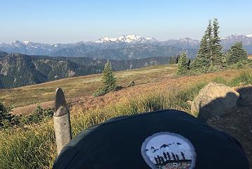 1a_Olympus patch 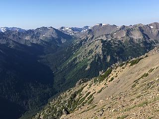 1b_Grand Valley 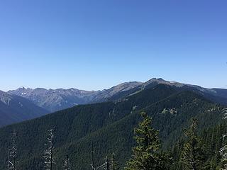 1c_Maiden Peak and Elk Mountain 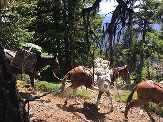 1d_packtrain 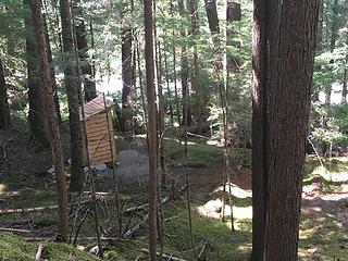 1e_Gray Wolf Privvy 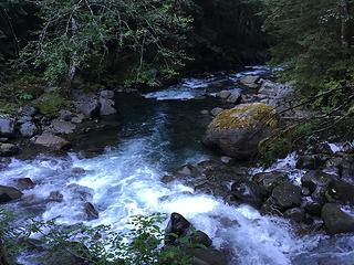 1f_Cameron-Graywolf confluence 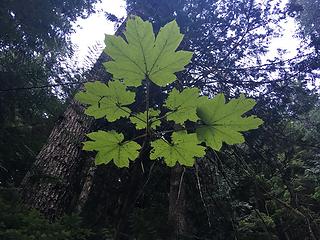 2_Devil's Club 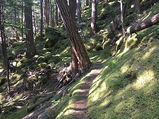 2a_Moss country 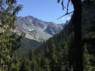 2b_First look at the Needles 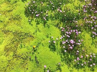 2c_GW basin flowers  2d_Needles pano 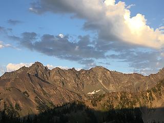 2e_Needles sunset 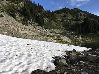 3_toward Cedar lake basin 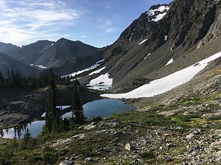 3a_looking back at GW basin 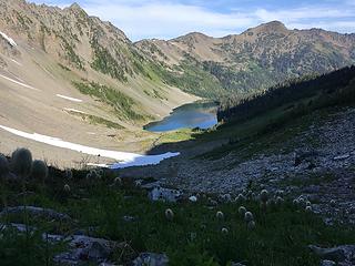 3b_Cedar Lake and Towhead Babies 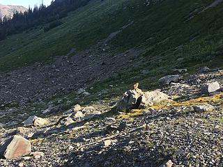 3c_Marmota olympus 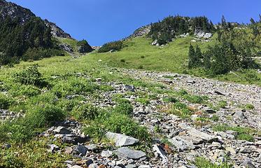 3d_Heading up to Cedar Lake Cameron divide 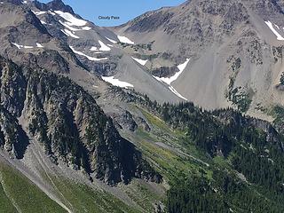 3e_The route ahead from Cedar Lake divide 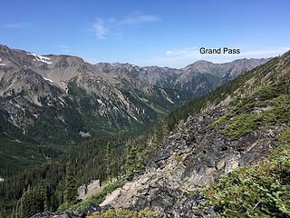 3f_Looking north to Grand Pass 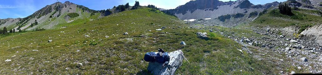 3g_first basin pano 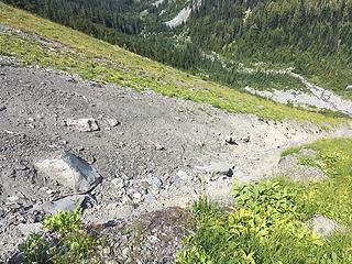 3i_Gully 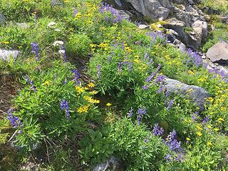 3j_Steep meadow flowers 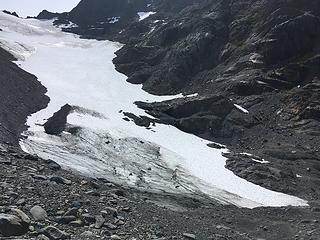 3k_central Cameron glacier 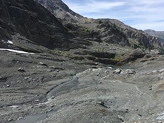 3l_The route ahead - go left 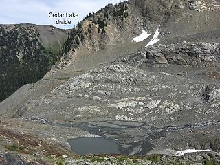 3m_Looking back at area below Cameron glacier 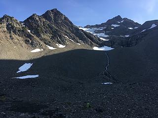 3o_Camp 3 below Cameron 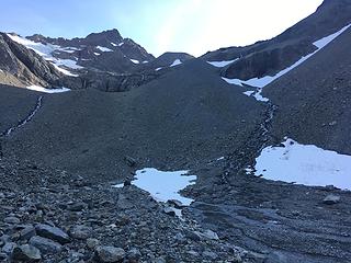 3p_Camp 3 view of the moraine 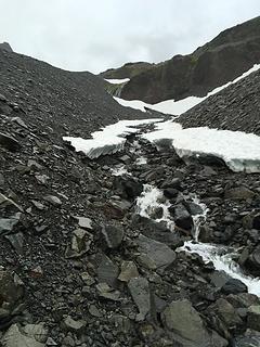 4_Heading up toward the moraine 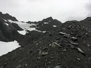 4a_mid moraine 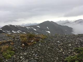 4e_view west from Cloudy Pass 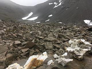 4f_Looking back at Cloudy Pass 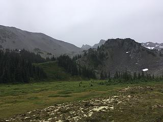 4g_View back from Cameron Basin trail  No further rain, but a cold NW wind was whipping up on Lillian Ridge, so I made a bee line toward my car and those all-so-comfortable inventions called seats.
All-in-all a great trip with an off-trail section that equals anything I have been through in the Olympics. It should not be taken lightly, however, as the route is both physically and mentally demanding with little margin for error if one were to stray. Ive seen reference to others doing the traverse in reverse, but its not clear to me how one would go down the spine of the moraine. I certainly would not want to No further rain, but a cold NW wind was whipping up on Lillian Ridge, so I made a bee line toward my car and those all-so-comfortable inventions called seats.
All-in-all a great trip with an off-trail section that equals anything I have been through in the Olympics. It should not be taken lightly, however, as the route is both physically and mentally demanding with little margin for error if one were to stray. Ive seen reference to others doing the traverse in reverse, but its not clear to me how one would go down the spine of the moraine. I certainly would not want to
|
| Back to top |
  
|
|
RodF
Member

Joined: 01 Sep 2007
Posts: 2593 | TRs | Pics
Location: Sequim WA |
|
RodF
Member
|
Thu Aug 15, 2019 7:06 pm |
|
|
Glad you enjoyed! Thanks for sharing your trip & photos.
"of all the paths you take in life, make sure a few of them are dirt" - John Muir
"the wild is not the opposite of cultivated. It is the opposite of the captivated - Vandana Shiva
"of all the paths you take in life, make sure a few of them are dirt" - John Muir
"the wild is not the opposite of cultivated. It is the opposite of the captivated - Vandana Shiva
|
| Back to top |
|
|
silence
Member

Joined: 25 Apr 2005
Posts: 4420 | TRs | Pics
|
|
silence
Member
|
Thu Aug 15, 2019 7:48 pm |
|
|
PHOTOS
FILMS
Keep a good head and always carry a light bulb. Bob Dylan
|
| Back to top |
|
|
Fatrick
Member

Joined: 09 Aug 2011
Posts: 27 | TRs | Pics
|
|
Fatrick
Member
|
Fri Aug 16, 2019 3:00 pm |
|
|
Committing route solo, nice work!
|
| Back to top |
|
|
|
|
You cannot post new topics in this forum
You cannot reply to topics in this forum
You cannot edit your posts in this forum
You cannot delete your posts in this forum
You cannot vote in polls in this forum
|
Disclosure: As an Amazon Associate NWHikers.net earns from qualifying purchases when you use our link(s). |


