| Previous :: Next Topic |
| Author |
Message |
meck
Member


Joined: 31 Dec 2010
Posts: 920 | TRs | Pics
|
|
meck
Member
|
 Tue Sep 03, 2019 10:46 pm |
|
|
I had the pleasure of hiking from the Dosewallips washout over to the Duckabush this last weekend over LaCrosse Pass.
I left the "TH" at 10:30am on Friday morning with the intent of making it to at least the LaCrosse Pass Trail Jct. Camp. I encountered a couple of parties at Dose Forks (one group was just about finished with 9+ days in the Olys!). There were a couple of pretty large blowdowns on the way up the switchbacks to the pass that required crawling under while dragging my pack. I was able to make it all the way to the pass (elev 5566') by 8:00pm. I was very thankful that there was a semi-level spot to put up my tent. It was a long day.
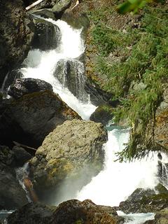 Dose falls 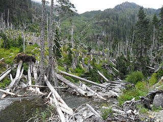 Blowdown event aftermath near Honeymoon Meadows camp 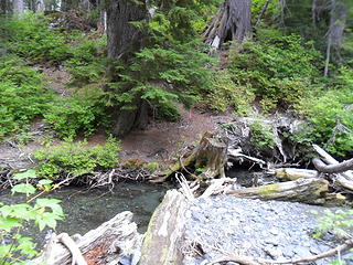 last easy to access water for the next 6 miles, I filled up w/ 4.5 liters here. 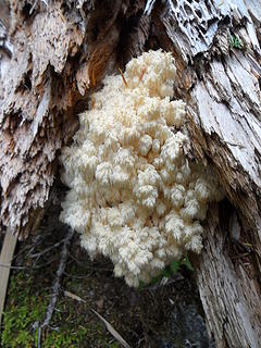 interesting fungi 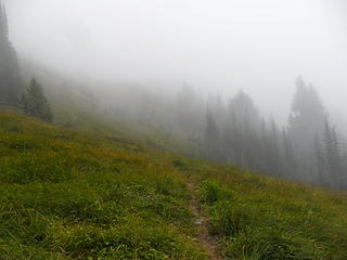 entering the upper meadows on the way to the pass in the clouds.... better get to camp fast, its getting dark! 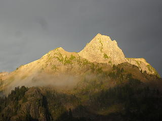 Mt LaCrosse just as the sun was hitting it. 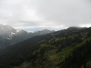 2 labels looking back towards the meadows north of LaCrosse pass. 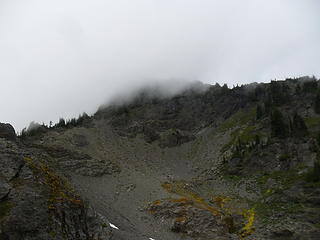 1 label Looking up at Mt LaCrosse from my turn around point. 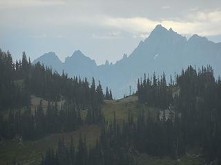 looking NE towards the saddle north of the pass 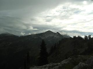 Point 6206 above LaCrosse Pass. 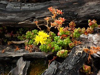 Stonecrop (?) flowers along the ridge goat path 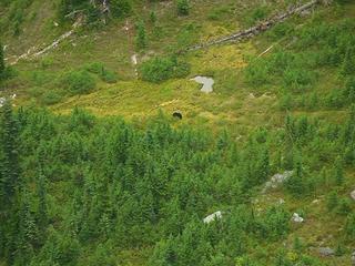 bear down in the meadowed basin below the pass 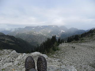 2 labels Looking at Mt Anderson from above the pass. 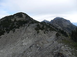 2 labels Pt 6206 from the first high point above the pass. The rock in the basin was pretty fun to ascend. 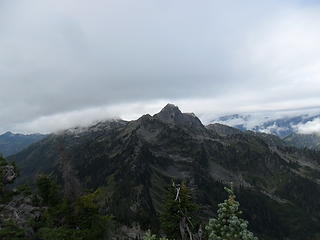 2 labels Mt Lacrosse and White Mtn from above the pass. 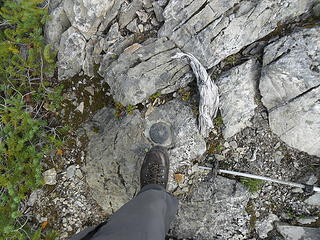 One of the benchmarks on the summit 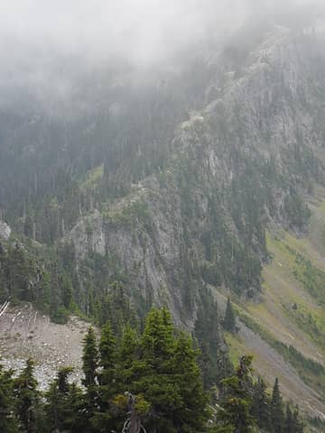 The ridge to Mt LaCrosse, looking like a giant natural wall.... 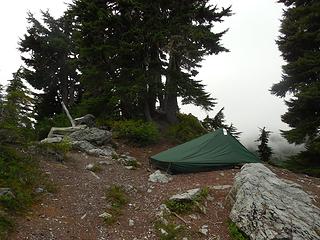 tent site at the pass.  yeah, made it down to the Duckabush! 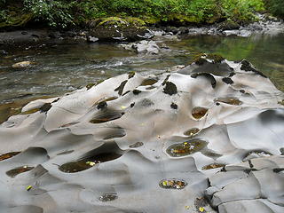 reminds me of rock along the coast 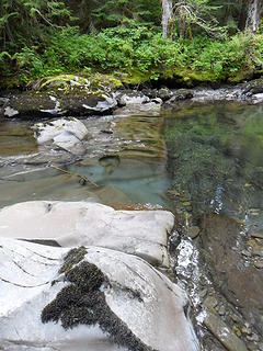 where the river crossed and eroded a rock-band... very cool erosion patterns 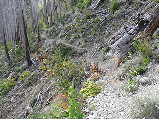 looking back at the trail regrade above a steep dropoff into the river. 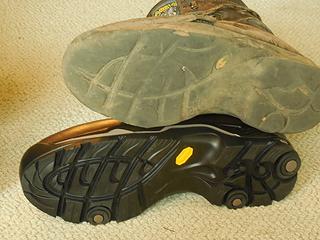 one of the old boots above (at least it slicked to rock pretty well), new boot below 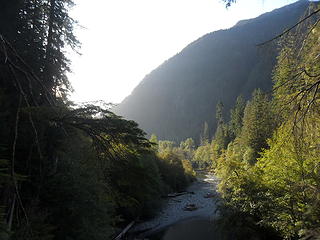 morning sunshine on the way out
*Just say NO to Rent-Seeking, don't give up the concept of "ownership"*
*Just say NO to Rent-Seeking, don't give up the concept of "ownership"*
|
| Back to top |
  
|
|
kitya
Fortune Cookie

Joined: 15 Mar 2010
Posts: 842 | TRs | Pics
Location: Duvall, WA |
|
kitya
Fortune Cookie
|
Wed Sep 04, 2019 6:41 am |
|
|
|
| Back to top |
|
|
Double_E
Member

Joined: 21 Jul 2005
Posts: 36 | TRs | Pics
Location: Seattle |
|
Double_E
Member
|
Wed Sep 04, 2019 11:15 am |
|
|
Way cool!
A few years ago me and a friend went up the EF Quinault, over Anderson and Lacrosse Passes, and down the Duckabush... we were soo tempted to camp at LP, but in the end the desire for a fire trumped the desire to camp high up.  Love the curvy rocks in the Duck; had lunch there, if its the place I'm thinking of.
|
| Back to top |
|
|
cascadetraverser
Member

Joined: 16 Sep 2007
Posts: 1407 | TRs | Pics
|
Nice shot of Mt. Lacrosse! Always appreciate your posts...
|
| Back to top |
|
|
reststep
Member
Joined: 17 Dec 2001
Posts: 4757 | TRs | Pics
|
|
reststep
Member
|
Wed Sep 04, 2019 1:03 pm |
|
|
It has been a few years since I have been there.
Hope to make it to Dee Lake one of these times.
Thanks for sharing and thanks for the labels also.
Blowdown event aftermath near Honeymoon Meadows camp
"The mountains are calling and I must go." - John Muir
"The mountains are calling and I must go." - John Muir
|
| Back to top |
|
|
RAW-dad
Member

Joined: 07 Jul 2017
Posts: 119 | TRs | Pics
Location: Oregon |
|
RAW-dad
Member
|
Thu Sep 05, 2019 7:56 pm |
|
|
Nice TR of a beautiful section of the Olympics. I camped in the rocky basin above the pass last year on 19 July and there was plenty of flowing water. 
|
| Back to top |
|
|
|
|
You cannot post new topics in this forum
You cannot reply to topics in this forum
You cannot edit your posts in this forum
You cannot delete your posts in this forum
You cannot vote in polls in this forum
|
Disclosure: As an Amazon Associate NWHikers.net earns from qualifying purchases when you use our link(s). |


