| Previous :: Next Topic |
| Author |
Message |
awilsondc
Member


Joined: 03 Apr 2016
Posts: 1324 | TRs | Pics
|
This was probably my last opportunity for an overnight trip this year, and I was having great difficulty deciding where to go. I eventually decided to go for Buck Mountain with a night in Louis Creek Basin, and maybe another peak or two depending on how it went. I got my stuff packed up and woke up really early to make the long drive to the trailhead. But... first things first. Today was a big day, a monumental day, one that myself and many others had been waiting a long time for. August 30th, 2019 was the release date of Tool's first album in over 13 years and fortunately it was available for streaming. They were by far my favorite band in the 90's and 2000's but I haven't listened to them as often since I got married because my wife detests rock music (nobody's perfect) and I've had to adapt my musical tolerances. Anyway I was stoked listen to new stuff from my favorite band growing up and I rocked out to Fear Inoculum on the way. Initially I was unimpressed, but after a couple listenings holy ****! Best thing to happen to rock in, well... 13 years! I particularly love Descending and Pneuma. Anyway, back to the mountains...
It rained quite a bit on the way to the trailhead. To get achieve my goal of getting Buck with a night in Louis Creek basin I had three options. Via Little Giant and Napeequa valley, bushwhack up the east ridge of buck, or take the long way up via Buck Creek Pass. With all the wet foliage I figured hiking through Napeequa Valley and it's overgrown trail would get me soaked, as would the bushwhack up the east ridge. Only the long way around up Buck Creek offered the opportunity to stay dry so I picked that way. I figured since I was going up that way I'd start with Fortress and see what the day brought after that. Some time between 8:30 and 9:00 I was on the trail.
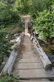 This used to be a nice bridge 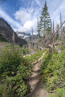 Entering the burn area 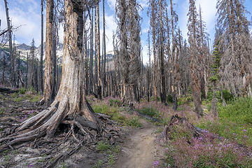 I enjoyed this part of the approach 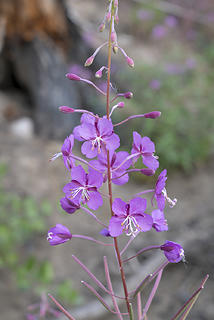 Still a few flowers left 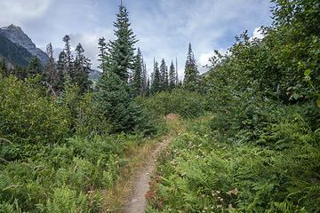 Green! 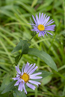 Flowers 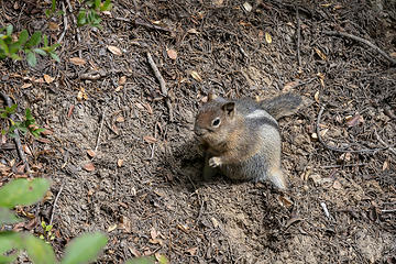 Hey there lil' guy! 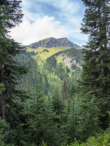 Helmet Butte 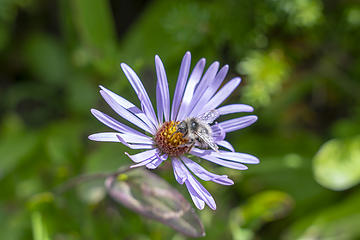 Bee 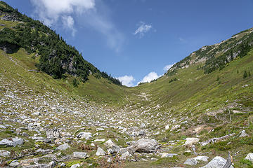 Pass No Pass 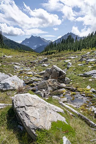 Pass No Pass drainage 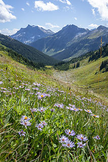 Wildflower meadow 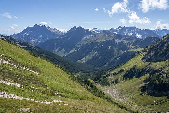 Getting higher 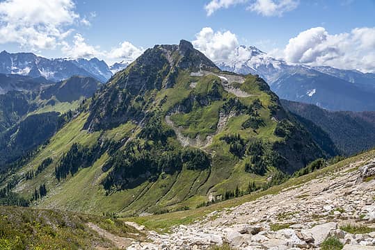 Helmet Butte rising tall 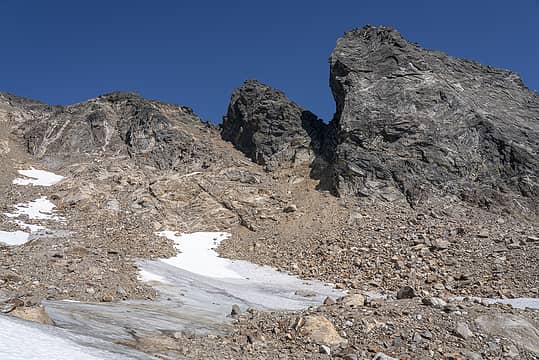 Choss! ughhhh 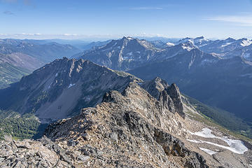 Looking down from the summit at my bivy spot 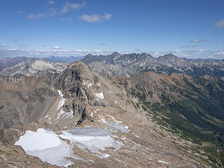 Chiwawa and Fernow, 7FJ, Maude group 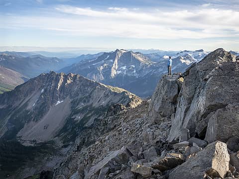 Dreaming of Buck 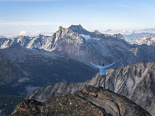 BONANZA!!! 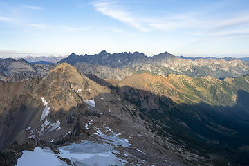 Shadows descend 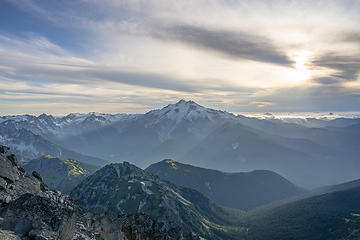 A moment in time 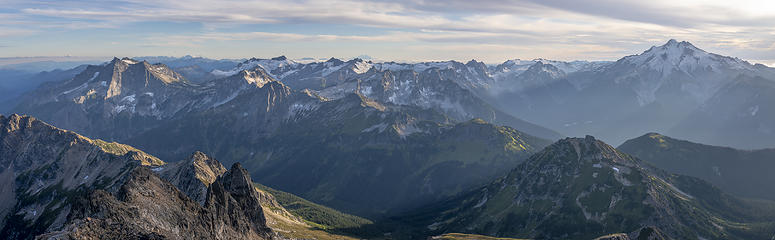 Golden hour pano 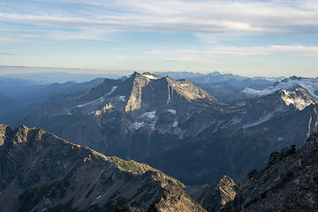 Buck 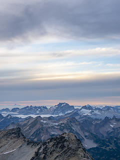 Dome 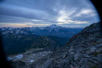 Good night world 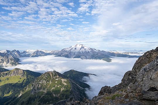 Oh, hi there! 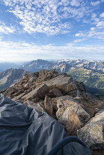 I guess I should get up 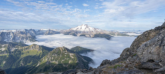 mmmmmm, yes that'll do 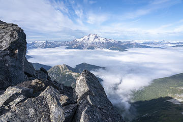 Breakfast views 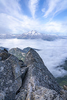 Fun clouds 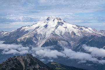 My favorite side of Glacier Peak 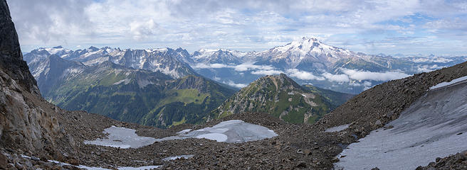 Descending. Views were still good. 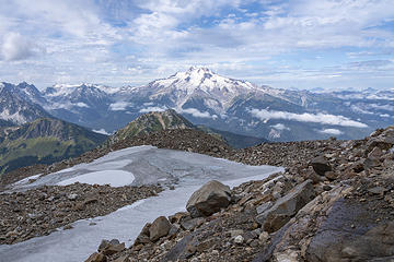 Can't. Stop. Staring! 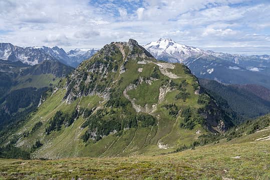 Next stop, Helmet Butte 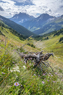 Back in the meadow 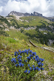 Gentians and Fortress 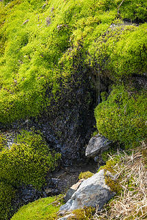 Water! 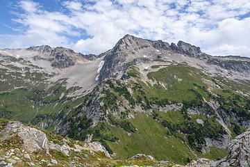 Fortress Mountain from Helmet Butte 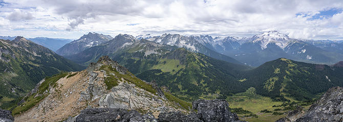 Helmet Butte pano 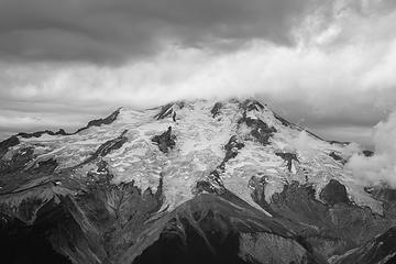 GP BW 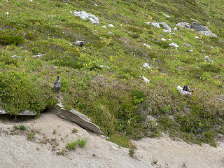 Marmots 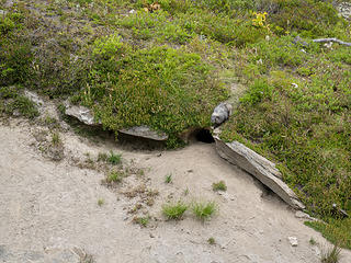 Guardian of the lair 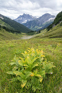 Autumn is near 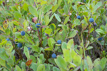 Berries were abundant 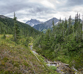 Time to depart 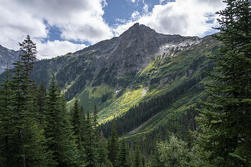 A clearing 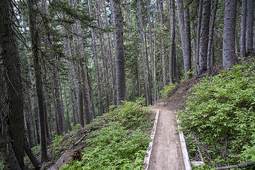 Lots of trail to go 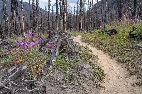 Back through the burn 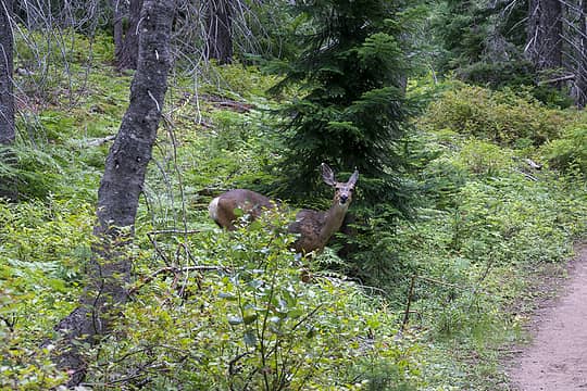 Deer
|
| Back to top |
  
|
|
mrszupke
Member

Joined: 03 Sep 2019
Posts: 4 | TRs | Pics
|
|
mrszupke
Member
|
 Tue Sep 03, 2019 11:56 pm |
|
|
Great report! And those pics... 😍
Would you be willing to post a link to your GPX track or shoot it to me in a message? Doing a trip out there in two weeks and am collecting beta / ideas. If not, I understand.
Cheers!
|
| Back to top |
|
|
geyer
Member

Joined: 23 May 2017
Posts: 463 | TRs | Pics
Location: Seattle |
|
geyer
Member
|
Wed Sep 04, 2019 9:31 am |
|
|
Ahh such a great area! you'll get to High Pass and Buck next time 
|
| Back to top |
|
|
cascadetraverser
Member

Joined: 16 Sep 2007
Posts: 1407 | TRs | Pics
|
EB looks loads funner than Fortress. I am likely heading up there in a couple weeks. Bringing my pooch so EB looks pouch worthy (I have been up Chiwawa but not Fortress; all that choss may not be good for paws!)
Thanks for the report!
|
| Back to top |
|
|
puzzlr
Mid Fork Rocks

Joined: 13 Feb 2007
Posts: 7220 | TRs | Pics
Location: Stuck in the middle |
|
puzzlr
Mid Fork Rocks
|
Wed Sep 04, 2019 10:34 am |
|
|
Awesome photos -- it really pays off for you to do those bivvys up high
|
| Back to top |
|
|
adam.rhoda1
Member
Joined: 18 Jul 2019
Posts: 2 | TRs | Pics
|
We saw your summit bivy spot with the Z-rest imprints on Fortress on Sep 1, I was wondering who was there and what awesome views you had! And also how much water you hauled up, haha.
Looks like you also narrowly avoided that rain which we got while at High Pass. Great pictures and TR.
|
| Back to top |
|
|
wildernessed
viewbagger

Joined: 31 Oct 2004
Posts: 9275 | TRs | Pics
Location: Wenatchee |
👍🏻Awesome pics, I probably listen to Tool once a week great running and workout music.
Living in the Anthropocene
Living in the Anthropocene
|
| Back to top |
|
|
awilsondc
Member
Joined: 03 Apr 2016
Posts: 1324 | TRs | Pics
|
| mrszupke wrote: | | Would you be willing to post a link to your GPX track or shoot it to me in a message? |
Here is a link to an almost identical GPS track of my trip from Peakbagger. I took different routes up/down Helmet Butte and did not record that portion. If you want my specific track PM me, but my route up Fortress went off route slightly and this track is better.
| puzzlr wrote: | | Awesome photos -- it really pays off for you to do those bivvys up high |
YES! It's becoming an addiction. I don't get a ton of opportunities for nights out in the mountains so I really want to make it count when I do!
| adam.rhoda1 wrote: | | We saw your summit bivy spot with the Z-rest imprints |
Excellent sleeping pad mark identification! That Z-rest is almost 20 years old and still going strong, although I don't use it all that much. 
|
| Back to top |
|
|
texasbb
Misplaced Texan

Joined: 30 Mar 2009
Posts: 1153 | TRs | Pics
Location: Tri-Cities, WA |
|
texasbb
Misplaced Texan
|
Wed Sep 04, 2019 7:27 pm |
|
|
My, oh, my. Those pictures from up high are spellbinding. What a perfect time to be up there. Thanks for sharing!
|
| Back to top |
|
|
rubywrangler
Member

Joined: 04 Aug 2015
Posts: 511 | TRs | Pics
|
| awilsondc wrote: | I guess I should get up |
Awe, that bivy spot. Gives me all the feels.
It's even better when you're broken & bleeding  Great photos as usual - one of my favorite perspectives of GP too. Louis will be even more lovely in a month or so!
|
| Back to top |
|
|
Nancyann
Member
Joined: 28 Jul 2013
Posts: 2319 | TRs | Pics
Location: Sultan Basin |
|
Nancyann
Member
|
Wed Sep 04, 2019 11:18 pm |
|
|
So many beautiful pictures! You were lucky to be above the clouds for those views. We were on the other side of Glacier Peak for several days during that time and were under the clouds more often than not. 
|
| Back to top |
|
|
contour5
Member

Joined: 16 Jul 2003
Posts: 2963 | TRs | Pics
|
|
contour5
Member
|
Wed Sep 04, 2019 11:33 pm |
|
|
The Glacier Peak sequence is full-on, transmogrifier-level transplendancy. Well done!
|
| Back to top |
|
|
Sky Hiker
Member
Joined: 03 Feb 2007
Posts: 1469 | TRs | Pics
Location: outside |
Great report.. This area will soon contain the high hunters on or before Sept 15th.
|
| Back to top |
|
|
RichP
Member

Joined: 13 Jul 2006
Posts: 5634 | TRs | Pics
Location: here |
|
RichP
Member
|
Thu Sep 05, 2019 7:16 am |
|
|
Sweet..
|
| Back to top |
|
|
GaliWalker
Have camera will use

Joined: 10 Dec 2007
Posts: 4930 | TRs | Pics
Location: Pittsburgh |
|
GaliWalker
Have camera will use
|
Thu Sep 05, 2019 7:48 pm |
|
|
Your trip report is great as are the photos, but...
| awilsondc wrote: | | August 30th, 2019 was the release date of Tool's first album in over 13 years and fortunately it was available for streaming. They were by far my favorite band in the 90's and 2000's |
...this was the real nugget! I'd never listened to Tool, and upon your words went ahead and downloaded the album. Wow, it was great! Invincible and 7empest were the standouts for me. Thanks!
|
| Back to top |
|
|
|
|


